Elliot Toe
Explore Elliot Toe on Mt Elliot’s western slopes, a rugged scramble over scree, boulders, and lantana to granite outcrops with sweeping views of Antill Plains, Ross River Dam, and Fredericks Peak. This craggy peak offers one of North Queensland’s most striking and adventurous climbs.
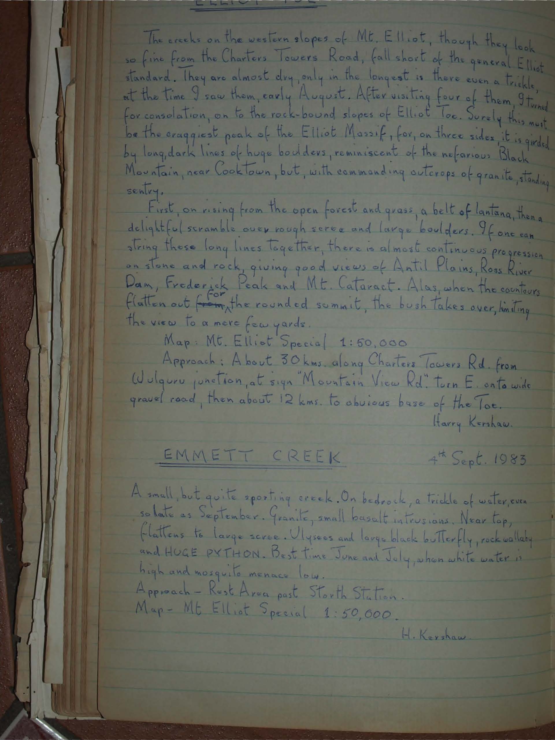
The creeks on the western slopes of Mt. Elliot, though they look so fine from the Charters Towers Road, fall short of the general Elliot standard. They are almost dry, only in the longest is there even a trickle, at the time I saw them, early August. After visiting four of them, I turned for consolation, on to the rock-bound slopes of Elliot Toe. Surely this must be the craggiest peak of the Elliot Massif, for, on three sides, it is girded by long, dark lines of huge boulders, reminiscent of the nefarious Black Mountain, near Cooktown, but, with commanding outcrops of granite, standing sentry.
First, on rising from the open forest and grass, a belt of lantana, then a delightful scramble over rough scree and large boulders. If one can string these long lines together, there is almost continuous progression on stone and rock, giving good views of Antil Plains, Ross River Dam, Frederick Peak and Mt. Cataract. Alas, when the contours flatten out from the rounded summit, the bush takes over, limiting the view to a mere few yards.
Map: Mt. Elliot Special 1:50,000
Approach: About 30 kms. along Charters Towers Rd. from Wulguru junction, at sign "Mountain View Rd." turn E. onto wide gravel road, then about 12 kms. to obvious base of the Toe.
Harry Kershaw.