Herbert River Gorge Adventure
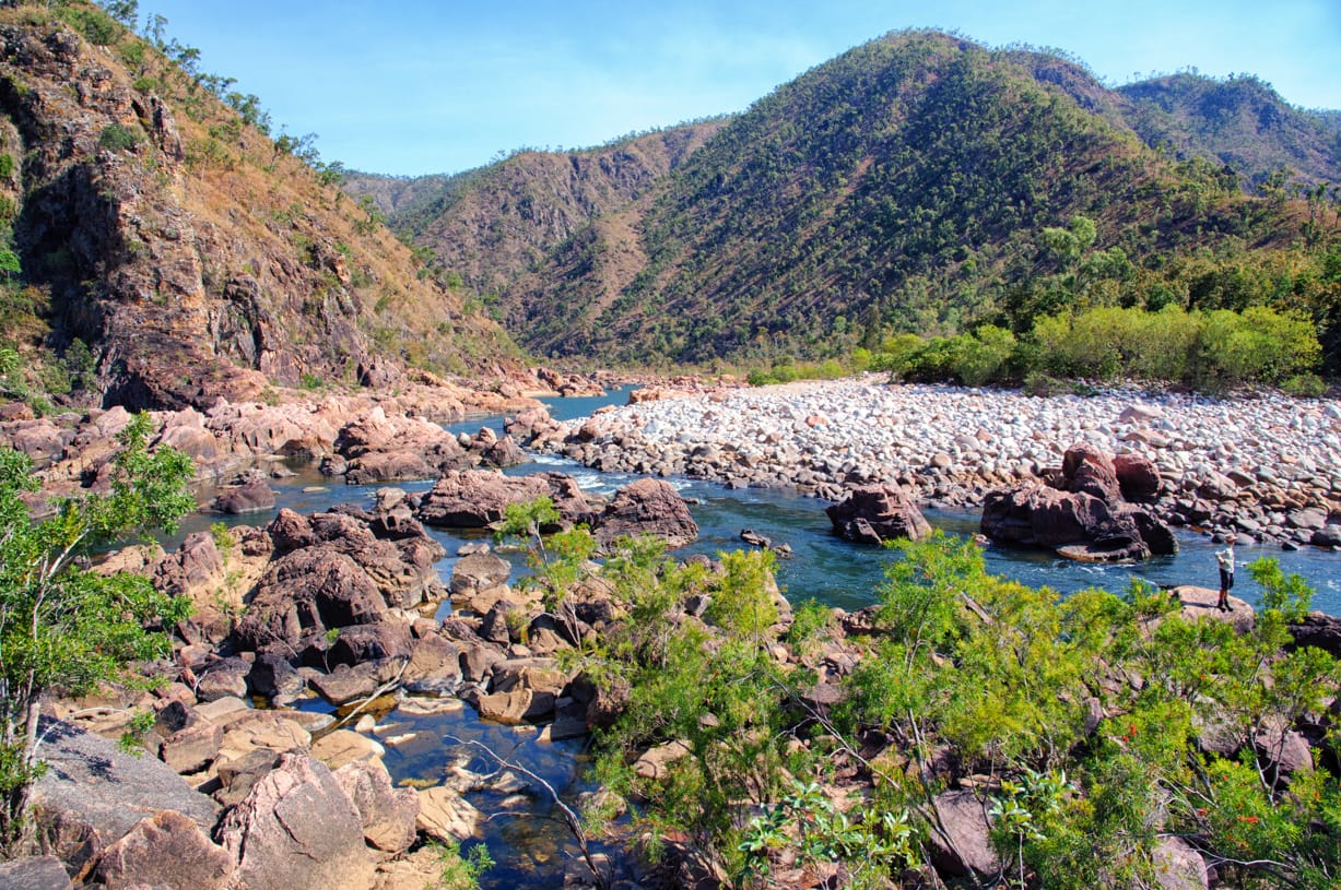
Herbert River Gorge Adventure was a five-day, fly-in hike-out through North Queensland wilderness. Starting below Blencoe Falls, walkers tackled rock hopping, river crossings, remote camps, crocodile country, and 60 km of spectacular gorge travel.
4th-8th September 2014. A five day 60.2 km wilderness bushwalking adventure along Herbert River Gorge (promulgated as 50 km walk). Fly in, hike out. The walk begins at bottom of Blencoe Falls and concludes at Yamanie NP gate (west of Abergowrie). Number of participants was restricted to eight due to transport and camping sites capacity.
The trip plan brief included ‘Lot of rock hopping, boulder clambering, scrub walking, and crossing rapids. Wildlife – estuarine crocodiles, wild cattle, pigs, snakes. Walkers need to be ‘croc wise’ as large estuarine crocodiles inhabit the river along this route. Every waterhole or large pool is reported to have crocodiles. All crocodiles along the walk are estuarine (saltie)’. This is wilderness area - no roads, no track, no comms , no designated camping sites - nothing. Once we start, we are on our own. Yet eight crazy bushwalkers volunteer.
A key part of the plan and briefing included ‘Duties – for group harmony, we will have delegated duties. Upon reaching camp site, females make fire for cooking. Men catch fish. Females clean fish, cook fish. Men eat fish. Very harmonious.’
The Townsville mob stayed the night before in Ingham. At 6:30 pm I had text ‘Hello Keith. Happy Hour at cabin 2 Larsens Rd – 3 hot ladies’ . My text reply was ‘hot ladies ? Get an ice bucket!’. But I was curious so went for a visit, to find three hot ladies on the wine, nibblies and chocolate, very jovial. They looked familiar too ….
Day 1 10.5 km (Blencoe Side trip 5.1 km, Main walk 5.4 km)
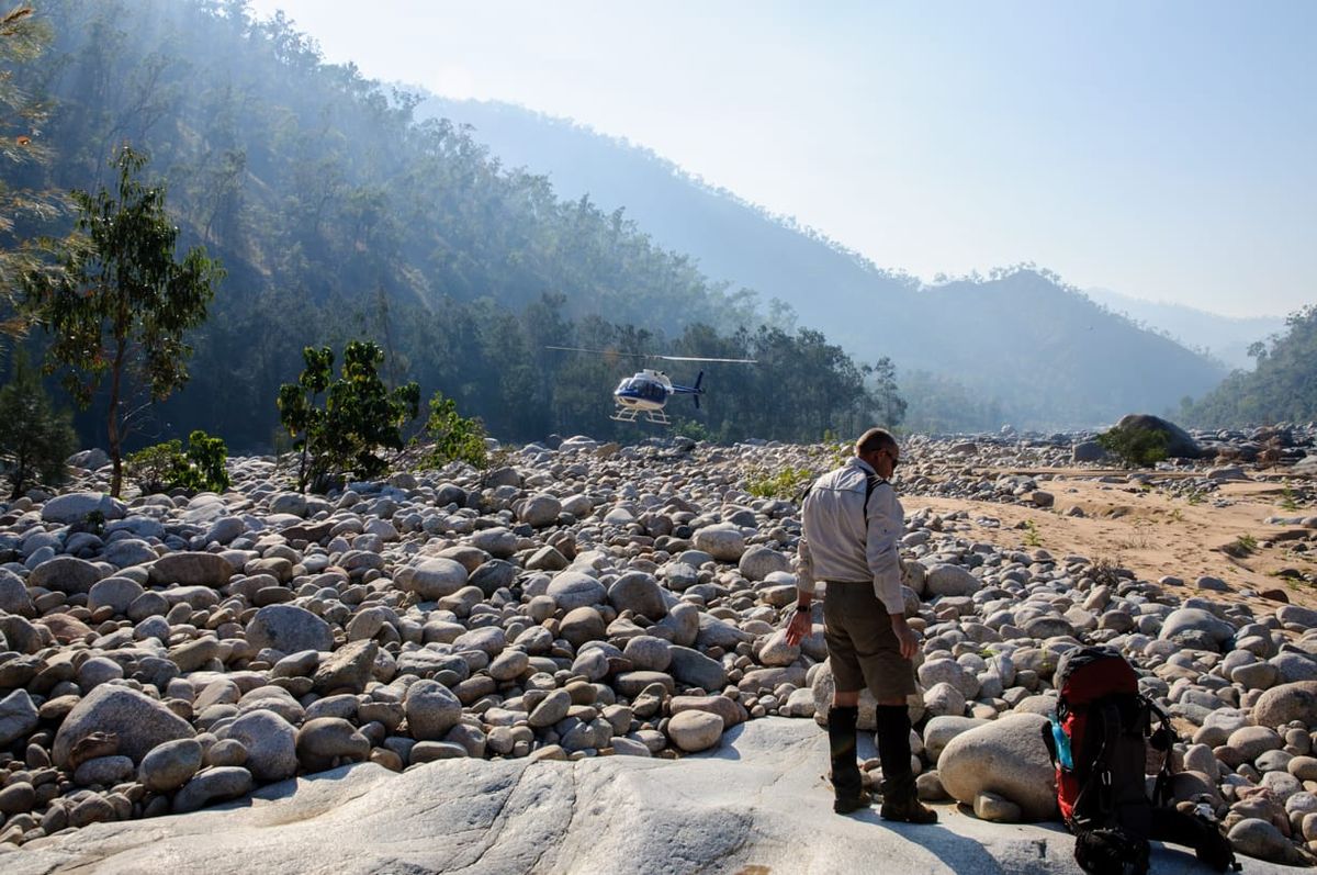
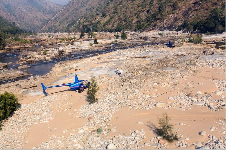
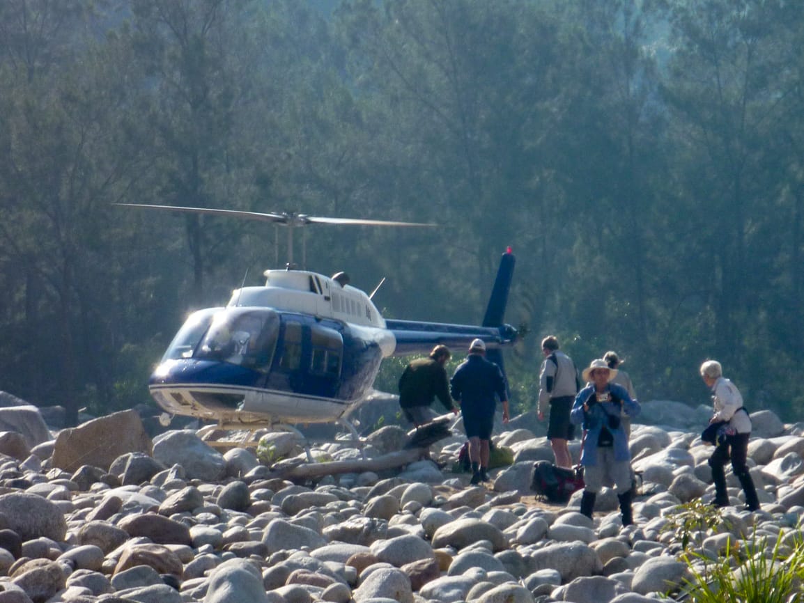
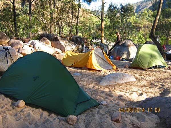
0700, Eight adventurers assemble at Ingham Airport. A smoky hazy day due to fires on Hinchinbrook and around the region. ‘Are we all within the weight restrictions for the flights?’ Now the plan was one helicopter for two shuttle flights. There is one R44 (small) on the pad. Josh the pilot comes out, says he has another helicopter (Jet Ranger) on the way down from Tully. So we might use more than one helicopter and go together. Then there is a second R44 on the pad. Final discussions, we now have three helicopters, and will launch and travel together. Very exciting.
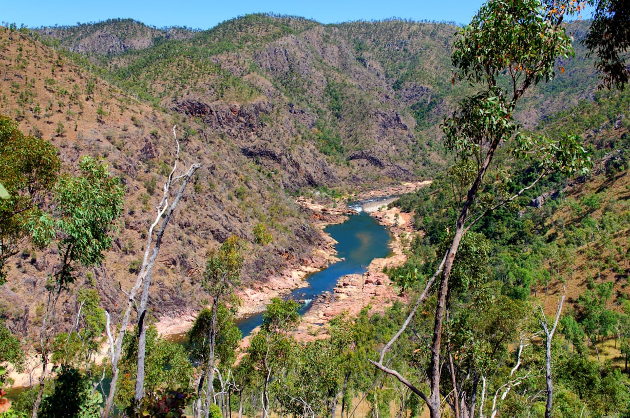
Launch time 0800, Hans and Rosemary in one R44, Wilfred and Suzanne in the other R44, with myself, Ailsa, Sue and Glenys in the larger Jet Ranger at the rear. A spectacular flight, over the cane farms, then along the river and up the gorge below the surrounding ridgelines. We see Yamanie Falls, zoom through Big W, then over crocodiles in the water, which we banked sharply and circled over, getting to low level. Arriving at Blencoe, the pilot flies into the Blencoe Gorge for closer look at the spectacular waterfalls. Then time to land, three helicopters landing together at the junction of Herbert River and Blencoe Creek, with the gorge towering above, was a great sight. Time was 0840.
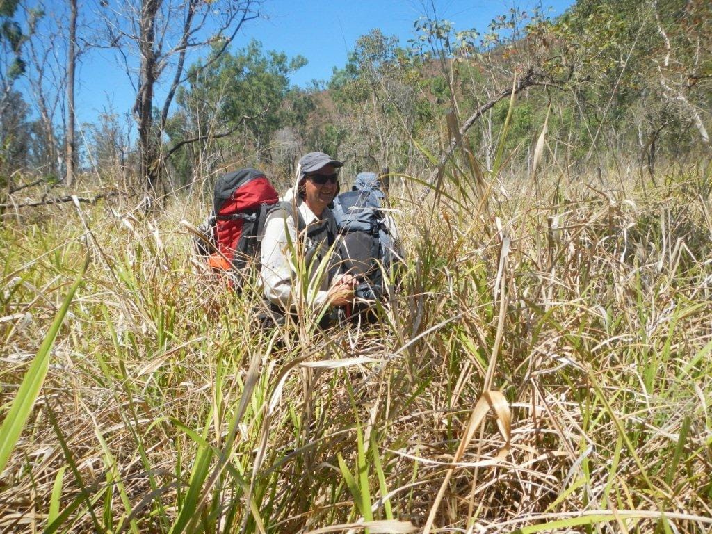
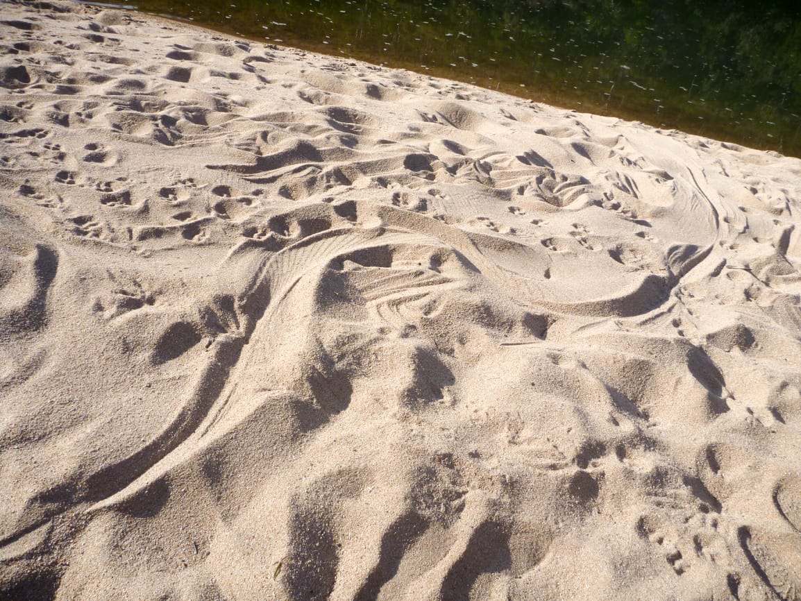
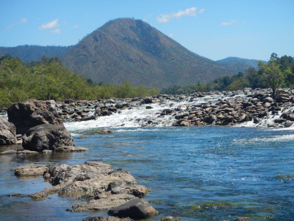
0915, leave packs, side trip to explore up Blencoe Creek, return trip of 5.1 km, rockhopping. We get to base of the first waterfall after one hour. Spectacular scenery in this creek. At 1130 we are back at the junction, have lunch. Packs on, the trek begins. Quick briefing ‘we walk till around 1600 each day, find a camp spot, doesn’t matter where we are, if not the planned spot no problem’. Head downstream, two minutes, our first challenge – crossing Blencoe Creek. Ooops. Boots off, cross over, then keep going, on northern side of the Herbert. Rock hopping downstream. About 1.5 hrs, we come to crossing point (advice is to get onto southern side here) – but this can’t be right, too much water, too fast, too deep. Ahead a cliff seems to block the northern side though. After trying for some time and not succeeding, we call it quits for the day and make camp at a side creek nearby, at 1550. This was a very nice camp spot, side creek with running water and small pools for bathing. A sea eagle circled overhead.
Unpacked, some of my gear is wet – one of my water bottles had sprung a leak. No problem, got another one.
Wilfred and I go exploring for options to get across, back upstream 1 km, then downstream again, but find nowhere to cross. I have had enough, about to turn back, Wilfred says we should check out the cliff - ‘We can’t turn back now, sun will be in our eyes, dangerous walking like that, wait for it to dip below the range’ he says. ‘What the …’ I think, well, can’t show weakness, so on we go. We then go to the ‘cliff’, get around it easily, and look further downstream, decide this is doable – ‘but wonder what lies ahead ?’. Anyway, that is the plan for tomorrow start. Trudging back to camp, sun has set (so safe to walk west now !!), about to enter camp and Wilfred says ‘I am knackered’. Staggers into camp, so that Suzanne takes his boots off, massages his feet, and pampers him. I just glare at him.
Day 2 10.2 km
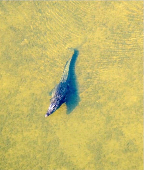
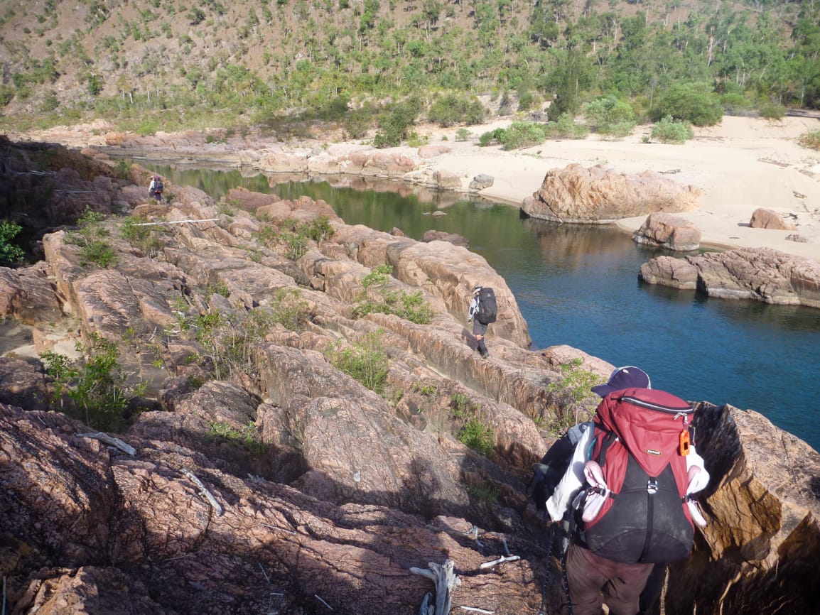
Wake up at 0600. It had been a starry night but morning was overcast, with cloud shrouding the gorge tops. 0800 start walking, see how we go on the northern side. My concern was that advice was that on the northern side there was a cliff blockage further down and you had to be on the southern side, but that would late morning I estimated, hopefully we would have found a way across the river by then. Very rocky terrain but easily traversed, but then we are blocked at 0910, either clamber over a bluff, or boots off and wade 7 metres around base of the bluff – boots off and wade was best option. Walking through spectacular scenery, many rapids and long waterholes in the gorge. There was no suitable river crossing yet. At 1030 come to a large rapid with great waterhole below, on the other bank was my planned camp site for day 1. Still no suitable crossing point though. Keep walking over sand banks, then into rocky terrain, at 1115 we are blocked by a sheer cliff – this is the blockage. On the opposite side is a crocodile slide on a sand bank. Wilfred and I explore, and curse – we are blocked. Discuss options – trek about 45 minutes back and try that rapid upstream, or …… looking above, there is a ridgeline. Consult map, decide up and over will do. We consider that we may need to stay high and go cross country for a fair while. So much joyous when we tell the others - at 1130 we climb a steep narrow ridgeline, loose surface – didn’t look this hard from below. A thirty minute, 140 metre very steep loose climb, to reach 291 mr altitude (it felt lot higher). A nice break at top of the hill with great gorge views. Reconsult map, look at terrain, we go along the side of the hill (avoiding the peak further above), which was difficult going in long grass, loose and uneven surface. Then zig zag down towards the river. Several others had fun on the hill with falls. Wilfred went ahead and cleared a path through thicket to the river bank, while I had the group follow me. At the thicket, it descended steeply to the river bank. Rosemary decided to be acrobatic, and came down the slippery slope upside down on her back – and covered in dust. Everyone slipped down this slope – controlled sliding on your bottom was a good option.. At 1315, we were on a sandy shady river bank, for lunch, and relieved. That was a 1.75 hr traverse. At 1400 we are ready to move, when we spot a crocodile in the water about 150 mr away upstream.
Walk for 45 minutes, take a break, hot afternoon. During this day we spotted some raptor type birds. Consult map, there are creeks running in ahead, so with my promise of running brook to camp by, we move on. Reach nice sandy area, keep walking along, that running brook will be near here, won’t it ! Keep walking, until at the end of the sand bank near the ridge. To find a muddy sludge. We look around for a few minutes, find a nice sandy area near the river but protected by trees, and make camp. Hans tries fishing, returns with a sooty grunter, so we cook that.
A tough day I thought.
Day 3 11.4 km
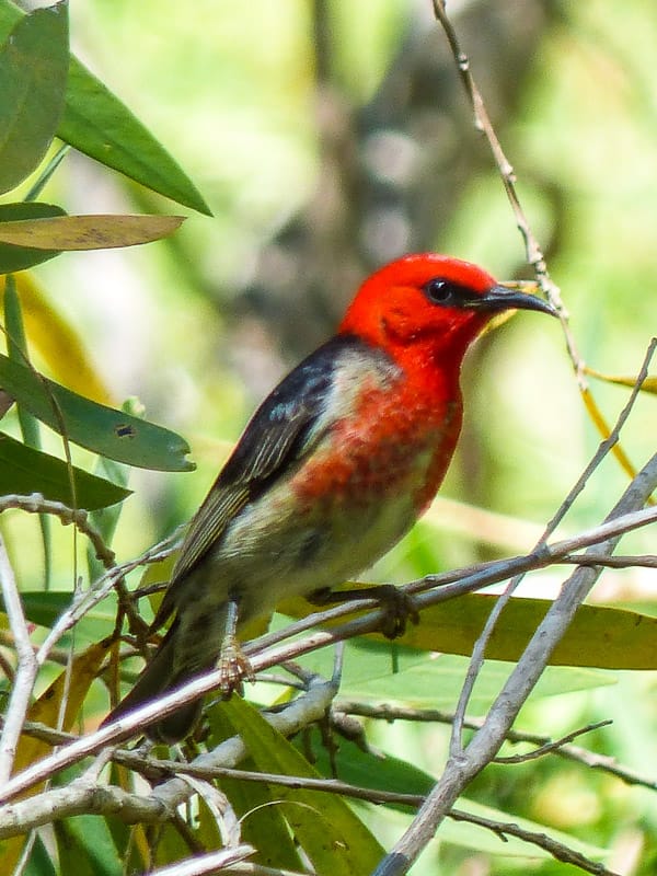
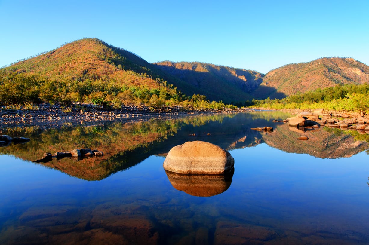
A glorious morning. Lot of birdlife on the riverbank, including scarlet honeyeaters amongst the numerous bottlebrush. The male are vivid scarlet red and black bird with whitish underparts.
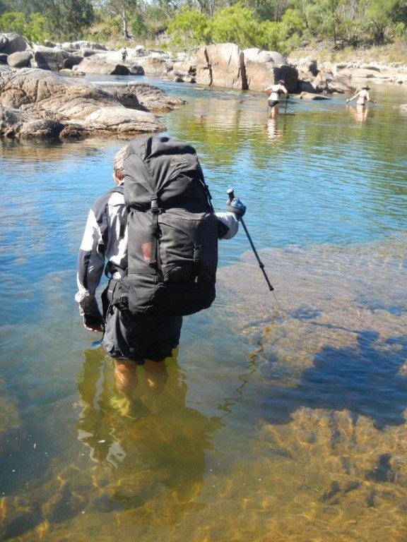
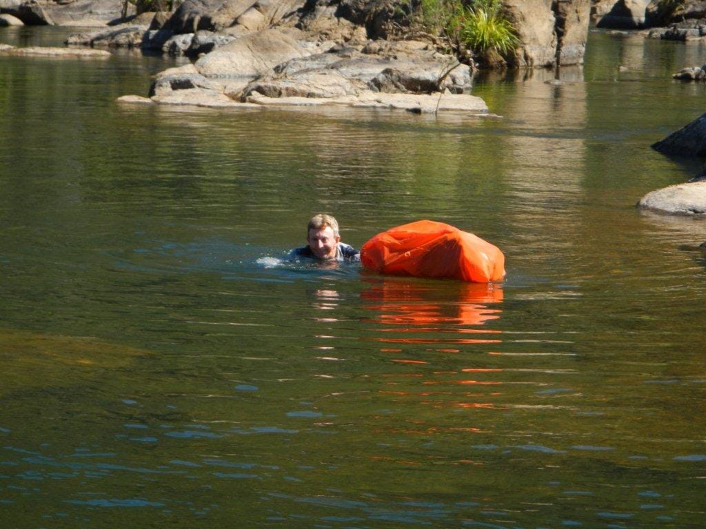
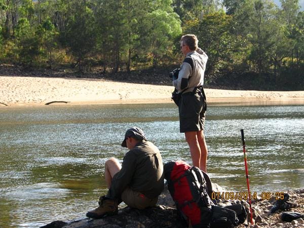
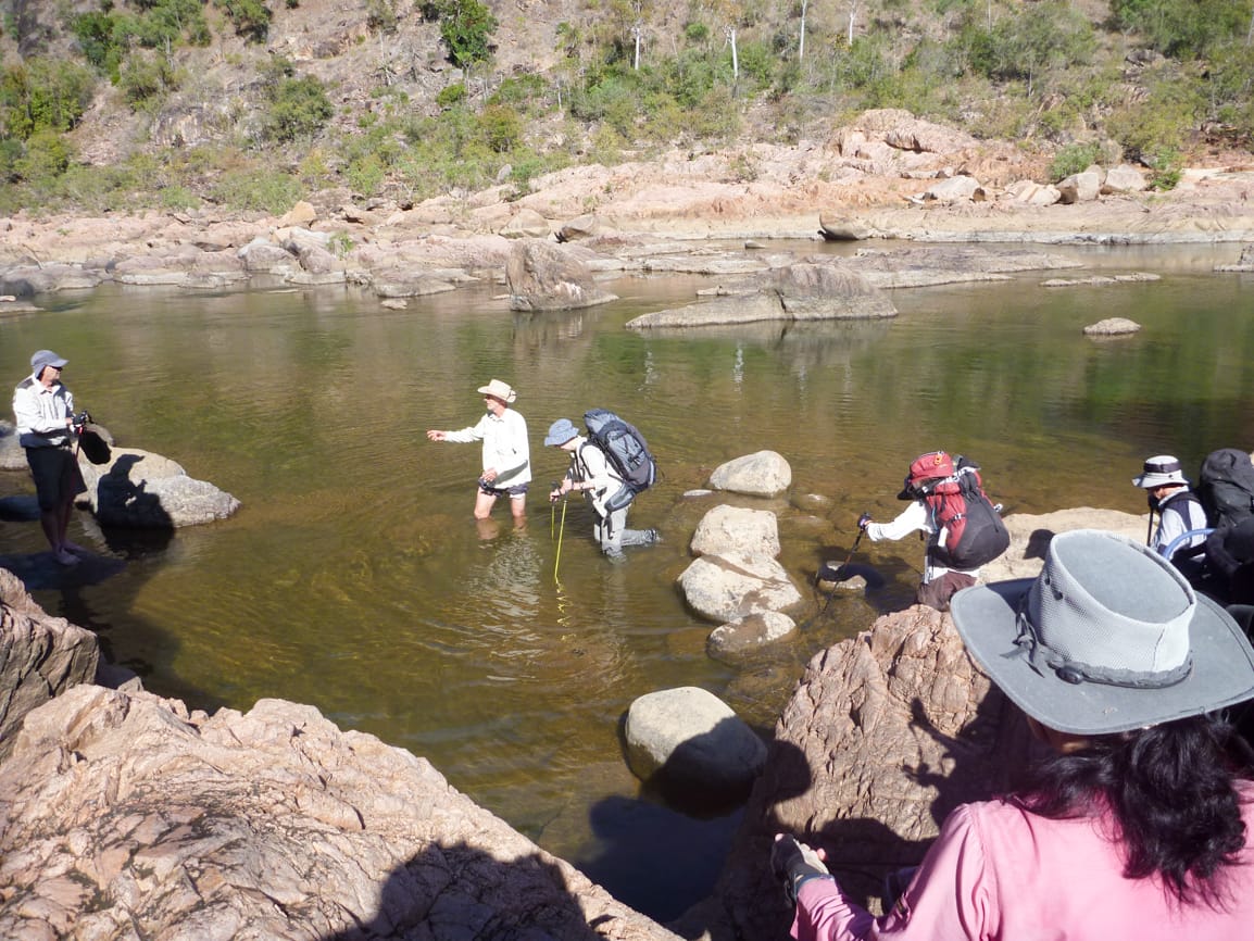
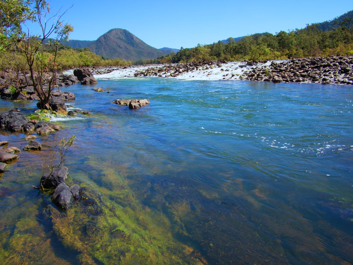
At 0805 we start, downstream through scrub and rocks for about 30 minutes, to reach the NP suggested crossing point. This is where we join the Juwun Great Walk route. This will be easy I thought – after all, it is the National Parks Juwun Great Walk crossing point just above Blanket Creek. But water level is high and fast. Shallow bits are very slippery. Wilfred and I explore to find a way across to the southern side. Back to the group, tell them to bag their packs for a wet crossing. Hans shuttles packs to a mid-point rock. We all cross over, some swimming the final part. It was over waist deep in parts on me. Nervous looks upstream as I cross. 45 minutes to get across here. Find most packs got some water in them, so quick unpack and dry of contents on the rocks. One couple discovered their toilet paper supply was now very moist and mushy – I kept a close eye on my full dry roll for the rest of the trip.
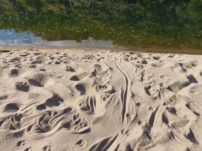
The river goes on a long sweeping bend here, open wide valley, so the opportunity to cut out the bend avails. Hopefully find a cattle pad to follow. So from the river head inland cross country, pick a point in the distance to aim for. Walking through long grass, waist high, then scratchy knee shredding weeds, into grass chest high, a great short cut I thought - not. After a while I am getting stuffed from bashing through matted grass, knees shredded, so Wilfred takes the lead – five minutes later we are in a side channel with sand and easy walking ! Follow this, to reach the main river bank at 1215 at a nice shady spot on a rapid , very scenic. At 1300 move on, about an hour later pass Smoko Creek junction on the opposite side (my planned day two camp spot – we are over half a day behind my schedule). We follow cattle pad along river bank, then inland on more cattle pad, easy walking. Then into scrub, Wilfred leading the way, with me pointing at landmark I was aiming for. We see some wild cattle close by. After bashing our way through scrub, we emerge on to the river bank, 200 metres upstream of the point I was aiming for. Head to that point, a nice sandy area for camping. Pigs are on the opposite riverbank. Making camp, spot a crocodile in the pool below our camp site, about 100 metres away. Bath in rapids at top of pool.
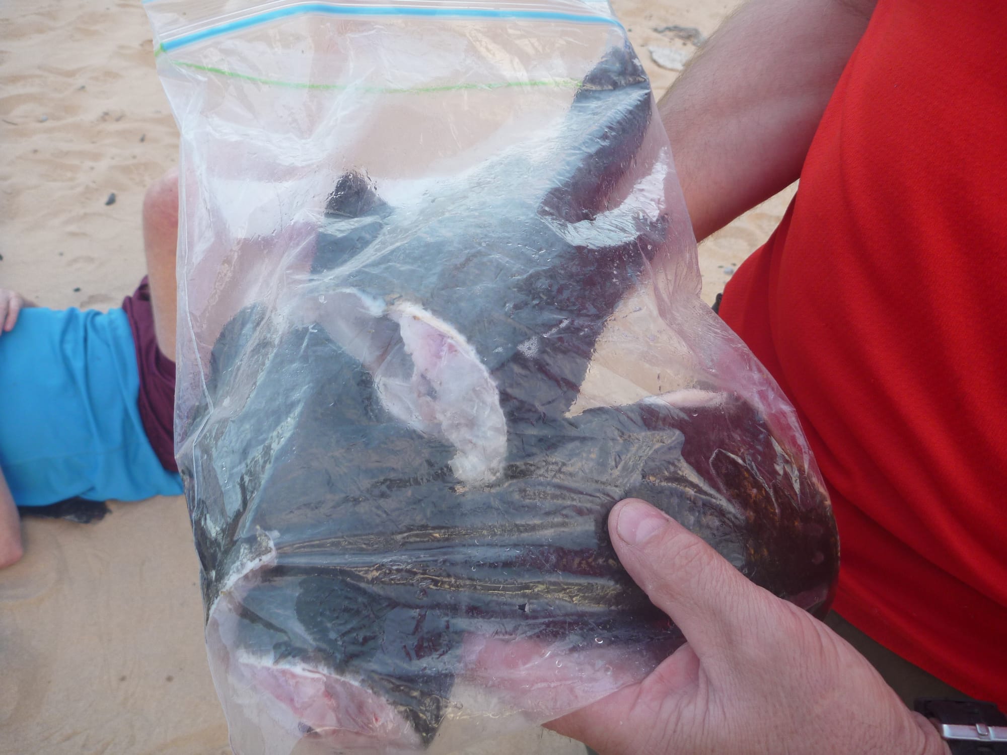
Hans goes fishing at base of the rapids, first cast catches a fish. Within a very short time he has four good size sooty grunters. Well, that is dinner taken care of. Wilfred tries fishing in the pool, and after a slow start lands four good fish as well. Wilfred proudly tries to gain attention of Suzanne to show his catch - Suzanne was too busy pampering herself in the rapids to notice. Me – well the Dyson curse, nothing. But we still had a feast of fresh fish for dinner. A great night, and set new standards for bushwalking tucker and camping.
Day 4 12.9 km
Up at 0600 – got my rod, down to the rapids. ‘We aren’t leaving till I catch a fish, even if that makes it a nine day trip’ I say. Eight casts into base of rapids, nothing. Ok, change lures, first cast, yeah, usual. Second cast – oops, is that snag ? Tighten drag, hmhmhm me thinks a fish – haul it in a for a good size sooty grunter. Okay, we can go home now.
0800 start walking, past the croc slide on sand point below our camp site, to the rapids just below. Cross here, shallow water, with me as croc spotter. We stay on the north bank all the way through Big W to Yamanie Creek. Easy going, rocky in parts, lots of round rocks, sand bars, then cattle pad near the end.
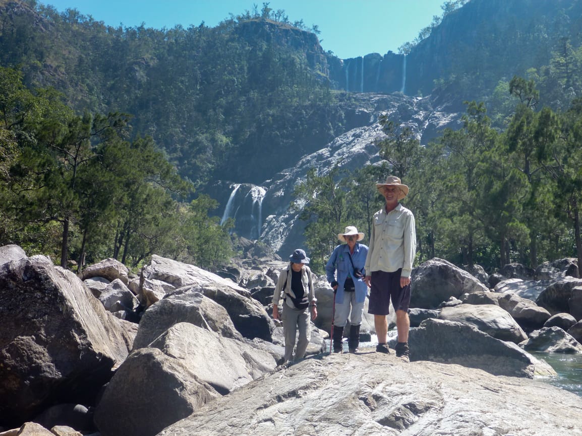
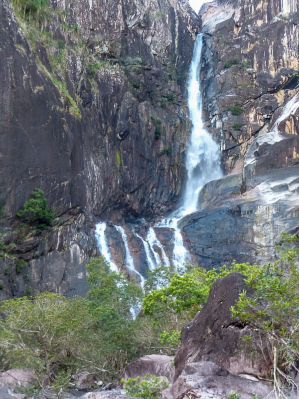
Arrive Yamanie Creek, go upstream a short distance to cross the rapids, make camp on pebbly bank at 1555. Wilfred, Hans and Rosemary go off to see Yamanie Falls, about 1.5 km upstream. The remainder of us just relaxed at camp site. At 1800 a sweaty three came back to camp, with photos of the waterfalls.
Day 5 15.2 km
Start walk 0755. Back to the river, along the river bank rock hopping for a while, some sand, then river bank walking in open terrain, often cattle pad, easy walking. Alongside a very long water hole. We are making good time, I am thinking we will be way too early for the bus at this rate. We see several crocodile slides on far sand banks. Came across a very large croc traverse on our path, where a very large croc moves from river to a side lagoon. Amazing sight, we did not linger in case it was around. Then into riverine rainforest, this slowed us down. It was shady and cool in here, but progress slowed. Past the first set of rapids (opposite Herkes Creek) which were barely noticeable from the rainforest, then alongside another long pool. Then into rocky terrain, a large brown snake is spotted close by. At 1015 arrive at large rapids, this is our crossing point (Orange Tree crossing) . Quick smoko break, while Wilfred and I survey for the best crossing. 5.89 km from Yamanie camp to here. 2 .25 hrs.
A wide crossing of one main channel and a side channel. Continual glances upstream to the long waterhole above, just in case. Cross over, knee deep mainly. On other side, a good photo location of the rapids and upstream view. Then we find the 4WD track, leave the river for the hot dusty track open forest walk. Come to the old Orange Tree cattle yards, inspect these. Find a Sunbird nest in the shed. Further on, a quick break in a shady gully ‘is it lunch time yet?’ are the pleas. ‘No – I have a place in mind further on…’. More walking, we arrive at lovely Sword Creek at 1315, a pool and running creek. Great spot for lunch and a bath. 12 km to here from Yamanie camp.
One hour lunch break, moving at 1415, promise of 30 minutes to river, then 2 km after that. A brisk pace, arrived at the river for the final crossing at 1440, 14.4 km from Yamanie camp. A long shallow river crossing (knee deep in parts), not worried about the NP ‘resident croc’ statement. Still looked upstream a fair bit though. Boots back on, track walk for 800 metre to arrive at the Yamanie NP gate at 1540 – the bus was here, a great sight (love it when a plan works – our pick up time was 1600). 15.2 km today.
A jovial bus driver, happily used seven cameras for our post-walk photos. We meekly asked ‘Do you mind stopping at a shop on the way so we can buy a cold drink please ?’ She responded 'I’ll take you to the pub’. ‘No, just a corner shop will do’. ‘No – I’ll take you to the pub’. Oh well, so be it then. Stopped at Long Pocket at the quaint Ashton Hotel on the way for welcome refreshments. And then, back at the Ingham airport, it was all over.
A great adventure.
Special thanks to Rosemary for organising the transport, the helicopter flight was amazing. And the bus was waiting in the right spot (phew). Special thanks to Wilfred for assisting with route leading – when the going gets tough, I let him take over J. And thanks to all participants for their co-operation, patience and tolerance – it was a very good group and good company.
Now, next time I get an idea for an adventure like this, please hit me over the head a few times !!
Regards
Keith
President


