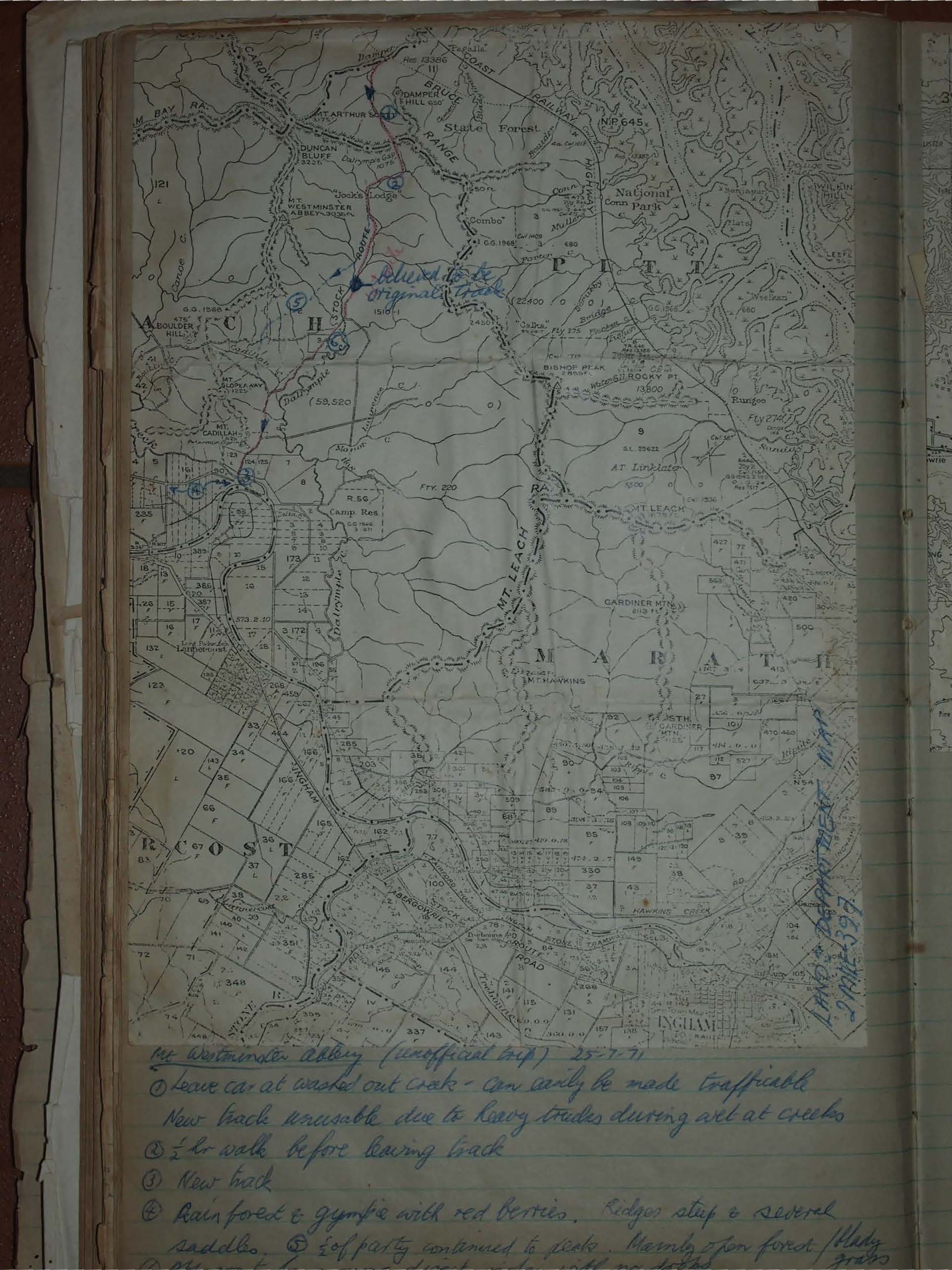
Mt Westminster Abbey, Bishops Peak, & Dalrymple Track
Mt Westminster Abbey, Bishops Peak, and Dalrymple Track, July 1971: an unofficial North Queensland trek through steep ridges, rainforest, and open blady grass to the summit. Offering misty forest climbs, creek crossings, and historic features, showcasing rugged bushwalking adventures.
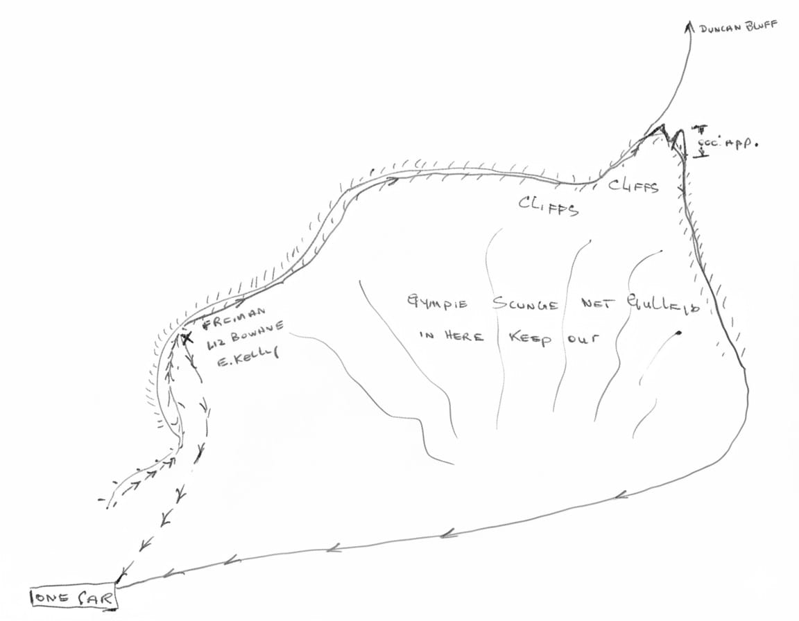
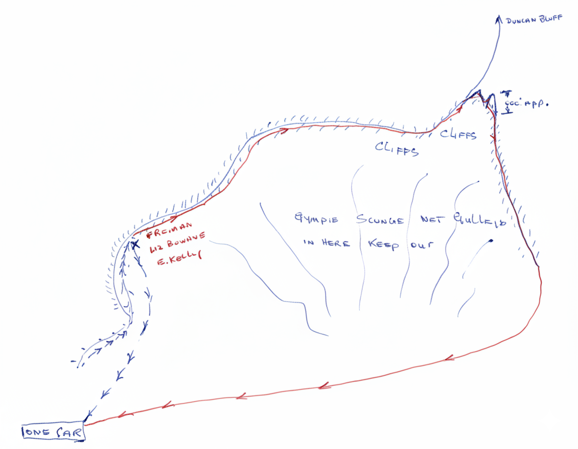
Mt Westminster Abbey (unofficial trip) 25-7-71
① Leave car at washed out creek - Can easily be made trafficable. New track unusable due to heavy grades during wet at creeks
② ½ hr walk before leaving back
③ New track
④ Rainforest & gympie with red berries. Ridges steep & several saddles.
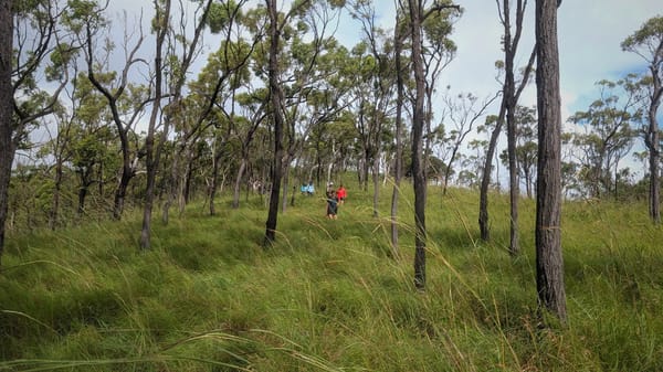
⑤ 2 of party continued to peak. Mainly open forest / blady ford / grass
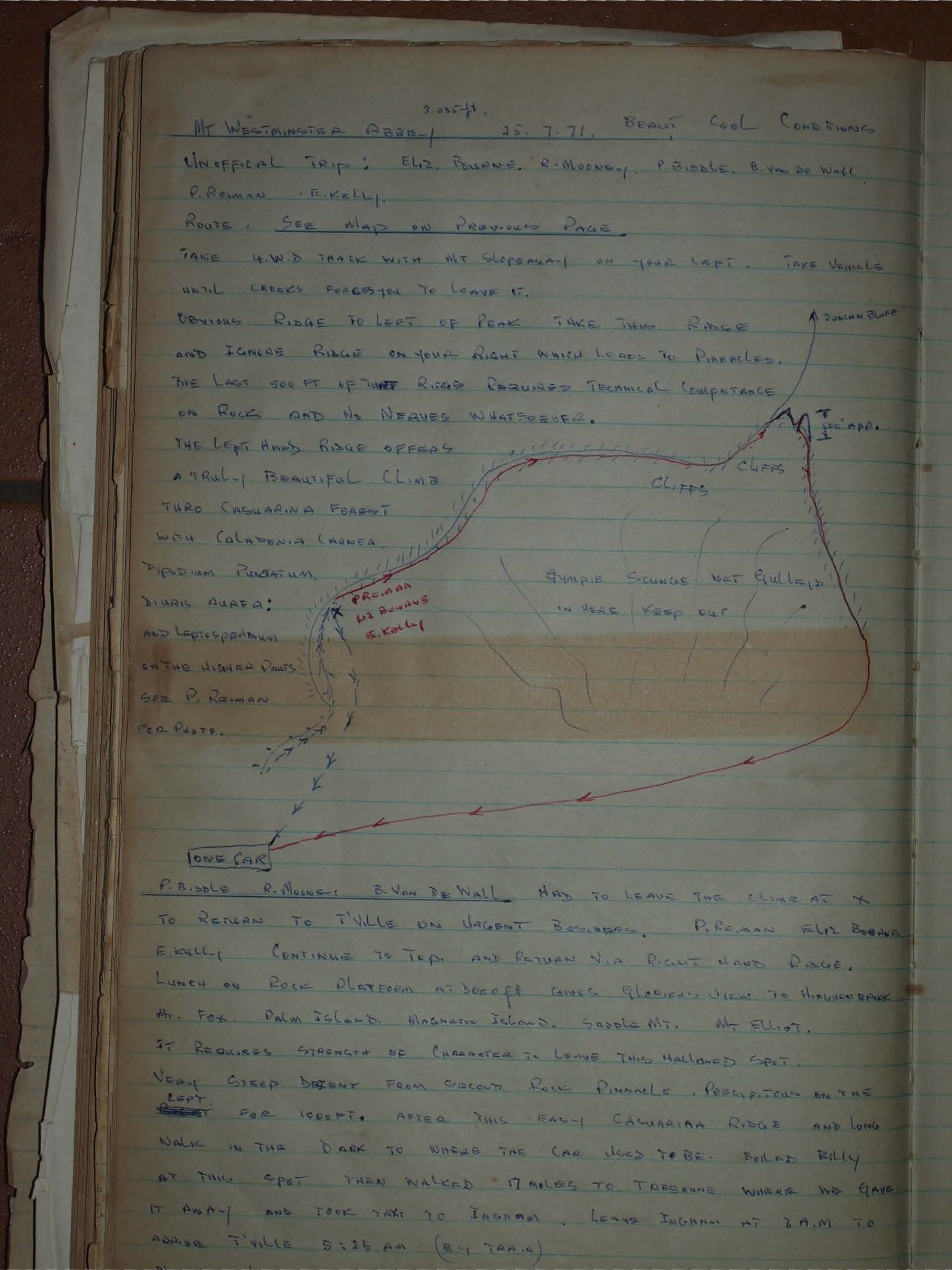
Mt WESTMINSTER ABBEY 3035ft
25.7.71.
Beaut Cool Conditions
Unofficial trip: Eliz, Bourne, R. Mooney, P. Biddle, B. Van De Wall, P. Reiman, F. Kelly.
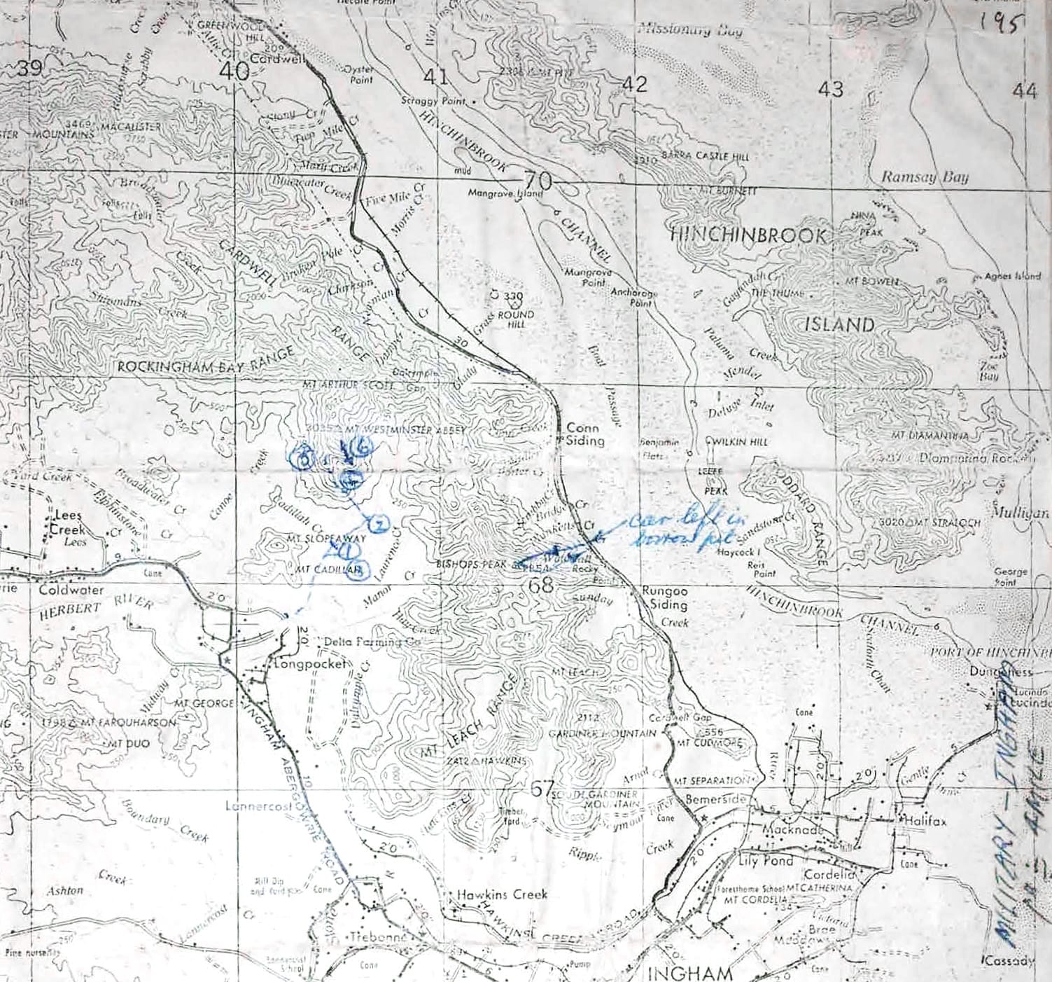
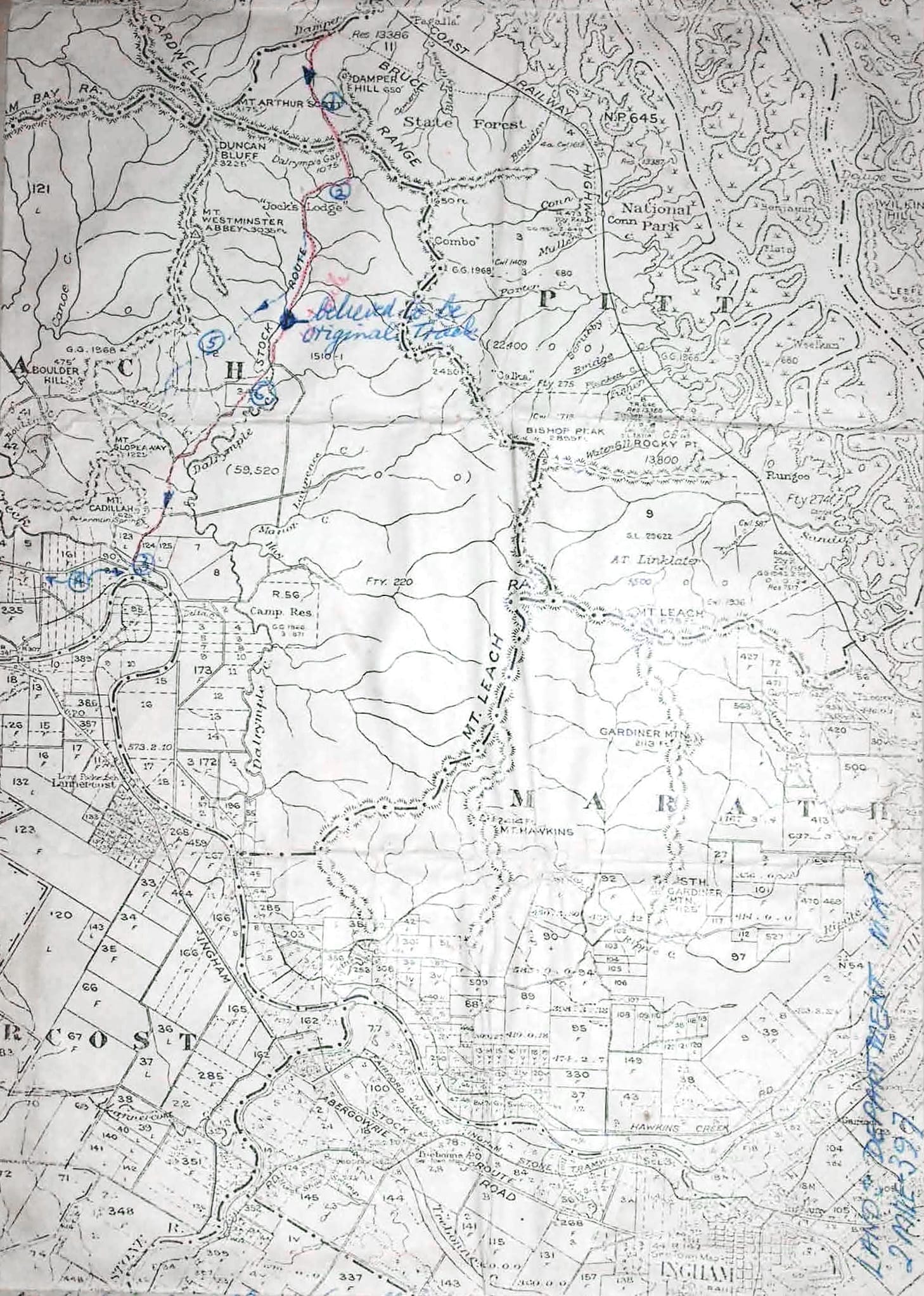
Route. See map on previous page.
Take 4.W.D. Track with mt slope on your left. Take vehicle
Until creek forces you to leave it.
Obvious ridge to left of peak take this ridge
And ignore ridge on your right which leads to pinnacles.
The last 500 ft of this ridge requires technical competance
On rock and no nerves whatsoever.
The left hand ridge offers a truly beautiful climb thru casuarina forest with caladenia carnea pteridium punctatum, diuris aurea; and leptospermum in the higher parts.
See P. Reiman for photo.
P. Biddle, R. Mooney, B. Van de Wall had to leave the climb at X to return to T'ville on urgent business.
P. Reiman Eliz Bourne F. Kelly continue to top and return via right hand ridge.
Lunch on rock platform at 3000 ft gives glorious view to Hinchinbrook, Mt. Fox, Palm Island, Magnetic Island, Saddle Mt, Mt Elliot.
It requires strength of character to leave this hallowed spot.
Very steep descent from second rock pinnacle. Precipitous on the left. For 1000 ft. After this easy casuarina ridge and long walk in the dark to where the car used to be. Boiled billy at this spot then walked 17 miles to Trebonne where we gave it away and took taxi to Ingham. Leave Ingham at 8 a.m. to arrive T'ville 5:25 am (by train).
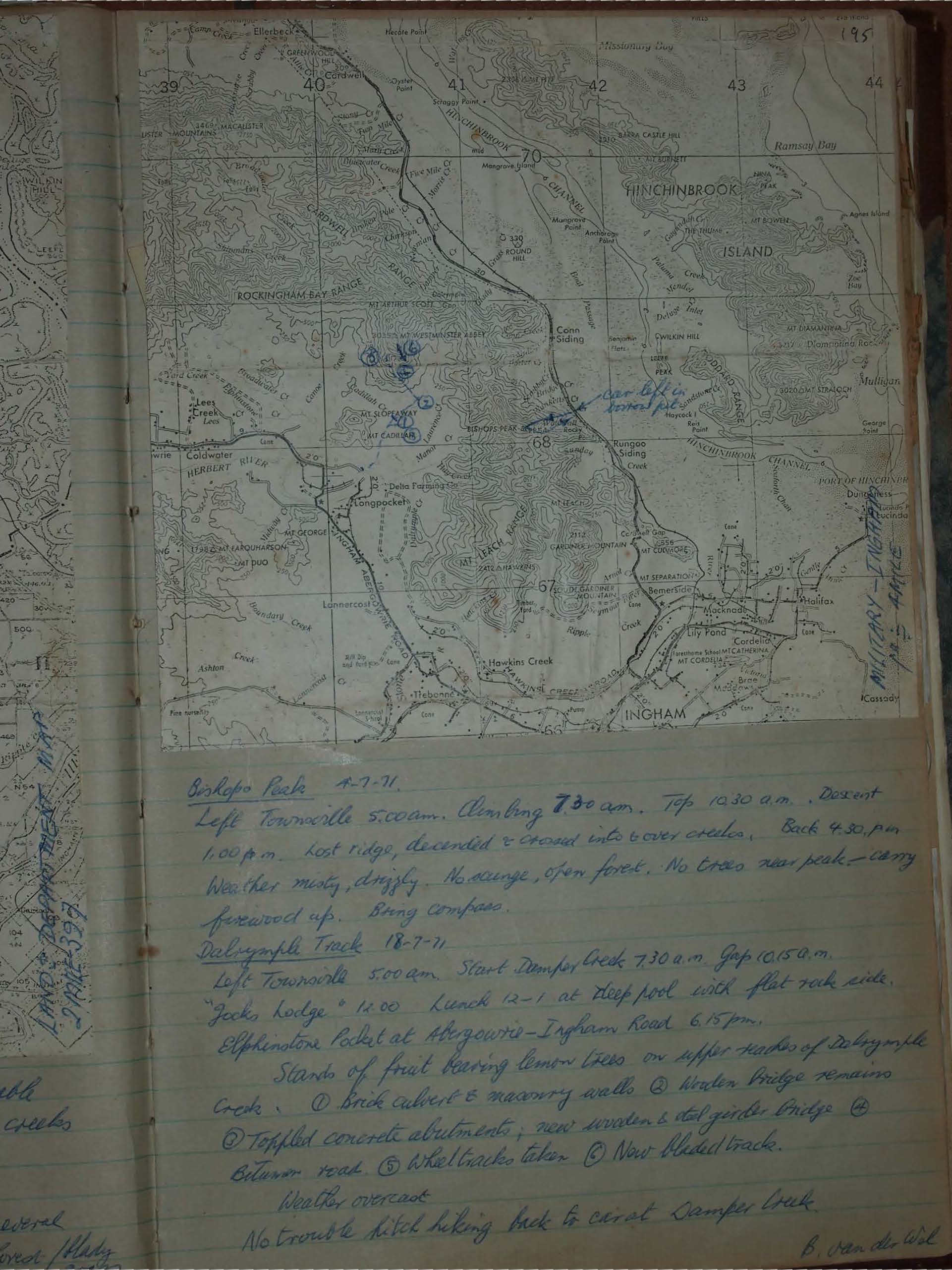
Bishops Peak 4-7-71.
Left Townsville 5.00 am. Climbing 7.30 am. Top 10.30 a.m. Descent
1.00 p.m. lost ridge, descended & crossed into & over creeks. Back 4.30. p.m.
Weather misty, drizzly. No scunge, open forest. No trees near peak – carry
firewood up. Bring compass.
Dalrymple Track 18-7-71
Left Townsville 5.00 am. Start Damper Creek 7.30 a.m. Gap 10.15 a.m.
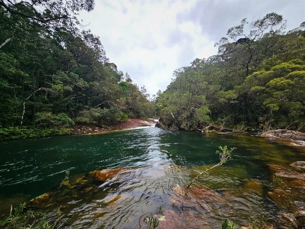
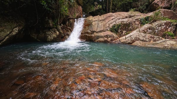
Jacks Lodge ~ 12.00 Lunch 12-1 at deep pool with flat rock side.
Elphinstone Pocket at Abergowrie - Ingham Road 6.15 pm.
Stands of fruit bearing lemon trees on upper reaches of Dalrymple
Creek. ① Brick culvert & masonry walls. ② Wooden bridge remains
③ Toppled concrete abutments, new wooden & steel girder bridge. ④
Bitumen road. ⑤ Wheel tracks taken. ⑥ Now bladed track.
Weather overcast
No trouble hitch hiking back to car at Damper Creek.
B. Van der Wijk