Yarns of recent activities
Featuring three adventures - a scenic, history-rich Dalrymple Gap walk with far more creek crossings than expected, and a tough Mt Storth and Killymoon Creek bushwalk with granite scrambles, swims, and sweeping views.
18th July Saturday – Terraces.
A club event, Wilfred led the local meet-up group up to the Terraces and Ultima Falls. A good day out with multiple waterfalls in an awesome creek.
Four Crossings ... Dalrymple Gap Track
Four creek crossings (one way) our leader advised. An easy 16 km track walk, four creek crossings out, same four back, a short hill, historical, a nice easy day.
Heading along towards the gap, after the fourth creek crossing, leader muses “must be 1 or 3 more crossings to go ya know ......”..... “why?”............................ “ well we are on wrong side of creek to go up to the
gap, so must be at least one more, but maybe 3.... ”. Then crossing number 5, then 6, then 7, then 8,
then 9, then 10, then 11 ..................... what the ...........
Saturday 18th July 2020, 14 keen walkers (5 members, 9 visitors) met at Ingham. Then we convoyed to start of the Dalrymple Gap track at the southern end. This was an out and back national park walk alongside Dalrymple Creek then climb to the gap and the historical bridge. Start walking at 0845, short distance later first creek crossing, leader wades straight through non-stop, emerges on other side and stand there arms crossed. The group mulls on the creek bank, most taking footwear off, all looking for an easy or dry way to cross, but they have to get wet anyway - a few follow the leaders example with shoes on. A few yelps about the cold water. Shortly after, next crossing, this is deeper, almost waist deep on some, and this water is very cold. And so the walk progressed as the track followed and crossed the creek numerous times. The creek is quite scenic, paperbark trees with knarly root systems line the bank, and looking upstream the trees and rocks frame nice creek scenery. As the number of creek crossings increases, more just wade through the creek with footwear on. By the last crossing, only one was still removing footwear, the rest had given up. We reach the old grave, and discuss why it is here. Mystery murder, or otherwise ? Nearby is a magnificent strangler fig tree. Last creek crossing, then walk through fan palms, very nice, we are in real rainforest now. Then climb up the hill, past a known stinging tree area (Gympie Gympie), we sight several stinging tree plants alongside the track. We reach the top of the gap and lunch break at the historical stone-pitched bridge.
After lunch, the return journey, we are faster, and nobody takes footwear off for creek crossings anymore. Stop at the rock pool for a break, very scenic, but nobody braves a swim. Back at the cars at 1540. A very good walk and an excellent group of walkers.
The existing 10 kilometre Dalrymple Gap walking track is only a small section of the original 96 mile (160 kilometre) track to the Valley of Lagoons Station. The track was the first road suitable for wheeled traffic in north Queensland. The stone-pitched bridge is the oldest surviving example of civil engineering work on mainland north Queensland. The track was heavily used from 1864 to the late 1870s. Pack horses and bullock and horse teams carted supplies between the coast and the inland and cattle and horses were driven to the coast for sale. The track, initially built for bullock teams to pull wagon loads of wool, was always difficult and slow, so freight costs were expensive.
Drunken Rock, Mt Storth and Killymoon Creek
Sunday 19th July - 12 adventurers for a bushwalk up to Mt Storth, a hill at elevation 632 mr. Mt Storth is the northern summit of the Mt Elliot range of Bowling Green Bay National Park (north of Alligator Creek). Then depending on how we are going, cross over to Killymoon Creek, or if need shorter exit then down Dribble Creek. Aim is morning tea at Mt Storth, lunch at Killymoon pool, home around 4 to 5 pm.
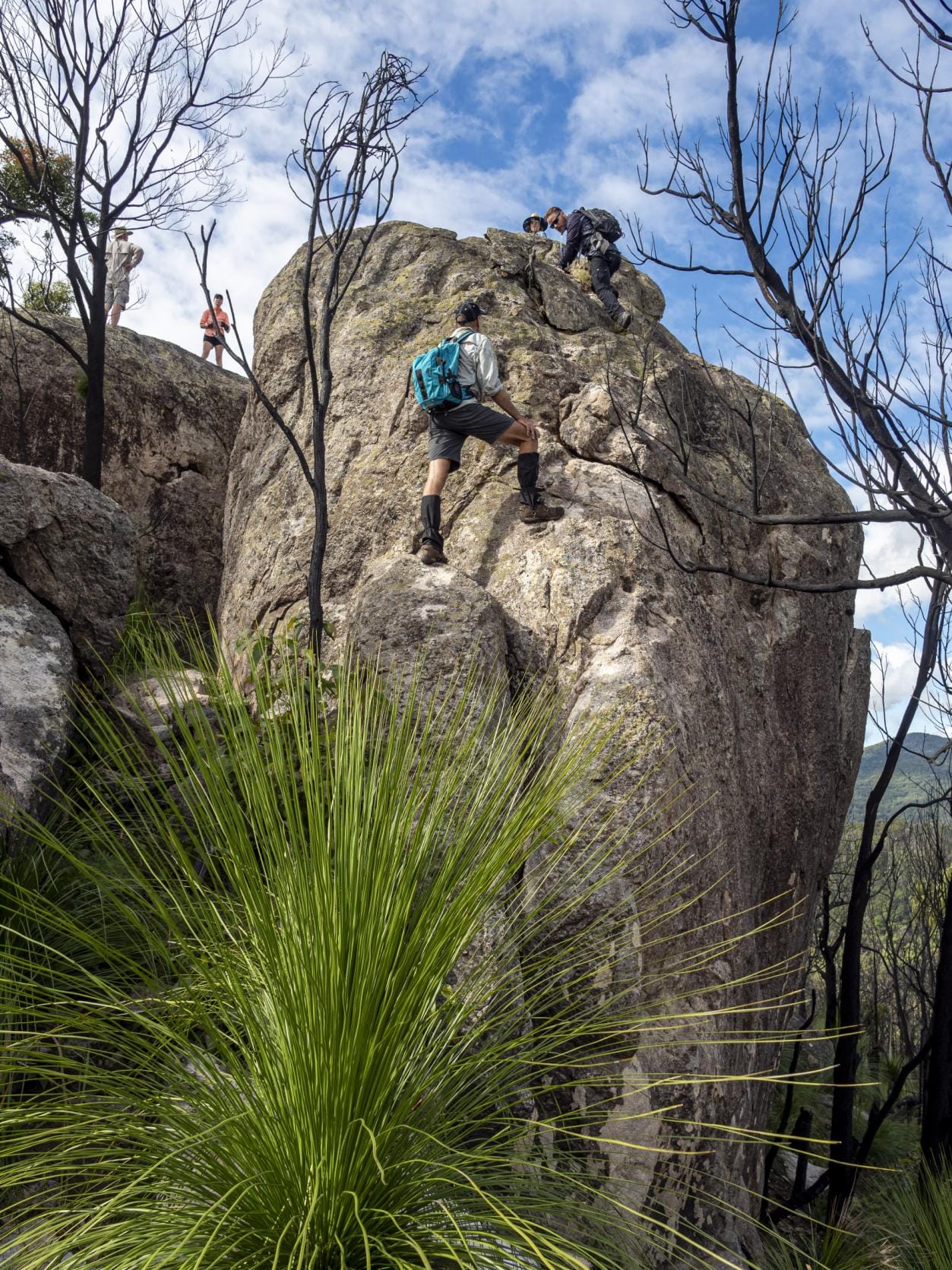
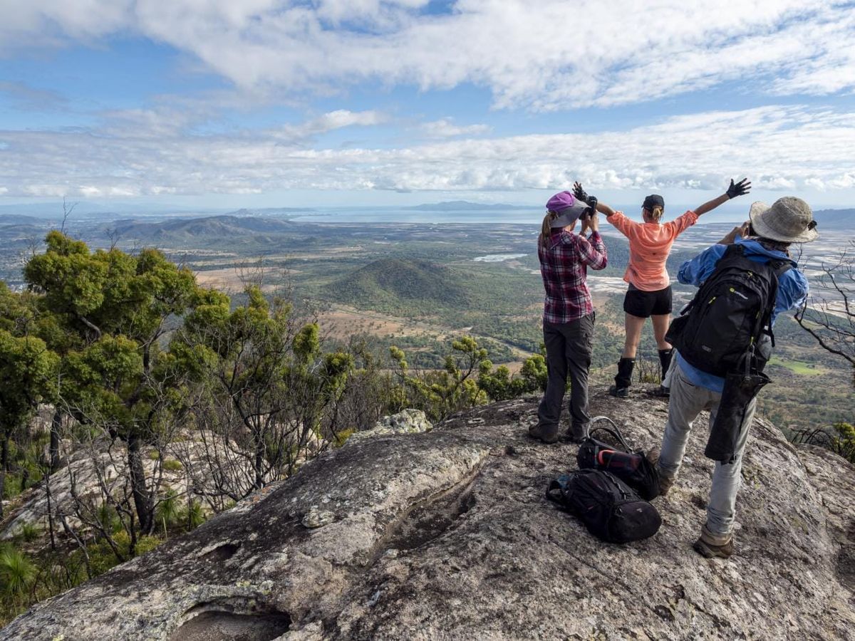
Started walking at 0715, cross country and fire trail walk to Killymoon Creek. MB broke a gate ! Then the climb along a spur through long grass, scrub and rocks to head for Mt Storth. Not as scrubby as last time due to fire management in past few years. Several good quick breather stops at granite outcrops that provided great scenic lookouts. Views over Cape Cleveland, to Maggie Is, Castle Hill, ranges in the south and west, The Sisters, Joy’s Cliff, and even the back of Lake Ross. At one there is a challenge to climb a boulder – why ? – coz it is there. Coming down was the real challenge. As we climb further along the spur, the vegetation changes, from scrubby to cycads then grass trees. We reach the rocky outcrops at the top for morning tea. It was 5.6 km 3 hr walk uphill from the start.
More granite boulders to climb. Drunken Rock, a fine boulder, we can all fit on top of for a morning tea of pikelets with jam and dolloped cream, followed by cake with dolloped cream. One adventurer, bit of a classy show off, brings out gourmet cheese and red wine. Alas, the excitement was too much and ‘drunken rock’ was the result of a full spillage. Ah well, enough in the bottle to refill the glass, but that means not enough for lunch time. If you see a red stained boulder, that is Drunken Rock.
There may be some happy drunken animals up that way now.
Time to move on, but damned el Prezidento says “ya know, I reckon that boulder ahead is higher, better climb that to reach true summit”. Get to that boulder, the Prez says “hang on, next boulder is even higher” to receive several groans “will you stop looking” but anyway, we trudge on to that boulder and most scramble to the top and all agree the Prez was right, it was higher (note - Prez is always right !). Again, coming down was most challenging. But then, damn Prez, staring south-east into the distance, starts shaking head and stares at WK, “ya know, I don’t think this is the true
summit either... ”. More groans, “stop looking will ya” (at start of day, el Prez did suggest we could
go to Mt Storth, then down McKenzie Creek as an ‘adventure’ shortcut, but WK was dead against that. So this might be Prez revenge?). Anyway, it was 1030, time to head for Killymoon. The hard part of the day was over – or was it ?
Memories – ah, a nice short flattish walk over the saddle to ridge above Killymoon, a short easy descent to the creek and life is grand. But ......
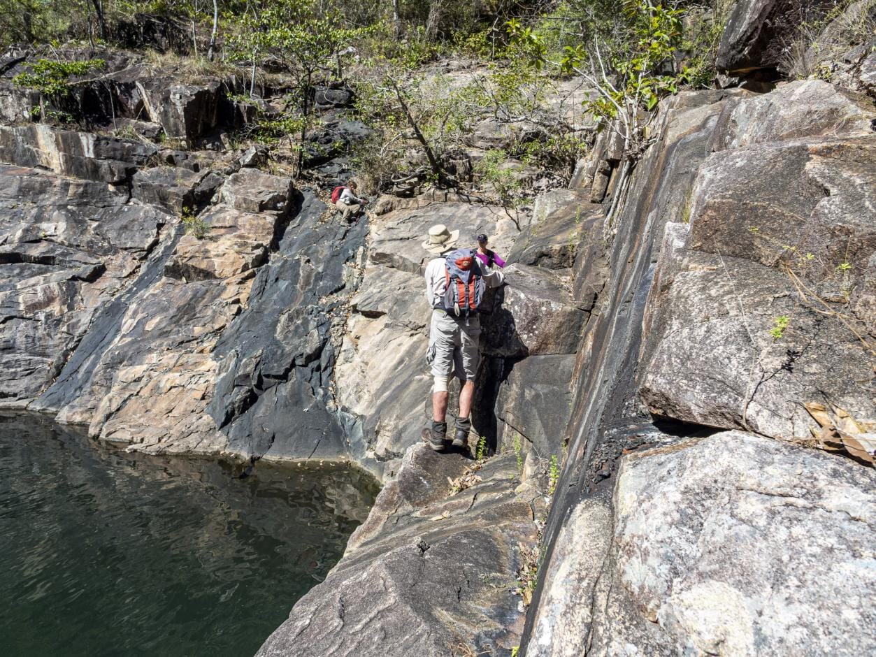
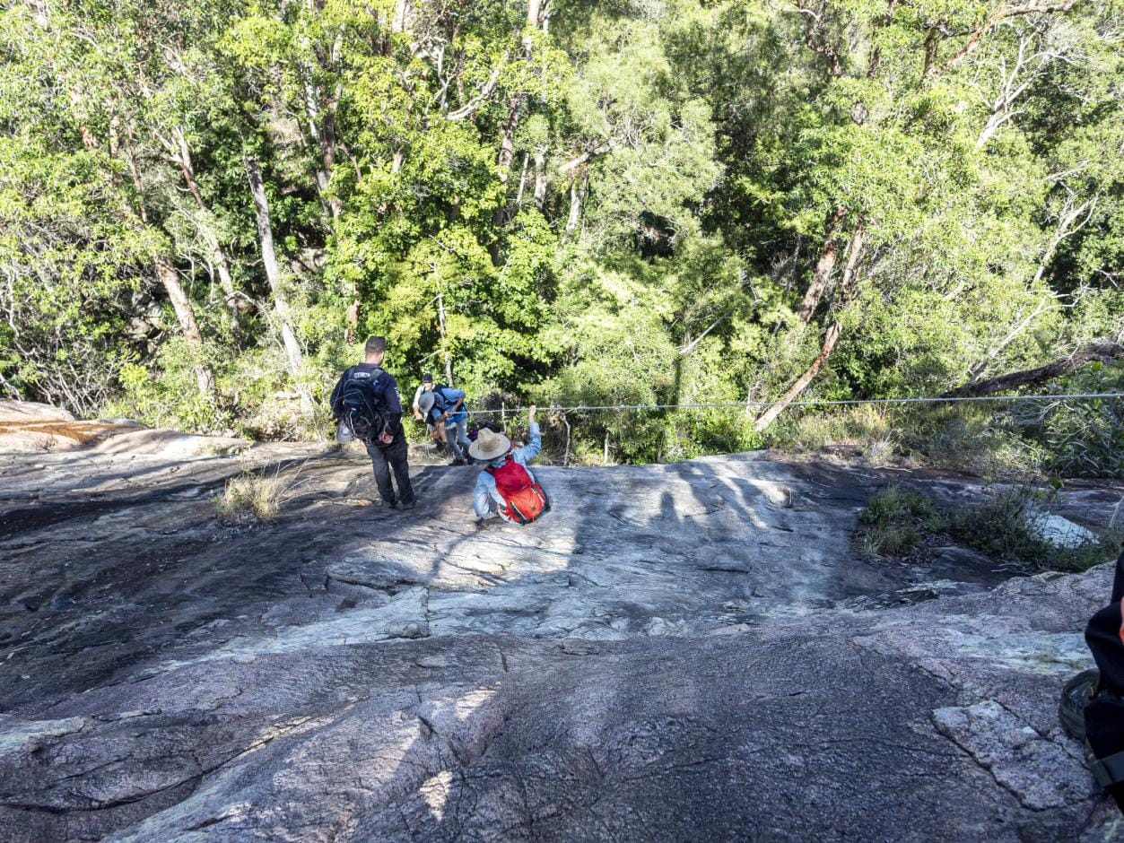
Looking towards Killymoon ridge, in between is a very deep rough gully of Dribble Creek. Was that there last time ? That means steep descent followed by steep ascent. A long steep scrubby descent, just above Dribble Creek we are blocked by sheer cliff face. Backwards and up a bit, try a steep sloping granite rock face to go down, very challenging. Not much grip ! The greyhounds and monkeys go down quick but it was challenging for us mere mortals. We put a rope in place to assist on the very steep slope that was bit slippery in parts, so that took some time to get down. No pants shredded surprisingly. Then the steep climb out of Dribble, “use the contours and aim for that saddle over there ” is the call, as the greyhounds lead off. It was steep and scrubby. I don’t remember this hardship ! Get to the saddle, but another gully to traverse then bit more up, to finally be on the ridge high above Killymoon. Then a hard steep descent, tough on knees, follow a rough small creekline, to finally reach Killymoon. That was a 1.8km bushbash to reach Killymoon from Storth, that took 2 hrs, 403 mr total descent. When did the fun start ? Then the 2.1km slog on a long rock and boulder traverse down Killymoon to the pool. The greyhounds, bounding far ahead, had time to stop and play by making multiple cairns. Planned lunch of 1 pm came and went with no stop “almost there, just around the corner”. I hear several hunger pain calls from others. An hour later we get to the pool for lunch at 2:10 pm. Just above the pool the creek is very scenic, waterfalls, rapids and good rock formations. That was a tough hike since morning tea. Lunch and swim was very welcome. Plus, more pikelets, cake, jam and dolloped cream - I tried to politely refuse any more, but I was forced to
....... several times.
Then it was the standard 3.6km 1 hr 45 min hike home, boulder scramble down Killymoon, to be back at the cars at 1630. A great day, tough hike, and harder than my memories!
Best of all, a fantastic group of adventurers. And the ice cream and cold drink at the roadhouse, awesome. Distance 16.5 km, total ascent 873 mr.