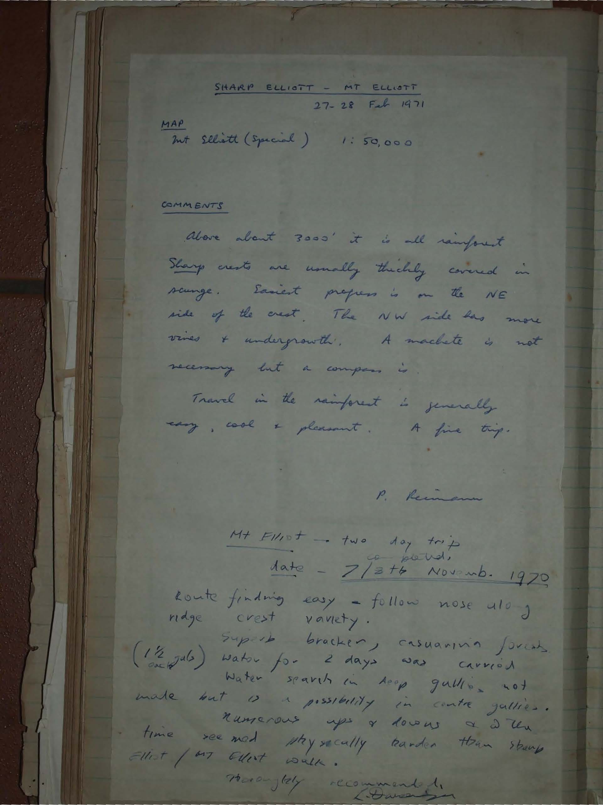
Sharp Elliott, The Shoulder, and Mt Elliott
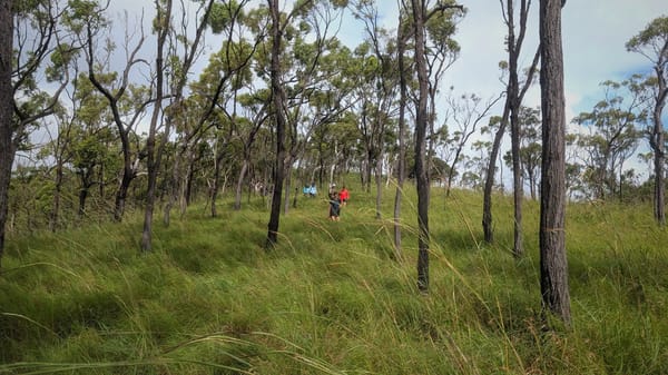
The rugged Sharp Elliott, The Shoulder, and Mt Elliott route near Townsville. Rainforest above 900 m, ridge crests, bracken and casuarina forests, and challenging ups and downs make this two-day hike rewarding. A compass is essential for navigation in this classic North Queensland adventure.
SHARP ELLIOTT - MT ELLIOTT
Date 27-28 Feb 1971
MAP
Mt Elliott (Special) 1:50,000
COMMENTS
Above about 3000' it is all rainforest.
Sharp crests are usually thickly covered in scunge. Easiest progress is on the NE side of the crest. The NW side has more vines & undergrowth. A machete is not necessary but a compass is.
Travel in the rainforest is generally easy, cool & pleasant. A fine trip.
P. Reimann
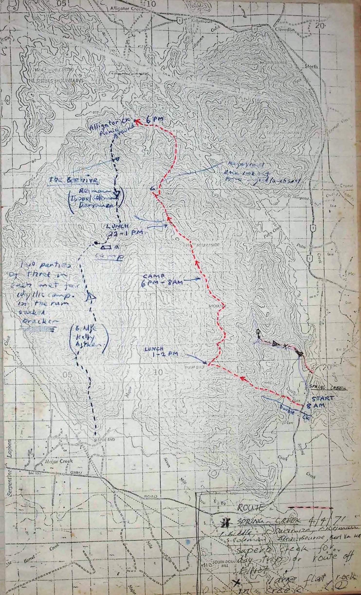
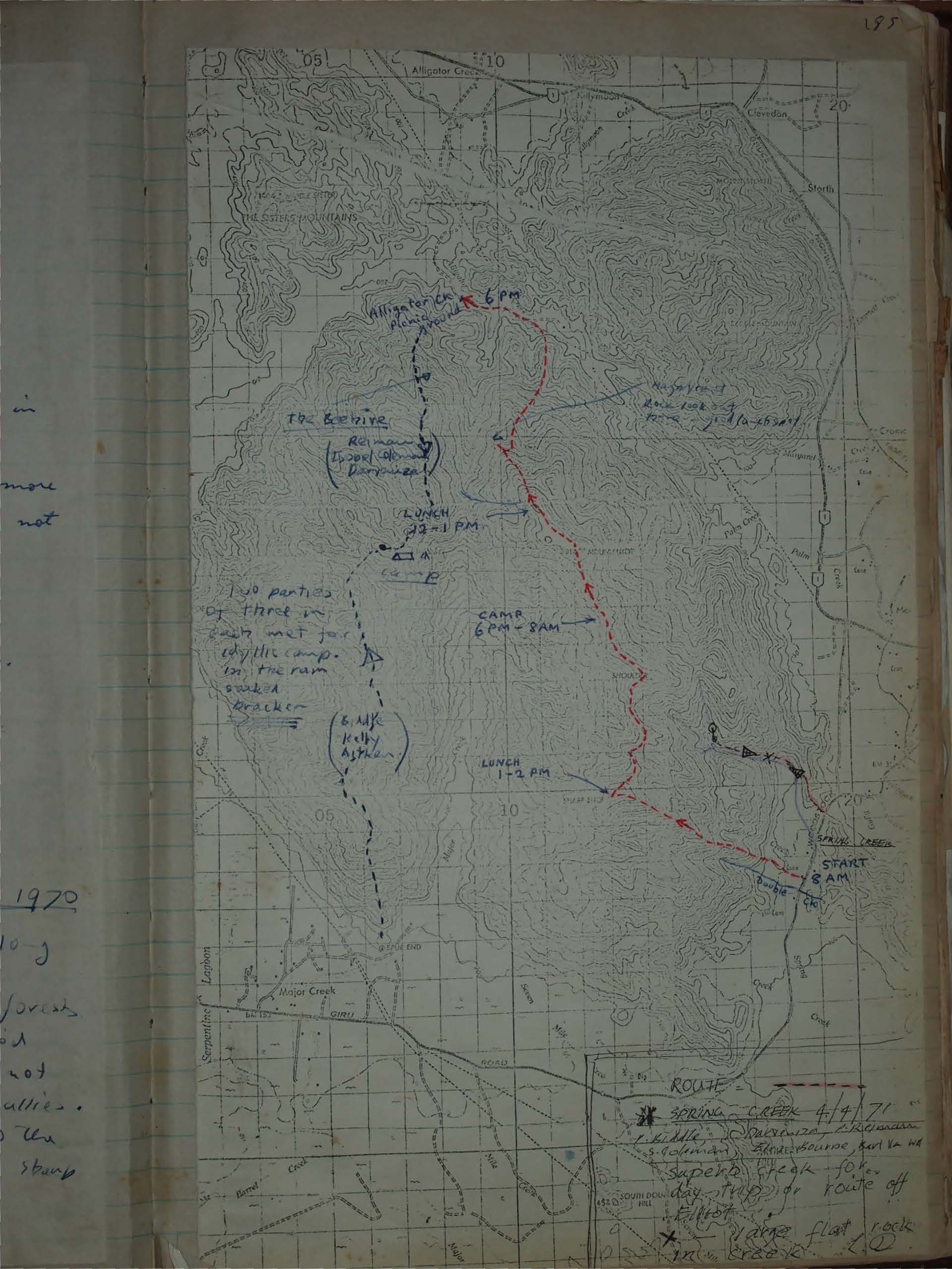
Mt Elliott - two day trip co pards.
Date - 7/8th Novemb. 1970
Route finding easy - follow nose along ridge crest variety.
Superb bracken, casuarina forests
(1 1/2 gals) Water for 2 days was carried
Water search in deep gullies not made but a possibility in centre gullies.
Numerous ups & downs & due to the time req'd made physically harder than Sharp Elliot / Mt Ellent walk.
Thoroughly recommended
L. Davenport
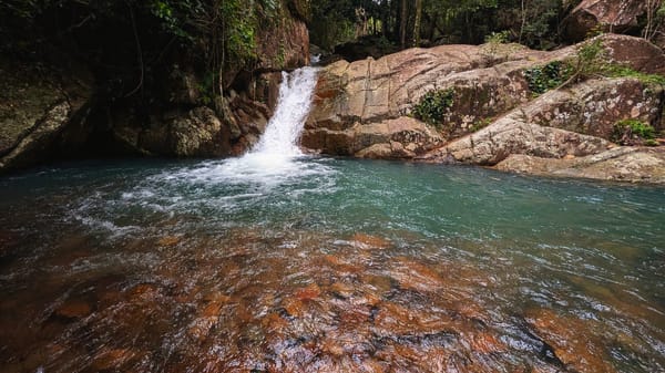
Spring Creek
Date 4/4/71
L. Middle, J. McKenzie, C.H. Wassell, S.C. Tolman, Frankbourne, Sui Va Ha
Superb Creek for day-trip or route off Elliot
x - Large flat rock in creek
L. D.