Waterfall Creek
Bushwalking Waterfall Creek, Paluma Range: rock hopping, cascades, orchids, and stunning views across Ingham and Hinchinbrook. A challenging hike with waterfalls, pools, and rugged rainforest adventure near Townsville.
8 walkers
We assembled at Paluma at 0715, quick coffee at Wilfred’s, departing 0735 for the dam in the 4x4s. Temperature was 9 degrees, it was chilly.
In the old days Waterfall Creek was called ‘100 waterfalls in day’. This is the waterfall system on the northern side of Paluma Range that you can see from the Bruce Hwy as you drive past Bambaroo school. Today was a day walk from Paluma to and from Paluma Dam.
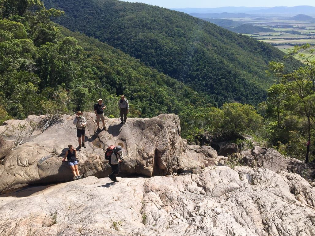
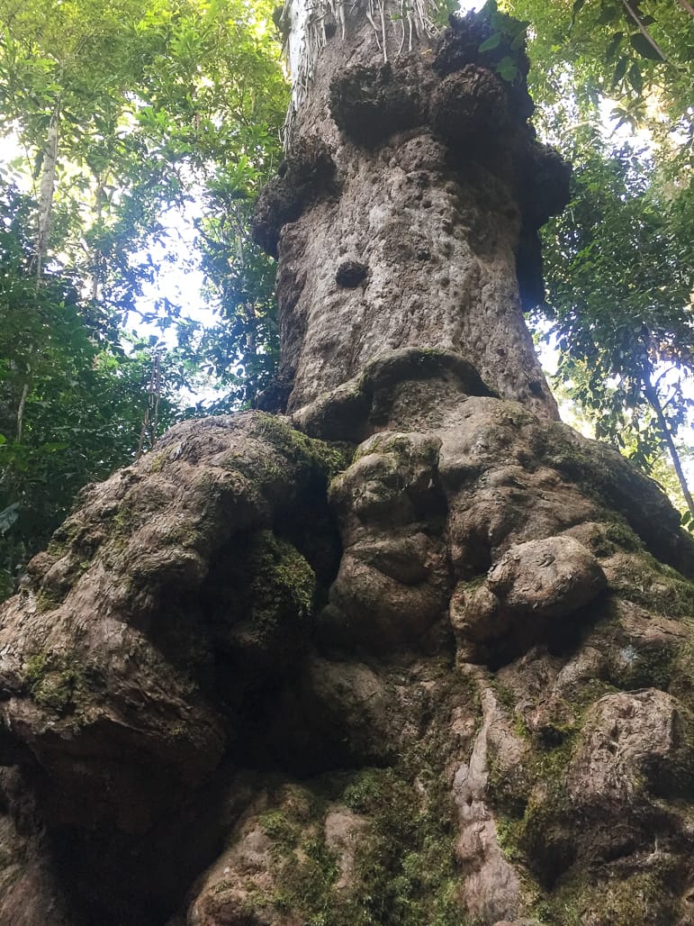
0800 at the dam. Proceed along the ‘roads’ to reach Diorite Falls at 0930. Along the way we stopped at the lumpy tree.
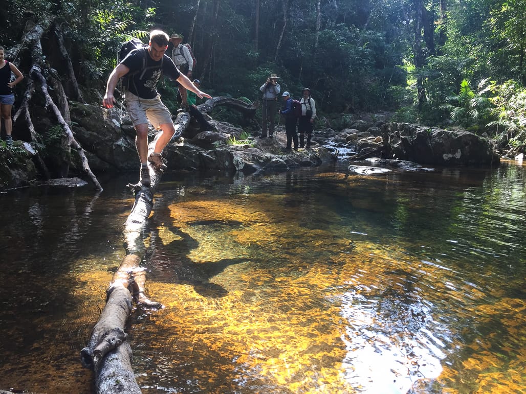
From Diorite Falls, we bushwalked down the creek, rock hopping or bushbashing through ferns. At one choke point, you had to be a contortionist to scramble over and under trees. Instead, Tim walked the plank, along a fallen tree hanging over the water, which worked until his weight pushed the log under water, and in he went.
Reached the lower cascade 1000, and keep going. No morning tea break today, tough leader.
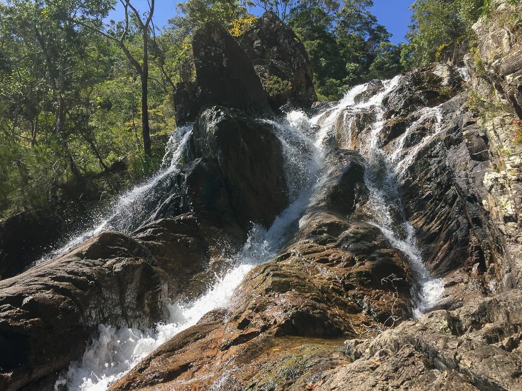
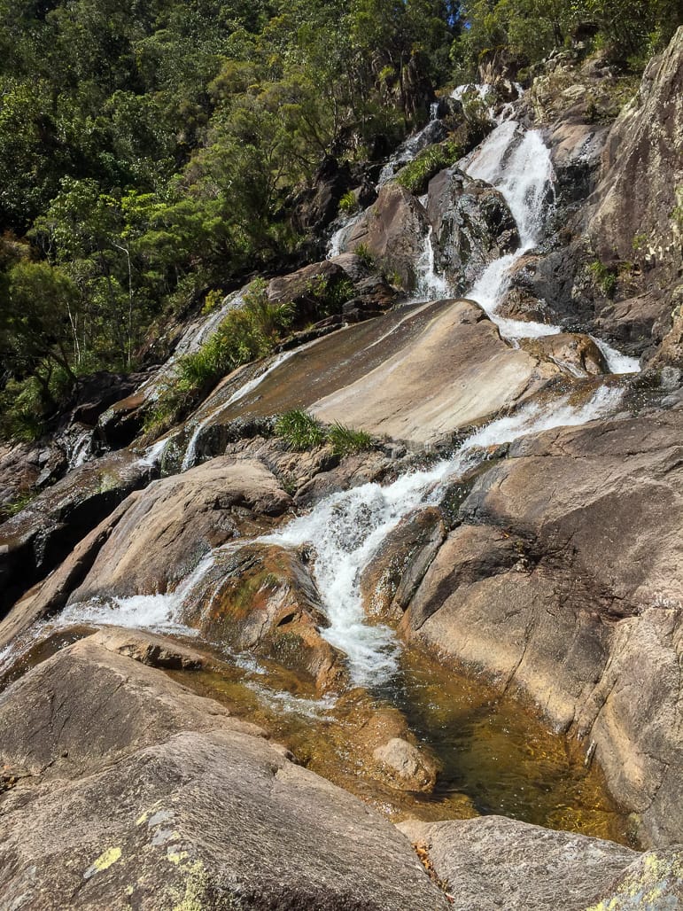
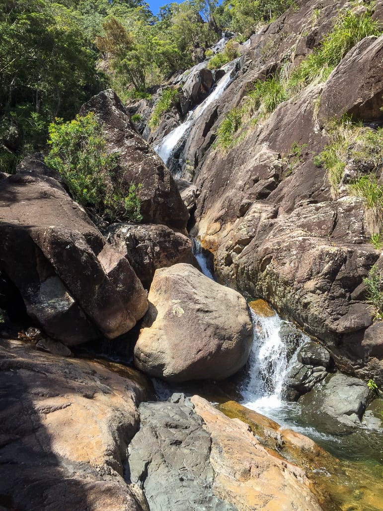
Continued rock hopping and fern walking, Waterfall Creek is a beautiful creek, clear water, nice pools and small cascades. In parts there are marked sections and faint track, probably from the Army adventure-training course. The creek starts to drop more, larger cascades and short rockfaces to negotiate, beautiful scenery. The mob is hungry and needs sustenance, some are weakening. The leader did not need a sustenance break because he consumed a ham tomato roll just before stepping off, hence the push to keep moving without breaks (destination mission focused). Anyway, being nice guy, I let them have a short break at a nice cascade at 1100. Orchids are starting to flower, a nice scene.
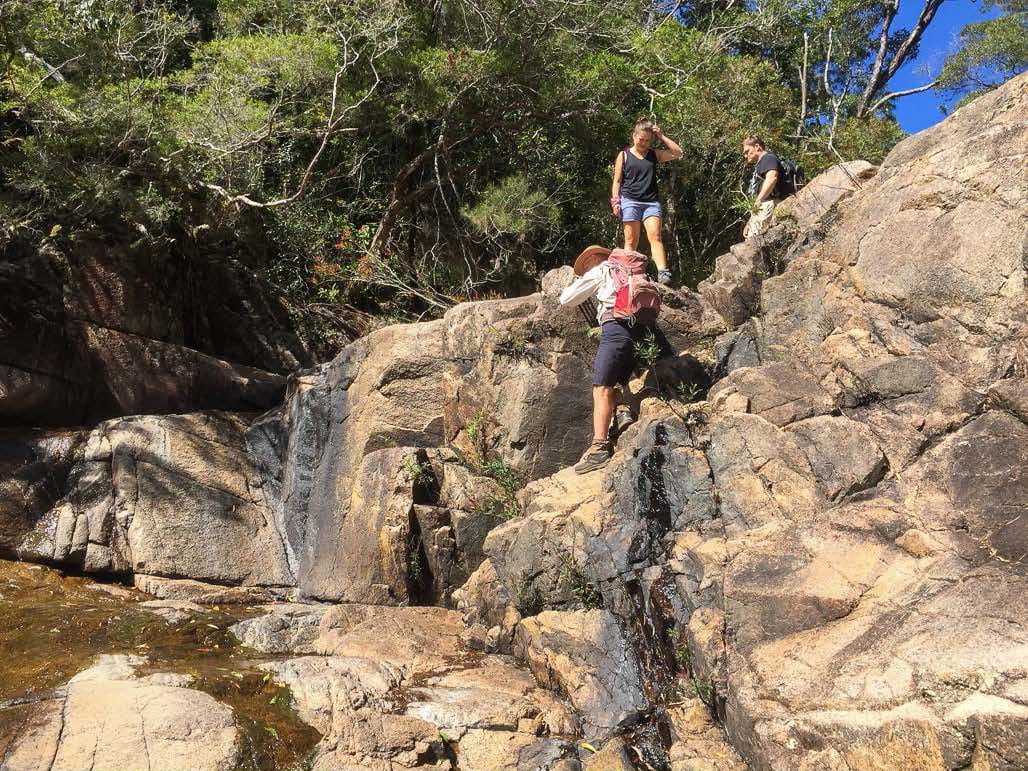
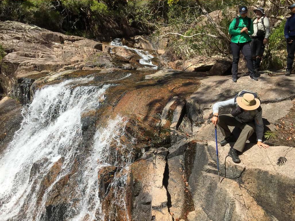
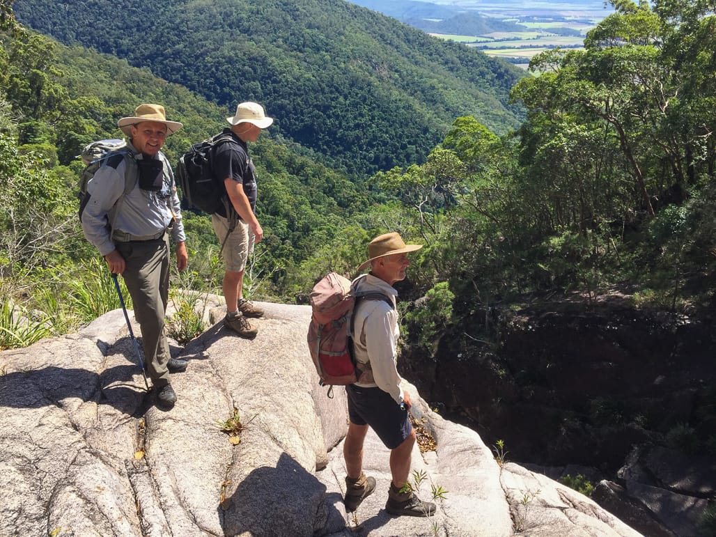
At 1130 we arrive at the top of the falls main drop-off. Splendid views of the falls drop-off, and in the distance Ingham and Hinchinbrook areas. We cross to the left side for better view.
Usually we go the right side to go down further, but as we are on the left we decide to try this side, and come up the other side back to the top of the drop-off, a circuit. With Wilfred leading, it is a serious bushbash, trying to avoid cliff lines and exposed rockfaces. We only have 150 mr to go, but the terrain and bush is challenging. We are not certain if this will work, but the bit we are aiming for should be suitable for re-entry to the creek if we can get there. Our efforts work and we re-enter the creek at the top of another drop-off. Find a way across the top, then short scramble up rocks for a lunch spot at 1215, with views of the top waterfall above, and valley views below.
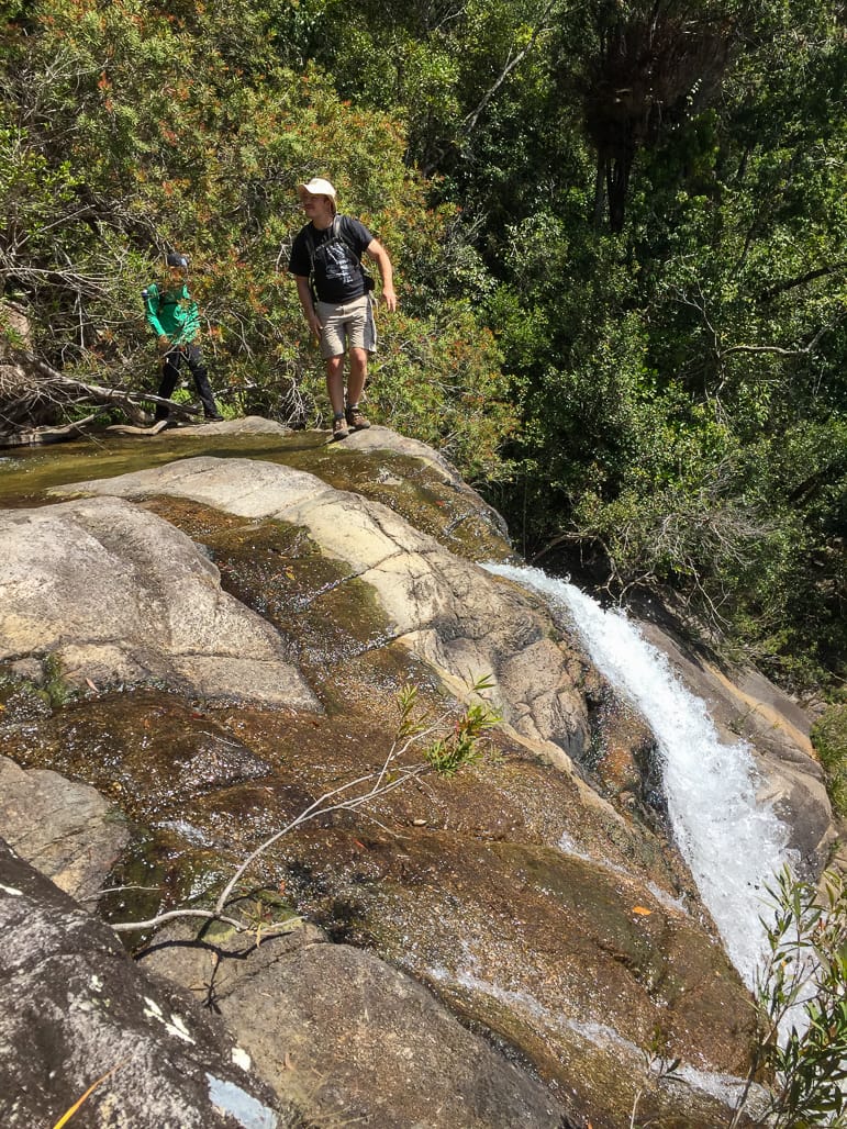

1245, time to return. We have a scramble to climb up steep rockface, which tests ones nerve on exposed rock faces. Some follow Wilfred up the exposed rockface, some follow me up a less exposed bit. Both still steep and challenging though. Gazza fell into Phil’s arms literally – unintended. Back at the top of the drop-off, we have a short walk along the creek to reach a waterfall with a fantastic pool. The four younger ones go for a swim – Bella set a record for the fastest in / out – it was very cold that water. Us four wise elders, invoked Rule 38 and could not swim - Leader has to be sentry and can’t swim - so we had a leader, an assistant leader, an assistant-assistant leader, and an assistant-assistant-assistant leader – no, we ae not scared of icy mountain pool water - just wise !
1340 we head back up the creek. 1435 we are the old lower cascade and old track start, but we keep going up the creek to Diorite Falls, for afternoon tea at 1455. Then it was track walk back to the cars,
long uphill slog, arriving 1630. Drive back to Paluma arriving 1655. Another great day at a great location with a good group.
It is such a good creek and waterfall system, one day we might think about doing a through day walk all the way to the bottom to Bambaroo with a small group. But some of us a mentally scarred from 2012 when we last did it and shiver with fear, eyes glaze, and mutter incoherently whenever we think of doing it again (it rained in 2012, and that was only one year after Cyclone Yasi, conditions were challenging). For those interested in the challenge, the 2012 report is here :
2012
‘What could possibly go wrong?’
Day two – Sunday, 4:30am, lying in my tent at Shay’s Clearing near Mt Spec, and light misty rain falling. Well, it is wet tropics rainforest here. Not a good sign for today’s long creek walk, really need dry conditions. 6am not raining. 7am as we pack up camp, light misty drizzle is present again. But the sky is brightening. Looking at the sky, I optimistically say to the others ‘this will burn off’. 7:30 am sky starts to clear, 7:45 am patches of blue sky, then sunshine. 8 am, it has turned into a lovely sunny morning. The weather forecast was for afternoon coastal showers moving inland, but we will be down by 3 pm.
Enthusiastically we set off for the day’s bushwalk down Waterfall Creek. Turning into a lovely sunny day - 800 metre descent over 5km, all downhill - ‘What could possibly go wrong?’ I enthuse.
Paluma to Bambaroo via Waterfall Creek 2 day walk, 29-30 September 2012
Four walkers – Keith (leader), Wilfred, Jenny Mc, Phil.
Initial plan was a three day base camp using Shay’s Clearing with a Sunday walk to top of Waterfall Creek main falls. That was changed to a two day through walk from Paluma to Bambaroo via Waterfall Creek, leaving day three as a contingency day ‘just in case’.
Total distance 17.8 km.
Saturday
Paluma to Crystal Falls 7.8 km track walk, then Crystal Falls to Shay’s Clearing track walk.
Leave Townsville at 6:30 am, drive to Bambaroo to position my car at Zammits Road at a cane farm. Meet Jenny here, she is dropped off by a friend. Arrange for him to pick her up at 5 pm Sunday at Frosty Mango. Drive up to Paluma in Wilfred’s troopie, leave car at his place in the village.
Start walk in Paluma 8:40 am. 930 m altitude, grid ref 0416589 / 7897797. Track walk from the park and toilet block, meets the main NP Cloudy track. We cross Cloudy Creek, following a track slightly uphill in rain forest that is cyclone damaged.
9:55 am bower of golden bower bird by trackside.
10 am smoko at Ethel falls. Good pool at base of falls. This is a ‘locals’ secret location.10:25 am moving.
Undulating track walk. 11:37 am a huge python blocks the track – joys of leading, got my heart pumping. Must be 3 to 4 mr long. After admiring it for a while, Wilfred touches its tail to get it moving.
12:30am at ‘Stinky’ Creek, log crossing. Good balance required. Strong waterflow in creek as this is from Paluma dam pipeline feed. Steep uphill climb from the creek.
12: 55 pm join Crystal Falls track, then go down this track, 1:10 pm arrive Crystal Falls for lunch. 7.8 km, on track (5.23 km direct line from Paluma). Chris Quinn, Ian, and co arrive on their way to DCK Hut for the night. 2:05 pm we depart Crystal Falls. Chris declines (with a knowing smile) the invite to join our ‘better’ adventure.
Undulating track walking in the rainforest. 3:11 pm come to large bower of golden bower bird, 25 yrs old this bower. 4:25 pm arrive at Shay’s Clearing, make camp. Leeches present. Good night around the campfire. Phil lightens his heavy backpack by making us eat lots of his chocolate (almost 1/2 kg of dark chocolate).
Sunday - Waterfall Creek descent
After a morning of light misty rain intermittently from 4:30 am, the sun shines at 7:45 am. Break camp. Looking forward to a great day down Waterfall Creek.
8:10 am, enthusiastically we set off for the day’s bushwalk down Waterfall Creek. Turning into a lovely sunny day - 800 metre descent over 5km, all downhill - ‘What could possibly go wrong?’ I enthuse.
Track walk for twenty minutes, then reach the top cascade at 8:30 am, rocks are dry, so all good. Start walking down the creek, mainly on the side in light vegetation.
First hour in the creek is reasonably flat easy going. Some rock hopping. 8:46 am first small waterfall. 9:15am, top of a long cascade, steep climb down the rockface. 9:19 another small waterfall.
9:50 am reach top of start of the main falls area. Smoko stop. 617 m altitude, grid ref 0413865
/7907671. Waterfall and cascades, very long drop down, great views down the valley.
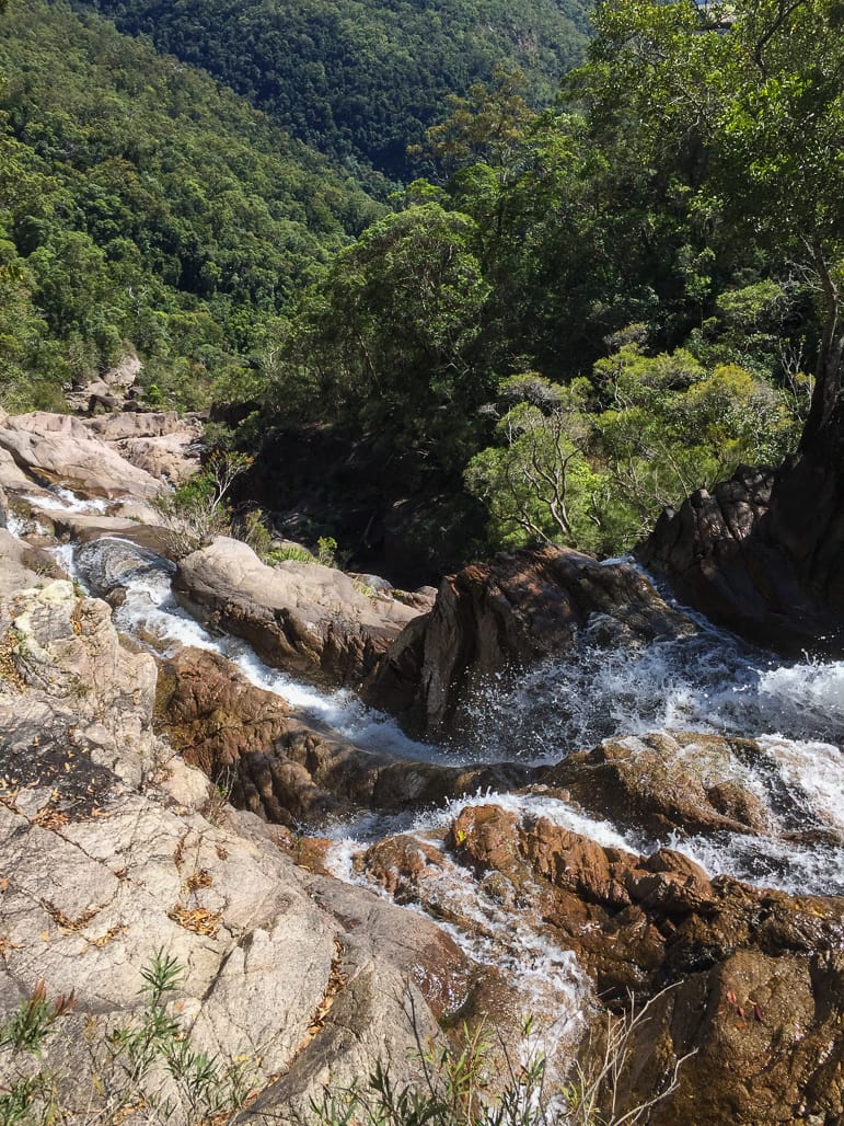
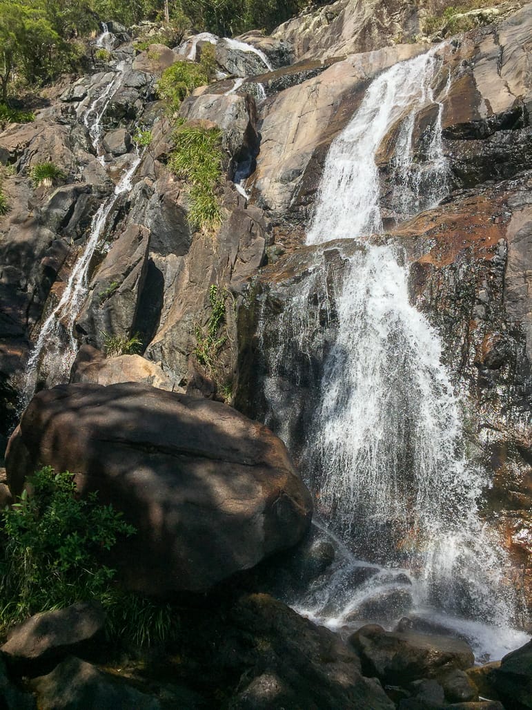
10:25 am moving. 10:40 am at a good two-tier waterfall. 11:09 am clambering down rockfaces, small cliffs. Couple of precarious climb downs. About half way down the long drop with numerous good waterfalls and cascades, superb waterfall scenery. Bottlebrush in flower, very colourful.
11:41 am, at bottom of very long multi-tiered waterfalls (visible from highway), spectacular. Sun disappears replaced by overcast skies. The past hour has been spectacular waterfall country, long drops with numerous good waterfalls cascading down the rockface and cliffs in a steep creek valley.
11:45 start to find waterfalls with sheer drops and pools below, and no way down, so need to start going bush to get around these precipices. Go western side of creek as that looks better terrain and bush. Find lantana, vines, hard going.
12:13 pm, 340 m altitude, grid ref 0413439 / 7908162, back in creek. Frustrated by drop offs here in the creek, so back to the bush.
1pm, after bush bashing, lantana, vines, get back to the creek, only to find our way blocked by another series of waterfalls and sheer drops. Investigate climbing down rockface, options not good. So take boots off and into the water to cross the creek, then have lunch. Another nice two tier
waterfall and pool here. We remark that the sky looks gloomy. Spoke too soon, it starts to rain lightly. We still have a long way to go and the granite is now slippery. Quick lunch, boots back on,
1:25 pm, get moving again, decide to try eastern side of creek as that might have less cyclone damage and lantana. Try the side of creek in the tree line looking for drier or less slippery way.
Head into forest on eastern side of creek, some hard going, go up the slopes looking for clearer going, then open rainforest ground but steep slopes and very loose soil underneath, hard to maintain footing. About one hour, rain is heavier. In a dry gully at 2:30 pm, dripping wet. Check map, at grid ref 134 835. It is gloomy and dark and need torch to read map (in a straight line on the map we are 2.6 km from the finish and car). Looking at topographic info, map shows a large ridge and side creek ahead. Decide to go down the dry gully we are now in to the main creek, try western side. Wilfred says ‘looks clearer on the map on that western side now than this eastern side”. We all concur (mind you, Phil and Wilfred spectacles were fogged up, so what were they reading ? I could barely read as my spectacles were in the pack). Reach the main creek, a large subsidiary creek joins on the western side. Any thoughts of going down Waterfall Creek are dashed by the sight a spectacular looking gorge below. Very wet now from lot of rain, we are drenched. Cross the creek slowly, into the scrub, but back into hard slow going in lantana, barbed wire vines, Tarzan vines and fallen trees.
3pm, Jenny needs to cancel her lift home to Cardwell as we will not make it in time to the meet point. Try the satellite phone to make the phone call, no connection. Short while later at 3:15 pm, after a slog in more lantana, fallen tree so open sky, try the satellite phone again, no connection, Jenny tries her mobile, gets signal and makes phone call and cancels her lift. At this point we can see cane fields down below in the distance. Does not seem far in a way .........
Keep moving very slowly, stay high to keep away from creek, still raining, gloomy. In some parts the vegetation clears up for easier walking, but then always turns into more lantana and vines. Come to a steep dry rocky side creek that is very difficult to get through vines, boulders hiding holes etc.
Every now and then we get glimpses of farm land way down below. I am always revising what time I reckon we will get out of here. Initial plan was 3 pm. At lunch I thought 4 pm. Now thinking 5 pm (optimistically). Going is very hard and we are wet and tired. Jenny is talking about nice cup of tea and scones. Wilfred and Phil talking about ice creams at Frosty Mango. Me - I am just thinking ‘gunna be fun walking in the dark in this crap...’. We often discuss whether we stay high, or try the creek. But in the creek we can always hear rushing water meaning waterfalls and cascades, slippery rocks, so no doubt we would get blocked again. Stay high is best option and enjoy the lantana and vines.
After a while of hard going half way up ridges, judging by noise in the creek we think we may have passed the last of waterfalls, so decide to head for the creek - gotta be easier down there than this crap up here. 5pm back in the creek. Very quick break here for water refill and snack. Wilfred stirs up wasps whilst refilling water, and Phil is stung under the eye. Check the GPS, we are at 71 m altitude, great news. Looking at the eastern side ridgeline, cannot be far to go now, I estimate 500 mr to open country. Grid ref 0413392 / 7909557. On the map it is 400 meters to reach flat ground, and 1.2 km to the car. It has stopped constant rain now, rocks down here a bit drier, but our boots are so wet we still slip. It has taken four hours to cover 1.4 km (straight line, in reality we covered more distance zig zagging).
Moving on to the eastern side of creek as that looks easier going, staying on edge of creek, slip sliding over granite rocks and creek side vegetation. Creek is flat here. Then back to western bank due to large rock that blocks our way, up onto flat creek bank and walk in long grass. Phil remarks ‘going to be a nice sunset’ as the sun sinks below the mountain to the west, and notice skies are clearing. Who cares about a damned sunset ? Looking back up the steep Waterfall Creek valley, can see rain and mist still up there. Then we come to a fence and vehicle track, and our spirits are lifted. Walk along this for a short while, then across the creek to eastern bank, into lantana, it is now dusk. Where the bloody hell is this cane farm ? Head north-east, scrub bashing, over a small creek, up that bank, and there is the cane farm. Now where is the farm house and car ? All we see is mile after mile of cane land. Head north several hundred metres, and around the corner in the dusk light is the farm house and my car. And a large angry dog ! 6:25 pm, just as it gets dark, we have made it. Quick chat to the old Italian lady at the farm house, as she tries to control the dog. The dog does not know whether to attack or be friendly (kept changing its posture, bark, and growling, mean looking thing). At the car we celebrate with handshakes and hugs, change of clothes, and we feel much better. 46 m altitude Grid ref 0413827 /7910988 at the finish. Doesn’t seem so bad now. Drive up to Paluma to drop off Wilfred and Phil at the other car. That was two weeks with two very tough walks. Back at the car, Wilfred asks ‘can we have an easy walk next time please?’
Then I drive Jenny to Cardwell, get there 9:15 pm. On way home refuel at Ingham just as the last open servo was closing at 10 pm (and I had less than 100km fuel left) , then back to Townsville and home at 11:10 pm.
Now - what possibly could go wrong........................ ?


