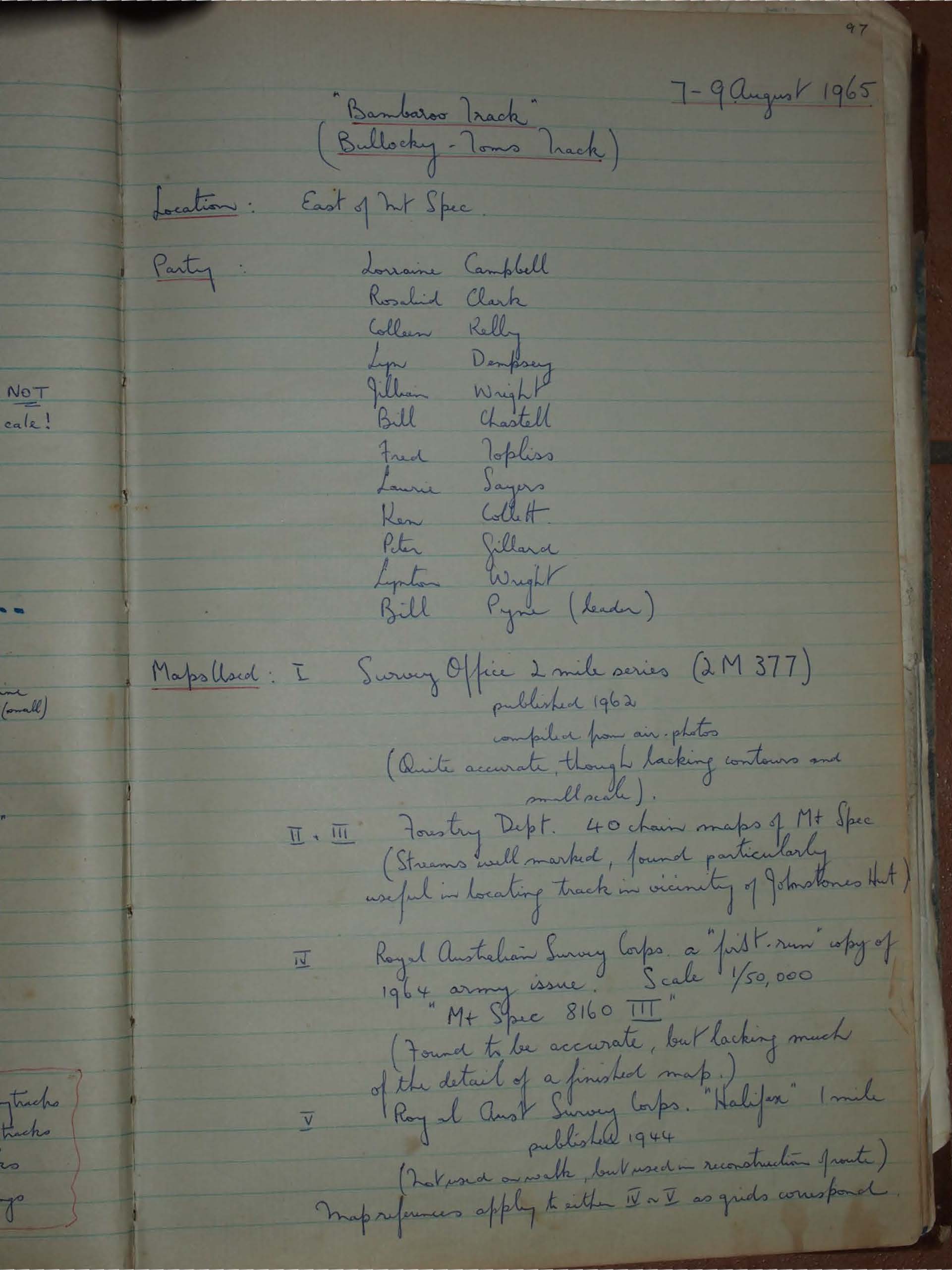
"Bambaroo Track" (Bullocky - Toms Track)
Discover the historic Bambaroo Track near Mt Spec, once used by Aboriginal people and pioneers. This 1965 Townsville Bushwalking Club trek followed Bullocky Tom’s Track by mistake, uncovering rainforest ridges, Crystal Creek crossings, and rugged terrain in Paluma’s wild ranges.
7-9 August 1965
Location: East of Mt Spec
Party:
Lorraine Campbell
Rosalind Clark
Colleen Kelly
Lyn Dempsey
Jillian Wright
Bill Chastell
Fred Topliss
Laurie Sayers
Ken Collett
Peter Gillard
Lynton Wright
Bill Pyne (leader)
Maps Used:
I
Survey Office 2 mile series (2 M 377) published 1962 compiled from air-photos
(Quite accurate, though lacking contours and small scale).
II, III
Forestry Dept. 40 chain maps of Mt Spec (Streams well marked, found particularly useful in locating track in vicinity of Johnstones Hut)
IV
Royal Australian Survey Corps. a "first-run" copy of 1964 army issue. Scale 1/50,000 Mt Spec 8160 III (Found to be accurate, but lacking much of the detail of a finished map.)
V
Royal Aust. Survey Corps. "Halifax" 1 mile published 1944 (Inaccurate on the whole, but useful on reconstruction points.)
Map references apply to either IV or V as grids correspond.
Transport:
1 V.W. (Bill Pyne)
1 Falcon (Fred Topliss)
1 Holden (Wrights)
(As this was a through-walk, the first two were driven to Shays, then to Bambaroo, the third car being used to transport drivers back to Shays)
Distances:
by car 170 miles
walking 15 miles
Type of Outing:
Bushwalk.
Rating:
Summary of Outing:
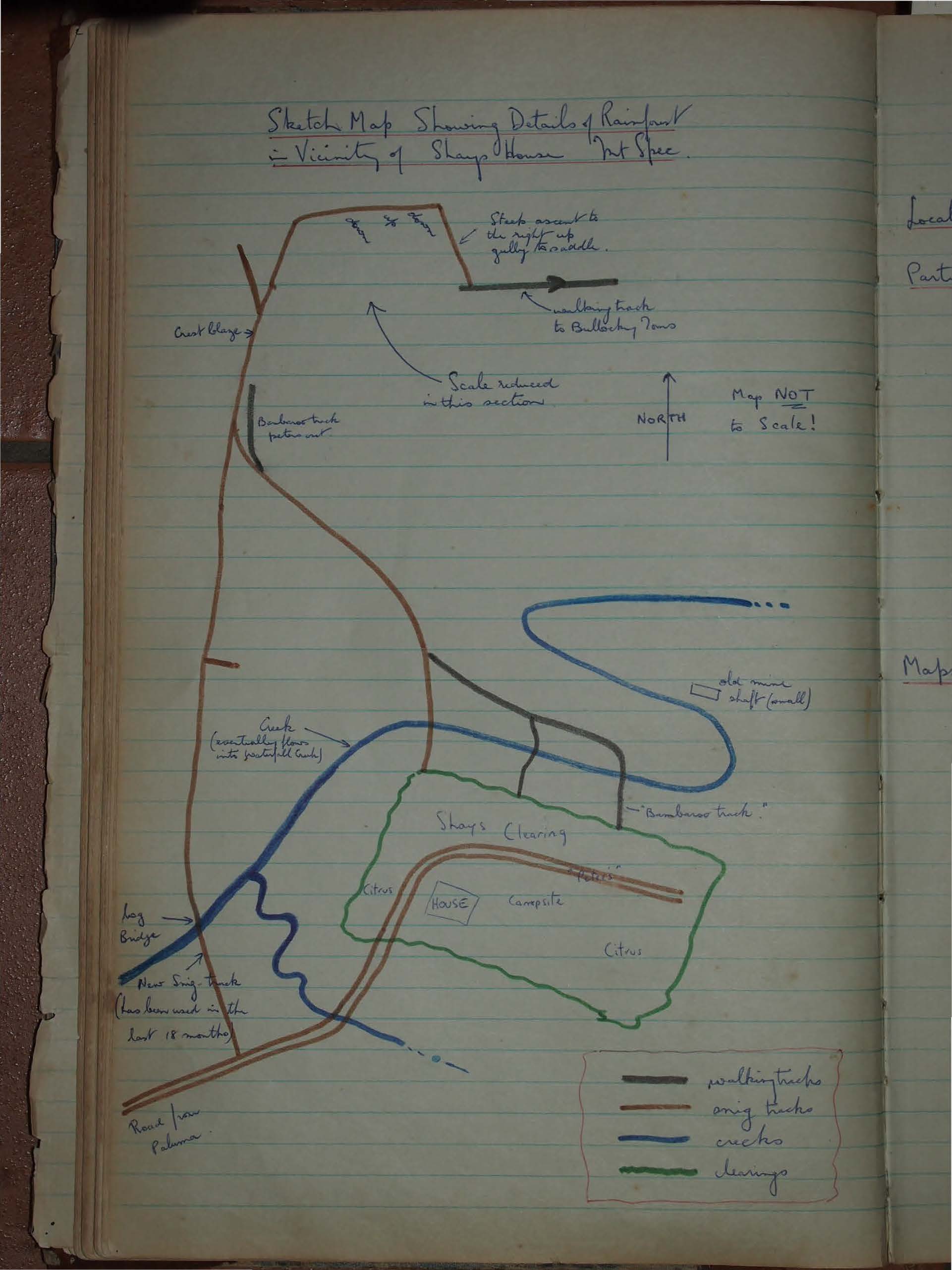
This weekend was an attempt to walk down the historic Bambaroo Track once used by aborigines and later by pioneers as a route on to Mt Spec, before the road was built via Paluma.
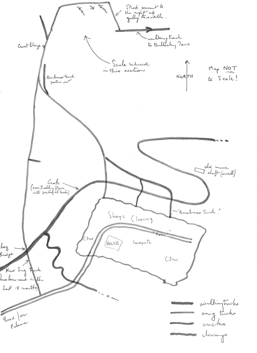
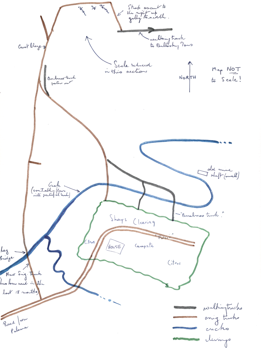
30 years ago Shays were resident on Mt Spec and much of the original house remains today. Much preliminary reconnaissance was done, and a wealth of useful information was obtained from Mr. Bob Burla, Shire Office, Ingham.
On Saturday while the drivers drove down and retraced their steps a recce party lead by Lynton Wright located what was believed to be the track on a saddle near a snig track believed to be 232267. I now believe this to be instead 227258.
When recce party returned to Shays, drivers also had returned, and a small party then made a thorough search of the area immediately in front of Shays, and compiled a local map (not to scale!)
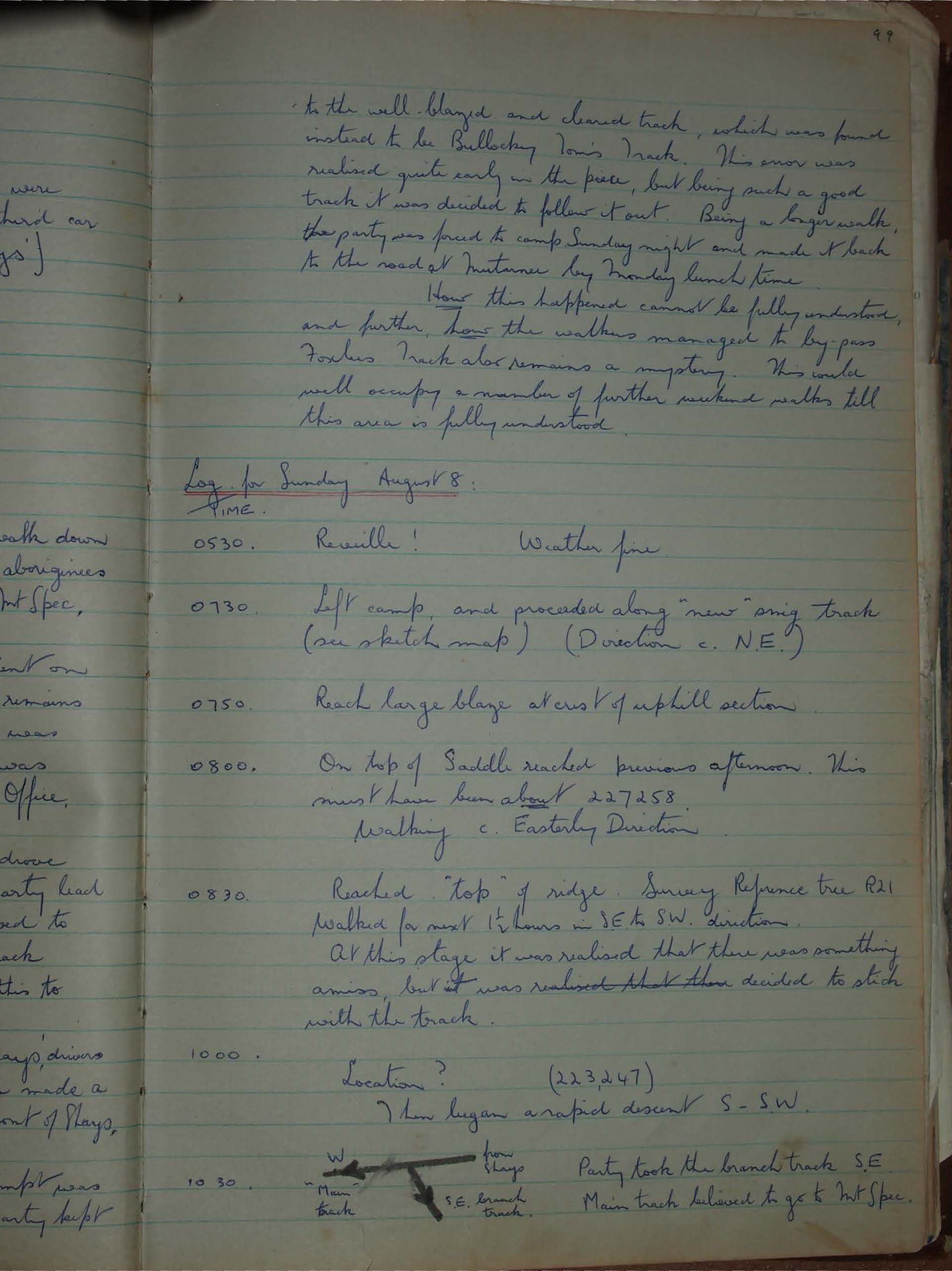
After a night at Shays', an attempt was made to walk down the track Sunday. The party kept to the well-blazed and cleared track, which was found instead to be Bullocky Tom's Track. This error was realised quite early in the piece, but being such a good track it was decided to follow it out. Being a longer walk, the party was forced to camp Sunday night and made it back to the road at Mutarnee by Monday lunch time.
How this happened cannot be fully understood, and further, how the walkers managed to by-pass Foxlee's Track also remains a mystery. This could well occupy a number of further weekend walks till this area is fully understood.
Log for Sunday August 8:
TIME
0530. Reveille! Weather fine
0730. Left camp, and proceeded along "new" orig track (see sketch map) (Direction c. N.E.)
0750. Reach large blaze at crest of uphill section
0800. On top of Saddle reached previous afternoon. This must have been about 227258. Walking c. Easterly Direction
0830. Reached "top" of ridge. Survey Reference tree R21. Walked for next 1 1/2 hours in SE to SW. direction. At this stage it was realised that there was something amiss, but it was resolved that they decided to stick with the track.
1000. Location? (223247) Then began a rapid descent S-SW.
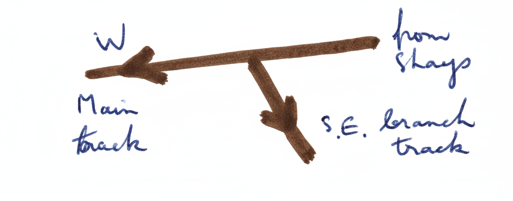
10 30. Party took the branch track S.E. Main track believed to go to Mt Spec.
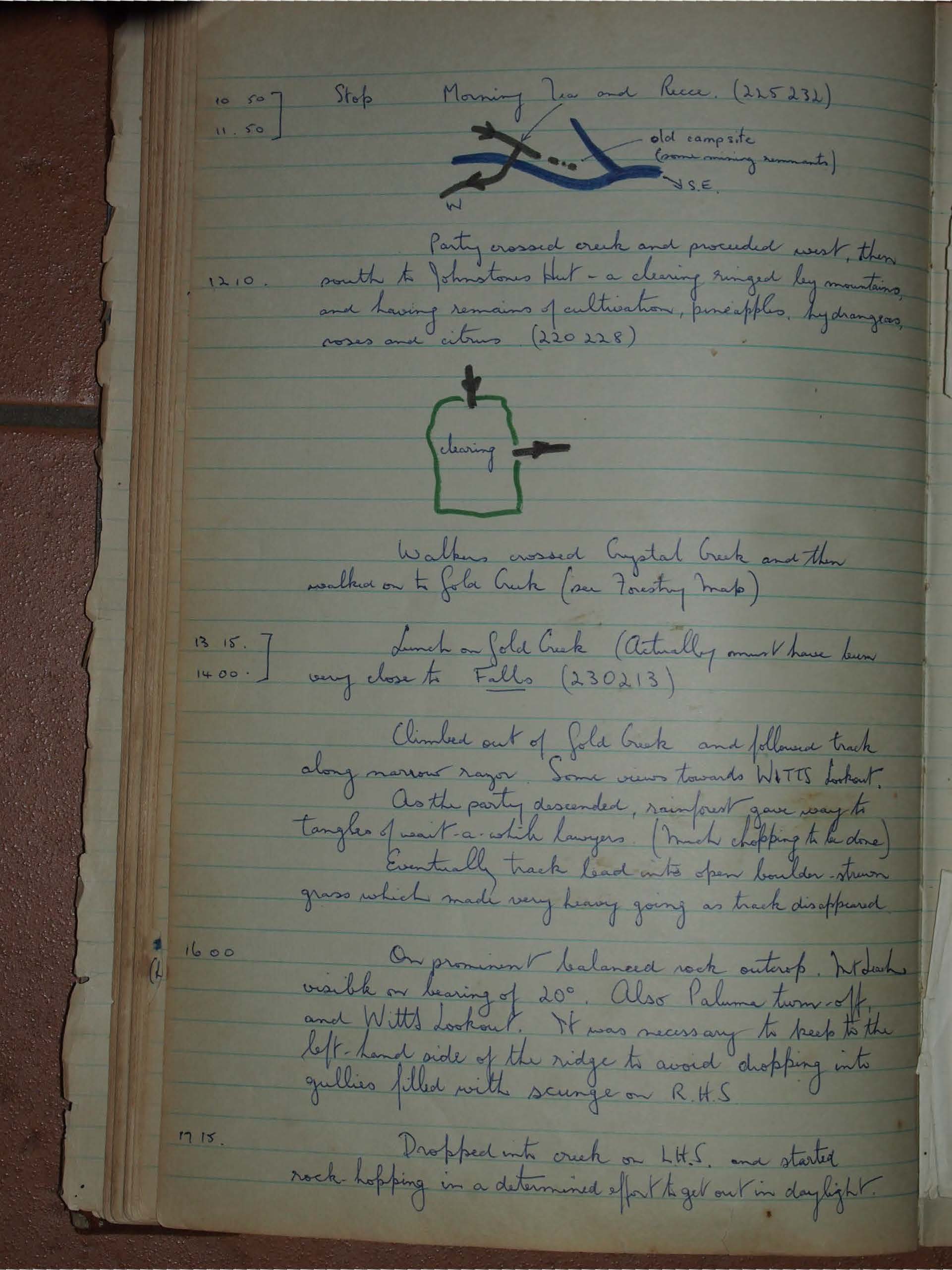
10.50 - 11.50 Stop Morning Tea and Recce. (225232)
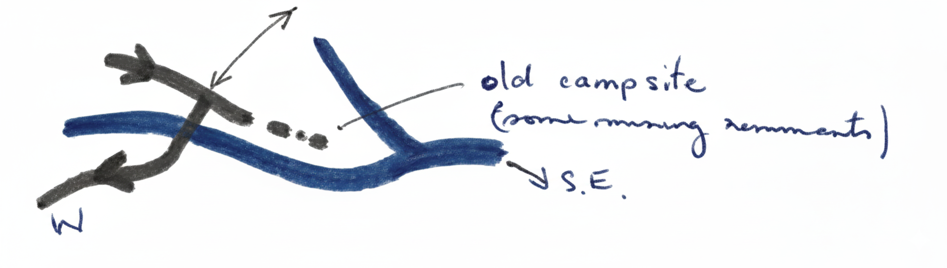
12.10. Party crossed creek and proceeded west, then south to Johnstones Hut - a clearing ringed by mountains, and having remains of cultivation, pineapples, hydrangeas, roses and citrus (220228)
Walkers crossed Crystal Creek and then walked on to Gold Creek (see Forestry map)
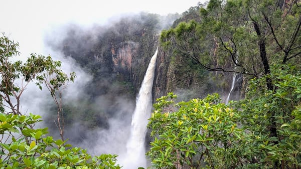
13.15 - 14.00 Lunch on Gold Creek (Actually must have been very close to Falls (230213)
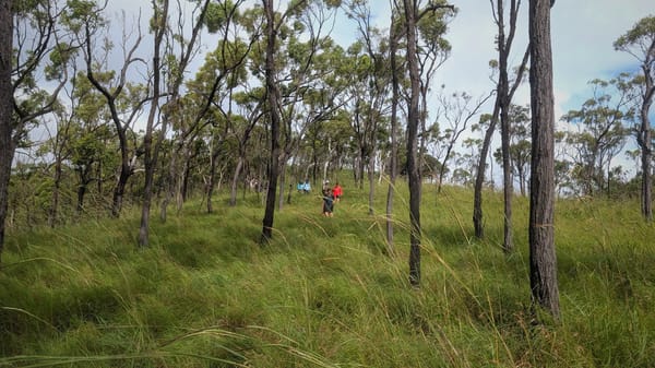
Climbed out of Gold Creek and followed track along narrow razor. Some views towards WATTS lookout. As the party descended, rainforest gave way to tangles of wait-a-while lawyers. (much chopping to be done) Eventually track lead into open boulder-strewn grass which made very heavy going as track disappeared.
16.00 On prominent balanced rock outcrop. Mt Dasha visible on bearing of 20°. Also Paluma turn-off and Witts lookout. It was necessary to keep to the left-hand side of the ridge to avoid dropping into gullies filled with scunge on R.H.S.
17.15 Dropped into creek on L.H.S. and started rock-hopping in a determined effort to get out in daylight.
18.40 Darkness. Impossible to proceed so camp for the night on creek bank. (251207)
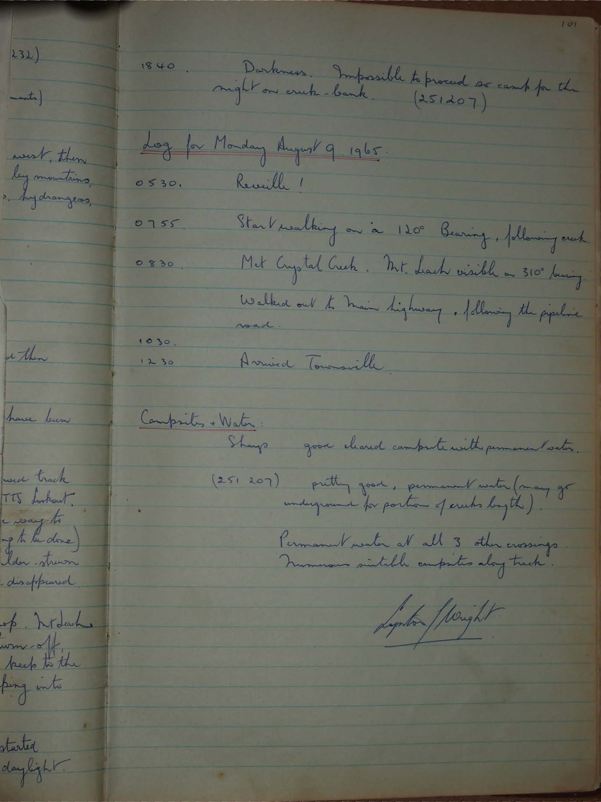
Log for Monday August 9 1965
0530 Reveille!
0755 Start walking on a 120° Bearing, following creek.
0830 Met Crystal Creek. Mt. Leach visible on 310° bearing. Walked out to Main highway, following the pipeline road.
1030 - 1230 Arrived Townsville.
Campsites & Water:
Shags good cleared campsite with permanent water.
(251 207) pretty good, permanent water (may go underground for portion of creeks length).
Permanent water at all 3 other crossings.
Numerous suitable campsites along track.
Leighton Wright