Bambaroo Track - Fowler Track
Bambaroo Track to Fowler Track (1966) in Mt Spec offered an easy yet rewarding bushwalk with rainforest trails, Gardes Battery ruins, and stunning views from Gardes Lookout. A weekend of creek crossings, campsites, and history made this North Queensland hike both scenic and memorable.
October 14-16, 1966
Location: Mt Spec Area
Party:
Maps Used: as for 7-9 August 1965. plus sketches from log-book.
Transport: 1 Valiant (Burt Bennington) plus 1 V.W. (Bill Pyne) to ferry cars from watermelon paddock (260306) to pineapple farm at (290283) (section 85, forestry map)
Distance: by car 110 miles
walking 13 miles
Rating: easy going - most enjoyable & rewarding.
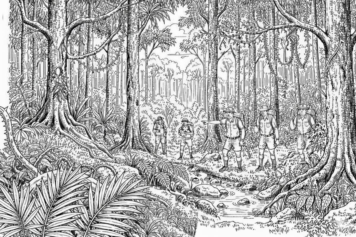
Summary of Outing: The bulk of the party journeyed up Friday night, were met by Bill and Ros Pyne at the Mt Spec Turnoff, and journeyed on to the watermelon paddock on the south bank of Sawpit Gully. From here good progress was made to the top of the ridge by torchlight when the party camped on the Bambaroo Track at (252312). A most miserable muggy night awaiting mosquitos.
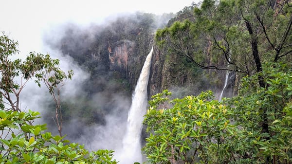
The leaders arrived early, and good progress was made up the Bambaroo Track. The only difficult going was the patch of open country shown clearly on forestry map. Lunch at the campsite (running water) below the Bambaroo-Bullocky low junction (224264). During the easy walk along to Gardes Battery a magnificent lookout was located near the R21 tree (228257). This lookout far surpasses Foxlees lookout in accessibility and the splendour of the view.
After a swim and water-party at Gardes camp was made in the rainforest near the junction of the track from Mt Spec (above Gardes). More items of machinery were located in the vicinity of the Battery, including the site of Gardes Hut (a ground floor defined by a pair of rotting beams and a stone fireplace).
Despite having climbed 3000 ft in 7 1/2 hours, just 2 1/2 less than the descent 12 months previous) all walkers were in fine shape and much feasting on baked apples etc occupied the time till about 10 P.M.
Sunday - a fairly easy walk down past Foxlees lookout to the pineapple farm.
Log for Saturday October 15.
0715 left campsite on ridge (252312)
0745 entering rainforest
0820 crossing soggy creek - track disappears. We followed around western side of rocky outcrop, past lunch-site of previous descent. Relocated track
0900 - 0910 at the junction in small saddle (see 11.40, Oct 30, 1965)
Walking up through rainforest
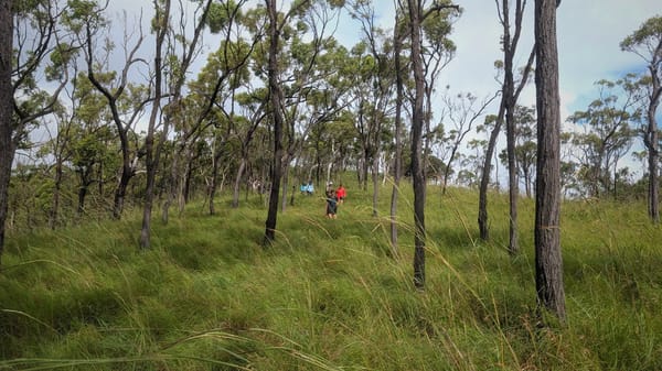
0930 open country. Track not easy to follow, faint, Head up along ridge W.S.W. direction. This is the only difficult section on the Bambaroo Track - difficult because of steepness, heat, and the profusion of grasstrees and other
ground flora.
1035 - 1045 Resting at entrance to rainforest (entre on bearing of 225°, entrance duration)
Climbing steadily on graded track through rainforest.
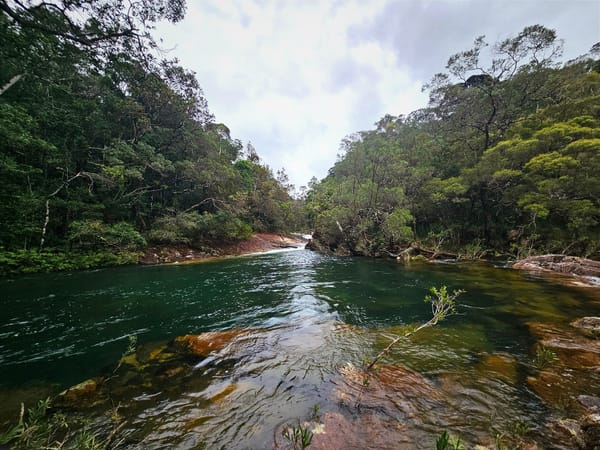
11.15. at the B.W. tree (on previous walks) after walking through saddle (232467) lunch was taken at the permanent creek on the western side of the composite at (224 264) see October 16, 1965 sketchmap).
1145 - 1330 lunch
14.00 Set out on the sharp climb (south) to the Bambaroo - Bullocky Tom Junction (at R24)
14.10 - 14.30 At RLI tree a few yards along the track the party, on the suggestion of Don, climbed about 10 yards to a very exposed lookout offering views of Ingham, Hinchinbrook Island, and Saunders Point, as well as enabling a reconnaissance of almost the complete Bambaroo Track. Further research leads me to believe that this is Gardes Lookout.
15.30 - 15.50 Proceeded on to the junction above Gardes Battery
Left packs - and
16.30 - 17.00 proceeded down to the attery where we replenished our water
supplies and some walkers swam. Made camp just above the junction.
(see map July 23, 1966)
We were able to finish tea in daylight - after which a very successful campfire was conducted.
Log for Sunday Oct 16, 1966.
0800 Left camp, heading off along the Tooles Track.
0840 - 0900 Tooles Lookout - not a patch on Gardes Lookout but gives a more Southerly aspect.
From here the track disappears several times in a tangle of lawyer vine. Keep to ridge, and watch your contours. Track can be easily located before it starts to zig-zag down towards.
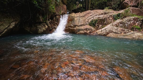
1100 In open country, track difficult to follow. The party accidentally found its way into one of the creeks on the south side of the ridge, just below a small waterfall.
1230 After rock hopping for some time the party climbed out of the creek, and proceeded through light grass to Bullocky Toms Creek.
1400 Lunch in creek - apparently below a swimming
1515 pool located on a previous visit to the creek.
1545 Back at pineapple farm. This is about 5-6 miles along a well kept gravel track from the highway just north of Connolly's at Mutarnee.
This has been reputed to have been a very strenuous weekend. It turned out quite easy, and very enjoyable and rewarding too. I have never climbed 3000 ft or previously. This kind of walk also eliminates the long road distances involved in a walk from the top to coast only.
Leighton J. Wright.