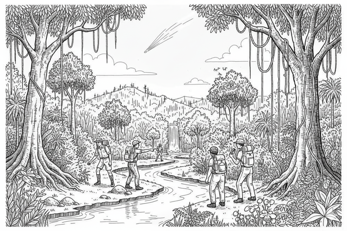
Bambaroo Track - Jourama Falls.
In October 1965, Townsville Bushwalking Club fulfilled their goal of walking the historic Bambaroo Track from Shays’ House to Alswold, then climbing to the top of Jourama Falls. The trek revealed rainforest trails, open ridges, swimming holes, and sweeping views across Mt Spec and Paluma ranges.
30-31 October 1965
Bambaroo Track - Jourama Falls.
An ambition fulfilled.
Location: Mt Spec + foothills.
Party:
Cheryl McHugh
Ross Clark
Colleen Kelly
Ken Collett
Duncan Median.
Lynton Wright (leader)
Maps Used:
As for previous walk. - together with sketch - maps prepared in previous visits to the area. Once more, the 40 chain forestry map was most useful.
Transport:
1 V.W. (Ros Clark)
1 V.W. (Bill Pyne delivered us to Sharp's then arranged to drive cars to Sun. Pt. Gully.)
Distances:
by car about 160 miles.
walking - Bambaroo 8 miles.
Jourama 4-5 miles.
Type of Outing: Bushwalk.
Rating: Average difficulty.
Summary of Outing:
Following previous exploration in the area, this weekend the Club realised its ambition to walk down the historic Bambaroo Track to Alswold from Shays House.
Walkers left Townsville Friday night 1910 hours and pitched tents beneath a cloudless sky at 2230 hours. On Saturday we followed the Bambaroo Track out to the main northern highway. After drinks from Mutarnee, camp was made at Waterfalls Creek. Sunday was spent in walking to the top of the Jourama Falls on Waterfalls Creek. After swimming and lunching the party returned to the city by 1800 hours.
Log for Saturday 30th October
0530
Reveille! The first time ever we have managed to see the sunrise at Shays - its been raining on all previous visits.
0710
Left camp heading along orig track previously followed.
0745
At junction of Bambaroo & Bullocky Toms Tracks.
0750
Passed R27 tree. (See sketch map previous trip)
0815
Starting to climb out of Saddle (232267)
0840
Passed B.W. tree, starting to descend (see sketch map)
0920
Crossed small dry creek bed running N.E. after climbing through wait-a-while tangle. (From creek, back-bearing through tangle is 160°)
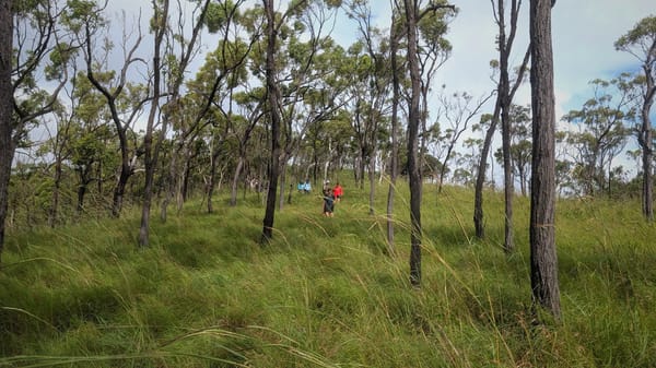
0930
Broke into open country. Mt Houston due West. (Back bearing to entrance is 225°.) The track may be a little hard to follow in open country but blazes are numerous. In any case, stick to the ridge and descend in a general ENE direction. Some good views along here.
1115.
Re-enter the rainforest where once more, track is quite clear.
1140.
Arrived at junction
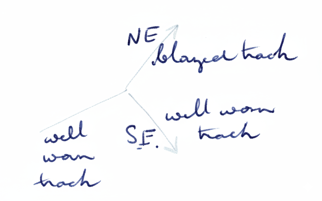
Not wishing to take any side tracks, the N.E. track was chosen. This was definitely not original Bambaroo but probably a new work carried out by army personnel. The SE track is probably the track - as shown by the map.
Track shown lead around northern side of a rocky knoll, then peters out.
1230 - 1330
Lunch taken near some large strangler fig-trees.
1355.
Crossed a creek with the first water-supply encountered, and here re-located the Bambaroo track. (This area is shown clearly on map).
1440.
Broke into open country on the final ridge to the road. (Back bearing to entrance 235°)
1505.
Top of ridge above Bambaroo Homestead bearing 244°. This open country had been burned off by bushfire, and the original track was at its best, a 6 ft wide Stone-pitched super-highway.
1630.
Arrived at road at Abswold.
1800.
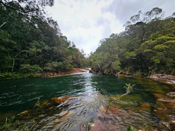
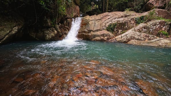
All members shuttled to campsite on Waterview Creek, where all enjoyed a freshen-up before tea, in the crystal clear water.
Log for Sunday 31 October
0400
Reveille! All up to view the comet "Ikeya Seki" in the eastern sky
0405
All sound asleep again
0800
People start to struggle out of bed
0900
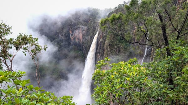
L/K campsite and walked up track to base of Jourama Falls.
0945
In gorge facing falls (147338)
1015
Started to climb to top of falls - go straight up side of gorge from the northern (left hand) bank
1220.
Arrived at top of falls. We have actually caught Mr falls (from whom you have rainforest on your left you know your part to the top of the falls).
Walkers enjoyed a swim in one of the many suitable pools.
1300
Lunch
1410
L/K for campsite. Cut around to the north and discussed our burnt off country.
1530
AV campsite. Bill Ryan arrived in 5 mins. After smoko, returned to Townsville.
Water Supplies.
Water should be easier on Bomboroo track as there are few accessible watering places.
Note.
A number of track buoys have been included with a view to following the track from the coast to Shepp at some future date.
Sydney Wright