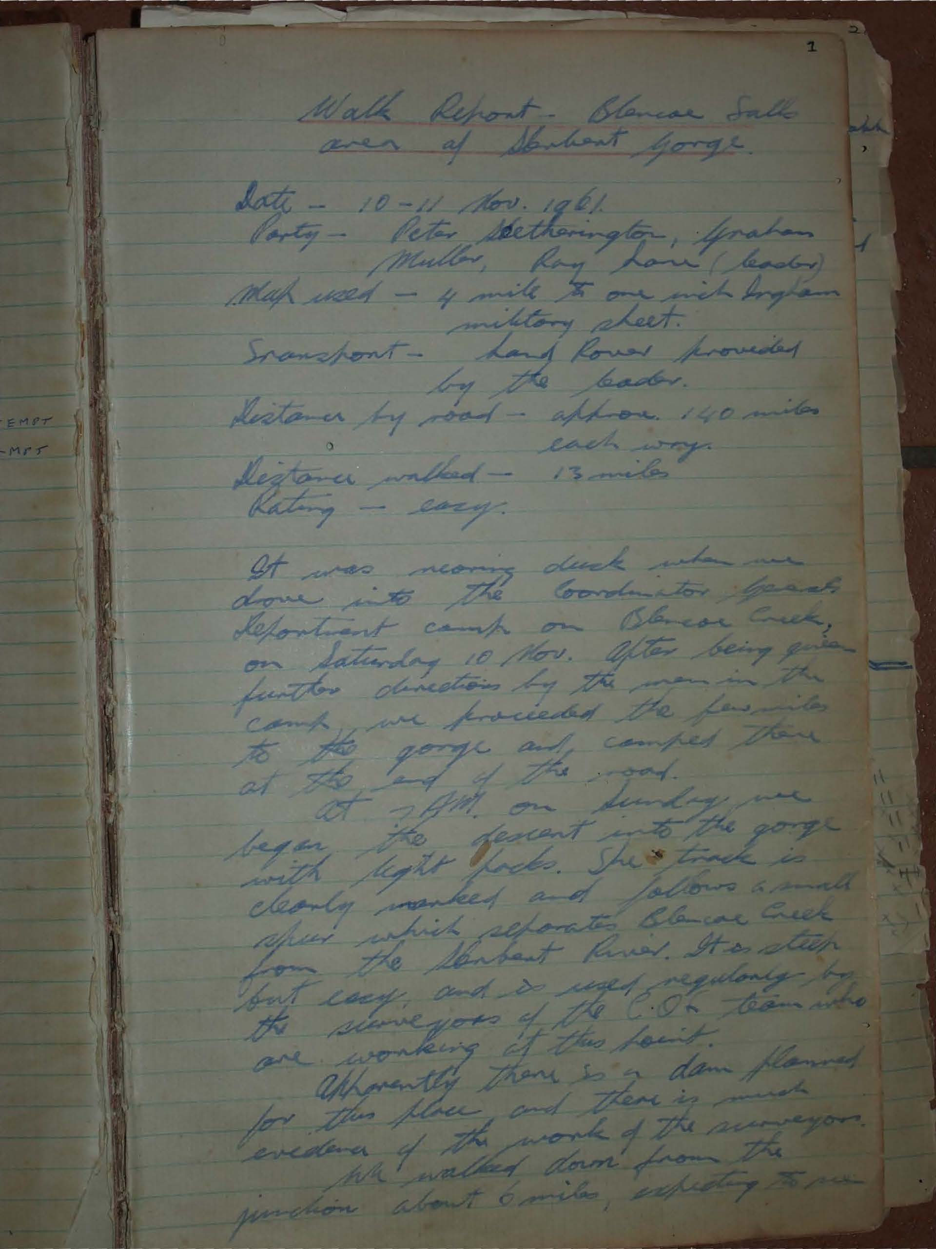
Walk Report - Blencoe Falls area of the Herbert Gorge
A 1961 walk report details an expedition to Blencoe Falls. Follow the handwritten account of a trek into Herbert Gorge to witness the "roaring fury" of the falls, a place described as a "hissing, crashing, vapourous monster." This is a captivating glimpse into a past adventure.
Date - 10-11 Nov. 1961
Party - Peter Hetherington, Graham Moller, Roy Lowe (leader)
Map used - 4 mile to one inch Ingham military sheet.
Transport - Land Rover provided by the leader.
Distance by road - approx. 140 miles each way.
Distance walked - 13 miles
Rating - easy.
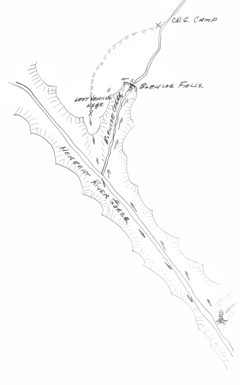
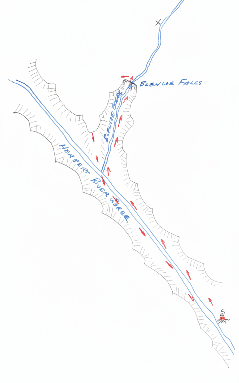
It was nearing dusk when we drove into the Coordinator General's Department camp on Blencoe Creek on Saturday 10 Nov. After being given further directions by the man in the camp, we proceeded the few miles to the gorge and camped there at the end of the road.
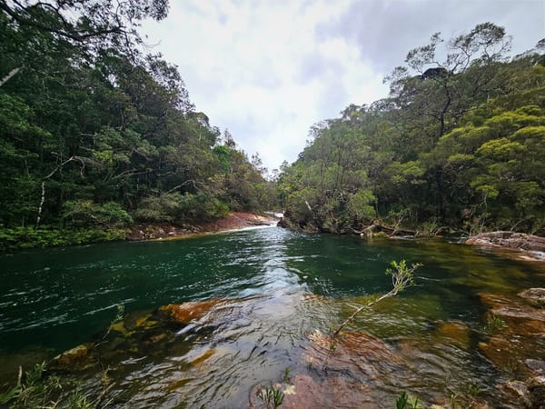
At 7 A.M. on Sunday, we began the descent into the gorge with light packs. The track is clearly marked and follows a small creek which separates Blencoe Creek from the Herbert River. It is steep but easy, and is used regularly by the surveyors of the C.G. team who are working at this point.
Apparently there is a dam planned for this place and there is much evidence of the work of the surveyors.
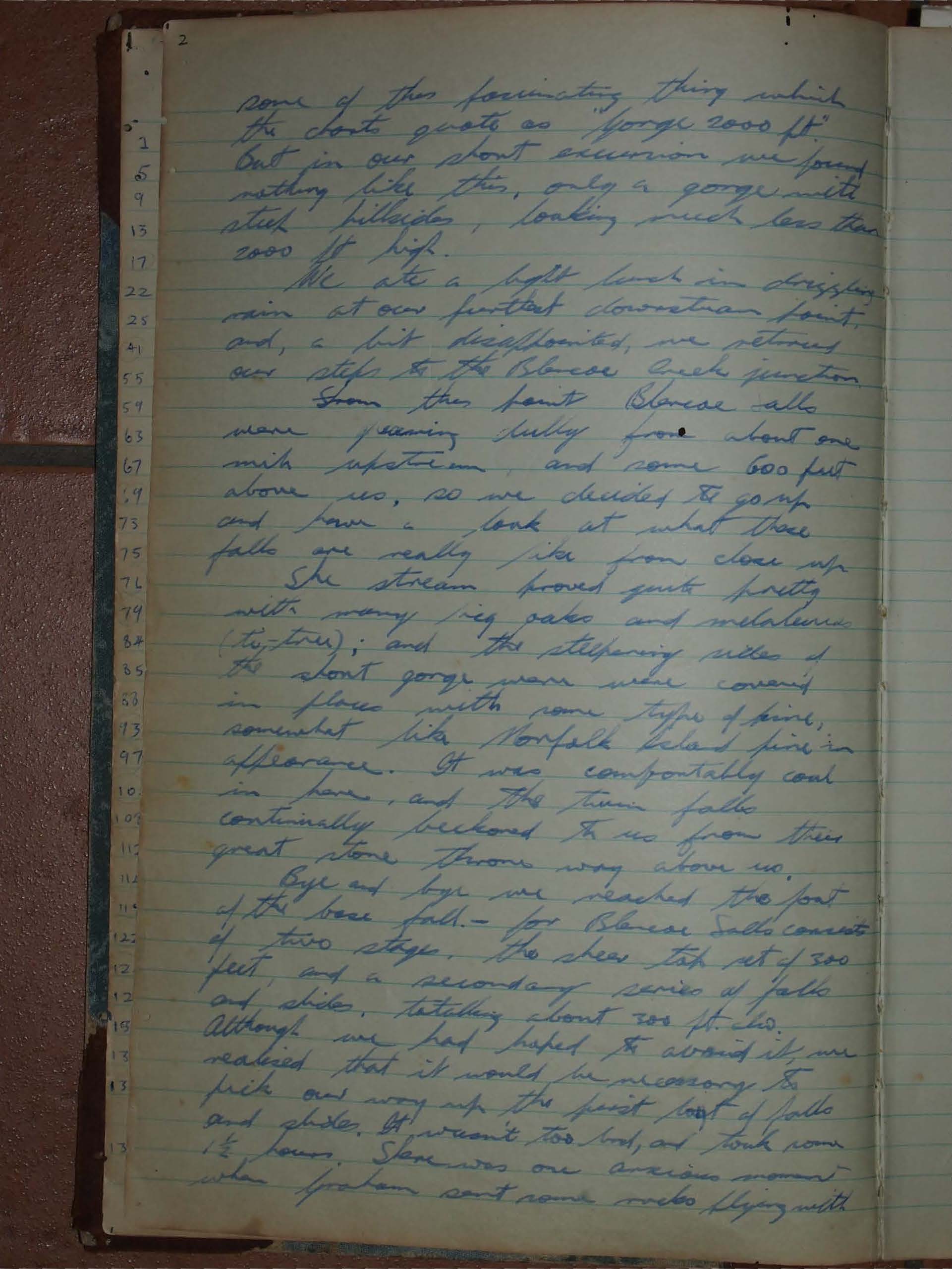
We walked down from the junction about 6 miles, expecting to see some of the fascinating thing which the charts quote as "Gorge 2000 ft". But in our short excursion we found nothing like this, only a gorge with steep hillsides, looking much less than 2000 ft high.
We ate a light lunch in drizzling rain at our furthest downstream point, and, a bit disappointed, we retraced our steps to the Blencoe Creek junction.
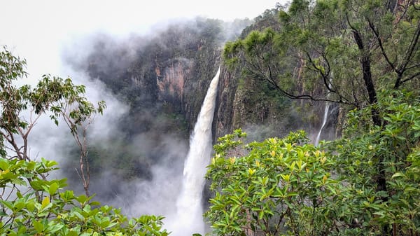
From this point, Blencoe falls were a roaring fury from about one mile upstream, and some 600 feet above us, so we decided to go up and have a look at what these falls are really like from close up.
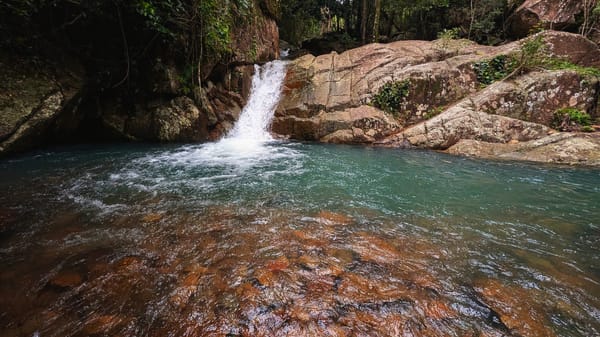
The stream proved quite pretty with many big oaks and melaleuca (tea-tree); and the steepening sides of the short gorge were in places covered with some type of pine, somewhat like Norfolk Island pine in appearance. It was comfortably cool in here, and the twin falls continually beckoned to us from their great stone throne way above us.
Bye and bye we reached the foot of the base fall - for Blencoe Falls consists of two stages, the sheer top set of 300 feet and a secondary series of falls and slides, totalling about 300 ft also.
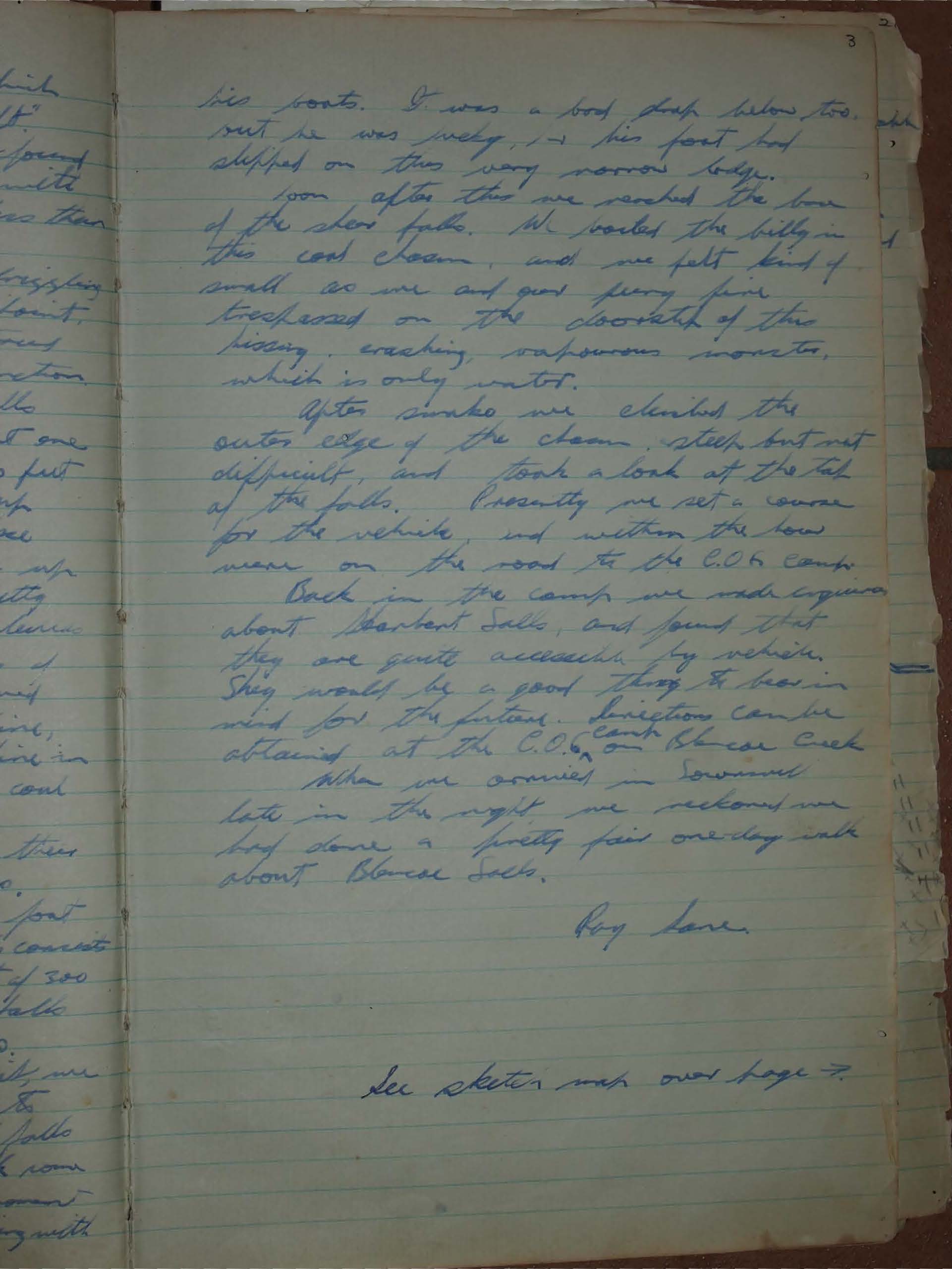
Although we had hoped to avoid it, we realised that it would be necessary to pick our way up the first set of falls and slides. It wasn't too bad, and took some 1 1/2 hours. There was one anxious moment when Graham sent some rocks flying with his boots. It was a bad drop below too, but he was lucky, – his foot had slipped on this very narrow ledge.
Soon after this we reached the base of the sheer falls. We boiled the billy in the cool chasm and we felt kind of small as we trespassed on the doorstep of this hissing, crashing, vapourous monster, which is only water.
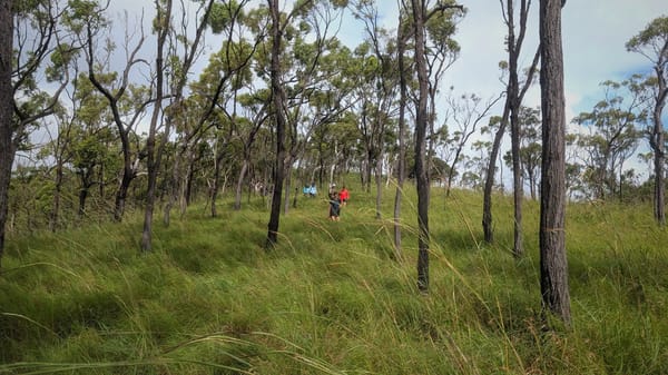
After smoko we climbed the outer edge of the chasm, steep but not difficult, and took a look at the top of the falls. Presently we set a course for the vehicle, and within the hour were on the road to the C.O.G. Camp.
Back in the camp we made enquiries about Herbert Falls, and found that they are quite accessible by vehicle. This would be a good thing to bear in mind for the future. Directions can be obtained at the C.O.G camp on Blencoe Creek when we arrived in Townsville.
Late in the night we reckoned we had done a pretty fair one-day walk about Blencoe Falls.
Roy Lowe.
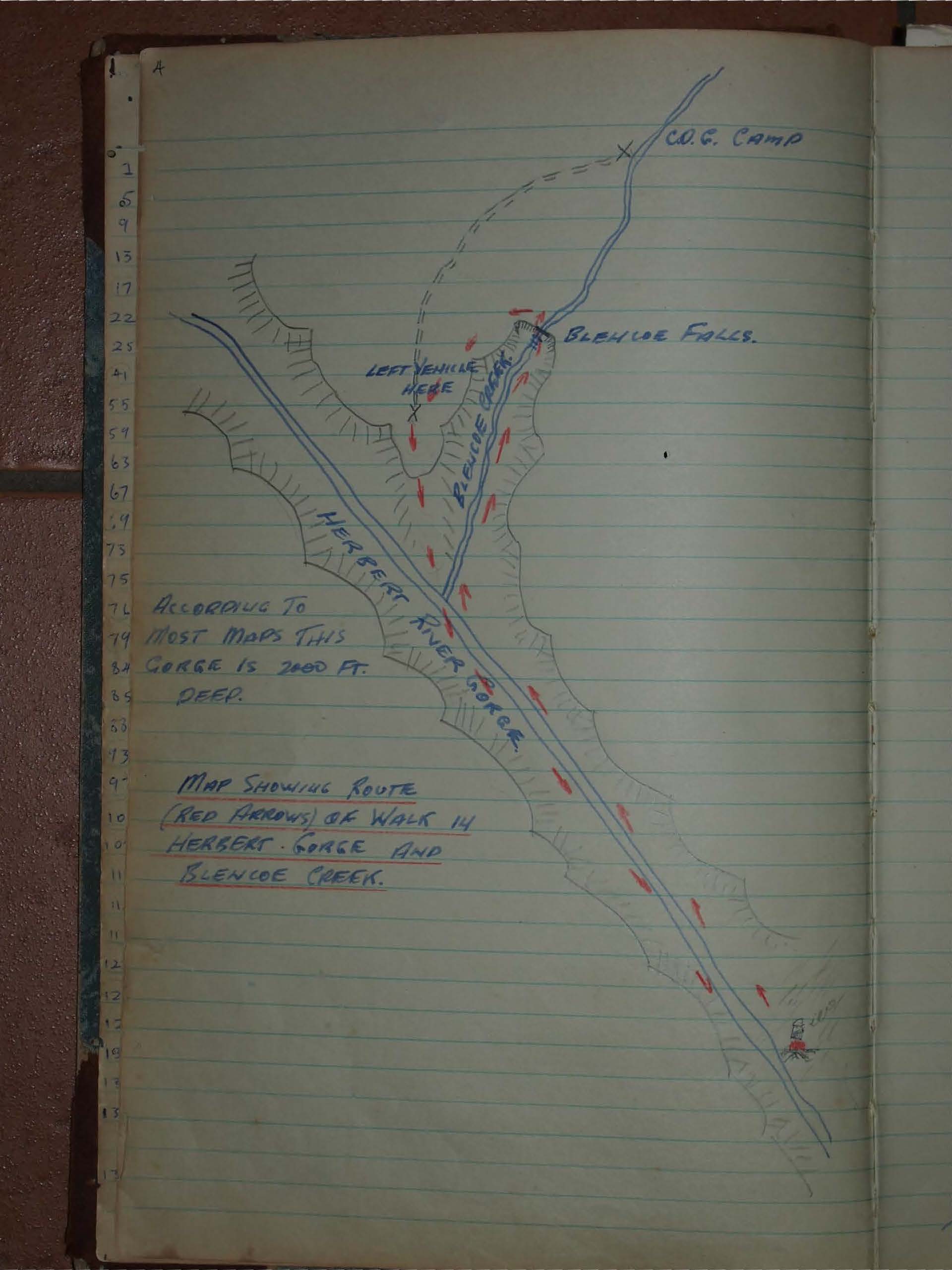
See sketch map:
Logbook: