Bullocky Toms Track
Bullocky Toms Track, Mt Spec (1966). A two-day bushwalk exploring Forbes Track, Fowler Lookout, Sardine Battery, and Gold Creek Falls. Featuring rugged rainforest trails, creek crossings, and panoramic views from Cardwell Range to Cape Cleveland, this North Queensland hike offers rich adventure.
23-24 July 1966.
Location:
Mt Spec area.
Party:
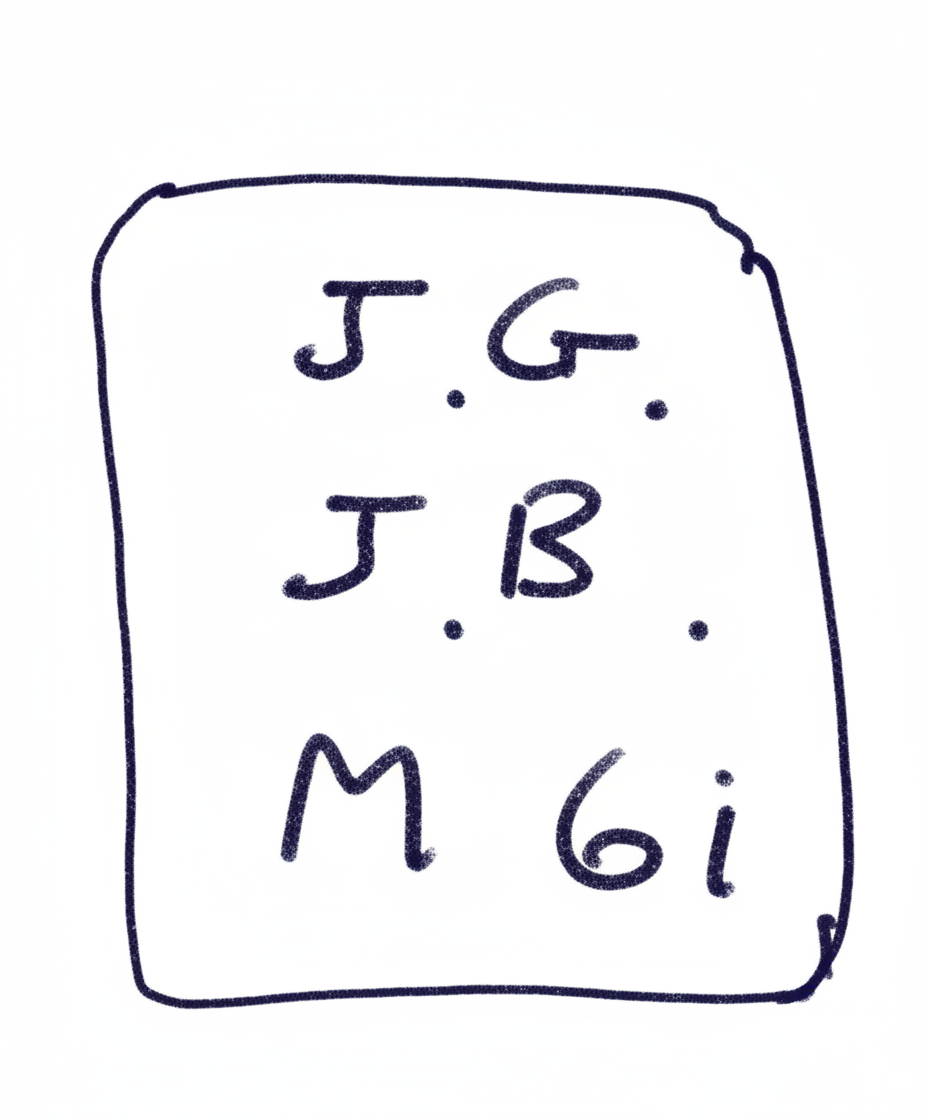
Colleen Kelly
Marian Spiers
Peter Reimann
Louis Darveniza
Rodney Newpat
Duncan McLean
Lynton Wright (leader)
Maps Used:
As for walk 7-9 August 1965. Plus local sketch maps prepared in succeeding walks.
Transport:
1 V.W. (Peter Reimann)
1 V.W. (Louis Darveniza)
1 Morris (Tony Rogers, ferrying cars)
Distances:
by car 150 miles.
walking 14 miles.
Rating:
average.
Summary of Outing:
This weekend was a repetition in part, of the walk carried out 7-9 August '65 with a number of variations.
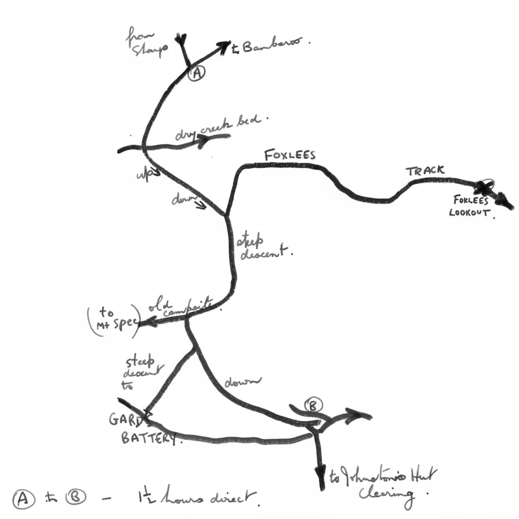
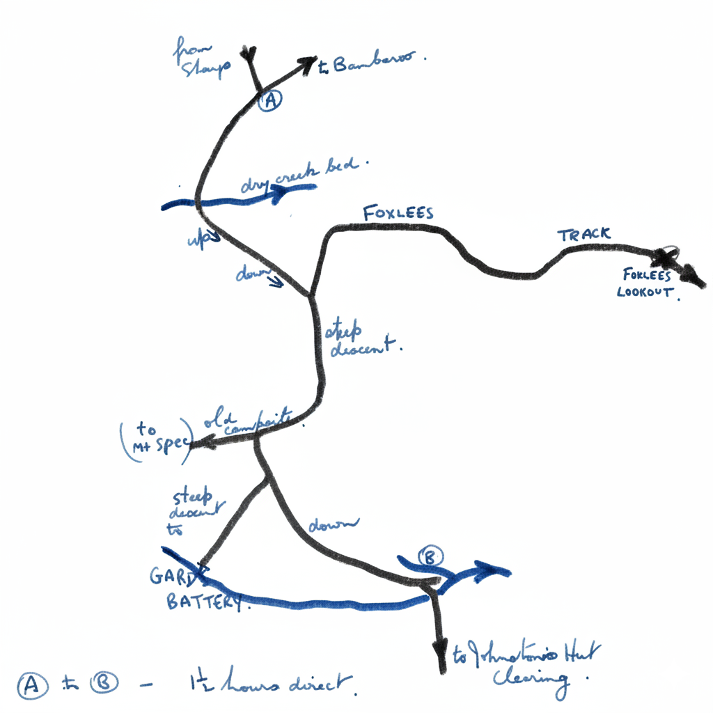
- The starter track from the back of Sharpe (located 16 Oct '65) was used. This made a saving of about 1 hour's walking.
- The Forbes Track Junction was located - and followed to Forbes lookout.
- Sardine Batting was located on a side track soon after leaving the main Mt Spec Track.
- We dropped into the creek, though went a while, earlier than last time.
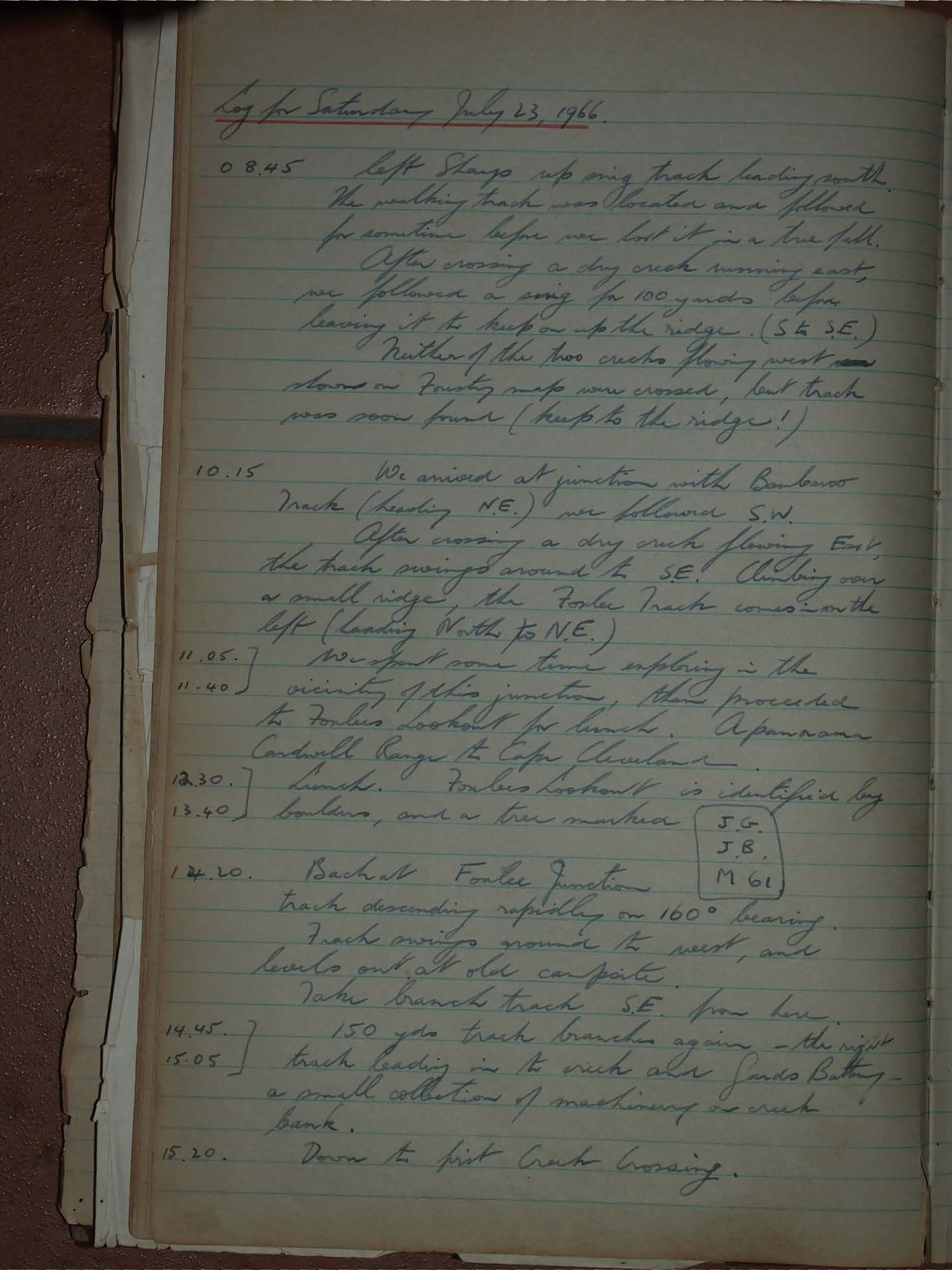
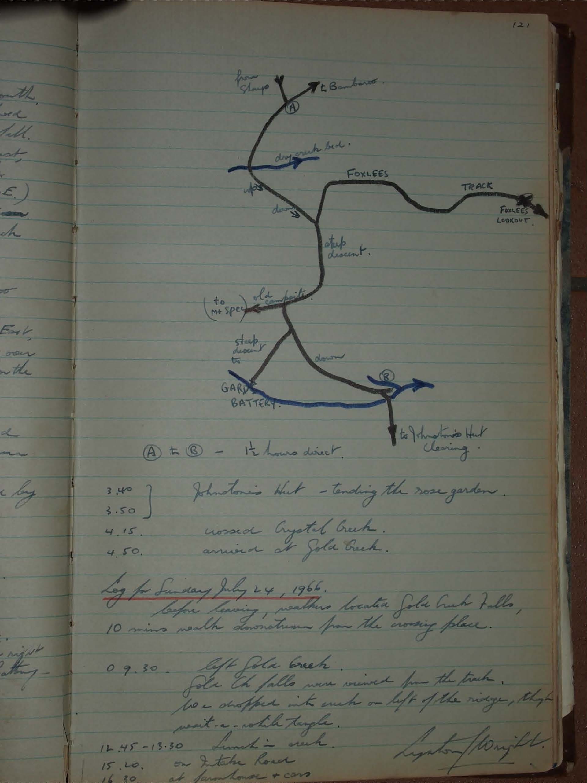
Log for Saturday July 23, 1966.
08.45
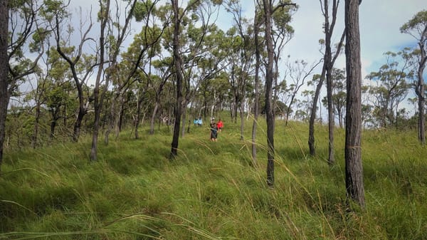
Left Shango up main track leading south. The walking track was located and followed for sometime before we lost it in a true fill. After crossing a dry creek running east we followed a swing for 100 yards before leaving it to keep on up to the ridge. (S & SE.) Neither of the two creeks flowing west shown on Forestry maps were crossed, but track was soon found (keep to the ridge!).
10.15
We arrived at junction with Barbour Track (heading N.E.) we followed S.W. After crossing a dry creek flowing East, the track swings around to SE. Climbing over a small ridge, the Fowler Track comes on the left (leading North to N.E.)
11.05 - 11.40
We spent some time exploring in the vicinity of this junction, then proceeded the Fowler lookout for lunch. A panorama Cardwell Range to Cape Cleveland.
12.30 - 13.40
Lunch. Fowler Lookout is identified by boulders, and a tree marked
14.20
Back at Fowler Junction. Track descending rapidly on 160° bearing. Track swings around to west, and levels out at old camp site. Take branch track S.E. from here.
14.45 - 15.05
150 yds track branches again, - the right track leading in to creek and finds Battery - a small collection of machinery on creek bank.
15.20
Down to first Creek Crossing.
03.40 - 03.50
Johnston's Hut - tending the rose garden.
04.15.
Crossed Crystal Creek.
04.50.
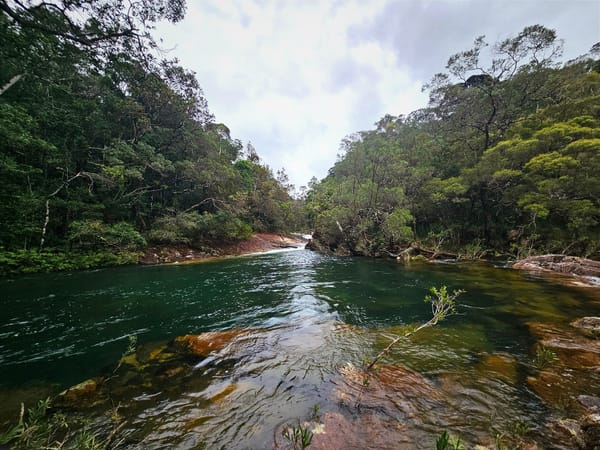
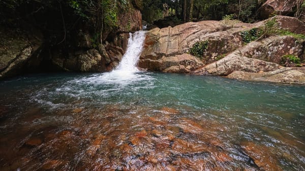
Arrived at Gold Creek.
Log for Sunday July 24, 1966.
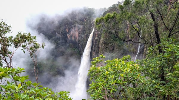
Before leaving, weathers located Gold Creek Falls, 10 mins walk downstream from the crossing place.
09.30.
Left Gold Creek. Gold Ck Falls now viewed from the track. We chopped into creek on left of the ridge, then went a while longer.
12.45-13.30
Lunch in creek.
15.20.
On Intake Road
16.30.
At Stanhouse + cars
Leighton Wright.