Burdekin River outing 1967
Explore the Burdekin River trip of November 1967, where Townsville bushwalkers camped by the Big Bend, rowed through rapids, discovered bowerbird bowers, and swam in the Echo Hole. A rugged journey of basalt tracks, river bends, and abundant birdlife in North Queensland’s outback.
Log Book record for Burdekin River outing, 25-26 November, 1967
Nine members altogether, though three were there for only one day.
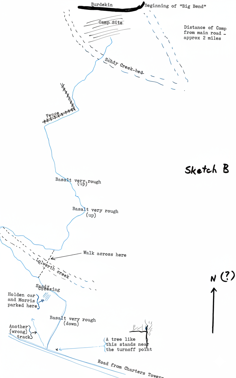
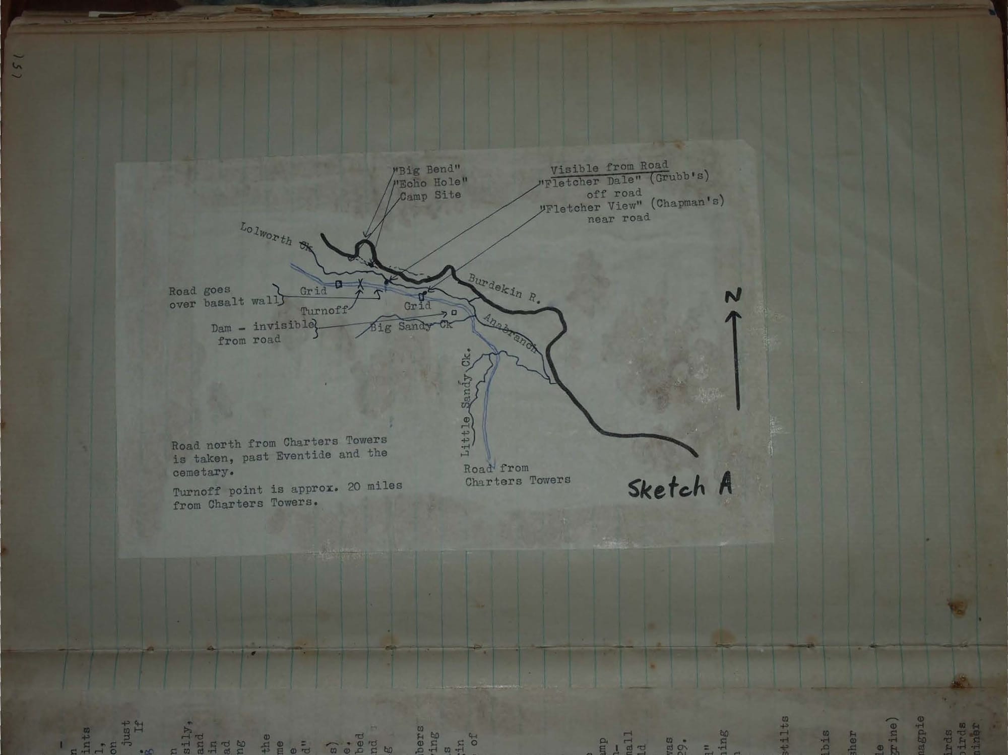
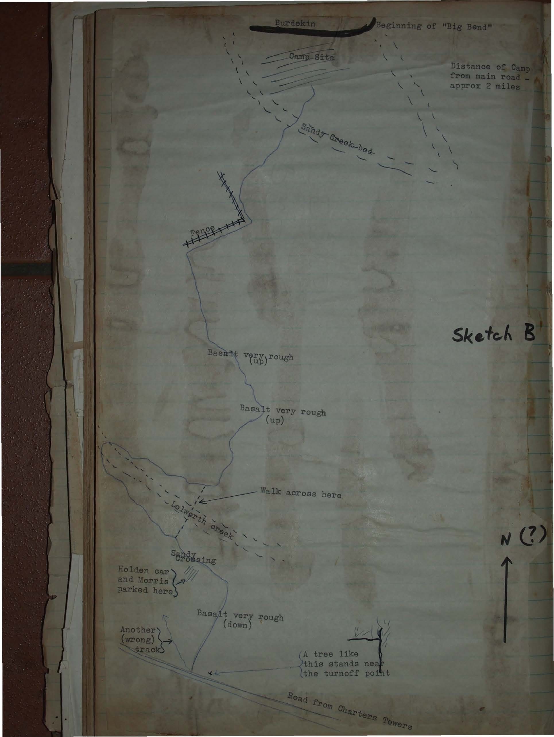
Departed Townsville 8 a.m. Saturday. Drove to Charters Towers - 84 miles, then north on Inland Highway - (bitumen for a few miles, then good gravel) for 20 miles, then turned to right on to wheel track. Points to note on approach to turnoff are - steepish hill up on to basalt wall, drive across wall, and not so steep hill down off wall - "crest" sign on the right - proceed along road less than ½ mile and see track on right just after a black tree with a branch at right angles to trunk (see sketch). If you go across another grid you have gone too far!
This track from the main road to the camp site is very rough in places, over basalt, and sandy creek banks. A Land Rover can do it easily, a VW did it on our trip, and also a Holden utility, but a Holden car (and on the reconnoitre trip, a Morris car) parked about ½ mile from the main road, having gone down a rather bad basalt bit. Distance from main road to camp site is about 2 miles. (See sketch B for track map, and walking shortcut).
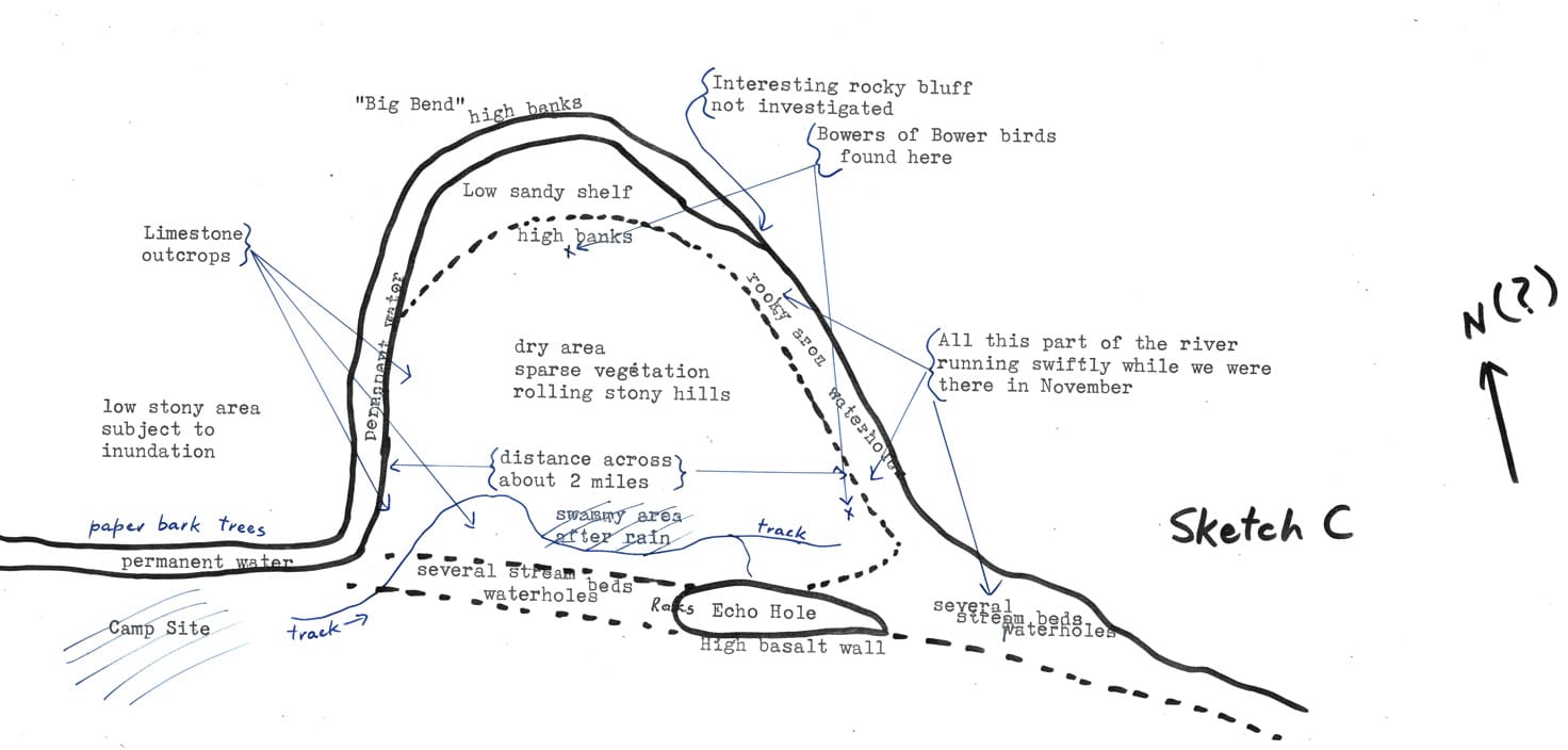
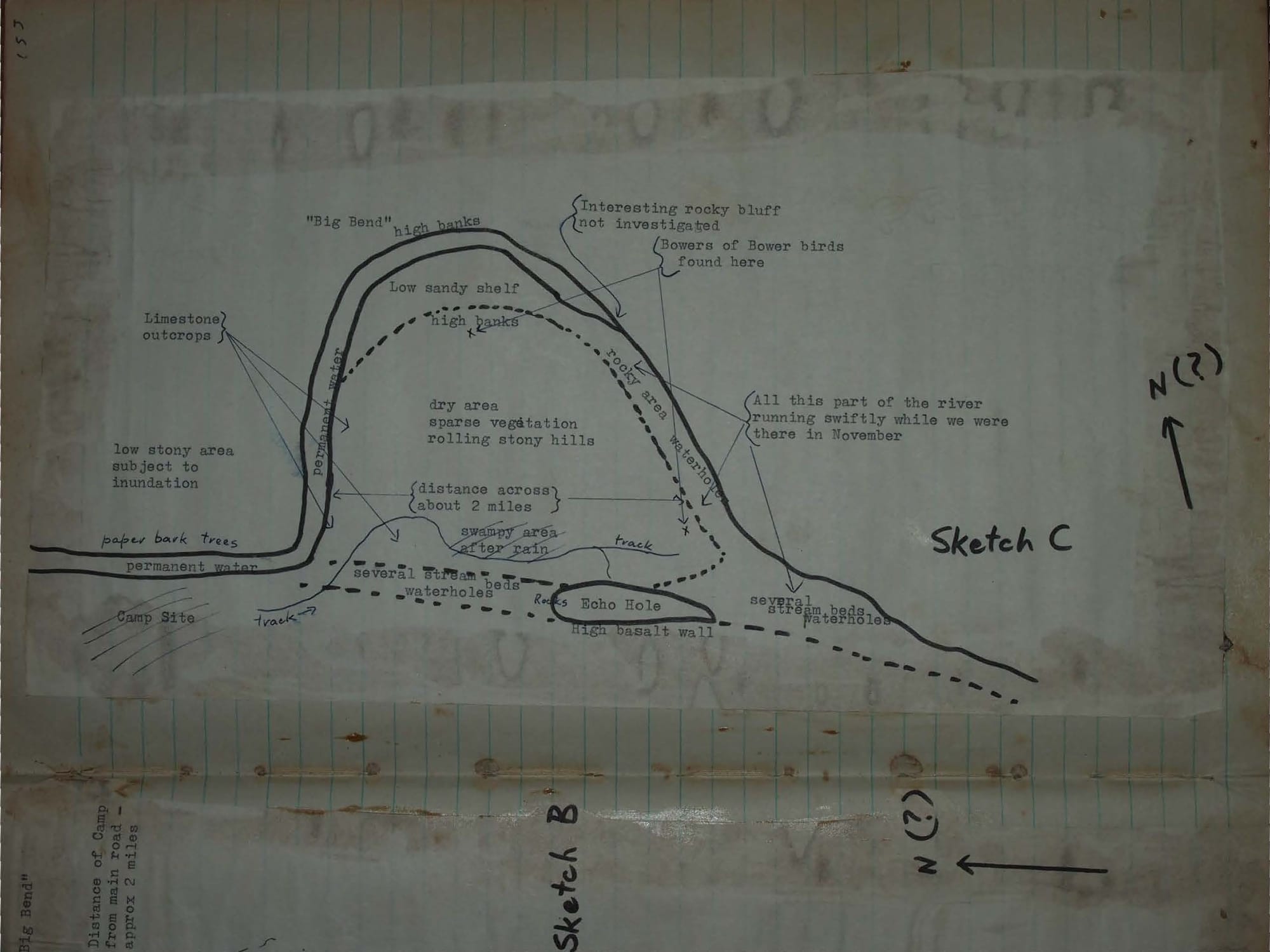
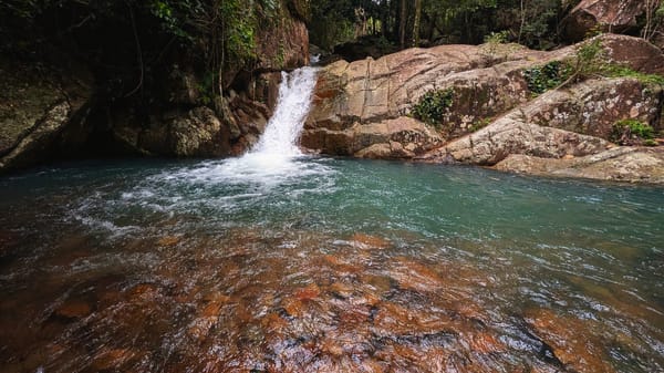
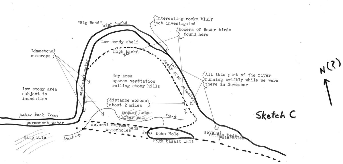
We had a small canvas boat which was carried by four men from the parked Holden car to the camp site. We arrived at the camp site in time for a swim before lunch. After lunch, we walked along the track to the Echo Hole which was once in the main part of the river before the "Bend" developed (see sketch C). The Echo Hole is a large waterhole with permanent deep water, and a 40-foot waterworn basalt wall (which echoes) on one side. Water would only flow through this waterhole in floodtime. We investigated the far end of the Echo Hole and the junction of this bed of the river with the main "Bend" stream. We swam near some rapids, and strolled back to the camp site (about 20 minutes' walking time) passing a swampy area with birds on it.
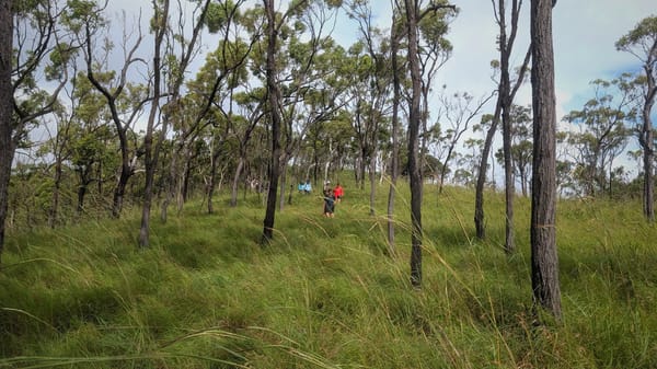
On Sunday morning we walked round the "Big Bend" while two members of the party rowed the boat downstream. The walking party and the rowing party stayed more or less together until the rowers came to some rapids about two-thirds of the way round the "Bend", when they decided to begin rowing back upstream to the camp site. The walkers then left the edge of the water and climbed up on to the bank, which was about 60 feet above the level of the river. The bower of a bower-bird was found there, and towards the end of the bank of the "Bend" another bower, with two others which were either in course of construction or abandoned. We proceeded to the Echo Hole again, for a swim, then returned to the camp site, this time following the bed of the stream, rather than the wheel track.
State of the water: On the reconnoitre trip on October 29 the river was not running. The water was at least 8 feet deep near the camp site, and stretched upstream at least as far as we could see, and downstream for at least half way round the "Bend". There were numerous small pools further downstream. The water was fairly clear, though one could not see the bottom.
On the club outing on November 25 - the Saturday - the water was running, brown in colour, and at least 2 feet higher than on October 29. On the Sunday the water was running even more swiftly and was even muddier, and was a further 3 feet higher. The whole of the main "Bend" course of the river was then flowing, though the "old" course, containing the Echo Hole did not seem to be different from when we had seen it on October 29.
Birds seen - list compiled by Andrée Griffin:
- white winged chough
- crested pigeon
- squatter pigeon
- pied butcher bird
- white throated warbler (yellow chest and abdomen)
- rainbow lorrikeets
- pale headed rosellas
- red winged parrots
- blue faced honeyeater
- white throated honeyeater
- yellow honeyeater
- brown honeyeater
- channel billed cuckoos
- koel
- white cockatoos
- white egrets
- nankeen night heron
- white faced heron
- pelicans 5
- brolgas (2 on swamp)
- darters
- cormorants (little pied black)
- white quilled pigmy goose - 1 pair
- black faced cuckoo Shrike
- blue winged kookaburra
- laughing kookaburra
- apostle birds
- great bower birds
- white headed stilts
- black duck
- grey teal
- straw necked ibis
- masked plover
- forest kingfisher
- kestrel
- whistling eagle
- falcon (?peregrine)
- crows
- black backed magpie
- magpie larks
- noisy friar birds
- little friar birds
- white rumped miner
- rainbow birds
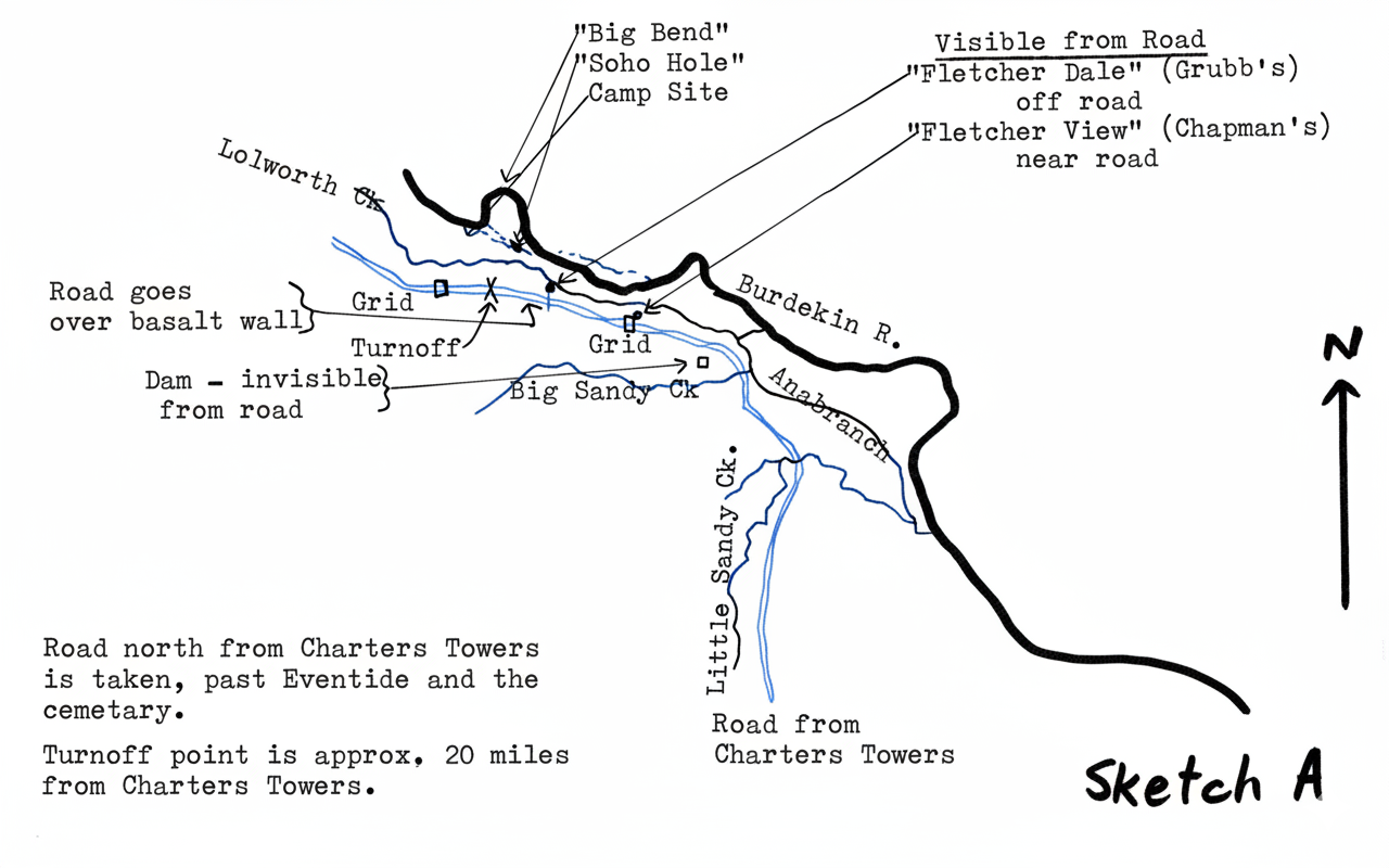
Road north from Charters Towers is taken, past Eventide and the cemetary. Turnoff point is approx. 20 miles from Charters Towers.