Garrawalt - Wallaman Through Walk 1968
Discover the 1968 Garrawalt–Wallaman through walk, a challenging two-day trek from the Herbert River to Wallaman Falls. Featuring rainforest scrambles, swimming holes, basalt cliffs, gympie stings, and rugged bush tracks, this classic North Queensland adventure tested skill and endurance.
January 1968
Party
Arthur Romer, Lon Darceniza, Peter Reimann, Norm Kelk.
The following walk was done comfortably in two days instead of un-comfortably in three days (see previous description - Queens Birthday weekend 1966)
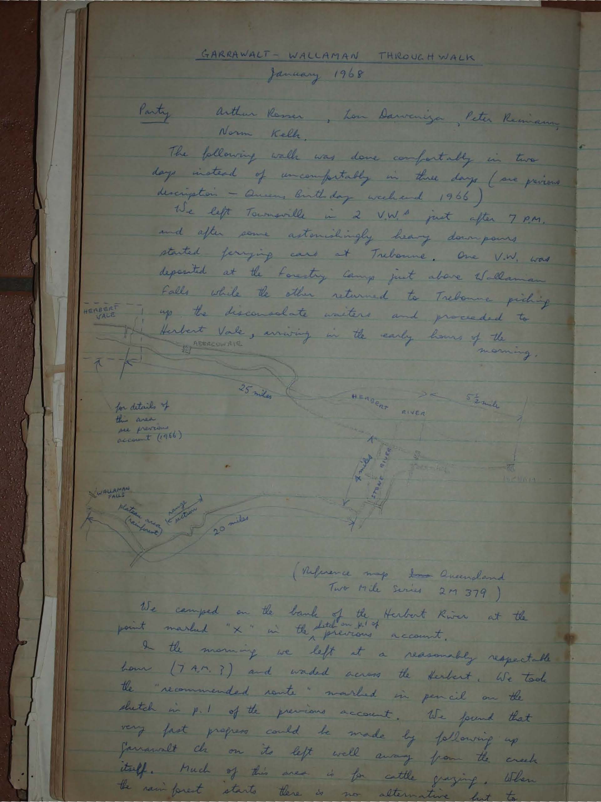
We left Townsville in 2 V.W.s just after 7 P.M. and after some astonishingly heavy down-pours started ferrying cars at Trebonne. One V.W. was deposited at the Forestry Camp just above Wallaman Falls while the other returned to Trebonne picking up the disconsolate waiters and proceeded to Herbert Vale, arriving in the early hours of the morning.
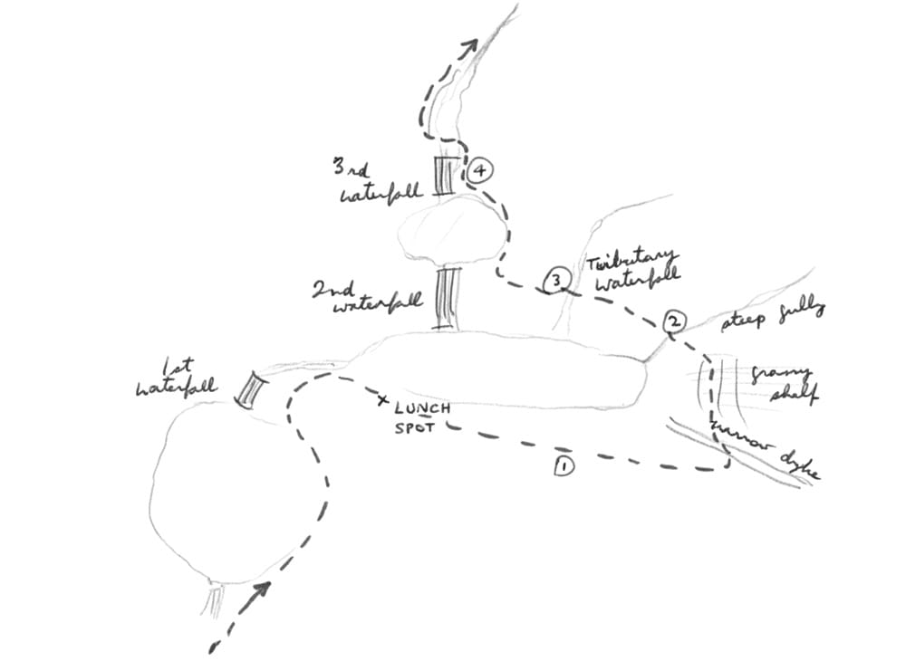
We camped on the bank of the Herbert River at the point marked "x" in the sketch on p.1 of the previous account.
In the morning we left at a reasonably respectable hour (7 A.M.?) and waded across the Herbert. We took the "recommended route" marked in pencil on the sketch in p.1 of the previous account. We found that very fast progress could be made by following up Garrawalt Ck on its left well away from the creek itself. Much of this area is for cattle grazing.
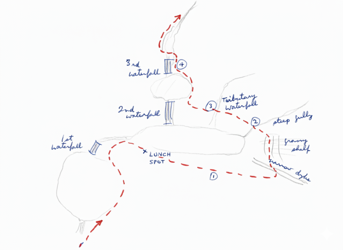
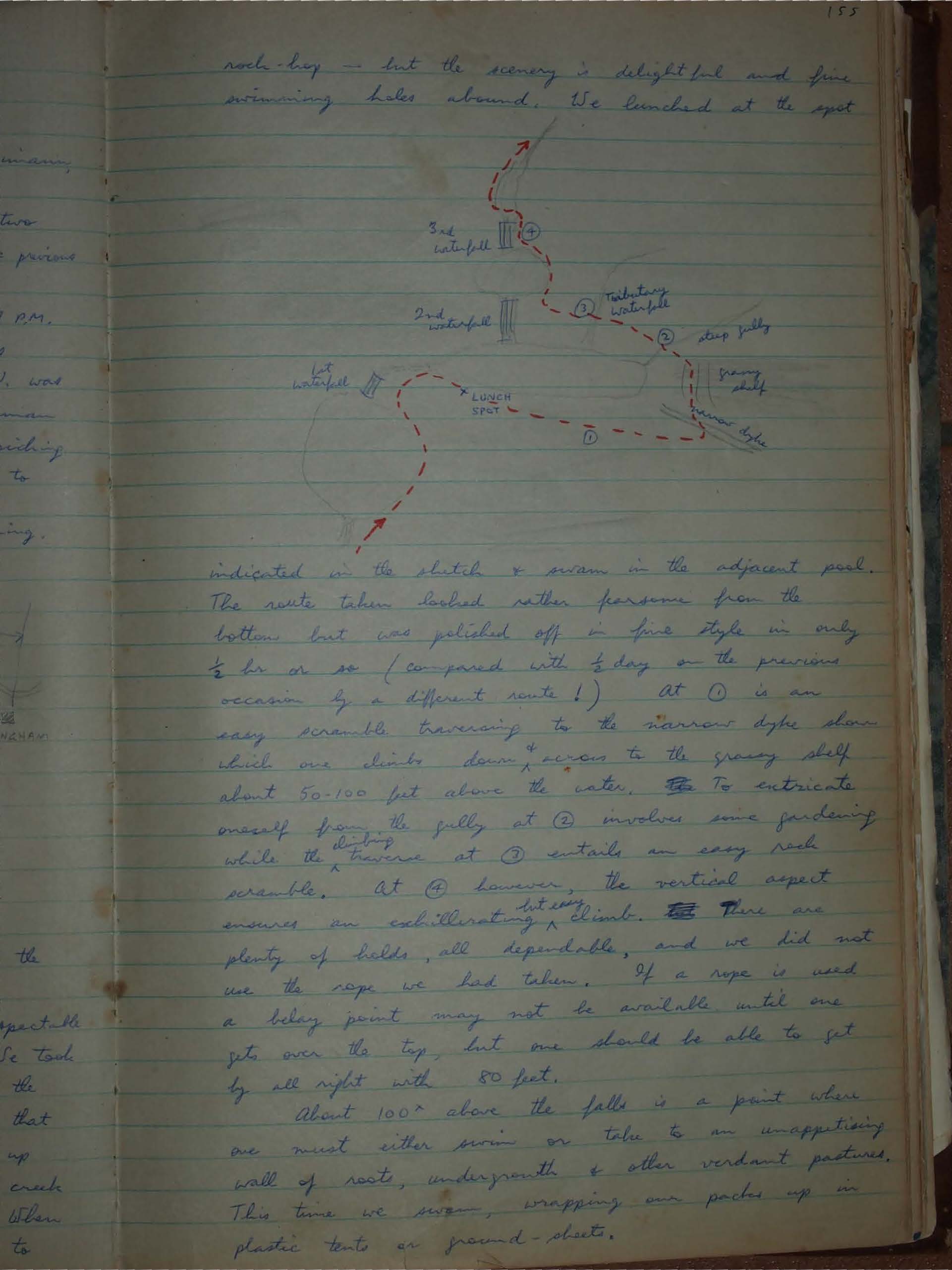
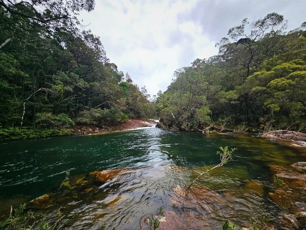
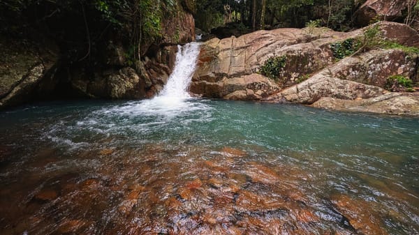
When the rainforest starts there is no alternative but to rock bay - but the scenery is delightful and fine swimming holes abound. We lunched at the spot indicated on the sketch & swam in the adjacent pool.
The route taken looked rather fearsome from the bottom, but was polished off in fine style in only ½ hr or so (compared with ½ day on the previous occasion by a different route!)
At ① is an easy scramble traversing to the narrow dyke down which one climbs down & across to the grassy shelf about 50-100 feet above the water. To extricate oneself from the gully at ② involves some gardening while the traverse at ③ entails an easy rock scramble. At ④ however, the vertical aspect ensures an exhilirating but easy climb. There are plenty of holds, all dependable, and we did not use the rope we had taken. If a rope is used, a belay point may not be available until one gets over the top, but one should be able to get by all right with 80 feet.
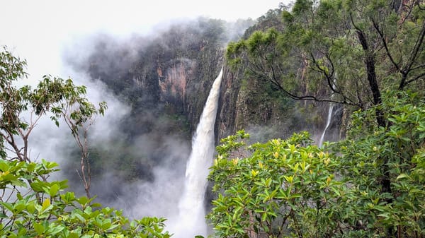
About 100 ft above the falls is a point where one must either swim or take to an unappetising wall of roots, undergrowth & other verdant pastures. This time we swam, wrapping our packs up in plastic tents or ground-sheets.
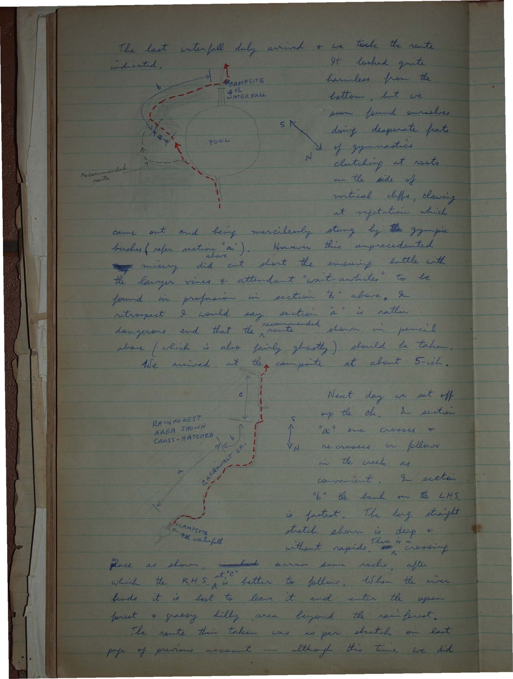
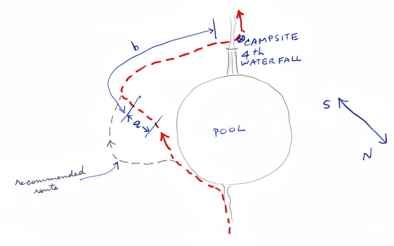
The last waterfall duly arrived & we took the route indicated. It looked quite harmless from the bottom, but we soon found ourselves doing desperate feats of gymnastics clutching at roots on the side of vertical cliffs, clawing at vegetation which came out and being mercilessly stung by the gympie bushes (refer section "a"). However this unprecedented misery did cut short the ensuing battle with the lawyer vines & attendant "wait-a-whiles" to be found in profusion in section "b" above, & in retrospect I would say section "a" is rather dangerous and that the recommended route shown in pencil above (which is also fairly ghastly) should be taken. We arrived at the campsite at about 5-ish.
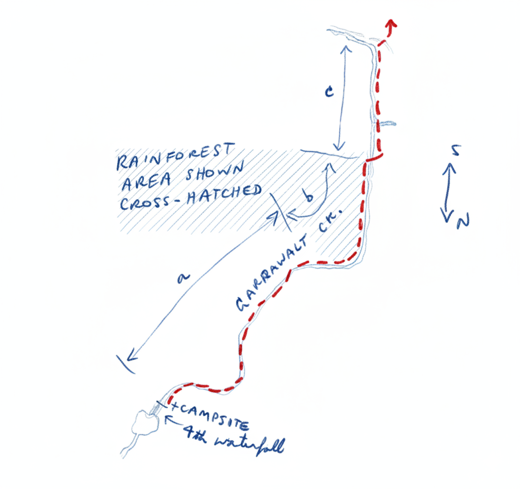
Next day we set off up the ck. In section "a" one crosses & recrosses or follows in the creek as convenient. In section "b" the bank on the LHS is fastest. The long straight stretch shown is deep & without rapids. Thus is no crossing. Race as shown, across some rocks, after which the R.H.S. is at "c" better to follow. When the river bends it is best to leave it and enter the open forest & grassy hilly area beyond the rainforest.
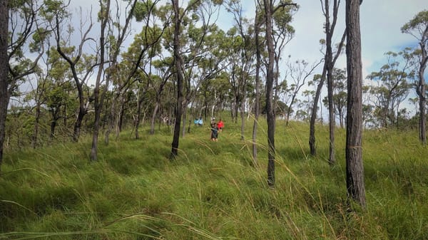
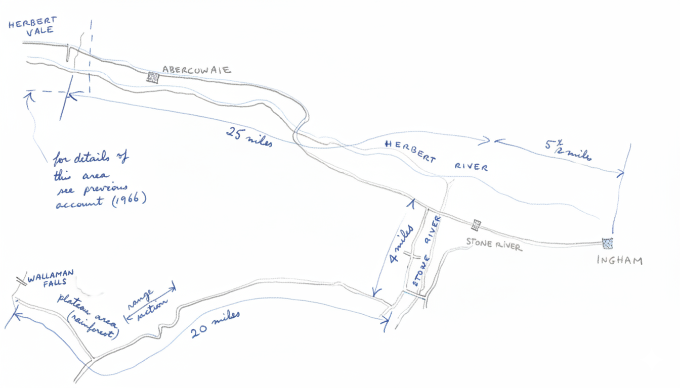
The route then taken was as per sketch on last page of previous account - although this time we did not strike any jeep tracks until arriving at the Forestry camp. We walked in a straight line from when we left the rainforest to the forestry camp site (some very fine gum trees in this area) and were very lucky not to miss it. It would be better to follow closer to the creek & across the bare patch (obvious on the air photo).
The forestry camp was deserted but we lunched and then, in a thunderstorm, followed the tracks indicated in the sketch in the previous account — however they were overgrown sometimes hard to follow. At the Wallaman Falls end we struck a new road being put in.
After collecting the car left at Herbert Vale we were back in Townsville by 7.30 P.M. — a magnificent trip.
P. Reimann.