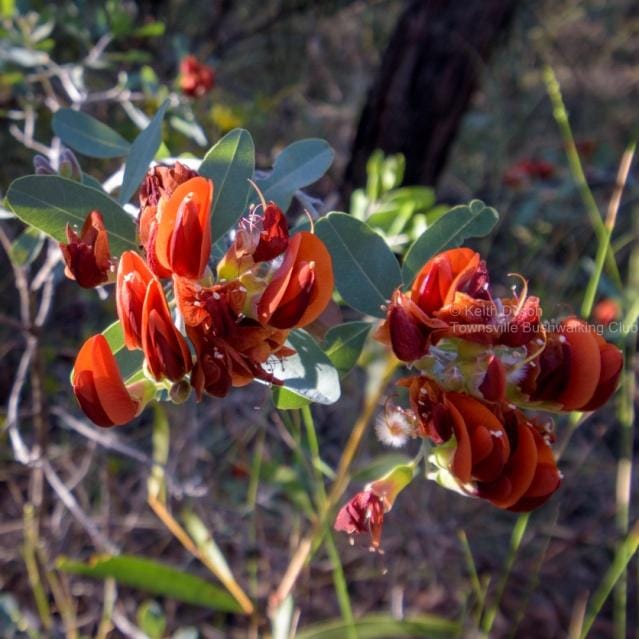
Grab A Cuppa & Read On!
June 2022 with Townsville Bushwalking Club: trip reports from Paradise Beach & Castle Rock, Crystal Creek’s hidden falls, The Terraces, White Mountains NP, and Three Lagoons. Stunning hikes, canyons, waterfalls, and off-track adventures across North Queensland.
Attached for your reading pleasure is our June 2022 club newsletter.
Please feel free to share it with like-minded, adventure loving friends and family
Hi friends,
Here’s a trip report from our last walks.
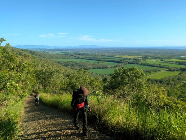
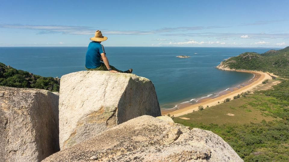
Paradise Beach and Castle Rock
On Sunday the 15th of May, Wilfred led a group of 13 hikers to Little Beach, Paradise Beach, and then on to Castle Rock. These beaches represent an untouched paradise waiting to be enjoyed. Castle Rock is aptly named, as it resembles a fortress atop the hillside with scrambling involved to ascend and exposed ledges once on top. After enjoying the views from Castle Rock across the rugged landscapes, Wilfred's suggestion of heading to Balancing Rock was soon dismissed by the others who preferred to return to civilisation. This walk provided valuable insight into remote bushwalking through bushland and clambering over boulders, and it was a good challenging walk for some of the temporary members.

https://www.instagram.com/p/CeH3s2vFcMv/
Photos and video by Gary Hutcheson
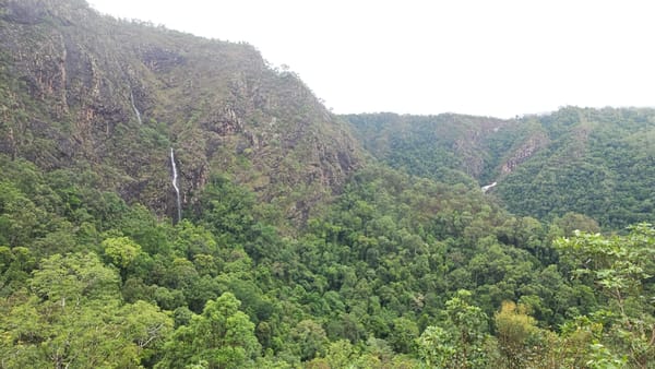
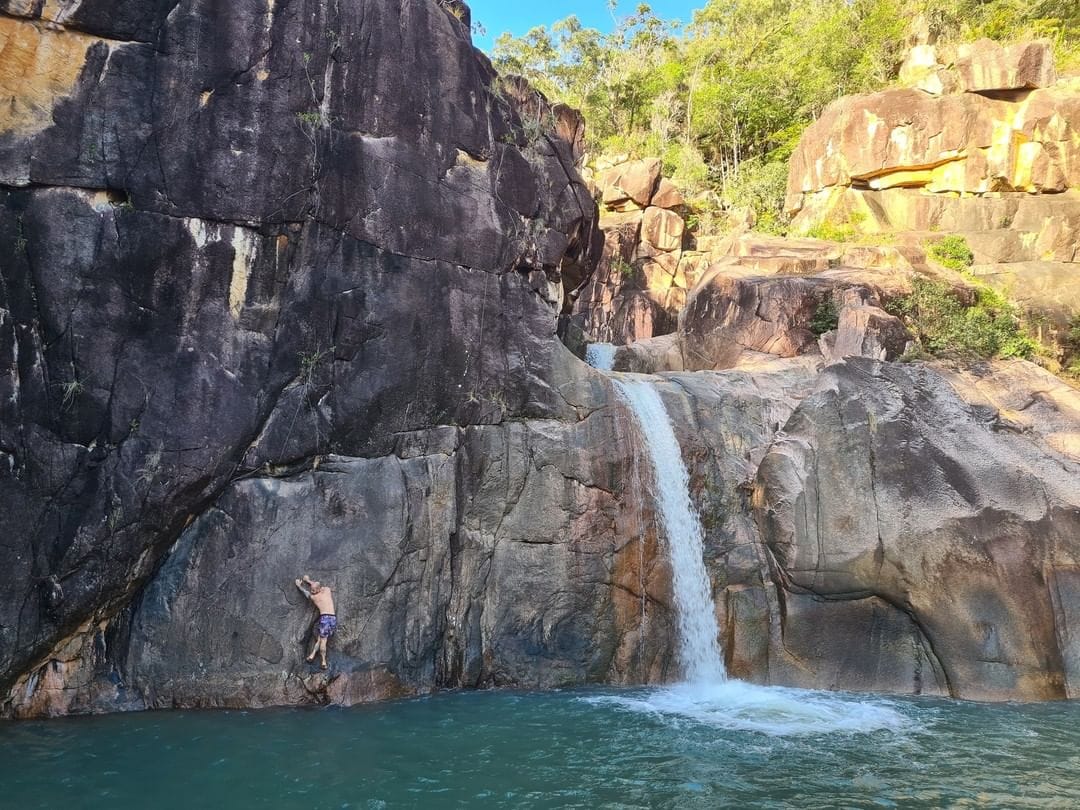
Lower Little Crystal Creek Falls
On the 21st of May, Luen led a group of 7 through some pretty amazing country where we explored the Lower Little Crystal Creek Falls. It was a short pleasant walk down the ridgeline and straight to the monolithic granite outcrop just above the main falls. Three sides of this rock are exposed cliff edges, and this vantage point provides grand views. As we peered upstream, we were in awe of the surreal turquoise colours of the water and the photo-worthy cascades. Below us was the mini-slot canyon that, at the time, was flowing down around a corner, plummeting down into the main attraction, the lower falls. We then walked back off the granite platform, carefully scrambling around and then down the scree to be greeted by a 5mm cord tied to the tree. After scrambling down the last obstacle, we were rewarded with the falls and a beautiful swimming hole. After enjoying a swim and some deep water soloing, we returned via the same route for an early mid-day finish back in Townsville, just in time for lunch.
https://www.instagram.com/p/Cdz075eJhiz/
Photos by Leah Denman & Peter Birch
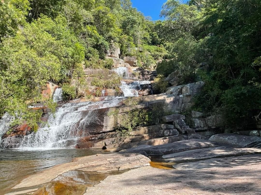
The Terraces and High Camp
On the 28th of May, Ian led a group of 15 on one of the Club's classics – The Terraces, a walk that was pioneered back in 1966. After gaining access via private property, we headed off-track and upstream of the St Margaret's Creek system to The Terraces. Here we were faced with one of the most difficult obstacles of the trip – a scramble up the righthand side of the waterfall. After enjoying The Terraces, we decided the rock hopping and cliff climbing was not enough challenge, so we bashed through the rough scrub, loose rocks, steep slopes, and fallen trees blocking the way, to reach further to Ultima Falls, which was our ultimate destination on the day. After turning around, to avoid a mutiny, we took the easier path along the creek bank. As well as the many glorious waterfalls, there were several high locations with spectacular views across the surrounding landscapes and out to the ocean. This creek-based walk is one of the most scenic creeks in the region (and the state) and is considered by many to be Townsville's best walk. It was a great opportunity for temporary members to experience many stunning waterfalls but also rough creek rock-hopping, boulder scrambles, and cross-country hiking.
https://www.instagram.com/p/CeJ5Lllt25u/
Photos by Ian Wallace
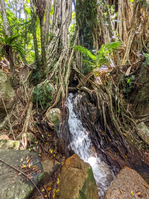
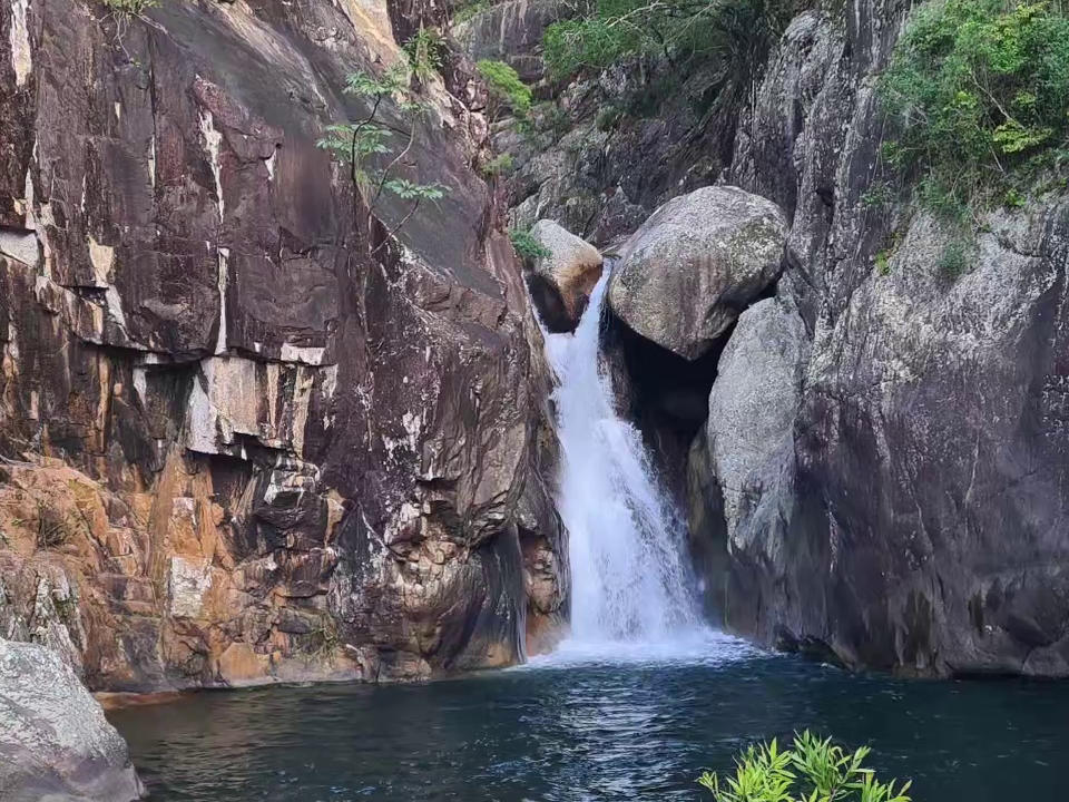
Lower Big Crystal Creek
On the 11th of June, Hue led a group of 8 through the rugged Lower Big Crystal Creek. We were lucky enough to experience these remote hidden waterfalls that aren't often seen, let alone enjoyed. It was a hard but short day out with a good number of temporary members.
https://www.instagram.com/p/CeufHBdPj4p/
Video by Thea Nitschke
White Mountains Eastern Section
Written by Keith:
Some members joined a private walk to White Mountains National Park Eastern Section to re-visit the bushwalking ideas from the club’s past Anzac weekend trip.
The club has bushwalked in the spectacular White Mountains National Park west of Townsville for many years. It provides some of the best remote bushwalking experiences you will find anywhere. There are different sections that we have historically explored in areas inaccessible to the public, but this year we are concentrating on the eastern section for a change. Can the eastern section be as good as the magnificent western section?
The plan was a four-day trip, with three days bushwalking and one day car exploring. This was based on the club’s Anzac weekend plan. One of the criteria for timing was to go before it gets too cold out there – well, that went well with ‘minus 2’ temps and iced tents!
Friday was an easy explore of Sawpit Gorge. In the past having visited it several times I have been disparaging about this area as compared to its western siblings I felt it was inferior, but this time we explored more and I must apologise, dear Sawpit, we love you. It has many hidden nooks and crannies, small canyons and gorges and sandstone formations to explore, and is very good.
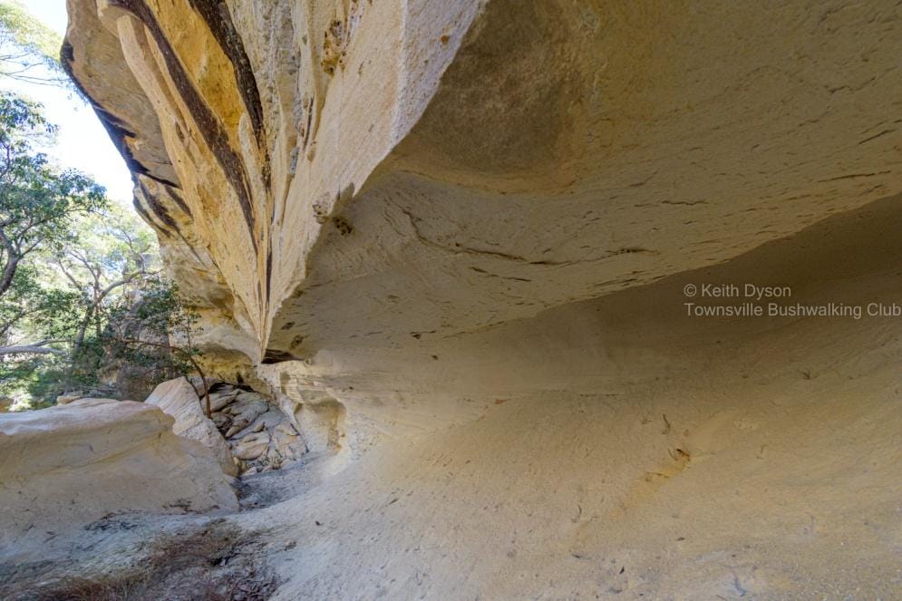
Saturday was the big walk plan –an exploratory adventure. A grand plan to do a 15-20 km loop based on Sunset View Creek. Twice before I have stood at Sunset View and dreamed of this walk. Today was the day to achieve it. We started down Sunset View Creek staying initially on the sandstone plateau, a myriad of sandstone formations, canyons, crevasses, and grottos. Pure spectacular!
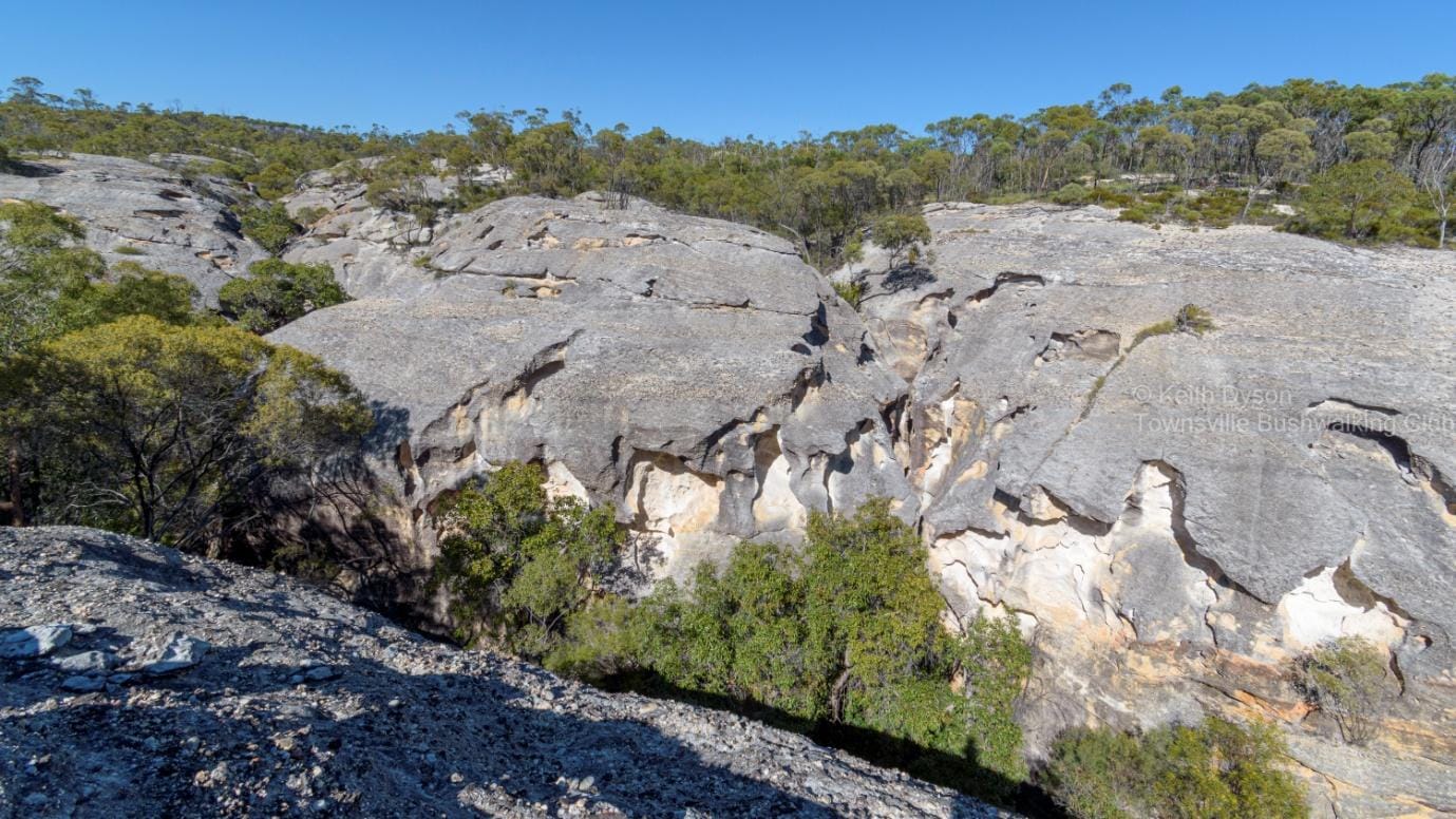
After an hour we descended into the canyon creek bed, to wander down the sandy creek with sandstone formations towering above. Surprisingly there was water in the creek, mostly small pools but one larger pool downstream. There are so many nooks and crannies to explore, that time got away from us as we enjoyed this spectacular scenery, so the full planned loop was not viable for a day walk this time.
At 1:15pm, we turned back (we were 2/3 of the way to the planned half way mark for the full loop!). We departed the creek for the easier plateau walking – yeah, good plan Dyso -up top on the plateau, was thick saplings and wattle, and when clear of them we were frequently blocked by deep long side canyons. These side canyons where spectacular in their own right and worth more exploring, but it was getting near camp Happy Hour time and the pack was thirsty, and we had seen so many canyons already! The side canyons forced us further inland to get around them. Then we came to the really deep impassable long side canyon – and the map showed there was another beyond it. We now had a choice, a long way inland bashing through saplings and wattle and head for the road, a long detour to get back to Sunset View - or try to get back into Sunset View Creek and retrace our steps there, a more direct route. After exploring along the sheer sandstone walls, we found a route down into the side canyon creek bed, for an easy walk back to Sunset View Creek. Then an easy walk retracing our route back to the start. This was an impressive bushwalk in magnificent sandstone country - almost as good as the almighty western section. Back to camp for a well deserved Happy Hour.
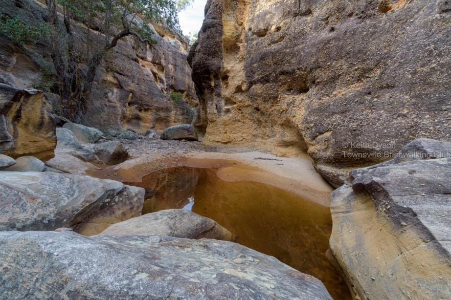
Sunday was the impressive Canns Creek canyon, probably the highlight of the area (a highlight amongst highlights). We have explored this creek canyon system previously, but plan today was to go further.
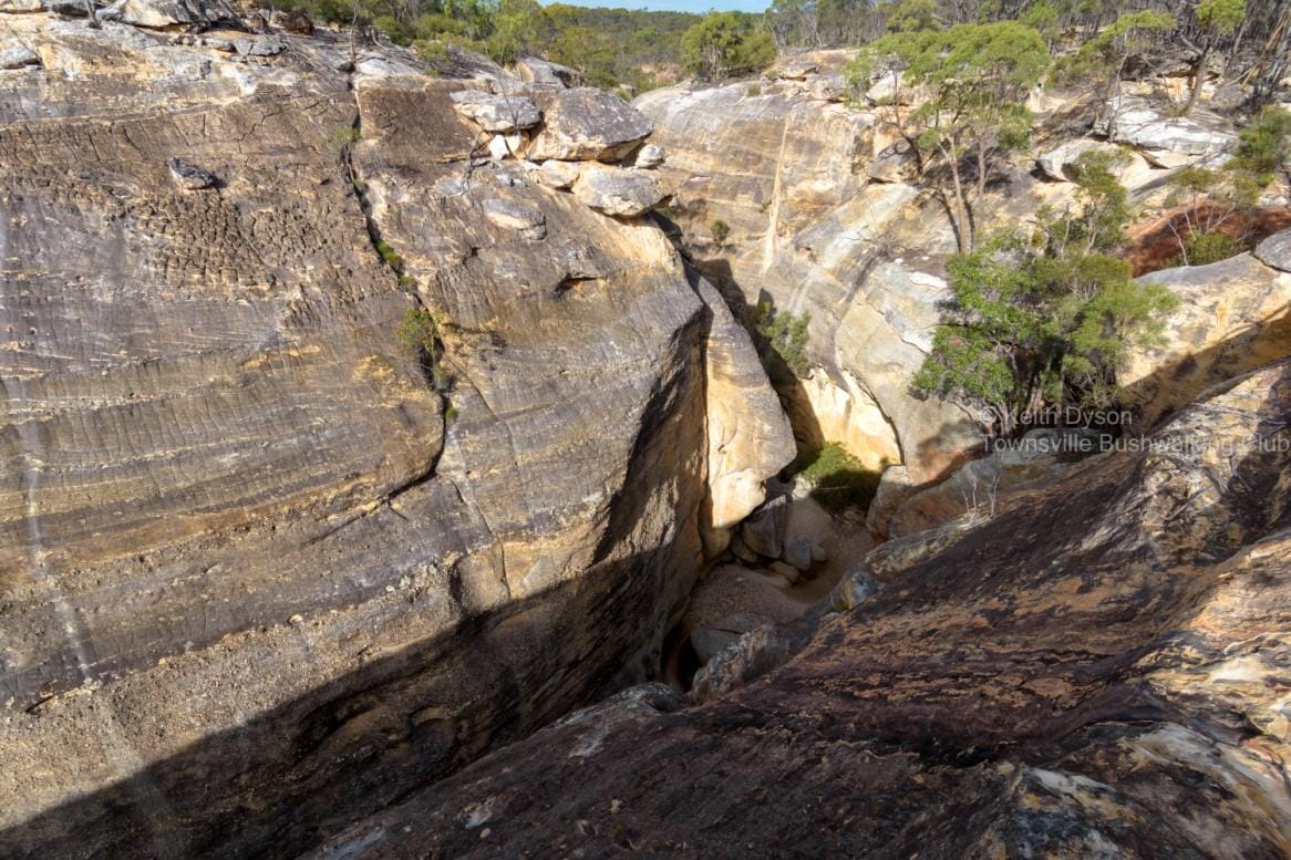
We head upstream, inside the canyon on the creek bed. There is more water in the creek than last time, and at some points even flowing water. Exploring grottos and nooks and crannies, I showed the others where we would find Red Hands Cave later, high above. Canns Creek Canyon is a deep sheer sided canyon in most parts, very impressive.
Eventually we were blocked by a large deep pool and overhanging boulder and steep side walls, and to detour along the canyon side wall was hairy, so we decided to get out of the creek on to the plateau. Up top, spectacular views looking down into the canyon.
We re-entered the canyon upstream, to explore new areas, finding fascinating sandstone features. We then returned downstream, along the plateau to Red Hands Cave. Then back to camp for another Happy Hour, a good way to finish another great days bushwalking. However, there is still more to explore in the system, so more time is needed to fully explore the whole Canns Creek system.
Sunday was the drive to Poison Valley. Of most interest was to find the heart-leaf poison bush Gastrolboum grandiflora that is common in the area. This plant contains the poison mono sodium fluroacetate, more commonly known as 1080. We found one bush of it on Burrah Creek bank – but nobody wanted to suck on the flowers or leaves – wonder why?
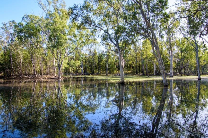
Along the way we passed Big Swamp.
White Mountains National Park Eastern Section is spectacular and provides magnificent bushwalking. You need to be proficient with remote area bushwalking and navigation and be fully self-sufficient.
The western section is still the most majestic part of the park, but the eastern section is very good and easily accessible in comparison. We will do many more trips to White Mountains National Park. We lead and explore – others follow in our footsteps.
Quiz – how many times was spectacular used?
Three Lagoons
Written by Keith Dyson
Beautiful mountain streams and pools, and nobody wanted to swim! When I
was challenged ‘well then, why don’t you show us how to swim in these
Mountain pools? - my response was ‘I have an allergy ....". Luckily nobody
progressed the challenge, otherwise I would have had to expand ‘allergy to icy
cold water’ - phew. Maybe the fact that it was 11 degrees at 0800 at the dam
car park, and remained cool all day, had something to do with no swimming for
the day ..... perfectly understandable.
This walk was based on Crystal Creek from Crystal Creek Falls upstream to the
junction with Dolby Creek. Beautiful rainforest creek scenes, numerous
cascades and lovely pools, a bushwalkers delight - with some rock hopping
and jungle bashing to add to the experience.
Started the walk from Paluma Dam carpark at 0845, headed on track to Crystal
Creek Falls. Quick stop at Skeleton Tree, and it briefty showed its best with a
dash of morning light to give a short skeletal glow. Then later, the usual
showing off for the newbies, the ‘toilet paper tree’. And yes, as usual, get that
quizzical look and response of ‘are you serious .... ?'. We reach Crystal Creek
Falls and explore the creek line, waterfalls and pool, and have the morning tea
break. A sunny spot with a back rest is nice, but the best spot was already
occupied by Joe Black (resident Red Bellied Black snake), so we left it alone and
rested elsewhere.
Now to head upstream in Crystal Creek to Blue Lagoon. Creek level was bit
higher than usual so some of our regular rock hopping points weren't safely
feasible, so we scrambled in or out of the creek upstream. The cascades below
Blue Lagoon were excellent with good waterflow. Then the bush bash to top of
Blue Lagoon. Continue further upstream, mainly in the jungle along the creek
bank with occasional creek rock hopping. Stop at the junction with Double
Barrel Creek, a lovely pool and cascades, a very scenic spot. So far along the
creek we had passed numerous lovely pools and small cascades. Continuing,
we come to a nice waterfall. Ahead was a decent waterfall upstream, but the
creek narrows and rocks are wet, and the terrain along the creek bank gets
steeper, rougher and thicker. So we go higher up the creek bank for a nice
jungle bash. We knew we were close to Junction Falls, our destination, and
shortly after arrived at 1300 for a well-deserved lunch break at a great scenic
location. Almost stood on a carpet python here. That 1.2 km route (per the
map) up the creek had taken about two hours (we would have walked about
2km zig zagging along the creek line). After a nice lunch break (albeit chilly, even in the sun), we headed upstream to re-join the track network, for the
return walk back to the dam carpark, arriving there at 1615 — temp was 18
degrees!
Another great club bushwalk with wonderful creek scenery and a great group
of walkers. Next time we might take creek shoes and walk up the creek to avoid
the jungle bash on the creek bank.
We explore, we lead - others follow in our footsteps.
QTOPO Data:
1.2 km Falls track to Junction Falls following creek line.
600 mr from Double Barrel to Junction Falls
400 mr from Junction Falls to track.
312 mr direct from track
Thanks for reading. We hope you enjoyed reading this and that it provides insight into what we do.
Kind Regards,
Luen Warneke
Flipbook: