Hen-Camp Creek
Hencamp Creek bushwalk, Nov 1963: a 12-mile hike in the Paluma Range with rock-hopping, swimming in deep rock pools, and rugged mountain scenery. The Townsville Bushwalking Club explored creeks, bushfire-scorched flats, and crystal-clear waterholes on this easy yet rewarding North Queensland walk.
Location. Paluma Range area. Coastal slopes.
Date. 17th November 1963
Party. Ken Collett (Leader)
May Collett.
Roy parker.
Desmond Collett
Richard Collett.
Jock Spence
Margaret Liddy
Graham Smith
Graeme Staffe
Bill Pyne
Map used. Lands Dept. 2 mile series. 377
Transport. Dodge Car. Ken Collett./Citroen Car. Graham Smith
Distance travelled by Car: 34 miles each way of Northern Highway, Total 68 miles.
Distance walked. about 12 miles
Type of Outing. Bushwalking and Rock hopping
Rating. Easy.
The party left the Courthouse at 7-50 am Sun. 17th one day trips, a little late leaving and a little unlucky for Ken had a flat tyre to change a couple of miles north of the Bohle river Bridge.
We arrived at Hen Camp Creek at 8.55 am and leaving the cars at the bridge on the Nthrn Highway we started upstream at 9-15 am, our first club visit here.
This creek, like most of our creeks, and small rivers, along the coastal highway at this time of the year, appeared to be rather dry, but for a few slimy pools, polluted with dead toads.
About three miles from the Highway we came to quite a good-flowing stream, which on leaving this higher rocky area, went through the sand and gravel bottom of the creek, through the lower coastal plains area out to the sea.
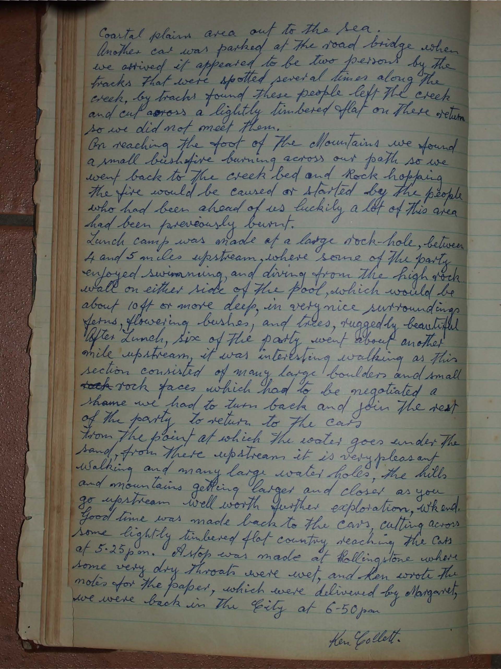
Another car was parked at the road bridge when we arrived it appeared to be two persons by the tracks that were spotted several times along the creek, by tracks found these people left the creek and cut across a lightly timbered flat on their return so we did not meet them.
On reaching the foot of the mountains we found a small bushfire burning across our path so we went back to the creek bed and rock-hopping. The fire would be caused or started by the people who had been ahead of us luckily a lot of this area had been previously burnt.
Lunch camp was made at a large rock-hole, between 4 and 5 miles upstream, where some of the party enjoyed swimming and diving from the high rock wall on either side of the pool, which would be about 10ft or more deep, in very nice surroundings ferns, flowering bushes, and trees, ruggedly beautiful. After Lunch, six of the party went about another mile upstream, it was interesting walking as this section consisted of many large boulders and small rock faces which had to be negotiated a shame we had to turn back and join the rest of the party to return to the cars.
From the point at which the water goes under the sand, from there upstream it is very pleasant walking and many large water holes, the hills and mountains getting larger and closer as you go upstream. Well worth further exploration. Good time was made back to the Cars, cutting across some lightly timbered flat country, reaching the Cars at 5.25pm. A stop was made at Rollingstone where some very dry throats were wet, and Ken wrote the notes for the paper, which were delivered by Margaret, we were back in the City at 6.50pm.
Ken Collett.
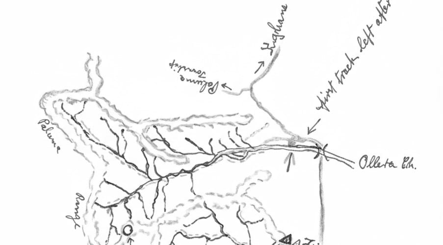
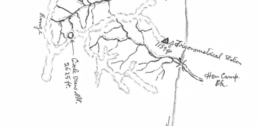
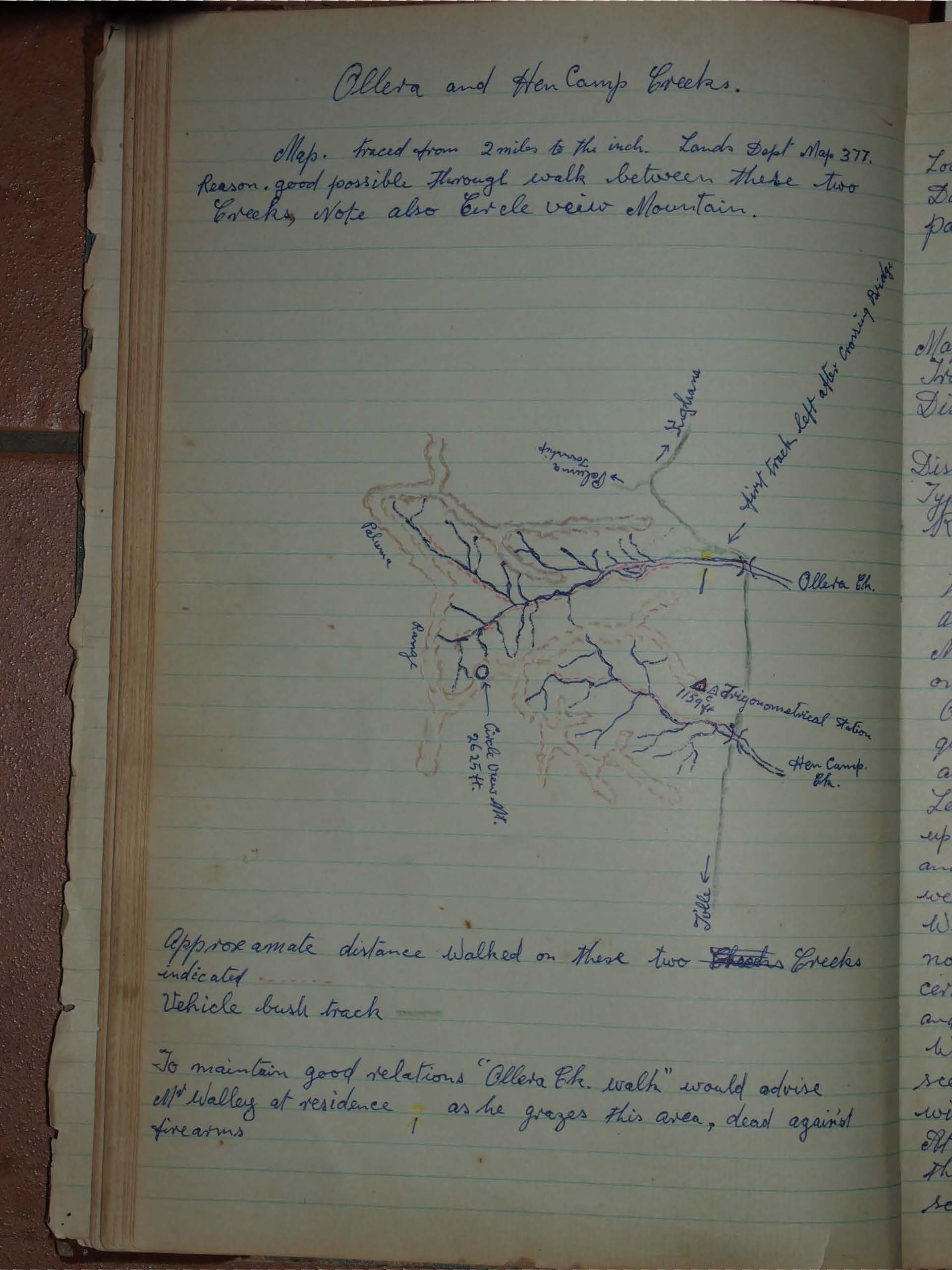
Map. refer to combined Map:
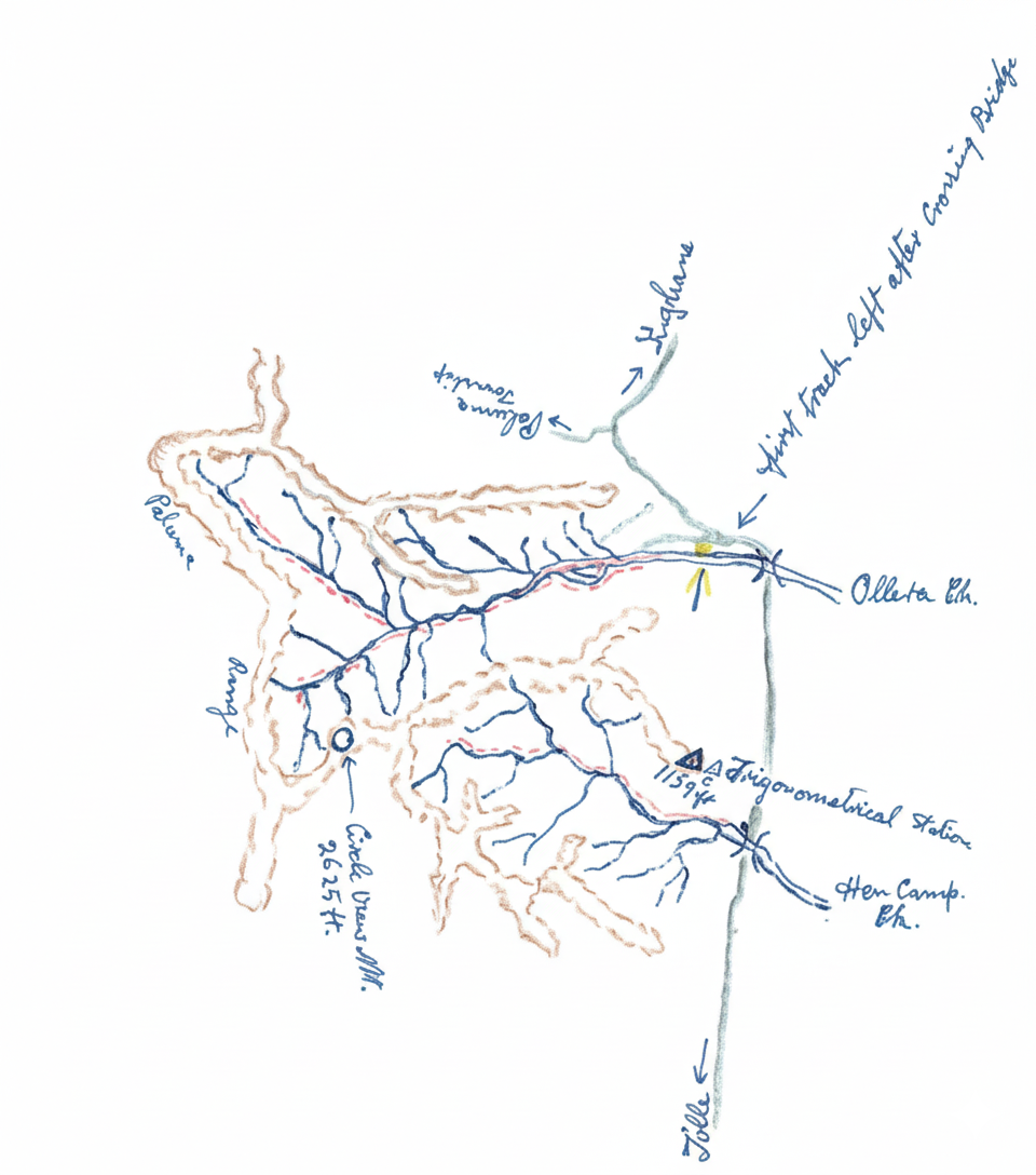
Ollera Creek & Hen-Camp Creek good possible through walk between these two creeks with Circle view Mountain between.
Two or three miles to good water is not far
But you can get mighty dry this time a year here. So every walker, carry a pint, or quart bottle for emergency, its better to have it, and not want it than want it and not have it. Water, water;
See also: