Hinchinbrook Island April & May 1967
Experience the wild beauty of Hinchinbrook Island with a 1967 expedition to North Peak and Mt Bowen. Featuring rugged creek routes, the Fingers ridge, fishing, oysters, and dramatic coastal landings, this classic bushwalk showcases some of Australia’s most spectacular wilderness scenery.
29 - 30th April 1967 & 1 - 2nd May 1967
Participants :-
Lon Darveniza, Flora Carstens, Lorraine Campbell, Malcolm Stuart, Bert Bearington, Lynton Wright, Marion Spiers, Morrie O'Donnell, Ken Fretwell, Peter Reimann.
Access :-
Map :- Army 1 mile
Travel to Dungeness via Ingham and Lucinda. The boat "Eva II" was piloted by Girbutt who owns the shop on the water front at Lucinda (Phone 22)
Cost of boat was $60 total for the 2 trips to the E. coast of the island.
Max. capacity of the boat is 10 persons.
IN :-
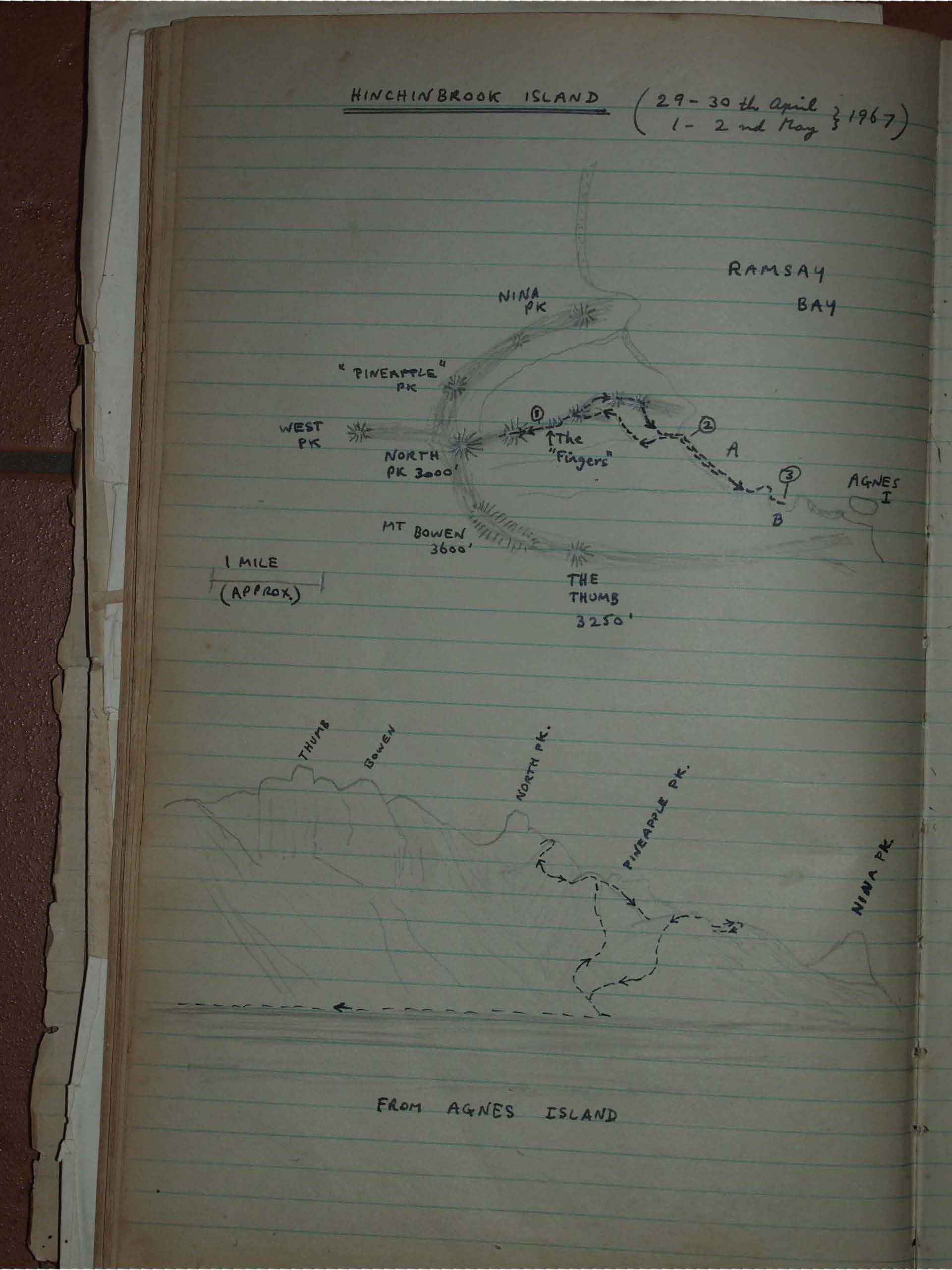
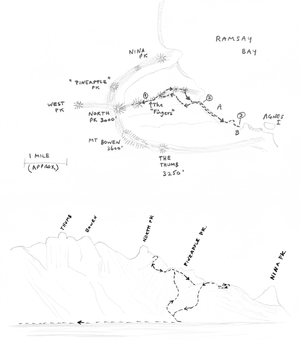
Our original intention was to land on the beach just south of Nina Pk where access to North Pk could be gained along the "Pineapple Pk" ridge. However rough south-easterly weather dictated a landing on the beach marked "A" which forced abandonment of original plans and the use of the "Fingers" ridge instead, whose feasibility was dubious.
OUT :-
On Monday, 1st May, the weather turned more from the east, thus it was necessary to use the more sheltered beach "B" for an exit. However the boat did not arrive until Tuesday 2nd, 9 A.M., and return to Dungeness was around the North of the island & Hinchinbrook Channel. a delay of 1-2 hours occurred in Missionary Bay from a ruptured oil line in the engine.
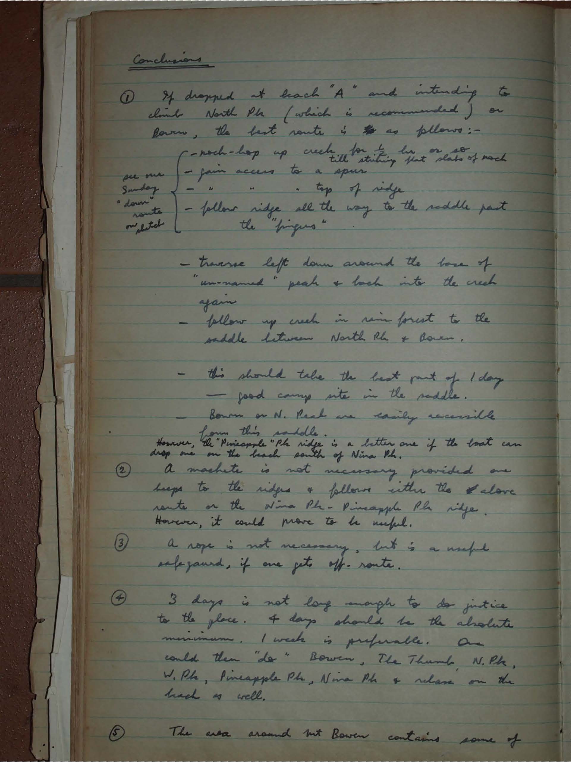
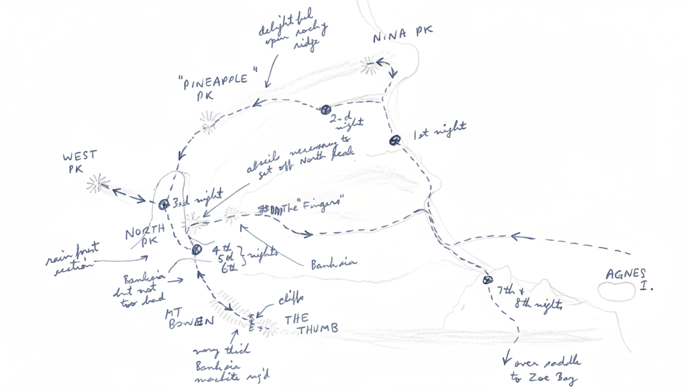
Route:
See sketch. Ringed numbers indicate camp sites.
Timing
SATURDAY
left Dungeness 5.50 A.M.
Arr. beach south of Nine Pk 8.30 A.M.
Arr. beach "A" 9.30 A.M.
Left " " 10.45 A.M.
Arr. saddle beyond the "Fingers"
See ① on sketch 5.15 P.M.
(incl 1 hr stop for lunch)
SUNDAY
Left saddle at ① 8.15 A.M.
Arr. "unnamed pk below N. Pk" 9.50 A.M.
Repulsed 300' below N. Pk 10.30 A.M.
We then loafed around admiring the views,
Eating sardines, & then proceeded back to
The campsite in the saddle.
Left saddle at ① 1.30 P.M.
Arr. back & camped at ② 5.00 P.M.
MONDAY
Left ② 12.45 P.M.
Arr. ③ 1.30 P.M.
TUESDAY
Left ② 9.30 A.M.
Arr. Dungeness 6.15 P.M.
Arr. Townsville after food in Ingham 9.00 P.M.
Comments
Saturday
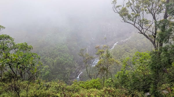
After a late (10 AM) breakfast we rock-hopped up the creek — cool clear running water. At times we walked along the side of the creek to add variety. We lunched on the small side branch shown and then proceeded through some ghastly muck onto the crest of the ridge. Vegetation was dense along the ridges. We camped in the saddle at ① - a good level spot among the grass trees and sheltered from the S.E. wind. Being at 2000 ft the views were good. Water was available very close at hand on the southern side of the saddle. During the night it rained.
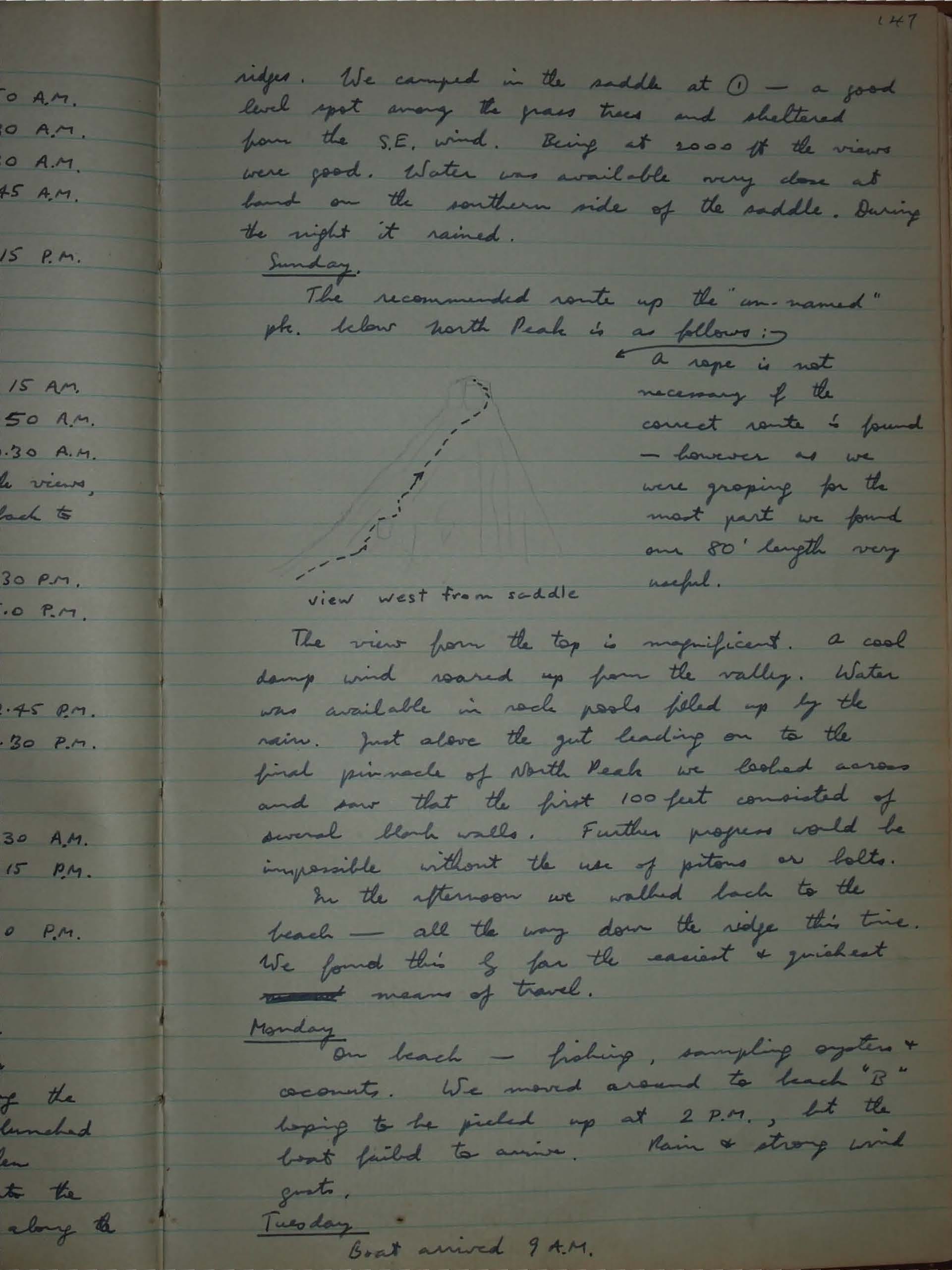
Sunday.
The recommended route up the "un-named" pk. below North Peak is as follows:
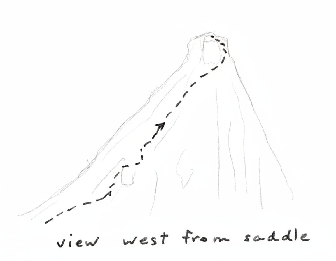
A rope is not necessary if the correct route is found - however as we were groping for the most part we found our 80' length very useful.
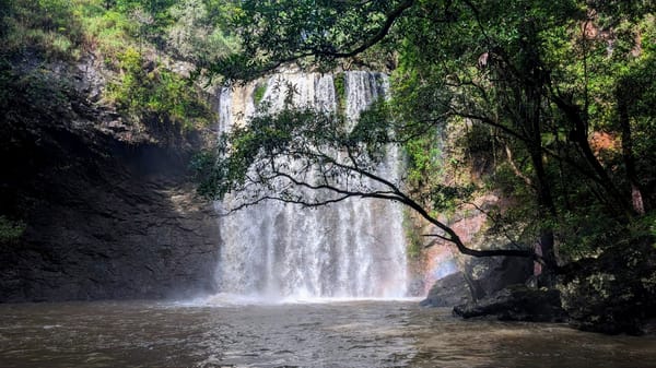
The view from the top is magnificent. a cool damp wind soared up from the valley. Water was available in rock pools filled up by the rain. Just above the gut leading on to the final pinnacle of North Peak we looked across and saw that the first 100 feet consisted of several blank walls. Further progress would be impossible without the use of pitons or bolts. In the afternoon we walked back to the beach — all the way down the ridge this time. We found this by far the easiest & quickest means of travel.
Monday.
On beach — fishing, sampling oysters & coconuts. We moved around to beach "B" hoping to be picked up at 2 P.M., but the boat failed to arrive. Rain & strong wind gusts.
Tuesday.
Boat arrived 9 A.M.
Conclusions
① If dropped at beach "A" and intending to climb North Pk (which is recommended) or Bowen, the best route is as follows:-
See our Sunday "down" route on sketch:
- Rock-hop up creek for 1 hr or so till striking flat slabs of rock
- Gain access to a spur
- Gain access to top of ridge
- Follow ridge all the way to the saddle past the "fingers"
- Traverse left down around the base of "un-named" peak & back into the creek again
- Follow up creek in rain forest to the saddle between North Pk & Bowen.
- This should take the best part of 1 day
- Good camp site in the saddle.
- Bowen or N. Peak are easily accessible from this saddle.
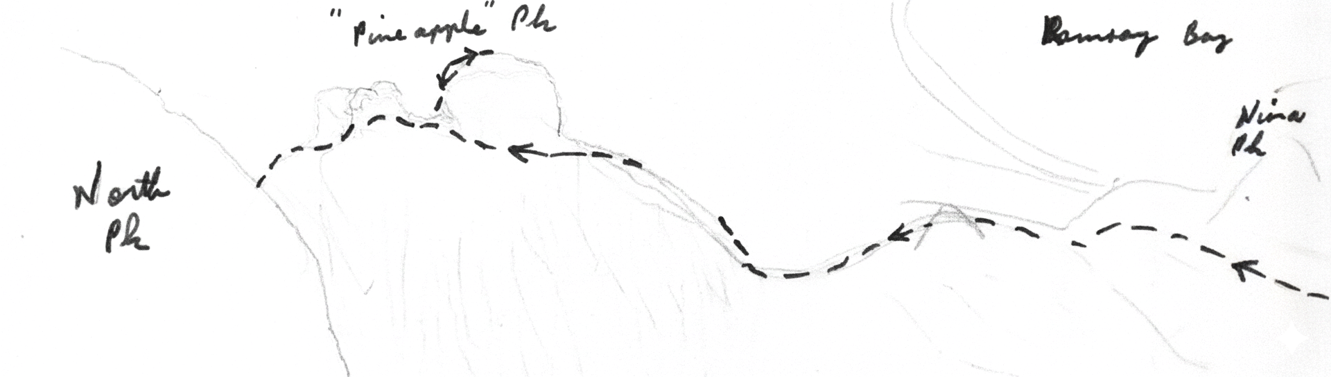
However, the "Pineapple" Pk ridge is a better one if the boat can drop one on the beach south of Nina Pk.
② A machete is not necessary provided one keeps to the ridges & follows either the above route or the Nina Pk - Pineapple Pk ridge. However, it could prove to be useful.
③ A rope is not necessary, but is a useful safeguard, if one gets off-route.
④ 3 days is not long enough to do justice to the place. 4 days should be the absolute minimum. 1 week is preferable. One could then "do" Bowen, The Thumb, N.Pk, W.Pk, Pineapple Pk, Nina Pk & whale on the beach as well.
⑤ The area around Mt Bowen contains some of the most spectacular bushwalking country in Australia — remote, lonely, magnificently wild & wooly.
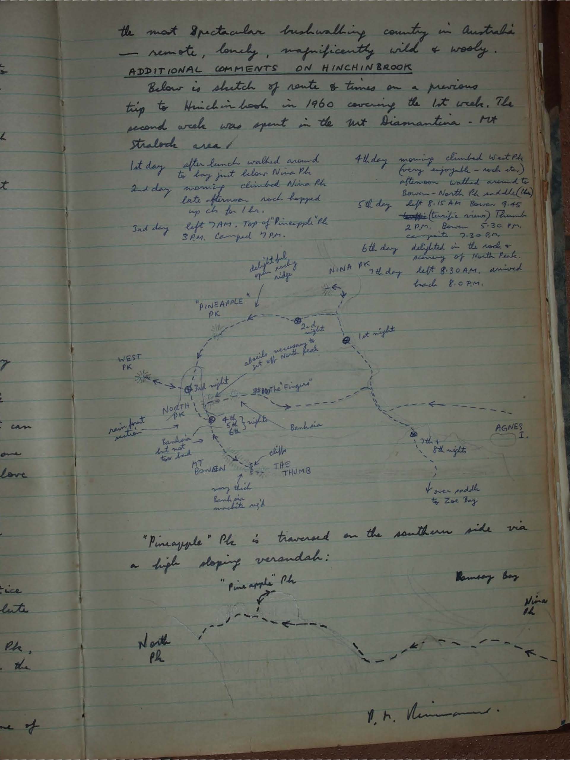
ADDITIONAL COMMENTS ON HINCHINBROOK
Below is sketch of route & times on a previous trip to Hinchinbrook in 1960 covering the 1st week. The second week was spent in the Mt Diamantina - Mt Straloch area.
1st day After lunch walked around to bay just below Nina Pk
2nd day Morning climbed Nina Pk late afternoon rock hopped up ck for 1hr.
3rd day Left 7 AM. Top of "Pineapple" Pk 3 PM. Camped 7 PM.
4th day Morning climbed West Pk (very enjoyable - rock etc.) afternoon walked around to Bowen - North Pk saddle (The)
5th day Left 8.15 AM Bowen 9.45 (terrific view) Thumb 2 PM. Bowen 5.30 PM. campsite 7.30 PM.
6th day Delighted in the rock & scenery of North Peak.
7th day Left 8.30 AM, arrived beach 8.00 PM.
"Pineapple" Pk is traversed on the southern side via a high sloping verandah:
V. H. Nimmo