Mt Elliot mid-1968
Relive a classic 1968 Mt Elliot hike near Townsville: a two-day trek climbing 4000 ft through ironbark ridges, rainforest, and rocky knolls. Highlights include sweeping views over Cape Cleveland, a stunning cloud-sea sunrise, and a rugged descent into Cockatoo Creek with rewarding rock-hopping.
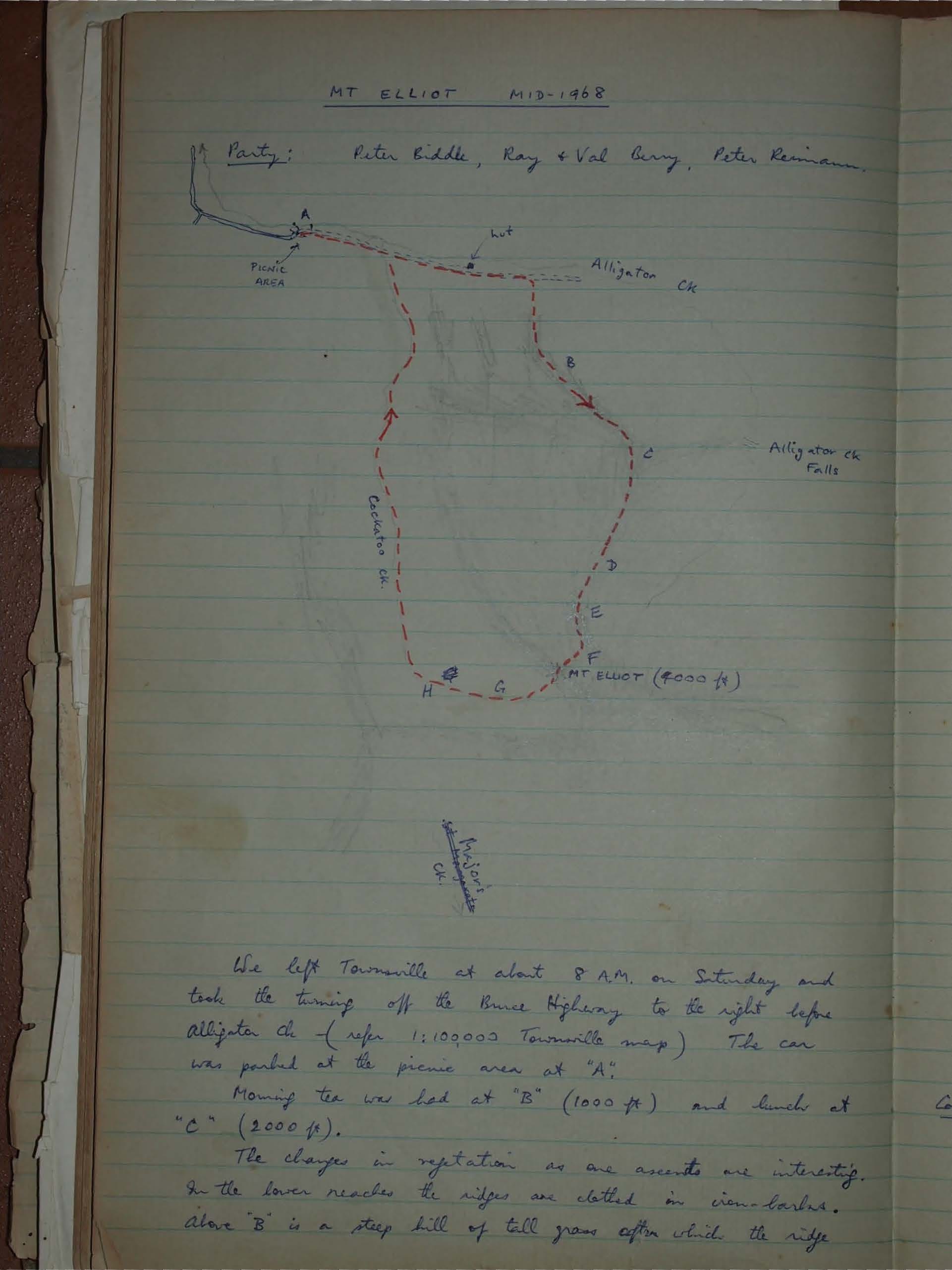
Party: Peter Biddle, Ray & Val Army, Peter Remiann
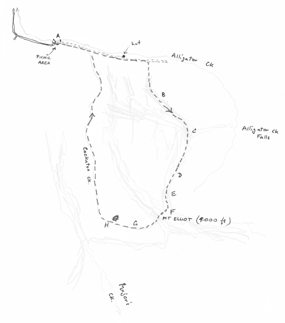
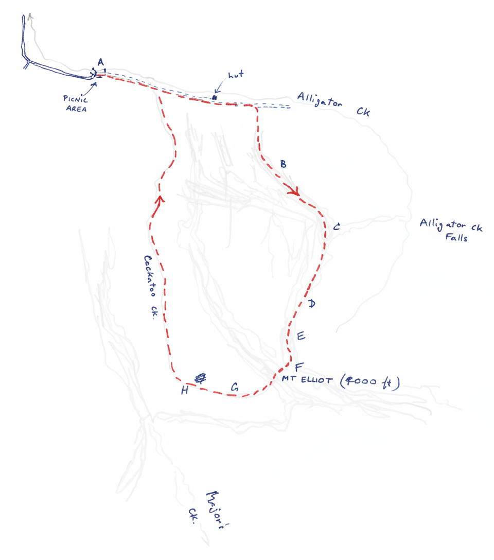
We left Townsville at about 8 A.M. on Saturday and took the turning off the Bruce Highway to the right before Alligator Ck - (refer 1:100,000 Townsville map)
The car was parked at the picnic area at "A".
Morning tea was had at "B" (1000 ft) and lunch at "C" (2000 ft).
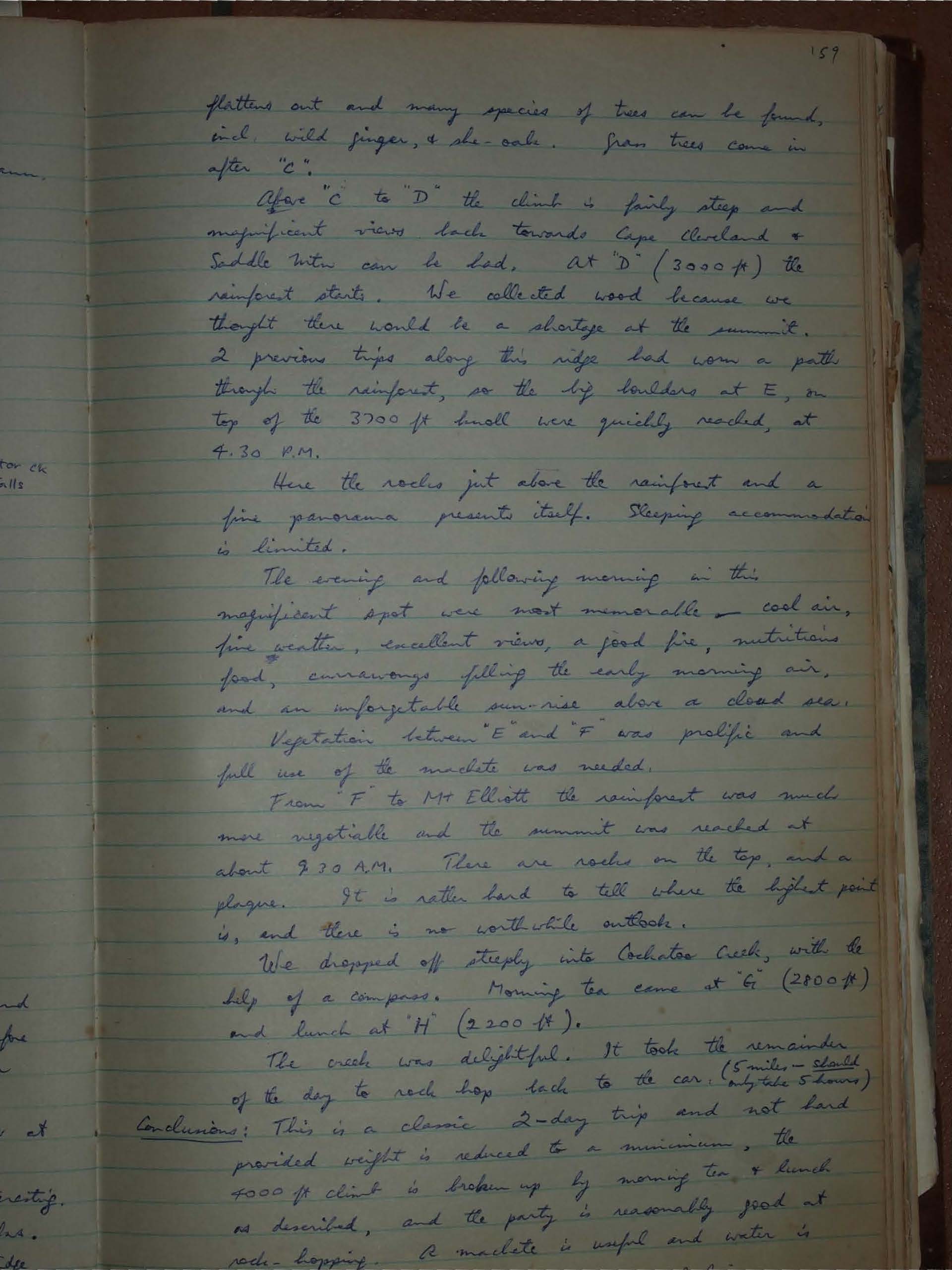
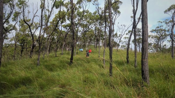
The changes in vegetation as one ascends are interesting. In the lower reaches the ridges are clothed in iron-barks.
Above "B" is a steep hill of tall grass after which the ridge flattens out and many species of trees can be found, incl. wild ginger, & she-oak. Iron trees come in after "C".
After "C" to "D" the climb is fairly steep and magnificent views back towards Cape Cleveland & Saddle Mtn can be had, at "D" (3000 ft) the rainforest starts. We collected wood because we thought there would be a shortage at the summit. 2 previous trips along this ridge had worn a path through the rainforest, so the big boulders at E, on top of the 3700 ft knoll were quickly reached, at 4.30 P.M.
Here the rocks jut above the rainforest and a fine panorama presents itself. Sleeping accommodation is limited.
The evening and following morning in this magnificent spot were most memorable - cool air, fine weather, excellent views, a good fire, nutritious food, currawongs filling the early morning air, and an unforgettable sunrise above a cloud sea.
Vegetation between "E" and "F" was prolific and full use of the machete was needed.
From "F" to Mt Elliott the rainforest was much more vegetable and the summit was reached at about 9.30 A.M. There are rocks on the top, and a plaque. It is rather hard to tell where the highest point is, and there is no worth while outlook.
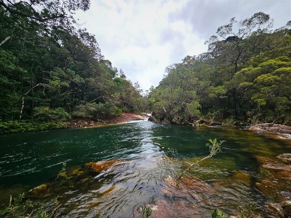
We dropped off steeply into Cockatoo Creek, with the help of a compass. Morning tea came at "G" (2800 ft) and lunch at "H" (2200 ft).
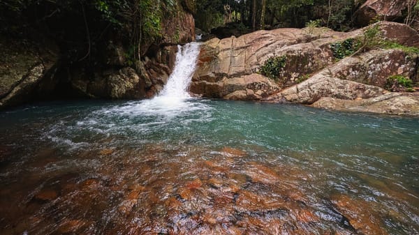
The creek was delightful. It took the remainder of the day to rock hop back to the car. (5 miles - should only take 5 hours)
Conclusions:
This is a classic 2-day trip and not hard provided weight is reduced to a minimum, the 4000 ft climb is broken up by morning tea & lunch as described, and the party is reasonably good at rock hopping. A machete is useful and water is ... TEXT CUT OFF.