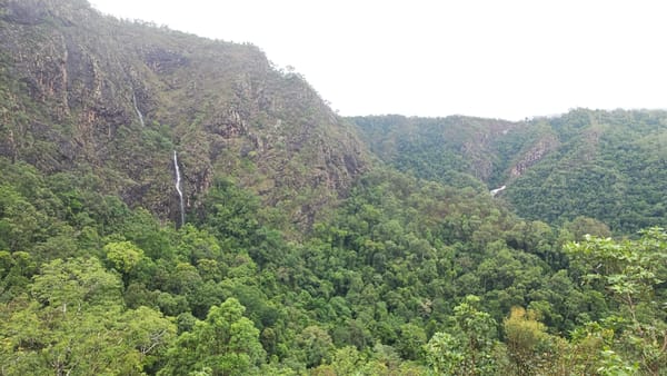
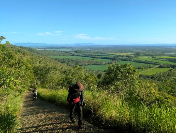
Mt Elliot summit
Mt Elliot summit (2012): A tough two-day adventure via North Creek to the summit, with rainforest climbs, dry saddles, thick wait-a-while, and shredded legs. Camped high, then descended Alligator Creek past cascades and falls. Hard, scenic, and a real club achievement.
22-23 September 2012
For a long time some of us have been ‘talking’ about Mt Elliot summit. Reading old log book and newsletter articles from days long gone of past adventures provided inspiration, and trepidation. Finally, the time came to ‘just do it’.
A week of planning by Phil, with counsel from wise old sages in the club. A plan was devised for a two day adventure to Mt Elliot summit. Our wise old sages counsel made it seem relatively straightforward. Old maps or copies thereof, just full of squiggly condensed lines, quick finger pointing at relevant features, and it will be all so straightforward they say. Tales of another member who did it twenty years ago and emerged somewhat erroneously in Majors Creek, long way from home, when he rang from the shop way out there, also inspired.
Now dear reader, if we write it was all so easy and lot of fun, then there would be nothing to write or talk about. So the author must embellish the tale with woe and hardship somewhat for your reading enjoyment. Timings are using 24 hour method (e.g. 0700 means 7 am, 1500 means 3 pm).
Saturday 22nd September 2012
Five walkers – Phil (leader), Wilfred (route clearer), Suzanne, Joy, Keith (bludger).
At 07:00 we departed Alligator Creek day use area. Followed the NP track, onto the power line track past Cockatoo Creek. Saw two mobs of wild horses with foals just past Cockatoo Creek. Even greys.
Ascended through burnt out open country, upslope but easy going, then hit vegetation, some pushing through vegetation here and secateurs use, then back into burnt out country. Top of ridge cross east towards North Creek, up over a saddle and descend into North Creek. At 0930 we are above North Creek falls (usual day walk lunch spot for the club) by about 430 metres. Quick break here.
Walk up the creek, boulder hopping. Arrive at a junction, Phil takes us on right hand branch saying ‘the wise old sages said to go the right hand branch’. Climb up this creek, some small cascades, very nice, getting steeper and rougher, heading south west (what the …… I am thinking - Mt Elliot is opposite direction ….). After a short period our way in the creek is blocked, the terrain and vegetation in direction of Mt Elliot looks tough and impenetrable. The western side upper bank is burnt off, fill up with water and we head up to that country on the right. On side of ridge, we follow that and then it bends around to the south-east (much happier now I am – Phil knew what he was doing, and the map showed this bend). After a while, terrain gets steeper and we leave burnt out country and into thick vegetation and steep climbing, rocks hidden in long grass, and many fallen trees to overcome. Some good viewpoints on bare rock faces, an excuse for quick breathers for Phil and I (the others were not puffing, well, not displaying signs of physician exertion like we were – and we were down the back benefiting from Wilfred and the girls clearing a path for us). After much bush bashing and climbing, time for lunch. Waypoint 027, 12:33 pm, lunch spot. Elevation 897 metres. Grid ref 959 462. Good views of creek lines and ridges below us.
Moving on, it was a hard slog through scungy stuff. Start of the rainforest, and was very thick and scungy on the lower parts. After sometime, into the rainforest proper and under good canopy, the underneath was reasonable clearer making better walking. In rainforest around 1430 hrs, found a small side creek with water, filled up here. Which was last water we saw this day (and until 1000 next day).
After discussion on what we wanted to aim for, we decided to make for a camp site and leave the summit until next morning. So we aimed for the saddle below the summit. Arrived at the saddle at 1530. Saddle 1077 metres altitude. Waypoint 028 (now called Mt Elliot camp on GPS). Grid ref 968 453. Saddle is between Mt Elliot peak and feature 1133 peak, and is the watershed between North Creek and Alligator Creek. Creeks were dry here. Last water was a side creek about one hour before.
Decide to find this mysterious bare rock that had been used for camping on many moons ago. So up to nearby Feature 1133 peak, scrub bashing and debris, get to the top at 1600 hrs and faced with thick gnarly vegetation. No sign of mysterious bare rock for camping. Much cursing. Stand on some narrow sharp rocks for superb views over the east. Head back down to the saddle 1077 to make camp 1630, clear flat area in rainforest. Water was a slight issue for two of as us no water re-supply here. The others had plenty so as a group we were good for water. Good night, good company, nice camp site. Some found the camp site rules a bit tough though, no sneaking off to bed before 2000 (8 pm).
Sunday 23rd September 2012
Wake up to a chorus of various bird noises. Pack and have breakfast. A robin had its nest above three of our tents. 0750 left camp; head for the summit which was 430 metres away and 150 metres up. Thirty minute walk through upwards sloping rainforest direct to the peak. Get to peak, altitude 1229 (on GPS), map says 1221 metres, grid ref 964 450. Monolith rock, heavily vegetated, also several tall palm trees, and a photo of a man with baby pinned to tree. Wilfred is challenged to scramble up a narrow pointy rock – he is firmly ‘told’ not to do it - so he does it – looked very ungainly. Much cursing by other half. The rest of us encouraged him on. Quick photos and he is allowed to come back down, to someone’s relief. Views here are very limited due to vegetation. Notice cloud bank well below us to the east.
Decide to come down Alligator Creek to make this a nice round trip and change of terrain. 0900 left the summit, straight into a creek bed, small rocks and boulders, in rainforest canopy, steep downhill, easy going. This is the top of Alligator Creek and this branch runs directly off the summit and is clearly marked on the map. 0930 have a break at a nice rainforest spot. After one hour from summit start to see traces of water. Creek is heading east then south-east – really hope it turns north soon. I flippantly remarked ‘be funny if we are in Palm Creek and come out on the Terraces’. Keep going down the creek, then another branch joins from the right, water flowing well now. Finally the creek turns north-east, then north, to confirm we are in the right system (I knew we were all the time). Small cascades and pools, rock hopping down. Come to a steep drop off that we cannot clamber down. Go bush to the left side as that side looked clearer than the right, but after a short while hit thick scungy vegetation, brambles, raspberry, vines, other stuff, and then wait-a-while. Keep heading away from the creek above the cliff line, and then find a gap to clamber down the cliff line, then more wait-a-while. Into serious wait-a-while. Seemed never ending. Well, the wise old sages did advise that wait-a-while existed here ! About 1.5 hours of wait- a- while and scungy stuff. Wilfred did a sterling job clearing a path through this for us. Phil and I valiantly brought up the rear providing rear protection from the elements. Steep drop downs, then clambering down through steep rainforest slopes heading back towards the creek, and then get back into the creek at a nice spot for lunch at small pools and cascades. It was great relief to get here.
Lunch spot was at Altitude 741 metres. Waypoint 029 (now called Alligator Lunch on GPS). 11:57 am. Grid ref 976 452. This altitude reading actually dismayed us somewhat as we felt we had come down more than that. Also meant, long way to go down yet.
Finished lunch and got moving again at 1300. Walked one hour down the creek, easy going. 1400 stop for a break. Check altitude, 552 metres. Still bit dismayed about this altitude – surely we must be lower (nup, GPS was reading correct).
1415 moving again, easy going on flat or gently sloping rocks, some nice waterfalls and cascades, a beautiful part of the creek, very open too. Vegetation changes from rainforest to dry woodland with eucalypts and sheoaks. Start to get great views in open terrain looking out to Saddle Mountain, Cromarty wetlands, Giru, Haughton river mouth, and Cape Cleveland. In the afternoon light it looked very good. At good scenic spots, waterfalls, views etc, I instructed Secretary to take photos – poor bloke was running all over the creek taking photos at my direction (and as a result always lagging behind – c’mon, keep up Phil) (to reduce weight I never took a camera. My pack weight 10.2 kg with another 2 kg on waist pack, his pack weighed 16 kg). I asked our club Secretary ‘this is beautiful here in the creek, why haven’t we come up here for day walks or overnighters before ?’. Wonder why he just stared at me, puffing away.
1500 finally get to top of Alligator Creek Falls, a long drop below us awaits. Find a marked track on the left off the rock face, follow that to the bottom of the falls, get to bottom pool at 1520. Great scenery of the falls as we descend. Sitting on flat rock at bottom pool, looking up at the falls, have another break. One person lays on the flat rock and exclaims ‘I am absolutely knackered, can I cancel Pilates tomorrow please ?’ (the answer was negative, Pilates is good for you after a two day adventure – apparently). The other female walker asks who is coming to the gym at 0530 tomorrow morning with her – all replies are rapid negatives (120 kg leg presses sound scary). Get moving again at 1545, 8.5 km track walk (slog) in front of us. Back to cars at 1740. Ice creams at Alligator Creek roadhouse, admiring the Mt Elliot peak we can see as we eat our indulgent ice creams. Home at 1900.
All our legs were shredded from the scungy bush bashing. Raspberry, brambles, wait-a- while, vines with thorns etc. Two of us had marks near eyes where we ran into sharp bits with our heads.
Water – from the saddle (1077 camp site), it would be an hour down Alligator Creek before water is found. Assume same for North Creek.
It was a great adventure. The whole trip went to plan, the route used was as devised by Phil, we had good cross country navigation, and for the group overall it was a great achievement.
Alligator Creek above the main falls is beautiful country, great scenery and views. Well worth visiting on a future walk, possibly two dayer (but stopping below the off-creek scungy stuff is reached).
I lost 4 kg on these two days. If found, please return to author.


