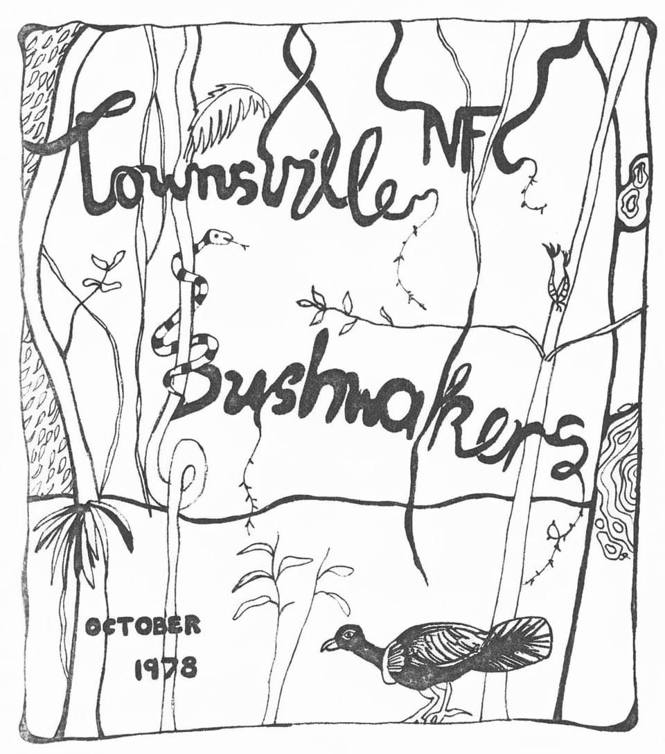
TNFC Newsletter - October 1978
Explore the Townsville N.F.C. Bushwalkers Club’s 1979 walks program: Jourama Falls, Cape Cleveland, Little Crystal Creek, Hinchinbrook and more. Grades from easy to difficult, day hikes to long weekends. Meetings at Cleveland Terrace—join us to hike, paddle, and explore North Queensland All welcome.
TOWNSVILLE N.F.C. BUSHWALKERS CLUB.
P.O. Box 494,
Townsville,
Q'ld. 4810.
HON. OFFICERS:
PRESIDENT
Alan Watson
VICE PRESIDENT
Ron Ninnis
SECRETARY
Les Hyland
TREASURER
Lily Marcellos
EQUIPMENT OFFICER
Bill Dunstan
SAFETY TRAINING OFFICER
Bob Ferguson
EDITOR
Ron Ninnis
CONTACT OFFICER
Marion Darveniza
22 Banksia Street,
Kirwan. Qld. 4814.
Phone: 73 1074
MEETING PLACE:
The National Fitness Office,
Cleveland Terrace (side entrance)
Opposite the old Supreme Court.
TOWNSVILLE N.F.C. BUSHWALKERS.
P.O. BOX 494,
TOWNSVILLE.Q. 4810
Contact Officer:
22 Banksia St. Kirwan
Phone: 731074
PROPOSED WALKS PROGRAMME - 1979 FIRST HALF
| Date | TO | TYPE | CAT. | LEADER |
|---|---|---|---|---|
| Su. Mar 11 | Jourama Falls | D | E | Lynn Murray |
| Sa/Su Mar 24/25 | Cape Cleveland | W/E | D | Lou Darveniza |
| Su. Apr. 8 | Little Crystal Creek | D | E | Jim Cameron |
| Fri Apr 13 to Mo Apr 16 |
Hinchinbrook | 4D | V | T.B.A. |
| Sa/Su. Apr 21/22 | Yaminie Creek | W/E | E/C | Alan Watson |
| We Apr. 25 | Hen Camp Creek | D | M | Les Hyland |
| Sa-Mo May 5/6/7 | Porcupine Gorge or Palm Island |
3D | M | Lily Marcellos |
| Su May 20 | Mt Cataract | D. | M | Bill Dunstan |
| Sa/Su Jun 2/3 | Broadwater Creek | WE | D | Ron Ninnis |
| Sa-Mo Jun 16/17/18 | Upper Herbert Gorge | 3D | V | David Blair |
D = Day Walk w/e = Weekend Walk 3D etc. = 3 day C = Canoeing
E = Easy (very suitable for beginners) V = Variable as desired
M = Moderate (an average walk - no real difficulty)
D = Difficult (not for beginners - either because of terrain or distance but suitable for those accustomed to walking)
Meetings
Meetings are held to discuss the walks as follows:
- March 7th
- March 21st
- April 4th
- April 18th
- May 2nd
- May 16th
- May 30th
- June 13th
Confirm meeting time and place with Contact Officer above.
EDITORIAL
We hope this magazine gives you an inkling of what goes on in the Townsville Bushies. Enjoy reading it - or better still join us on a walk. Many thanks to contributors, Karmen N. for typing, and Rick W. and Jill (J.) for drawings. A special thanks to Harry K. (HK) for his enthusiasm.
WHAT HAPPENED IN 1978
- ** Rick and Lee Williams (nee Mc Bryde), two popular bushwalkers are now married and living at Halliday's Bay. We wish them many happy days of sailing and exploring.
- ** Elaine and Helga Nome have now a baby daughter.
- ** Mary F. is now an instructor with Outward Bound in Canberra.
- ** Debbie E. and Liz Mac L. are now qualified world travellers and have returned to Sydney and Brisbane respectively.
- ** Doug and Chris Kiddell are now back in Aussie (Brisbane) having stayed in U.K. just two years.
OVERSEAS TRIPS
- ** Les H. and Lyn L. returned to sunny Queensland from an icy trip to Ireland and Les's many homely friends.
- ** The "New Guinea Expedition" comprising members Penne G., Allan W. and Helen A., tramped the Kokoda trail, and returned.
- ** Ron N. searched for lost snow in New Zealand in June. He is now the proud owner of the only set of cross-country skis in Townsville.
- ** Dave B. returned in January from China. He walked on part of the Great Wall, and is now saying he has plans for a long bushwalk somewhere.
TONGARIRO NATIONAL PARK VOLCANIC AREA
(New Zealand)
It was really cold that night (it was June). but inside Manatepopo hut (1250 m) it was snug and warm once I had mastered the art of keeping alive the coals of the slow combustion stove - a compromise of warmth and smoke. I had planned to wake around 3am. and climb Ngauruhoe, but the inevitable happened: I slept in.
I awoke to see snow drifting past the window. I plunged into the mist Ngauruhoe (2291 m), the highest peak in the North Island, was just visible. It was a beautiful sight: a perfect volcanic cone which is still active, evidenced by a continuous belching of steam and fumes.
The track was inlaid ice crystals each approximately 2cm. long, with 1 metre long icicles dangled from rocks. The area was a stark wilderness comprising mostly of rough dark scoria sprinkled with powder snow.
The silence was profound, the only sound being the crunch of boots on the iced-up track, and my own breathing.
I sat at the top of the cirque and contemplated the mist swirling around the top of Ngauruhoe, and decided it would be safer not to ascend. In front of me was a filled-in crater 1 km. across forming the saddle between Mt. Ngauruhoe and Mt. Tongariro.
I decided to climb Tongaririo (1968 m) instead, only a short climb. The ski poles marking the track were encrusted with horizontal icicles 150cm. long.
Returning to the saddle, the track edged around the gaping Red Crater, a hissing, fuming awesome sight. The track then revealed a placid chalk blue tiny lake.
Down the steep slope I bounded to Ketetahi hut, to laze in the thermal pools and bathe aching limbs in pools of varying temperatures.
Ron Ninnis
A TITILLATING SNAKE RECIPE
After killing, cut off head; skin, chop into pieces. Wipe pieces dry before adding to pan which has been rubbed with garlic. Melt 2 tablespoons butter in pan and blanche some diced onion then add snake pieces with parsley, thyme, bayleaf, cloves, pepper and salt and cook few minutes. Add stock and claret in equal quantities to cover and bring all to boil for 20 minutes. When tender remove snake pieces and strain liquor. Thicken with arrowroot, add some diced cooked onion, juice of ½ lemon, teaspoon mushroom catsup, ½oz. anchovy butter, brown colouring and more salt and pepper if needed. Boil till thick and add few button-mushrooms which have been warmed in their own liquor. Garnish with onions and mushrooms after pouring sauce over snake in dish.
..from the Cooktown Cook Book..
CONWAY CONQUERED OR IS IT ?
The third and latest trek to the Conway wilderness did indeed produce a long looked for result: the penetration of the unknown north end of the wilderness. We have now been from the sea in Repulse Bay to the sea in Pioneer Bay, a distance of some twenty miles, but for a mile at the Repulse Bay end where the salt and fresh waters meet.
It was an odd weekend that found no-one prepared to go, so by prior arrangement I left Friday night to meet Lee, Pat Magee and Russell Williams (Mackay club) at the little property at Brandy Creek. At dawn the following day we crossed into Repulse watershed via the Forestry road. Five miles in, right at the pine plot we were suprised to see timber felling. Local merchants had just dropped a Red Cedar that had to be cut into four to truck it out. The base of the tree was probably twelve feet in circumfrence. So much for one of the last Coastal rain forests in Central Queensland!
The creek we were to follow was called Impulse Creek according to the timber workers. The map showed that it wound around a north south ridge into Gorge country. At eleven o'clock we left behind the rattle of the dozer and followed Impulse. The creek, like the Repulse country towards the sea, was flat with rain forest along the banks. Pat could identify a great number of the trees and herbs that lined the sides. At the foot of the ridge the creek we wanted turned sharp right, reminding me a bit of Yaminie. There was some reduction in waterflow but we were indeed in Gorge country and remained so for the next day. Pat had not been walking for eighteen months and found the going laborious. Night found us well into the mountains and bedding down on not too comfortable Island in the middle of the creek. After a leisurely breakfast next day we pressed on, conscious that we had yet to cross the coastal rim, a range that is over one thousand feet. From the branch of Impulse, the creek had been rising and a fairly significant waterfall was passed. This involved roping of packs.
By 10.00 hours the gorge had run into steep granite country and myself into confusion. A creek that was on the map was not in reality - or I was hopelessly bushed. (In retrospect, the map is probably incorrect.) As it transpired we could look back on to a Granite wall from the rim of the gorge and for a creek to run out of that it had to be insignificant or run underground.
When the Black Granite became too large, we did a compass march up a convenient ridge thick with Acacia and Blackboy, so thick in fact that one had to force a path through and up. Rather unpleasant. Rain forest came again, this time with a deal of tangle and Water Vine, brought low by a number of large trees that had come down in the cyclone that wrecked so much of that forest a few years ago. Just on noon I suggested that a couple of kilometers would bring us to the mountain rim. It was then that we noticed that familiar skyline through the trees. We walked out on the rim about two hundred yards from where we had hoped to come out. The walk down the escarpment was cool and interesting. Trees much larger than those on the Repulse side, but all the creeks and gullies were dry. Such a contrast from the bubbling streams of Repulse and only an hour's walk apart. The country at the top of the rim is actually a tableland of sorts, small but very fertile. There is no significant timber from Impulse to the Rim where the National Park starts and one would hope that the Park might be extended into the State Forest, at least to the extent of the Gorge country.
At the foot of the mountain we came out in an area called Jubilee Pocket. A land developer had broken up five acre blocks which seemed to be owned by folk who wanted to keep the Jungle. The developer was in the process of putting in his own road. His face wore an odd expression when he saw us walk out from the foot of the range, but could not believe that anyone could have come across from Repulse. He and his family had been unable to cross the Rim though they had made a few half-hearted attempts. To complete the weekend the developer's wife took us to a point where transport was available to get us back to Brandy Creek and the completion of a great through walk.
Conway Conquered? Not a bit of it! That is only the beginning. There is Repulse proper to the East, Waterfall Creek to the South, the Inlet down at the bay and fourteen miles of the Conway Peninsula - Creeks and Gorges, Rain Forest and true Wilderness. The tourists down at Shute Harbour think they camp in Conway National Park and it's probably as well they are content with their patch of forest, but the real Conway lies silent, alone and unpenetrated behind its blue mountain rim. One day, someone will "discover" Conway. I only hope its discovery is by people who will treasure it for what it is: A true and irreplaceable wilderness.
RICK WILLIAMS.
AROUND THE CAPE. (21st to 29th May, 1978)
Par d'elle y on que nous - the hoary phonetic French joke was certainly in evidence on this trip.
Les saw us off, before he went on to work with, the cheerful remark "last seen heading towards ..........". Unknowingly to us the blighter even took a slide-shot of us as we paddled out into the gentle glassy swell. Ahead were the noble rock-heads of Cape Cleveland, and, under such ideal conditions we decided to push straight across the bay. A thousand black dots on the water resolved into a mass of ducks and we couldn't resist quietly sidling up to them before they rose with a splashing roar. And now to orientate - many rocky ridges ran down from Mt. Cleveland, but at the foot of which is Laun's Beach, still over 17 kms away? We settled for the third one (actually it was the fourth) and then to the paddles, pushing the calm water towards the orange "Rock" as Townsville slowly sank into the blue sea. We arrived off Loun's Beach well ahead of our appointed time, decided to land even on the falling tide, and vowed never again! We finished up abandoning the canoe to slop ashore through calf-deep ooze. But we had made it, for now we could be somewhat sheltered from those nasty South - Easterlies that are so apt to ruffle our Eastern waters. So confident were we that no "quelle dommage!" could affect our serene atmosphere, that, whilst waiting for the incoming tide, we ate and drank, lazed, and even went for a walk down the beach, where, the previous day, three hapless beings had bogged their 4 wheel drive in the mud. Little did we know that the insidious tide was again bringing us near disaster - after our bog-trot, we left our paddles on a rock shelf, so were astounded to find, when we returned on a premature look see to find the canoe bobbing about in chest-deep water and the paddles just about to float off the ledge! Five minutes later and they would have gone! The innocents abroad retrieved them and looked for a sandy camp site: But the relentless full-moon tide rose and rose, spattering out our rock-top camp fire and marooning us on the high scree on which the hut rests. So we slept on the verandah, the lights of higher Townsville dim across the bay. In the early hours, in day-like moonlight, a tall, thin dingo sniffed its way across the beach.
Rejoicing in the calm sunny conditions we paddled past rocky headlands, sandy bays and the spread of sand and mangroves at Long Beach to dip round the Red Rock Point and on to a secluded camp in Red Rock Bay. With an abundance of wood we had several nightly camp-fires here. The peninsula is "thin" here, and the contours less, so we had a safari to the opposit coast, a lovely swimming bay bordered by steep cliffs dropping into deep blue-green sea. The next day, with puffs of wind mottled the water's surface - we had now finished with our doldrum days - but we went past the lighthouse, watching some big tuna? jostling in the waves and turned our frail craft round the standing cliffs of the cape. Only a short distance, for the surging swell and pointed wind-waves intimidated us, so we turned around to the shelter of the peninsula. We had a fixed fishing line tied to the canoe and "something big" had a go at it, bit off bait, line and sinker in one snap! (We gave over dangling our hands over the side.) J. did catch two fish but they were at the other end of the scale - too small. Now to return - after an abortive attempt to round Red Rock Point through wind and wave, we solved the problem by a midnight, moonlit journey to Long Beach. The coloured hills beckoned, long fingers of granite dipping into the ocean as we scrambled up the rough granite. Soon, however, the bush closed in, so we descended to the stream, and walked up this mild Elliot - like creek for about 2 kms.
It was a good camp on Long Beach - plenty of driftwood, people helpful about water etc., but our time was ending as the moon waned, so early in the morning we said "Good-bye" to our friendly pelicans and set off under the blurred half-moon for Townsville. When it came daylight we saw the orange "Rock", many miles away, though what was more to the point, the wind began to rise. We could not make a bee-line for the City - it was better to travel round the Bay and take shelter as much as possible from the mangroves. And, if the breeze turned North Easterly we would face the possibility of dangerous white water as we approached Townsville. Accordingly we skulked near the mangroves, but, of course, this piled up our mileage horribly, so I decided to run down wind across the chord of the curve - a bad decision; for not only were the wind waves white capped, but a tricky cross swell climbed over the side unless we were quick enough to counteract it. So, it was with great relief, two wet and weary travellers bailed up at Ross River mouth, with our longest day's run, 27kms behind. At that point, I do not think we would have fully appreciated anyone saying -
Paddle your own canoe.
Par d'elle y on que nous, No, not one little bit!
J.M.R.
TICKS
Most animals, birds and reptiles can be afflicted by ticks. Ticks are around at all times of the year but are most often found in spring and autumn. Most ticks will suck blood from only one species or group of animals. However, the common Paralysis tick, which lives in scrubby coastal districts east of the Great Dividing Range, may attach itself to most mammals and some birds.
Ticks feed on the blood of animals and inject a poisonous saliva to assist with the digestion of the blood and to prevent it clotting while they feed.
Adult female ticks can be dangerous, sometimes causing temporary paralysis in humans. In some cases they have caused the deaths of very young or elderly people, who have less resistance than most people to the venom. Mammals, including native animals such as dingoes and kangaroos, as well as household pets, are highly susceptible to tick bites, although some become immune after a series of attacks from which they have recovered naturally.
Appearance
Newly hatched ticks are so tiny that they can be seen only as a minute spot in the centre of an itching lump. These are irritating but not dangerous. The dangerous adult female tick is usually called the Shellback. When it attaches itself, it is flat-bodied and no larger than a match head. After feeding for a few days, it can swell to about the size of a pea, and will then drop off to lay its eggs.
Checking for Ticks
A tick causes such itching that the victim usually discovers and removes it before much poison is injected. Ticks prefer to attach themselves to a warm, soft place, often where there is hair. The ears, scalp and groin are favourite places and pain in these areas should always be investigated promptly.
In infested areas, pets should be watched carefully and checked for ticks if there is a change in their cries or a slight wobble on their hind legs. Remember to check the ears, neck and under the collar.
First Aid
- Once a tick is found, it should be nipped out with tweezers, taking care not to squeeze more venom into the wound. Alternatively it can be dabbed with turpentine or petrol, which will cause the tick to back out.
- The areas should then be swabbed with strong antiseptic.
- If pain becomes intense or headache, dizziness or vomiting occur, seek medical attention.
- The C'wealth Serum Laboritories prepare tick antitoxin, which is available for hospitals and veterinary surgeons.
BUSHWALKERS ON THE WATER
That is the way it was planned. We were to travel up to the Herbert/Yaminie confluence or thereabouts by canoe, walk up to see the falls and back, then shoot (NO you stupid conservationist - we mean rapids) back again. We left on Friday 20th August and two car loads drove up to the Herbert Valley each with a predetermined camp site in mind. Alan was headed for Peter Gough's and Les for the Mooney abode. The arrangement worked admirably except in one minor detail: Alan had Karmen's pack, Les had Karmen! Well she had the couch, a mewing cat, a transistor, no toothbrush and no spare clothes to make the night memorable. The two vehicles reunited at Long Pocket, sped up to the "end of the road" and parked.
The Kayaks and 2 Canadians were unloaded and launched near the other car from which Ron and Jim - the reconnaissance party - had launched on Friday. A minor surprise was Jim the walker who entrusted his pack to Alan and Pauline's Canadian and set off up the south bank on foot. Remarks about crocodiles were pooh-poohed and the soon-to-be-familiar "lining up" process began. This means you get out of the boat, nearly break your ankle on a slippery rock, fall in the river, grab the canoe as it floats away and somehow drag the damn thing up the shallows.
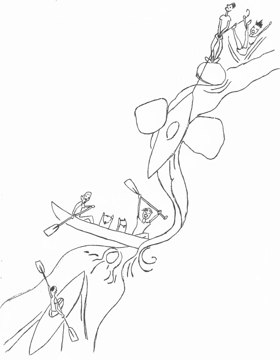
During Saturday this was repeated at least "n" times and all future canoe parties have a charted course to follow, marked in blue gelcote on the river rock bed. The river runs now deep, now wide and rapid for miles, past Sword Creek, past the lunch spot, to a magnificent rapid. Alan and Pauline managed to sink the blue one somehow, Les dashed to rescue contents and nearly capsized trying to lift Jim's pack out.
What did he have in it?
How could anyone lift, let alone carry it? Come to think of it where the h-- was Jim?
Lynn and Les partaged the rapid and don't care whether you regard it as prudence or panic. At Herkes Creek there were two lounging lizards - Ron and Jim, but not the right Jim - no sign of Jim the walker. "Heybobs" brought no results so we just had to paddle on. Just downstream from Yaminie it was decided to camp on the South Bank. Vessels beached, several rude shelters arose and campfire cuisine produced attractive aromas of many kinds. Bob and his Nasi Goreng, dehydrated peas and spuds ( with a drop of the "craitur" to liven it all up) was one of the star turns. At this point there was still one Jim missing. Alan, as leader, dropped the comment of all time. "Well he's not on the trip list by rights we should not therefore have to look for him!" Evening dwindled into night. Some stars shone. Some bushwalkers slept.
On Sunday after a ferry service across, we walked up to Yaminie; a twisty rocky rapid creek and one and a half hours later gazed on the majesty of the mighty fall (some 400 ft. high, we guessed.) The easy way on the last stretch was to swim - brrrr! But it was pleasant except for the poor snake Ron nearly leaned on. The hugh toad we found was dead - the snake definitely wasn't. Pauline in some exuberance went swimming once more than the rest. It was a slippery rock. Bob vanished, climbing, knocking down an odd rock to confirm his presence. The party retreated to camp site for lunch. Marvellous to relate, the missing Jim had just arrived having overshot Yaminie by about 3 hours walking time - obviously he hadn't got his pack with him. We all ate, giving away leftovers madly. The return was faster if a trifle hard on the boats. We have just repaired the green Canadian. But it was good fun. Mind you the cane fire lapping the ears on our arrival was a little less than funny. Still all those who set off returned safe and sound.
LES HYLAND.
STINGING TREES
A group of prickly-barked, pink-berried trees known as Stinging Trees
or Stingers grows along the coast from the subtropical rainforests of
south coastal New South Wales to the bush rainforests of North Queensland.
They seem to grow most thickly along old bullock tracks in gullies once
used by the long-past timber-getters.
The large heart-shaped leaves are covered with fine stinging hairs.
Just brushing against the leaves can cause a burning sensation which
may not entirely disappear for as long as three months. The stinging
seems to grow worse if the affected area gets wet.
First Aid
- The best way to relieve the stinging is to dab on plenty of
antihistamine lotion. Some bushmen say you should squeeze the juice
of Cunjevoi lilies over the stings. This lily is sometimes called
Taro and usually grows in the same area as Stingers.
MAPPING MADE EASY - WE HOPE!
What has become of the club's vast collection of maps? Their absence from the club's premises may have been noted of late by some club members. No, they haven't been misplaced, just transferred to the address of one club Secretary. Why? To allow the transformation to take place. What transformation?, one may ask. Why, the indexing and filing of course - a long overdue project indeed.
A brainstorming session by some club members has produced what we consider to be a simple, efficient and fool - proof system of cataloguing, indexing and storage of this map collection which we feel is one of the club's most valuable assets.
All relevant information regarding the system is contained in a blue map folder which accompanies the new map storage unit. This unit being the masterpiece of Harry Kershaw and Les Hyland. Many thanks to the carpenters. The storage unit will be housed at our regular meeting place.
Basically, the file has three main sections.
SECTION 1. 1:250,000 scale maps
- Arranged T'ville north, then T'ville south.
SECTION 2 1:100,000 and 1:50,000 scale maps.
- Each 1:100,000 map is followed by the four 1:50,000 maps that exactly cover the parent 1:100,000 area. They are arranged T'ville north, then T'ville south.
SECTION 3 Any special scale maps
- Arranged T'ville north, then T'ville south.
*** Each map has been indexed and enumerated according to its scale and position in relation to T'ville. A colour code denotes the map scale as follows :-
Red 1:250,000
Blue 1:100,000
Green 1:50,000
Orange Special Scales.
For the purpose of enumeration of the 1:100,000 scale maps the line running through T'ville is taken as zero on the 1:100,000 scale grid for Qld. Thus every map on this line will be coded 0. Each line of the map north of the T'ville line will be coded N1, N2, N3 etc. Similarly those south of T'ville will be S1, S2, S3, etc. The map depicting the coast on each line ie. the most easterly map produced, is sub coded A and each one westward is thence B, C, D, etc. Hence 2 lines north of T'ville on the coast would be N2B and progressively westward from there would be N2B, N2C, N2Detc.
Each 1:100,000 map covers exactly four 1:50,000 maps and these latter maps will carry the identical enumeration of the parent 1:100,000 map with the addition of the numeral 1,2,3,4 arranged thus.
N2A
N2A4 N2A1
N2A3 : N2A2
- Some of our more frequently used 1:50,000 scale maps have recently been dissected and mounted on linen, by courtesy of Harry - thanks.
A browse through the blue folder following reading this article should clarify your understanding of the map file system.
Any queries should be directed to Les Hyland or Lynn Murray.
HAPPY MAPPING FOR THE FUTURE !!
A future project of the club is to copy our historic Log Book, to ensure that this valuable asset is not lost to Club Members of the future.
Lynn Murray.
HIKING IN BRITAIN AND IRELAND. - Roland Gregory.
Recently I was fortunate enough to spend several weeks touring England, Scotland and Ireland (the bit without the bombs) and managed several short hikes in different areas. I'll try to describe my impressions.
First of all, the hiker's greatest foe is the weather - very changeable and depending on the area, bad weather can be deadly if one is unprepared. Secondly, campfires are not encouraged and so the good old billy-brew is not possible on most hikes. The alternative is to drop down into a vally and call in at a village pub - but not for a cuppa!
The Lake District of North West England was the scene for a through walk of about 12 miles from Conistan near Conistan Water, back to the camping ground at Great Langdale close to the mountains known as the Langdale Pikes. As long as the cloud stays higher than the tops of the relatively low (2,000-3,000 feet) mountains in the Lake District, it would be difficult to lose the way: the hills and mountains are bare of trees, covering being restricted to grass, rocks, bracken, heather and sheep, and views are consequently quite staggering. The partly manmade panorama from atop a peak unfolds beneath, lush green glacier-carved valleys neatly divided by a maze of stone walls, fields dotted with grazing sheep, numerous lakes of all shapes and sizes, and the steep and somewhat rounded mountains, looking larger than life because of the absence of trees. This particular hike led upwards to a ridge, whence the walking was mostly downhill, descending a long superb ridge with a couple of minor bumps (peaks) enroute. Whilst the mountains are bare, the lakesides and parts of the valleys often have magnificent trees in abundance. Somewhat unusual perhaps, the sun shone all day, making the seven or eight lakes visible, appear a deep blue amidst the greenery. The previous afternoon had been spent on the Langdale Pikes in showery weather. The hillsides then were colourfully spotted with lots of "gnomes" as numerous other hikers in "tip-to-toe" wet-weather gear of rainbow hues, moved purposefully up or down.
The Cuillin Mts. on the Isle of Skye offer some of the best climbing in the British Isles, but my hiking here was limited to a long afternoon's walk along the peninsula at Glenbrittle, right at the base of the Cuillins. The going was easy enough, if boggy in parts. Vegetation was mainly grass and heather, the latter beginning to burst into purple bloom. Wildlife comprised a number of sheep busily turning grass into wool, plus seabirds along the rocky shore. Eight kayaks moved colourfully across the calm blue waters of the bay below. It was one of those afternoons that the holiday-maker dreams of - warm, sunny and clear. In fact, I even cooled off twice under a small waterfall hidden from view in a minature ravine. All the while the Cuillins stood close by, bare rocky peaks playing hide-and-seek among some low clouds.
One of the highlights of a too short trip to Ireland was a day hike up Slieve League along the coastal cliffs nearby. This mountain, 1,972 ft. high, is in southern Donegal County and rises abruptly from the sea; consequently, the scenery is nothing short of spectacular. A well-worn track (which was even more well-worn by the end of the day, after umpteen people had walked up and down) led up through the familiar green and treeless sheep country. Near the rock-strewn summit there was the ruin of an ancient stone dwelling. Onto a ridge next and soon the highest point was reached. The views down onto the sea and across Donegal Bay were breath-taking, the sea was grey under cloud shadows and deep blue in open sunlight: seabirds wheeled far below and a number of toylike fishing boats were visible on the calm sea. It was the perfect spot for lunch, sitting amongst the heather and drinking in the panorama. The descent followed a narrow ridge, parallel to the shoreline, and always offering new vistas. In the clear water below, floats and lines on lobster pots were clearly visible, while caves in the cliffs at shoreline revealed themselves as being accessible only by boat - likewise two little sandy beaches at the foot of the steep cliffs. Lastly, followed a visit to a signalling tower dating from the Napoleonic era and then the four mile hike back to the Youth Hostel at Carrick.
ROM? OR BLACK AND WHITE?
From the first time, years ago, coming up the Bruce Highway, eight miles from Proserpine, I would incline my gaze westerwards towards the gap in the nearby hills. For there, though many miles behind, peeping between the green hills is a darlin' of a mountain. I had no trouble pin-pointing its name for my road map declared Black & White Mountain, and there was no doubt that it was as pie-bald as a magpie. But my mountaineering eyes appraised and approved those semi-vertical walls of white rock a climber's mountain - and I mentally stored a little "someday" to be consummated in the future. However, it wasn't until 1977 that it came about.
J. closed the gate - "No entrance, trespassers prosecuted" - behind us and soon we met the farmer, who, when he assured him we would not light any fires ("I'll crucify you!") on his dusty brown paddocks, was very helpful, camping and directionally, though he did give us some misinformation that stymied us the following day. We started early for we had six miles of grazing paddocks to the foot of the mountain, looking hopefully into every ravine for fresh water. The farmer told us there was plenty but we found only stagnant pools. One mile only to the summit of the beckoning mountain but, without water, we dare not take the risk - even returning to "Bessie", which we reached before noon, we were parched and clack-tongued. On our next attempt we took 4 litres, leaving two at mountain base and taking the rest with us. We started up a gully but this proved too steep after the thousand-foot contour and forced us on to North Ridge. This turned out steep, but climbable - J. says it is the hardest she ever did - so ropes and tackle were the order of the day. Again our direct route became impassable and we turned onto ledges on the west side, disturbing a rock wallaby who shot away like a Spring-heeled Jack. Our next problem was to find the weakness that would allow us to gain the elongated egg of the summit. After an abortive chimney, we found the route as per farmer, and we were atop in a cool south wind, but could not find the ascent book in its appointed place. What an exhilarating view! Seemingly miles below us were the trees on the flat pastures, stretching out to the inland far beyond Collinsville and out to sea at Bowen, with the sentinels of Gloucester Island leaning across Edgecumbe Bay, and the smoke of Proserpine etched against the green Conway Hills. Across the East Gully was the upthrust of the South Ridge, bare and bold. A couple of pictures and we descended by the North - West Creek, thankfully found our cache of water, and plodded through the long paddocks to the farm. From the peak we had noticed several be errors in the map, and were even doubtful of our mountain's name, but the farmer said it was "Black and White"!
This year our access was from the north-east - turning from the main highway south of Bowen onto a gravel road sign posted "Roma Peak Road". Once again we went through a KEEP OUT gate but found the people very helpful. Two great advantages from this side - two miles nearer and could see our mountain all the way until we reached its foot. We made a cache near a "big egg rock" and started up the steepening slope pushing through the thickets of lantana and bush for the first hundred yards, which thankfully gave way to big scree and promising rock ridges. These consolidated into one great spur, complete with rock window, which now necessitated rope and climbing gear. The next three hundred feet was a joy to a mountaineer's heart - steep sun-seeping rock, but climbable, as rope-length by rope-length we ascended, taking care not to follow the pieces of loose stone, flung clattering down the precipice below. And then a full stop - our ridge finished and we found ourselves on theprecarious right horn of a great "gendarme", reminiscent of that on the Swiss Obergabelhorn, a seventy - foot drop below us, and, far above a soaring wedge-tail above the glaring white summit. I suppose it would be possible to abseil down into the gap and it might be possible to find a route up the opposing face, but our turn-back time was at hand, and we gave ourselves up to the delights of gently, gently descending the bright rock and through a shorter struggle with the lantana.
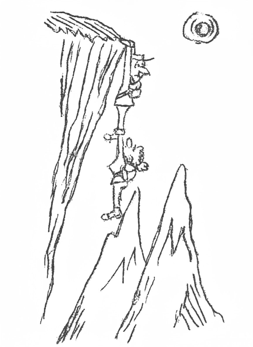
Imagine our dismay, when we found a forest of "big egg rocks". But, luckily, our alignment, between the high crag behind and a pointed hill on the horizon was right, and we gained our much-needed cache of food and water. From here it was a steady plod through cattle lands, but often we looked back as the declining sun gilded the precipitous flanks of our mountain, marvelled that two insignificant beings could have perched on the horns of that incredible airy ridge, and thrilled to that realisation - "the terror of height and distance".
But now we were convinced that our crag was Roma Peak, with Black and White Mountain a much smaller rock mound on its west. Nothing, however, can detract from its wonderful potential as a climbing mountain - the thrill of over coming, foot by foot, inch by inch, its "awful steep", or the sublime feeling of hauling up the last glaring rock to look around at that fantastic view from the top-most reach of that two-named crag.
J.M.R.
H.K.
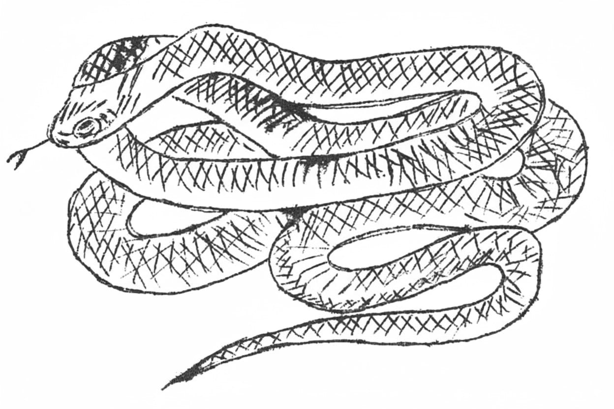
The Snake And You.
- Aggressiveness. Without exception every Australian snake is shy and will avoid contact with people if at all possible. It is true that if frightened, cornered or provoked, some of them will attack with great ferocity. This is its only means of defence, however, and it should not be blamed for this.
Perhaps some levity would be excused here in an attempt to bring this point home. The number of people who suffered an 'unprovoked' attack by a snake probably equals the number who have been 'attacked' by a train on a railway level crossing. In both cases it is certain that you got yourself into the situation where either the snake must bite you because it cannot get away or the train must hit you because it cannot avoid doing so. YOU ARE TO BLAME IN EACH CASE.
In fairness to all there is one minor reservation. The Death Adder makes little effort to avoid you. Should you approach too closely it will strike purely as a means of defence. In this case there is probably an excuse for both parties, but the victim is at least guilty of contributory negligence. Stout shoes and thick long trousers are recommended in known death adder territory.
To return to the serious side of the discussion consider these points:-- All Australian snakes are carnivorous, and they all ingest their food whole.
- A snake cannot bite off small pieces from a larger piece, therefore it is foolish to think that a snake regards you as food.
- If a snake does not consider you as a meal it has no reason to attack you; UNLESS YOU FRIGHTEN IT, OR PROVOKE IT, OR ANNOY IT.
- The Speed of Snakes. Much has been written about how fast snakes travel and how quickly they strike. There is little need to go into elaborate detail here, but it is an established fact that no snake can travel faster than about 8 m.p.h. (even this is probably exaggerated) and certainly not even the much feared mamba of South Africa can catch a running man. The speed of the strike is an illusion. A trained boxer can deliver a blow as fast as a snake can strike, but what is probably more important is that the reaction time of a snake is so much quicker than that of a human being. It is only when we compare our reactions with those of a snake that it seems so fast.
- The Potency of the Venom. Around every camp-fire on a hunting trip, and in the bars of most Australian hotels, stories of snake attacks are commonplace. Invariably these stories are accompanied by reports that the victim dies within 5 minutes. It cannot be stressed too highly that all of these stories are mere fabrication.
For a snake bite victim to die in under two hours the venom would to be injected directly into one of the main veins or arteries. Please note that this comment is valid only for snakes. It is a proven fact that the box jelly-fish or sea-wasp, can kill in under 10 minutes. - Other fallacies. There are other fallacies existing which can be either dangerous in their own right or given cause for undue concern.
- A snake has to coil, and rear up, to strike. It can be dangerous to accept this statement. Five minutes experience with any snake and a long stick and a piece of rag will soon show how wrong this is. A snake can strike in any direction, from any position; but not over a distance of more than about one-third of its length.
- A Snake will return to the spot where its mate was killed. Numerous attempts have been made to prove this point. They have failed.
- Snakes are only dangerous at mating time. All venomous snakes are dangerous at any time. At mating time they are probably more active and may be more excitable, but there is no evidence that it has any bearing on their belligerence.
- A beaten snake will not die until sundown. This is utterly fallacious. A snake dies at the moment you crush its head. If there is any doubt, cut the head off.
SNAKEBITE
Up until now this article has been general in approach. Now is the time to be quite specific without being any more technical than is necessary. So far the advice has been to avoid snakes where possible and so minimise the risk of snakebite. If we now concentrate on the properties of snake venom, how to decide if you have been bitten by a venomous snake, and a recommended method of treatment for a bite, it should clear up some loose ends.
- The Properties of Venom. Laboratory study of Australian snake venoms has shown that they are mainly a highly complex mixture of proteins. Four (4) of these are highly toxic when introduced into other animals, such as man. These toxic agents act in different ways:-
- A neurotoxic action. This acts on the muscles and nerves of the throat, jaw, tongue, neck and chest. If allowed to progress it leads to death by asphyxiation in most cases, or, in the case of a victim with a weak heart, by heart failure. This neurotoxin serves the purpose of speedily immobilising the prey of the snake and is the principal toxic component of most Australian snake venoms except the common black snake.
N.B. Neurotoxin speedily immobilises rats, mice and other small animals but takes between 3 - 24 hours to affect a healthy grown man. - Coagulation of the Blood. Blood clotting. An enzyme called Thrombase is present in at least four of the seven recognised deadly snakes of Australia. The Copperhead and Death Adder do not have this component. Previously it was stated that the only chance of a victim dying within minutes of being bitten was if the venom was injected directly into a vein or artery. In the extremely unlikely event that this occurred it is conceivable that a large clot could develop in the vein and block the heart. Except for this possibility Thrombase is not regarded as a very significant component of Australian snake venom.
- Haemolytic Action. All Australian snakevenom contains Haemolysin which destroys red blood cells. This component is not really significant as a potentially lethal substance but it provides a useful guide in deciding if a person has been bitten by a venomous snake. The passing of red or black urine is generally the first visual evidence of this type of snake bite.
- Haemorrhagin. Destroys small blood vessels and tissues of the internal organs. Found mainly in venoms from the black snake and copperhead. Not really significant when compared with the other components.
From the above it can be seen that the major factor in all venoms is the neurotoxin and all first aid measures should concentrate on this aspect. More about this later.
- A neurotoxic action. This acts on the muscles and nerves of the throat, jaw, tongue, neck and chest. If allowed to progress it leads to death by asphyxiation in most cases, or, in the case of a victim with a weak heart, by heart failure. This neurotoxin serves the purpose of speedily immobilising the prey of the snake and is the principal toxic component of most Australian snake venoms except the common black snake.
- Deciding if a bite is from a suspected venomous snake.
It is not always easy to establish this unless the snake is immediately killed and identified by an expert. In any case do not delay treatment: but during and after, this treatment the following examination should be made.- Puncture marks from fangs. Australian venomous snakes have only two fangs. They also have smaller teeth behind the fangs but these rarely contact the skin. Even the main fangs may leave no visible puncture marks and there is very rarely pain or swelling at the bite. Some of the venomous snakes hang on or bite more than once so that more than two puncture marks does not mean the snake was non-venomous. Only if the tooth marks are semi-circular in shape, or there is pronounced pain at the bite, it is safe to assume the bite is not from a venomous snake. If the bite is semi-circular it is from a python or other constricting snake; if there is pronounced pain it is probably a spider, wasp or scorpion.
- Keep a close watch on the patient and particularly look for the following signs:-
- Vomiting or continued coughing with spitting blood.
- Otherwise unexplained headaches.
- Pain in the groin or armpit with some tenderness of the glands.
- Blood stained or black urine often passed without control.
- Drowsiness or sudden loss of consciousness.
- Pain in Abdomen.
- Drooping eyelids, slurred speech or double vision.
- Sweating.
Drooping eyelids and slurred speech or difficulty in swallowing are sometimes the first visible symptoms to show up. It is important not to wait for more than one or two of these symptoms to occur; especially passing of black or red urine or painful glands in groin or armpit. If either or both of these are present take prompt action. The other symptoms may not be recognisable for up to 24 hours.
- Treatment for a suspected snake - bite.
In the absence of a doctor the following steps should be taken.- DO apply a tourniquet before anything else.
- DO wash the area surrounding the bite.
AFTER APPLYING THE TOURNIQUET. - DO reassure the patient that most victims recover.
- DO seek expert assistance from the ambulance or a doctor.
- DO be prepared to administer artificial respiration while awaiting assistance. Mouth to mouth resuscitation and/or external cardiac massage may be required.
- DO try and kill the snake and retain it for expert identification.
- DO NOT do anything before applying the tourniquet.
- DO NOT cut or excise the wound in any way. Unless you are a doctor you will probably do more harm than good.
- DO NOT alarm the patient. Make every effort to reassure him of ultimate recovery.
- DO NOT permit the patient to move about any more than absolutely necessary.
- DO NOT administer alcohol or other drugs which depress respiration.
- DO NOT give any fluids at all if there is difficulty in swallowing.
- DO NOT forget to release the tourniquet for 30 seconds every 20 minutes.
- DO NOT panic yourself. Most first-aid treatment is plain commonsense.
- Further explanation of these points follows:-
- TOURNIQUET: It will be noted that a lot of importance is placed on the tourniquet. It is the most important step in the case of suspected snake-bite. Its purpose is to slow down (it will not prevent) the progress of the poison to other, and more important, parts of the body while you are seeking assistance. Most snake-bites are on the lower limbs and the correct place for a tourniquet is on the upper part of the limb where there is only a single bone. The tourniquet should be just uncomfortably tight but not excruciatingly painful. It should be released for 30 seconds every 20 minutes. Even if no treatment has been forthcoming discard the tourniquet after 2 hours. Failure to do so may mean permanent damage to the limb. Many snake-bite kits contain a length of rubber tubing to use as a tourniquet, but it is the author's strong belief that the best thing to do with this item is throw it away. A tight rubber tube can be very difficult to remove if inexpertly applied and in the circumstances may do more harm than good. A quite efficient tourniquet can be made from a leather belt, a necktie, a handkerchief or piece of light rope. Tie it loosely and twist a stick around to exert the correct pressure. It is then a simple matter to loosen or tighten whenever necessary.
- EXCISING THE WOUND: The same snake-bite kits that contain rubber tubing generally have a fancy plastic container of Condy's Crystals with a small knife (usually blunt) in one end. Throw this away at the same time as you get rid of the tubing. In any but skilled hands, cutting can lead to disfiguring scars, severed artery or ligament or muscle. Washing with any suitable liquid such as water, tea, milk, beer, or even urine serves the same purpose and is far safer. Condy's Crystals in an excised wound generally destroys more healthy tissue than venom.
- OTHER POINTS: Most other points are common sense. If there is difficulty in swallowing it is common sense not to give the patient anything to drink. Similarly you should get the patient to rest as much as possible. Any exertion increases blood circulation and makes it easier for the venom to circulate through the body.
A QUICK GUIDE TO SNAKE IDENTIFICATION
This is rather a difficult subject to write about with any great hope of success. It is a typical case of 1 colour picture being worth a thousand words. Better still is a visit to a zoo where the snake can be seen alive.
The advantage of positive identification should be obvious. It ensures that the correct anti-venene is used, and may also provide some indication of the degree of urgency required in the treatment. A bite from an ordinary brown snake is nowhere near as serious as that from a taipan, tiger-snake or death adder.
If there is any doubt about the type of snake proceed on the assumption that it is venomous.
DEATH ADDER
Can be found anytime but is more likely to be moving about at night. In the opinion of the writer is the most dangerous snake in Australia. It is usually not noticed until it bites and injects comparatively large quantities of powerful venom through well developed fangs. It is the only snake which will not get out of your way, but it is not aggressive just lazy.
Habitat: Found nearly all over Australia generally around loose leaves or sand.
Shape: Short stumpy body; short thin tail; wide flat, trengular head. Av. length 2' - 2'6"
Colour: Generally dirty grey, but may be dusty reddish in colour. Wavy dark bands.
Venom: Mainly neurotoxic.
TAIPAN
This snake is not aggressive except when frightened. Then its size, speed of attack and potency of the venom combine to present a dangerous animal indeed. If a taipan is examined it will be seen that most prominent scale on the head is shaped like an heraldic shield. This is an infallible means of identification but if you are close enough to a live snake to see this YOU ARE TOO CLOSE. In torch light, at night, the eyes glow ruby-read. If you even suspect the snake is a taipan LEAVE IT ALONE.
Habitat: Mainly Queensland & Nth. Australia. Gympie, in Qld appears to be the furtherost south in its range.
Shape: Rather slim body for its size with a thin neck and a long tapering head which at first glance appears too large for the neck. Av. size from 4'6" - 6'0" although there is a specimen of 11'0" recorded.
Colour: Dark brown with dirty yellow bellies, but older snakes have been noticed to be almost black.
Venom: Potent and mainly neurotoxic.
COMMON BROWN
This is the most pugnacious of all Australia's snakes but is still more inclined to retreat than attack. It is quite fast and bites repeatedly. It has the habit of coiling round its victim after biting and may be difficult to dislodge. The important difference between the brown snake and the taipan is the thick neck and small squarish head.
Habitat: All over Australia, except Tasmania. Seems to prefer dry, grassy plains. There are about 4 species of 'brown' snakes all closely related.
Shape: Rather slim body and small head. The neck is about the same size as the head. Grows to about 6'0" although the different species may vary in length.
Colour: Basically brown with yellow belly but there is so much variation in colour that this is not a good means of identification.
Venom: Quite powerful but as the fangs are small and the venom yield not great it is not considered unduly lethal. However, it is dangerous.
WARNING!
BUSH WALK IN CONWAY
NATIONAL PARK 22/23 JULY
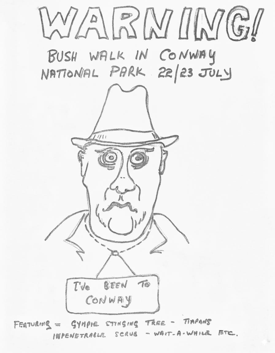
FEATURING
GYMPIE STINGING TREE
TAIPANS
IMPENETRABLE SCRUB
WAIT-A-WHILE
ETC.


