Newsletter – September 2019
Join the Townsville Bushwalking Club this September 2019 for guided hikes to Little Crystal Creek, Paluma rainforest, Mt Cook on Magnetic Island, and more. Discover new introductory walks, safety tips on the Gympie Gympie stinging tree, and updates on meetings, membership, and local adventures.

President – Keith
Vice Prez – Glenys
Secretary - Phil
Treasurer – Rosemary
Committee members – Wilfred, Joy
Bushwalks Schedule
15th September Sunday – one day. Little Crystal Creek – Leader Keith.
22nd September Sunday – one day. Paluma / Mt Spec area rainforest track walk – Leader Phil.
29th September Sunday – one day. Mt Cook (Magnetic Island), via Nelly Bay and Endeavour Ck to Horseshoe Bay (a long walk to the pub) – Leader Keith.
5th to 7th October - three day long weekend – TBA. Any interest in South Molle Island bludge trip?
13th October Sunday – one day. TBA need leader (Keith away).
19th October Saturday – Introductory walk Killymoon Ck -Leader Wilfred.
Walk details will be promulgated via the club email list in the week before the walk.
Other walks under consideration include the Terraces (Mt Elliot) again as some of our newer members have not been up there, Godwin’s Peak, Godwin’s / Mt Halifax through walk, Crystal Creek falls lower section, and Frederick’s Peak.
As it gets hotter from late-October onwards, we may start doing more Paluma area rainforest track walks. And revert to fortnightly only walks, depending on interest.
Walks are subject to availability of walk leaders, logistics, and environmental conditions. Consequently walks may be restricted, changed or postponed at short notice.
Next Meeting
14th October Monday Monthly meeting 6 pm
Monthly meetings are second Monday of each month.
Introductory Walk Monthly
Townsville Bushwalking Club is trialling holding an “introductory” walk monthly, on the Saturday following the monthly meeting each month. The aim is for new walkers to be introduced to creek based rock hop walking on an easier walk. New walkers may be required to attend the “introductory” walks before progressing to the harder creek rock hop or cross country adventures. This is being trialled to enhance safety for new walkers before they attempt the harder bushwalks. At this stage “introductory” walks will be on Killymoon Creek, but we may expand that to other locations later.
Walk Registration
Registering for a walk – intending walkers must register with the walk leader and obtain briefing and approval to attend a walk, either at the monthly meeting or by phone. Do not email the club as that may be missed and will not be accepted!
Reminder that walker registration will not be accepted if the leader believes that the walk is unsuitable for you.
Visitors who have not walked with the club before must attend a monthly meeting, and sometimes the ‘introductory walk’, before participating in a standard walk.
Facebook and Website
Keep an eye on our Facebook presence for updates to activity dates. Walk details will continue to be promulgated via email. Phil (Secretary) is the club Facebook page admin/coord.
Our website will list next walk and meeting dates, and has heaps of good info on club walking and preparation.
Membership
We are often asked by new walkers how do they become a member. The club rules are to complete three qualifying walks first, then apply for membership, cost $40. After three walks it is mandatory to join the club (subject to membership application being accepted by the committee). It is a condition of the bushwalking insurance policy that covers the club that membership is mandatory after three walks.
Birthday
Next year is the 60th birthday of the club (May 1960). We will have a think about what celebration we will have. Any ideas pass along to the committee. Early thoughts are a shirt (embroidered), and a celebratory weekend of walking, maybe camp out or similar elsewhere.
Gympie Gympie Stinging Tree
A fact of bushwalking in our region is the Gympie Gympie stinging tree. It’s sting is very painful and long lasting. Best to avoid contact. But occasionally we inadvertently run in to it and do not always see it. Therefore part of why the club always recommends full long sleeved clothing and fingerless gloves (also to decrease the scratches and cuts from other vegetation and rocks, and sun exposure).
The plant is toxic !
On a recent walk four of us ran into a forest of stinging tree – three of us did not have long sleeve clothing nor gloves so received stings to exposed arms, hands and legs. Therefore the club re-iterates the recommendation to wear protective clothing to negate contact with the stinging tree. Or follow Wilfred to avoid the stinging tree (the four of us did not follow Wilfred, we chose our own route, so Wilfred was not stung, but we were).
Now, you can still get stung through clothing, but it does negate the severity of the sting.
You do not want to join the stinging tree club ! There is a saying ‘once stung, never forgotten’. And the pain or sensation is long lasting, for months (I reckon bad sting lasts for a year !).
Dendrocnide moroides, also known as the stinging brush, mulberry-leaved stinger, gympie gympie, gympie, gympie stinger, stinger, the suicide plant, or moonlighter, is a plant common to rainforest areas in the north east of Australia. It is best known for stinging hairs that cover the whole plant and deliver a potent neurotoxin when touched. It is the most toxic of the Australian species of stinging trees. The fruit is edible to humans if the stinging hairs that cover it are removed.
Every single part of the deadly plant – its heart shaped leaves, its stem and its pink/purple fruit – is covered with tiny stinging hairs shaped like hypodermic needles. You only need to lightly touch the plant to get stung, after which the hair penetrates the body and releases a painful toxin called moroidin. Sometimes, merely being in the presence of this plant is sufficient to cause itching, rashes, sneezing and a fair bit of pain.
http://www.factfiend.com/gympie-gympie-butthole-destroying-stinging-tree/
Smart Phone Emergency App
Do you have the Emergency+ app on your smart phone ?
If you have to call emergency services, they will ask for the lat / lon of the location of the incident. This is not just limited to bushwalking but any remote area activity, even car accidents. How many of us can do that easily? Currently we can get the details off the GPSr, but we do not use lat / lon for bushwalk navigation, so lat / lon is not a normal setting we have set-up for day to day use (we set- up UTM as default)- so who can change the GPSr setting from UTM to lat / lon under duress let along normal circumstances ? And how to find the lat / lon of the point we are at on the GPSr - which screen / menu / button ?
The solution is, we all have smart phones. And there is a free app we can all download to our smart phones:
The Emergency+ app is a free app developed by Australia's emergency services and their Government and industry partners.
The app uses GPS functionality built into smart phones to help a Triple Zero (000) caller provide critical location details required to mobilise emergency services.
The app displays the lat / lon - no buttons to press, no menus to sort through, it is there on the app front screen all the time.
http://emergencyapp.triplezero.gov.au/
This does not rely on phone network coverage, but uses the GPS function of your phone, so will always work if you have sky coverage. Of course to call Triple Zero you may need satellite phone if no network coverage, but at least you can advise the lat / lon if required using your smart phone app.
Walk Ravings
Slippery Rocks Creek 8th September
A damned good leg workout – no need for squats or lunges for another week ! Location – Bowling Green National Park, Alligator / Cockatoo Creek area.
An exploratory walk into the unknown. When we did Joy’s Cliff earlier in the year, we started in Slippery Rocks Creek but had to get out due to boulders and wet rocks. But I was eyeing off those sheer cliffs on the western side, the creek below might be interesting. So, let’s go exploring, see what mischief we can get into. Allowing 12 hrs, we had an early start. Set-up the car shuttle, with cars at Alligator Creek NP day use area for the finish, assuming we could come out on Cockatoo Creek. Drive around to Mt Panorama Drive, and started the walk there (private property).
What was the plan – well, plan A was to try and go all the way up the creek to the saddle, 800 mr ascent, then drop into Cockatoo Creek on other side and come out that way. Plans B, C, D were all potential deviations if we could not get up the creek – we did expect to get blocked at some stage. Four fit adventurous bushwalkers, we started walking at 0700, into Slippery Rocks Creek. After about an hour we hit the boulders. That was the start of a long period of clambering up, over and around numerous large boulders. It tested the legs, balance and upper body as we constantly hauled ourselves up and over those boulders. Long flexible strong legs come in handy. The creek was in the shade therefore walking was pleasant temperature. And being a dry creek with only a trickle, made the going good. We then hit some gorges, we got through the first ok. The second we were blocked by a pool of water, and sheer sided rockwalls. We tried to build a rock crosing, but only succeeded in wetting the rock face we had to exit on, a green slimy rock face, so that became unviable. Above was the
sheer gorge rock walls, but there were exposed ledges that looked navigable. We chose different routes, my route went higher, slipping and sliding on loose stuff in mixed scrub, missed seeing stinging tree and grabbed a bare stinger stem to stop sliding – OUCH. Plus stings on leg as well. Looking around, I had stumbled into a mini-forest of stingers. Wilfred’s ledge route had no stingers (always follow Wilfred, not me !) but was more exposed. Passed the gorge, we continued boulder scrambling up the creek, now behind Joy’s Cliff. We found a large carpet python curled up in rocks, beautiful creature. We were making good time, so at the creek split near the top (less than 1 km from saddle), we decided to try for hill 900 to the south. We got out of the narrowing scrubby creek bed, and climbed steeply up through scrub and rockfaces, into grass trees and pandanus palms, easy going despite the steepness, to reach the plateau. Then short flat walk to 900 hill, which is covered lantana, that slowed us down.
1145 we are at the top, having lunch in a very small clearing with giant curious friendly ants, and surrounded by lantana. We are calling this hill top “Lantana Hill”. No views, not worth going to.
Now the route home, via Cockatoo Creek, which lays 1 km east, down the steep sided mountain slopes. Study map, choose a route than avoids the steeper contour lines and known cliff faces. We aim for a steep creek line to take us down. We do expect at some stage to be blocked by a cliff, surely. I was cheerfully predicting it (some say hoping for it). Start walking again at 1230 heading down the mountain side. Easy scrub walking, find the creek, and follow that down, a few steep drop offs which meant a bush bash to get around, we enter Cockatoo Creek at 1400. That was relatively easy even though steep. And no cliff blockage ! Then it was the 3.5 hour slog down Cockatoo Creek, which seemed to drag on and on. Back at Alligator Creek NP day use area car park at 1730. That was a very long day, but a good one.
Wilfred is enthusiastic to do it again as an open club walk (today was restricted), as the boulder scrambling was fun. But we would use a different route at the top to avoid Lantana Hill – a plan is forming. Good fitness and endurance / resilience required though, recommend small group only.
10.5 hr hike. 15.5 km. Total ascent 961 mr, highest point 902 mr.
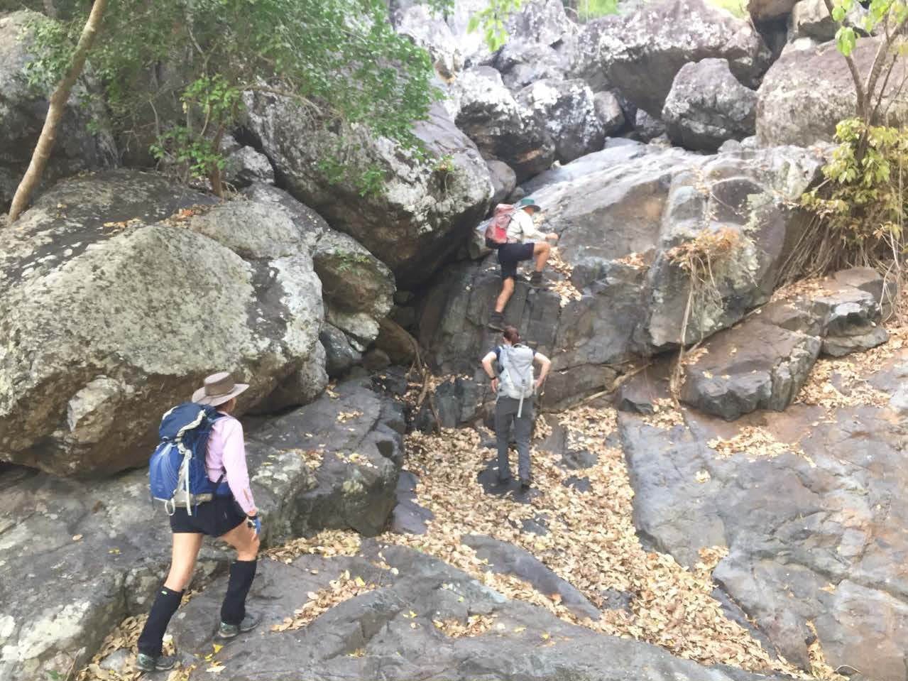
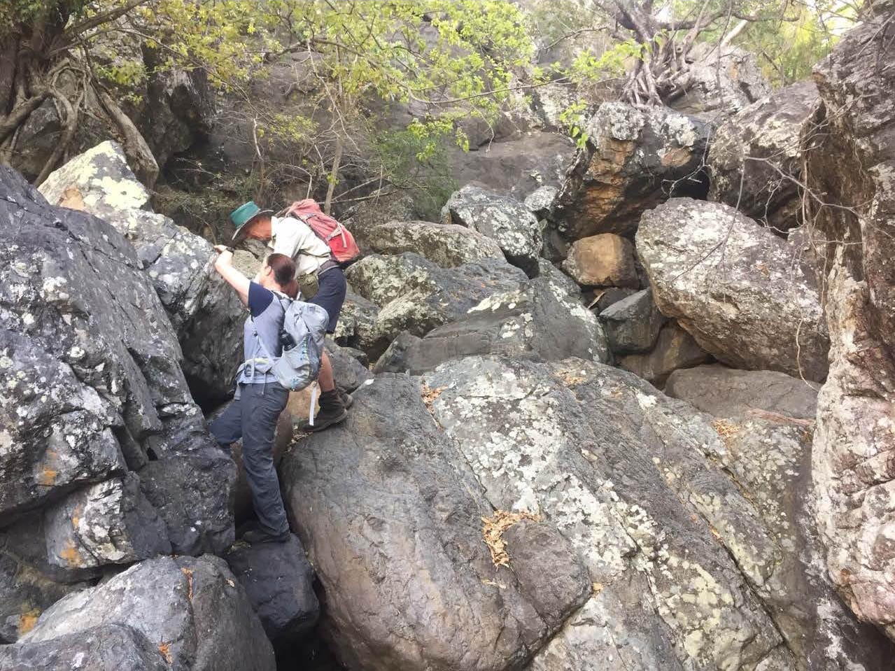
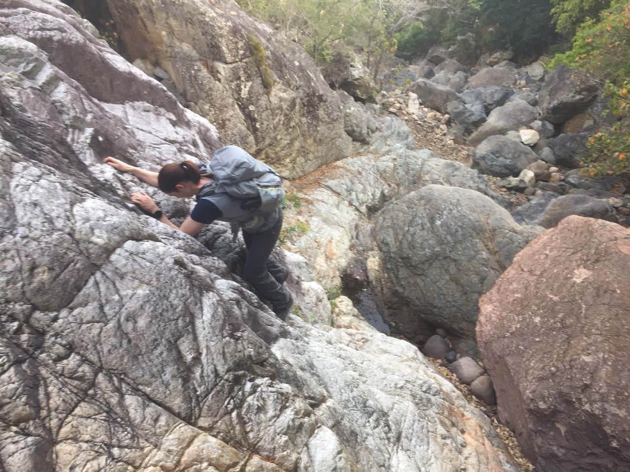
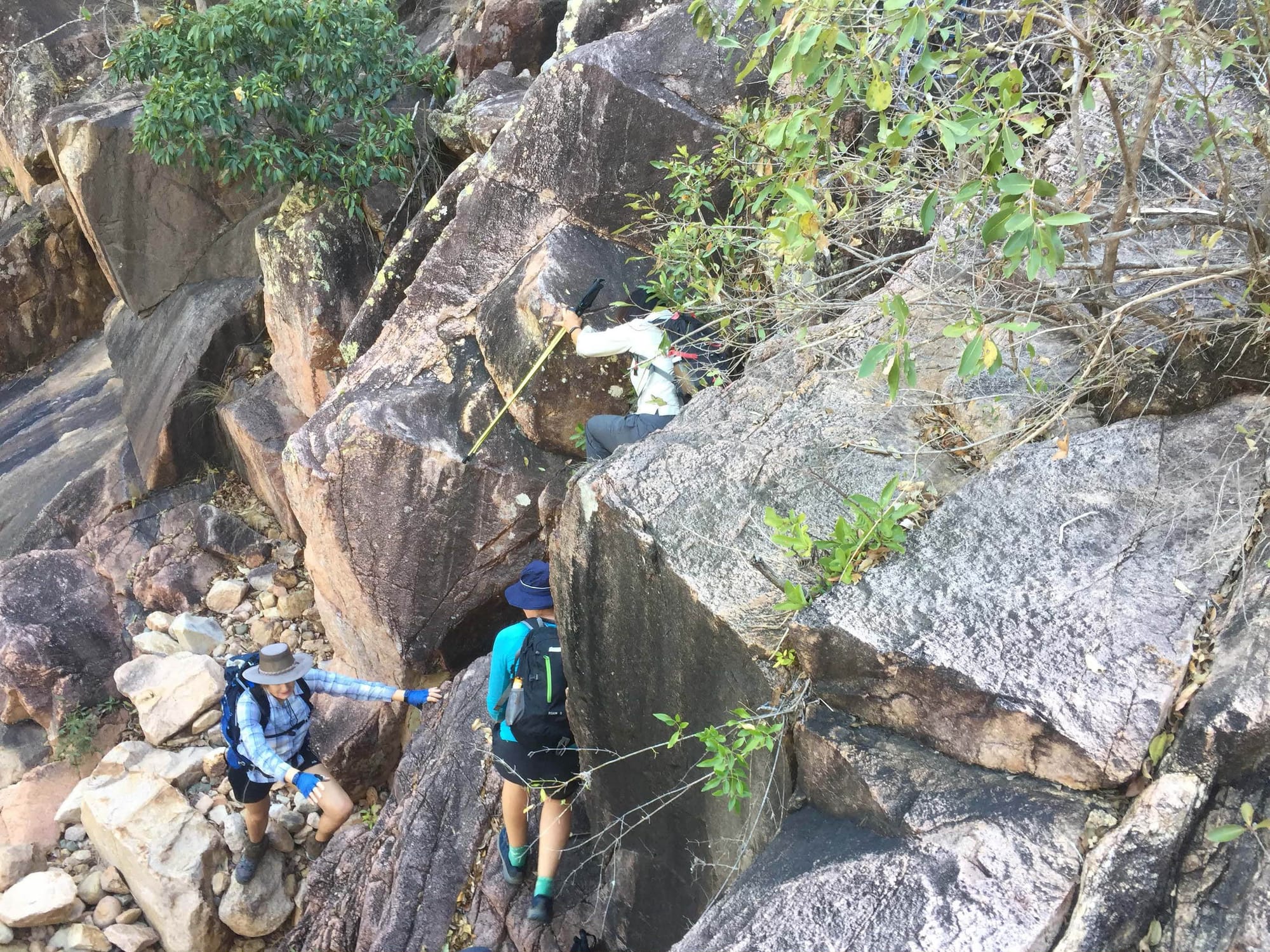
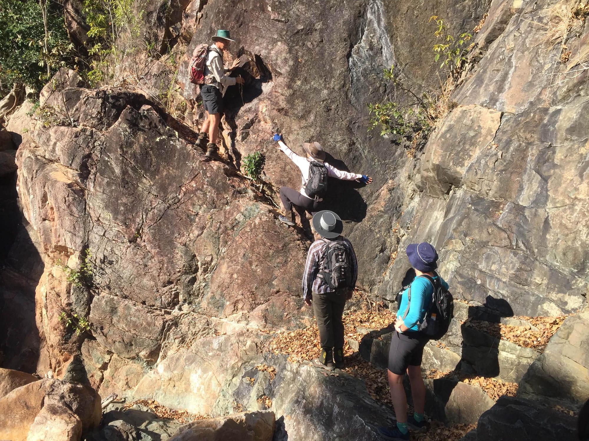
Killymoon Creek 7th September
Location – Bowling Green National Park, Alligator Creek area.
The first of our new introductory walks that Wilfred has initiated. Eight walkers, comprising three new walkers, two ‘mature’ returning walkers, and three regulars. Killymoon is a shortish creek rockhop, about 2 hours up to the pool. But is has all the attributes of a standard creek walk with rock hopping, boulder scrambles, short rockface climbs, exposed ledges, and a swimming hole. The main hazard at the start was a bushbash through chinee apple, a horrid bush with sharp thorns (Native to southern Asia and eastern Africa, Chinee apple is a large shrub first recorded in the Torres Strait in 1863 and in Townsville in 1916. In Queensland it is known as the Chinee/Chinkee apple as it was believed to be introduced by Chinese miners to areas such as Charters Towers, Ravenswood and Hughenden (Our species, incidentally, is Indian but has a temperate-climate Chinese relative.)) Once in the creek it was rock hop and scramble up the creek. Surprisingly there was still flowing water, some of the cascades were pretty. Two hours we arrived at the pool. At the pool a long rest break, where pikelets with jam and cream were served by Joy (Joy gets more brownie points again). Some of us went exploring above the pool up to the waterfall. A good easy walk.
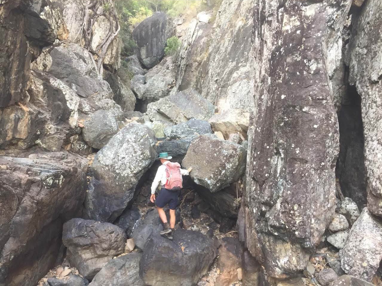
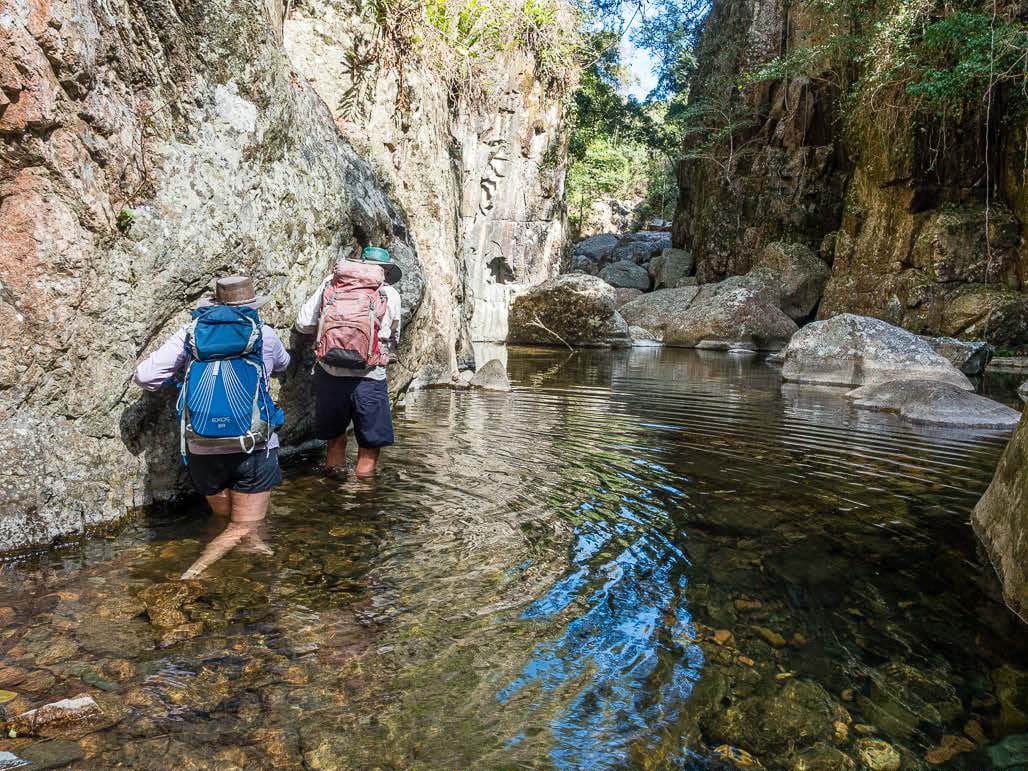
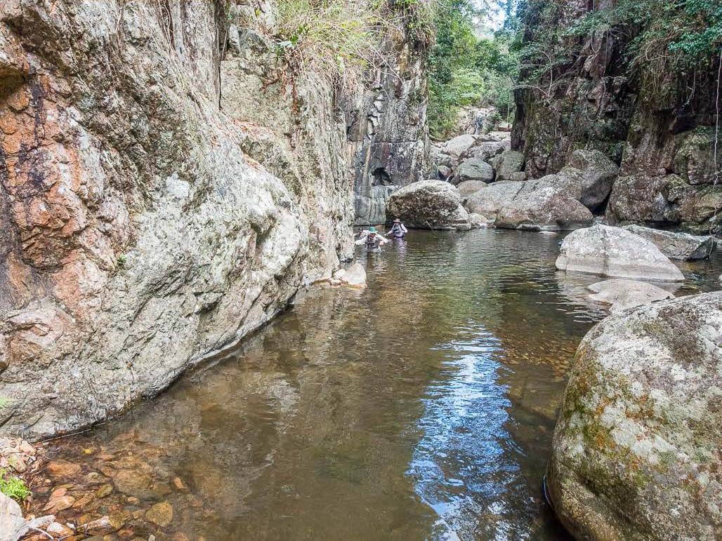
Bullocky Toms Creek 1st September
Location – Paluma Range National Park, Mt Spec section.
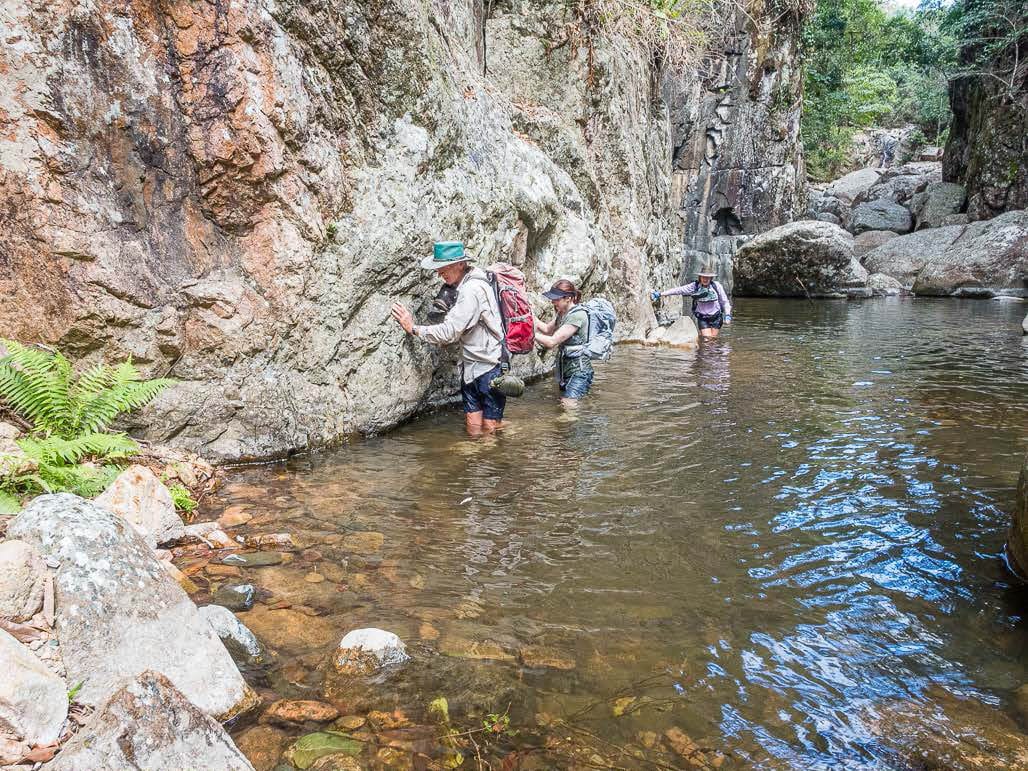
The return to Bullocky Toms Creek. It has been a long time since we did this creek. Wilfred was not keen when I suggested we should do this walk, he said it was full of stinging tree and crap last time he tried it after Yasi. But I never relented, and so off we go. The walk starts on private property. Six walkers, we started walking at 0820 (from private property). A short track walk, then into the creek to rock hop upstream. The lower reaches are gentle and scenic, with some nice cascades and pools. Maybe we should just the spend day here. As we go further upstream, the rock hops become boulder scrambling, large boulders prevail. Some rocks are moist and slippery. There are a few ‘giant’ leap rock hops, ok for long legged bushwalkers, for shorter walkers, well, it is a stretch. We reach the gorge that blocks the way. In past times we would go up and over the bluff, then swim back down. But today, the thought of steep bluff climb, bush bash, lantana and stinging tree which we know exists up there, means we eye off how to get up the gorge instead. Wilfred says “it will be a wade on the other side, easy”. I gaze at him with that doubtful look, and say “wade ? really ? are we looking at the same depth of water ? and how do we get out of the water and up the boulders at the end of the pool ?“. Anyway, he convinces me to try it, and the others dutifully follow.
We start the pool wade on left side, hard against the cliff face, it was deeper away from the cliff. It got waist deep that ‘wade’, wetting our packs (shorter persons were chest deep). Still a wade though apparently ! Then blocked by a boulder, we are able to scramble over, but a steep drop on the other side with a hail mary drop into water of unknown depth and uneven slippery footing. Of course, after Wilfred had gone over that boulder and wet it, just made it more difficult for those that followed. It was deeper here, but we had rocks to stand on so still only waist deep in the right spots. Then more boulders, which even Wilfred could not traverse. No grip trying to get out of the water onto boulders. After trying several options, we gave up. So back across the pool, two of us decide to swim rather than wade. We waterproofed our packs and footwear, as best one can when standing on loose branches in a pool or waist deep in water. I made an uncontrolled unplanned but graceful entry (kinda) to a deeper part of the pool, a very slippery sloping rock I was on and no grip. Much to the mirth of others. We swam or waded back to the start of the pool. Now what ?
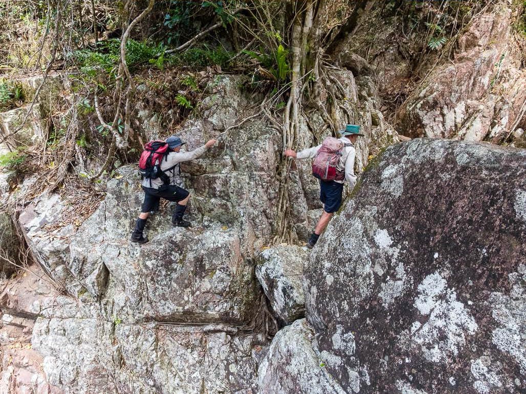
Looking at the bluff above, Wilfred asks where do we go up ? Right here will do I enthuse. OOOPs. It was a horrible steep friable slippery slope, no grip, often one foot up and the other sliding back down, using small trees as support when one could reach them. A slip would have resulted in a long slide down the slope. Tentatively, we made it, all relieved and not wanting to do that again. A short bush bash, then we are able to re-enter the creek. Here there is a ravine and large boulders. We go further upstream, all we can see is boulders. We had been talking of possibly going up the creek then exit via a spur to get onto Shays Track, then come down Foxlees Track, as a better route than back down the creek. At this stage one walker had a fall and we implemented our first aid process.
At 1400 it was time to return home, so back over the bluff. Back near the creek, along an exposed rock face, Wilfred goes down the rockface, but the rest of us aren’t keen, so we look for alternative option, going up higher for a short bushbash. But, we stumbled into a forest of stinging tree, and four of us were stung. Looking around, it was everywhere, and large plants too. So, gave that up and returned to Wilfred’s rockface and go down that way after all.
Moral of the story – sometimes following Wilfred is smarter. And, wear protective clothing ! An easy walk after that down the creek, to be back at the cars at 1615. Then off to Frosty Mango for ice creams.
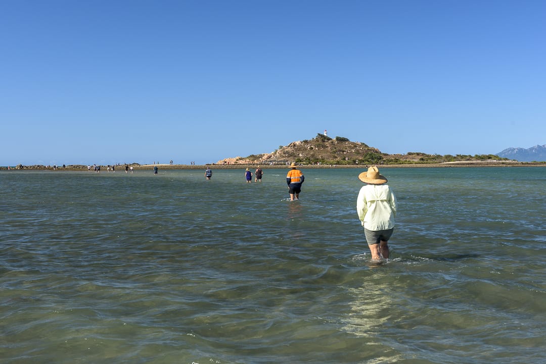
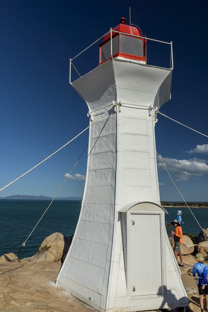
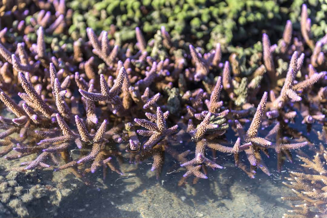
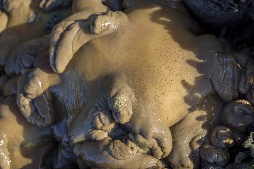
Bowen Lighthouse walk 30th August
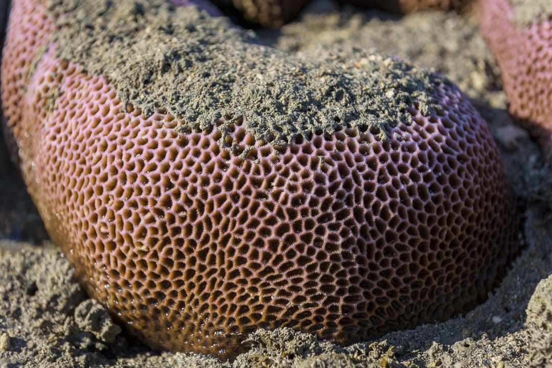
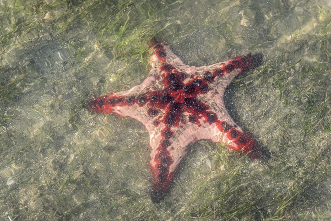
Whilst not a club activity, some of us went down to do the annual Bowen lighthouse walk. The annual walk to Bowen lighthouse is only held once per year on a very low tide. Refer https://www.tourismbowen.com.au/see-do/whats-on/walk-to-the-lighthouse . There is also the option for a nice coastal walk around Cape Eucumbene area, including Mother Beddock’s Pimple. We went down to walk over to the lighthouse on Friday and beat the huge Saturday crowd. Even Friday there was well over 100 people. Wading at low tide over to the island, one sees large red starfish and sea cucumbers. Around the island there are nice corals. Then walk up to the old lighthouse. Quick photo, then back before the tide runs in too much. A pleasant afternoon. I also went up the Cape Eucumbene track which includes Mother Beddock’s Pimple. From afar, the huge granite boulder looks like a pimple on the ridgeline. This walk is in the book Walks, Tracks and Trails of North QLD by Derrick Stone (highly recommended), that many of us have bought – if you need a copy, you can buy through Paluma Org (see Wilfred).
Bullocky Toms Track 25th August
Location – Paluma Range National Park.
The plan was a through walk on Ethel Creek. Rain Saturday night and Sunday morning, meant that was not feasible. Therefore we decided that Bullocky Toms Track to Gold Creek Falls was a better wet walk option. The car shuttle set-up for Ethel Creek was in progress but we changed that and re-assembled at Paradise Waterhole car park. Crossing over Crystal Creek was a slight challenge to find dry rocks, but not too bad. Same with Cairn Creek. A few leeches were out and about. Up the steep climb to the lookout, which tests one’s fitness, we did that in the usual one hour from Cairn Creek to the lookout. Along the way near the top, from the back there is loud shriek and exclamation – “how can four of you walk past this large snake on edge of the track?”.…. “what snake ?”. Go back, there adjacent to the track is a large carpet python, must be 2 to 3 mr - “oh, that snake ……., never saw that !” The front four never saw it ! We admire it close up, it wasn’t moving. At the lookout, nice orchids in flower, and good views, albeit the trees are growing bigger and blocking much of the view now. Then the next leg of the track, even steeper, to reach the falls after 45 minutes from the lookout. Very good water flow at the falls for this time of year. It was too wet and slippery to go down the rope to the top pool, so we went along the track about 75 mr, then bushbashed
down into the creek to have lunch on wet rocks above the pool. Found an interesting frog there. It was very scenic with cascades, ferns and rainforest.
After lunch, back down the track. The leaves on the steep track were slippery so grip was at premium. We passed where the snake had been – well, I didn’t see it again, but when I realised nobody was behind me, apparently I went passed the python again ! Stopped at Cairn Creek for afternoon smoko, then back to Lanskey’s Hut. Approaching the hut, I spied an echidna on the track. I stopped, waiting for the others to catch up – where are they ? After several minutes, still no-one ? hmhmhmhmhm. Meanwhile the echidna goes off the track.
The others catch up, they had seen another echidna as well that I walked past. A casual walk then back to the cars, a good day walk considering the conditions.
Mt Cleveland 18th August
Location – Bowling Green National Park, Cape Cleveland area.
Luen volunteered to lead a walk to Mt Cleveland. We assembled on Cape Cleveland Road, and started walking. GT volunteered to be Tail End Charlie, and fulfilled first part of his duties by conducting head count – 10 walkers we have he says. Later in the day as we had a break, I counted 11 – what the ? I thought I was the only one who had trouble counting past
10. Or did someone sneak in ?
A bushbash up a spur, we reached the summit in 2.5 hrs. We pass through a nice landscape of grass trees, including some large specimens. At the summit, getting a view is difficult, involves scrambling up boulders and trees. What do we do for the rest of the day ? Luen and I had planned to explore down towards Western Ridge, a favourite playground, so that is where we head. Down hills, up hills, we head west. WK exclaims several times “don’t you blokes know how to contour, rather than go over the top of every damned hill you can see ?”. So, Luen takes us up another hill, huge grin looking back. At the base of Western Ridge, towering above, some are tiring, they ask “we are not going up there are we? Think we have had enough “. I grin at them “yep”. We are aiming for a huge granite boulder outcrop high above. The steep climb up a spur is not too bad, to reach the boulder for great views and a great lunch stop. An excellent place to stop. Then along the top of the ridge heading south, for more great views. Western Ridge is a great walk. Steep descent off the ridge, back to the cars. An excellent walk, thanks to Luen for leading, and thanks to GT for being tail end Charlie (but someone else better count heads next timeJ).
Return / Narke
We had scheduled a walk to Return / Narke during August but we did not get approval due to other activity on the property. We will re-visit this idea in 2020.


