Paluma Range Traverse, Conway, Bambaroo
From steep climbs on the Paluma Range and long hot slogs on the Conway Circuit to a pig-charged rainforest and the fast “Bambaroo Express”, walkers faced hills, mishaps, laughter, and plenty of stories.
We have decided to form a new club – called the Flat Earth Society – no hills – Darren is first member J
October long weekend, and a hardy group of five set off to traverse Paluma Range on a three day bushwalk. Now we start at sea level and finish at sea level, so it must be a flattish walk. Oh, is there a hill in between ?
Saturday - Starting from Paradise Lagoon on Crystal Creek at Mutarnee, we first set-up the car shuttle, leaving a car at Jourama Falls. Then back to start the walk from Paradise Lagoon at 7:50 am, well four of us on the three dayer. The fifth ‘three day walker’ would join later from the dam (hopefully carrying red liquid supplies). Two ‘day walkers’ start with us. Darren looks at the lightish packs the others are carrying, compared to his. We cross Crystal Creek, amble along Bullocky Toms bush track up and down a few hills and across Cairn Creek, until we reach ‘the cairn’ for morning tea stop. It is hot and humid and sweaty already. The day walkers leave us for the sprint up the hill. After a nice break, we start the steep climb, a good test of fitness and pack weight. We reach the lookout after a 1 ¾ hr climb, for a deserved lunch break. Then onwards up to Gold Falls, another steep climb. Short stop here (no swim), then keep going to reach Johnstone’s Clearing about 3:30 pm, our overnight stop. 9.6 km, total ascent 1,027 mr. Darren decided his pack was ‘heavy’. Glenys arrived from the dam, minus the red liquid supplies – damn !
Sunday – with promises of a flat walking easier day, we set off at 8:06 am. Shortly after arrive at DCK hut, where Wilfred found a bottle of red ‘supplies’. We then ‘climb’ up to Foxlees Junction, then the undulating walk around to Gard’s Lookout for morning tea stop. Darren was asking ‘about this so called flat day you promised ...’. “did we promise that ....”. Then down to Shay’s Clearing, discovering that the log bridge ‘rope’ had been broken by a falling tree, but the creek was low and easy to cross. Then to Diorite Falls. Then the gentle uphill 1 hr walk to Shays Rd junction, then another hour to Prospector Creek for lunch.
At Prospector Creek, disaster struck the group. It almost meant the walk being called off. Our morale was shattered, we could barely think of going on. But, we had inner strength we could rely on, so we overcome the hardship. You see, Wilfred opened his pack up, and the bottle of red special medicinal liquid fell out, onto the rocks, smashing into many pieces. We were dismayed. How could we go on ? Ah well, the ants got very drunk.
With stiff resolve, we carried on, along the freshly maintained jungle track (thanks Charlie and Jamie) to later reach Station Creek camp site at 3:40 pm. 14.7 km, Total ascent 499 mr, total descent 548 – a flattish day.
Monday – all downhill today – well, it must be. Start climbing out of Station Creek, ‘eventually’ the track starts the steep descent down the mountain. The track is very steep and rough in places. About midday we reach Waterview Creek after a long descent, and have lunch at top of Jourama Falls, a fantastic place. To the dismay of some, the climbing ain’t over until it is over – and you have to climb out of Waterview Creek, a steep climb, up to the lookout rock – “why does this damned track go straight up and not sideways along?” was somebody’s exasperated question. Great views from lookout rock. Then the steep descent down to the national park lookout, a scrambling friable descent. We reach the car and declare a swim is required, a great way to finish off a very good walk. 10.1 km, total ascent 322 mr, total descent 1002 mr.
Overall - 34.5 km, Total ascent 1,852 mr
CONWAY CIRCUIT
A weekend in the Whitsundays, Airlie Beach, sounds grand. Islands, beaches, rainforest, cafes, a boutique village. What a great way to spend the weekend.
A walk that has been on the radar for a long time, Conway Circuit in Conway National Park (formerly know as Whitsunday Great Walk), at Airlie Beach. Katherine gets us organised, and five of us are at Airlie Beach for a two day bushwalk. We all go down Friday arvo/night, staying at separate places. Two hot ladies invite me out for dinner, where we talk bushwalking and what to expect tomorrow - the ‘hill’ towers above Airlie Beach, so is a big topic.
Saturday – four of us set-up the car shuttle, leaving two cars at Brandy Creek trail head. Start walking from Airlie Beach township (Jason joins us here) , the walk is straight up- yep, 400 mr elevation first up. Damned hot too, no shade. Pass a lot of young fit people on their way down from their morning run, we offer them the chance to carry our packs up, but they all politely decline. They don’t know what they are missing. At the top is the junction to Honeyeater Lookout, we drop our packs and take the side trip to the lookout – it was great without the packs as the side trip was about 3 km return. Good lookout with views beyond Cannonvale to the Dryander Range and the scattering of Whitsunday Islands. Back at the packs, we have morning tea, then keep going. The track becomes undulating but with uphill trend. At Bloodwood camp, there is a lookout that provides more fine views. We keep going to Mt Hayward, were we stop for lunch at the lookout, with views towards the islands. It has been a hot sweaty morning. The rainforest is very dry, and there are signs of canopy damage from recent cyclones.
After lunch, the downhill leg (thankfully), a 300mr elevation descent to Repulse Creek Camp. That was a 24.1 km day, tough day. The creek had only a small flow, and the pools were “greenish”, but enough to have a bath and wash the sweat off. We had a good camp that night.
Sunday – the short day. 8 km along a forest road gentle uphill, many goannas, to reach the cars in 2 hrs. Then back to Airlie for coffee, a swim, and the drive home. Now about the dream of islands, beaches, gourmet cafes ..............
A nice walk, with great company. Would be good mid year when the rainforest is moist and the creek flowing, but good anytime.
Now next time, South Molle Island anyone ..................?
BAMBAROO EXPRESS
Every year we do the Bambaroo Track, but always combine with another track to make a two day hike. This year, we plan it as a one dayer. To solve the car shuttle problem, we have a cunning plan. We advertise the walk as two groups, one going down starting from Paluma Dam, one going up from Bruce Hwy, and the car situation means limited numbers. We expect nobody will be mad enough to join Keith and Joy for the uphill party, all will want to be with Wilfred on the downhill group (even Keith wants to be in the downhill group!). But there are other mad people out there. So we had four downhillers, and four uphillers. Bambaroo Track to the dam means 900 mr elevation up.
We all meet at Frosty Mango at 7 am. El Prezidento is very strict, no ice creams allowed yet ! The four downhillers go with Wilfred and drive up to Paluma Dam. The four mad uphillers, drive up to Elanor Creek on the Bruce Highway for the uphill walk start at 7:30 am. This is a steep walk, so expect we will be slow, and get to the dam about 4 or 5 pm, and down the range about 6 pm. A long day. The downhillers will have an easy shorter day. But little did I know, uphill, was the Bambaroo Express.
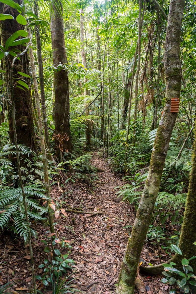
The start is the worst part of the walk, a tough hot climb up a vehicle track to a hill at 273 mr elevation. I decide I am going to plod today, conserve myself (yes, all you doubters there, I do walk slow). The others power on, racing up to top of the hill, leaving me behind. It was a fast 30 minute climb. At the comms towers, now I must lead apparently, as we go onto bush track. I was hoping someone would clear the cobwebs for me. The climb is less strenuous now, and we enter the rainforest. Soon after we are at the magnificent strangler fig tree, and the buttress trees. Mist swirls around the tree tops, and sunlight rays streak through the canopy, a moist pre-historic look in the rainforest, awesome. New fungi abounds (120 mm rain in the last 24 hrs). We steadily climb through the rainforest. There is a loud roaring grunting noise, a large pig is nearby, and crosses our path 15 mr ahead. Then, from the right, another pig is running at us, straight to Paul, and gets within about 2 or 3 meters, when Paul flaps his arms and makes noise, the pig seems startled and realises we are in the way and rapidly changes direction. A few minutes more, from the bush there is another very loud roar, another large pig nearby, we hear it charging through the bush, away from us.
We keep climbing, making good time. Joy wants to know about morning tea stop, I say at a tree. After a while “Where is this tree” she asks –“ahead” I say. We cut our way through a patch of wait-a-while, then traverse a fallen tree. We leave the rainforest, pushing up the hill. We go through lunch rock, which I thought was strange, so early to be here, but keep going. I kinda expected to meet the downhillers about here, but we are way early to this spot ! Keep going, another question about morning tea. But I knew I had missed that ‘tree’ – oops. After a while, I figured time for a break, so , we had a break. We were making good time. Back into rainforest, we start downhill - and more downhill – hmhmhm strange. Don’t remember this much. Only downhill I expect is at the saddle near the top, but we can’t be near that, no way. But, looking at the ridge line above, that is Gard’s Lookout up there not far away, and this is the saddle. But can’t be, we would have seen the downhillers before this ? Well, it was the saddle. Start the climb out of the saddle, to the waterpoint junction, I am astounded we are here so early. We hear voices – having a bludge at the waterpoint, a nice small cascade, are the downhillers, morning tea break for them. They are astounded to see us here this early! Quick chat, swap car keys, feed the leeches. And we discover the downhillers cheated by not walking from the dam, they drove part way in – but we were not complaining, as that would be to our benefit. We part ways, as we continue up – I am thinking geez, what do we do for the rest of the day ? A short climb and we finish the Bambaroo Track. A nice downhill walk to Shay’s Clearing, then to Diorote Falls reaching that at 1205 for lunch (about two hours ahead of my expectation). A nice lunch break at a great location. However, after one hour someone was getting restless, so reluctantly we had to depart. It was now a race, who would be first to the ice creams – downhillers, or uphillers. 45 minute walk to junction of Shay’s Track and Mt Spec track, 1:45 pm, we find a great sight, the troopie. Then simple matter of drive down the range, to the ice cream shop, reaching there at 3:05 pm - to the astoundment (again) of the downhillers who had not long been there. If we had a shorter lunch stop, we would have beaten them ! So, that was the Bambaroo Express. A great day, and the uphill walk was not that hard after all. And really, we were slowish, I thought ............


