Porcupine Gorge
Porcupine Gorge trip, Anzac Day 1976: a remote North Queensland adventure near Hughenden with sandstone cliffs, deep permanent pools, and the striking Pyramid rock. Basecamp fishing, upstream and downstream walks, and stunning gorge scenery made this a classic multi-day bushwalking destination.
Anzac Day Weekend
24 - 26th April, 1976
Participants: Rob Gregory, Deb Edwards, Mark Paterson, Lynne Murray, Grahame Wells, Lily Marcellos
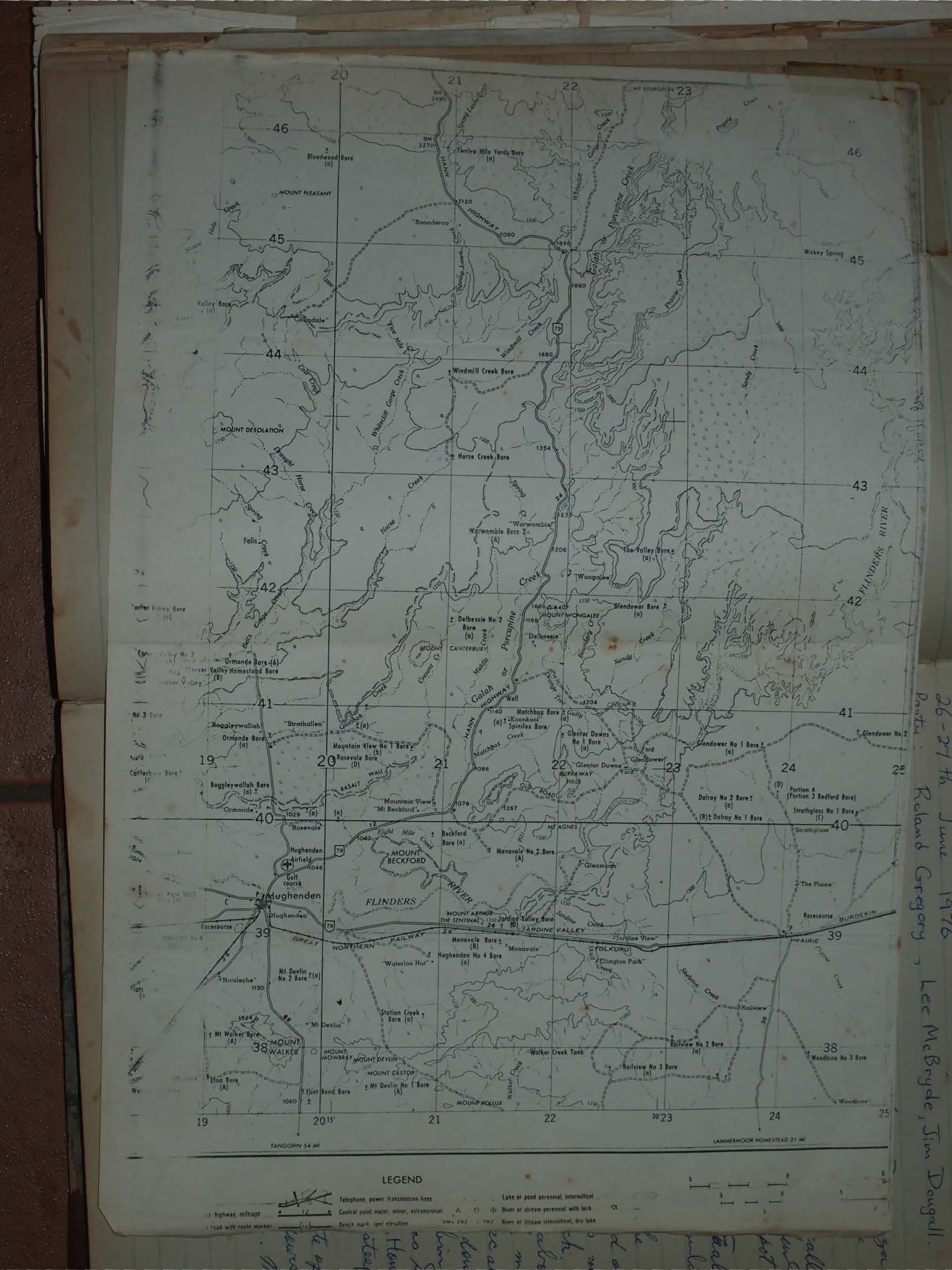
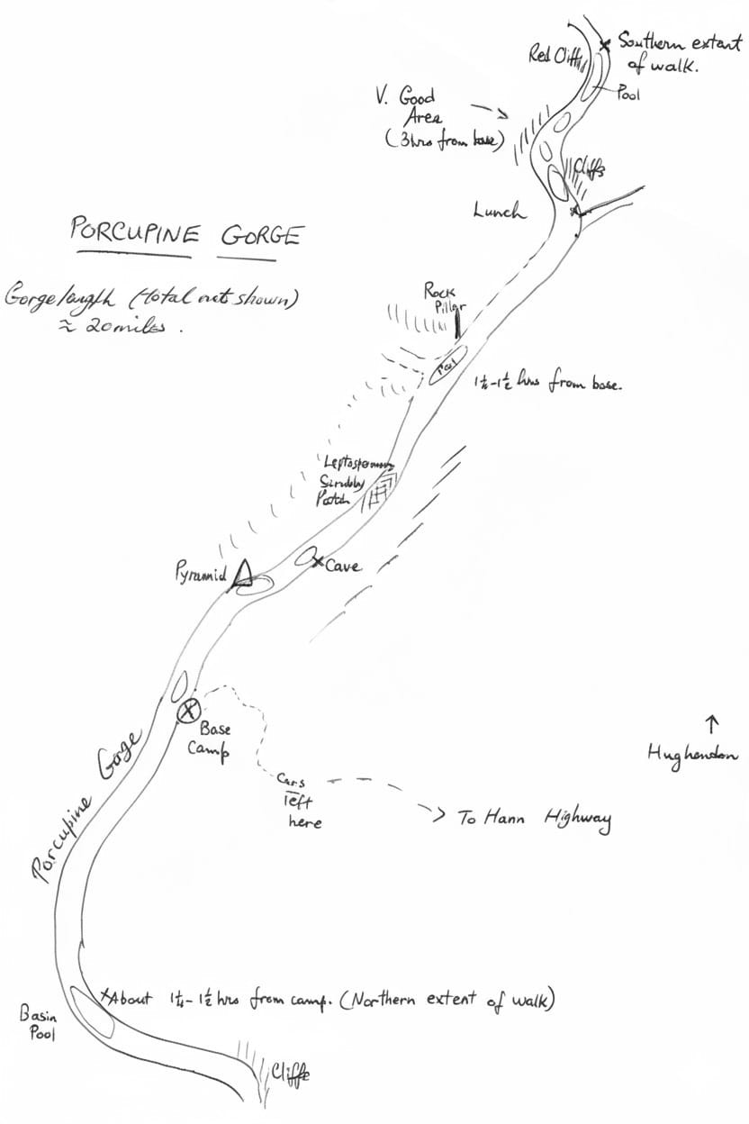
Map: Hughenden 1:250,000.
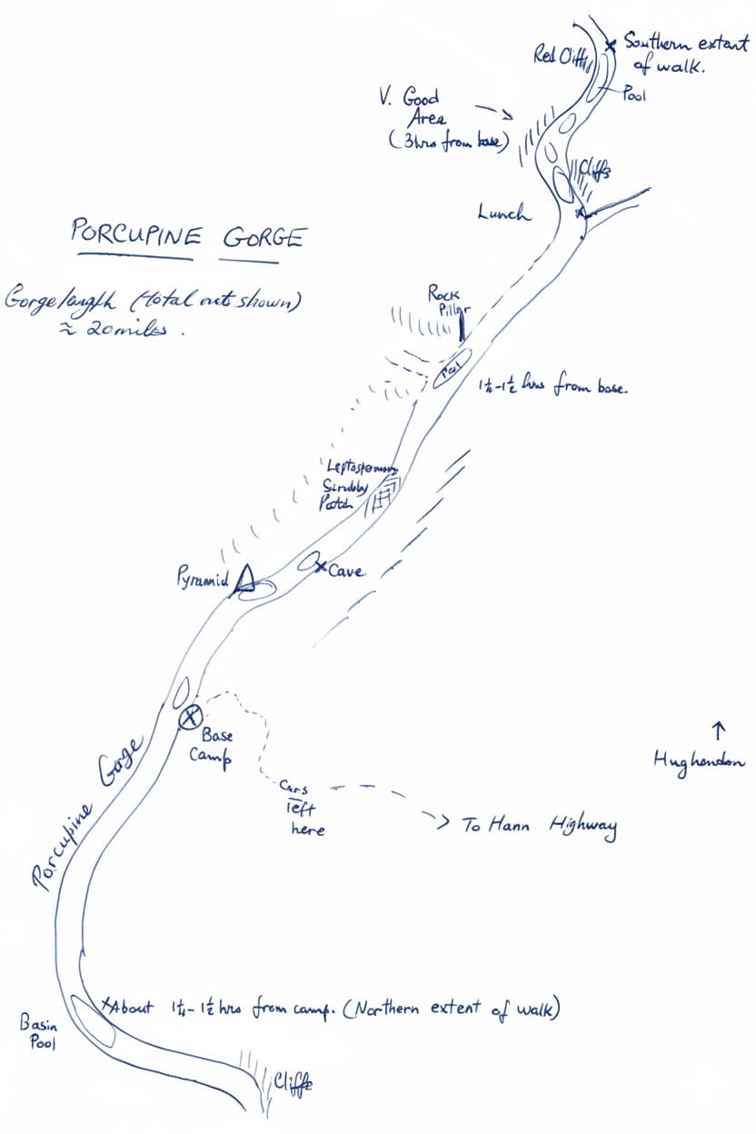
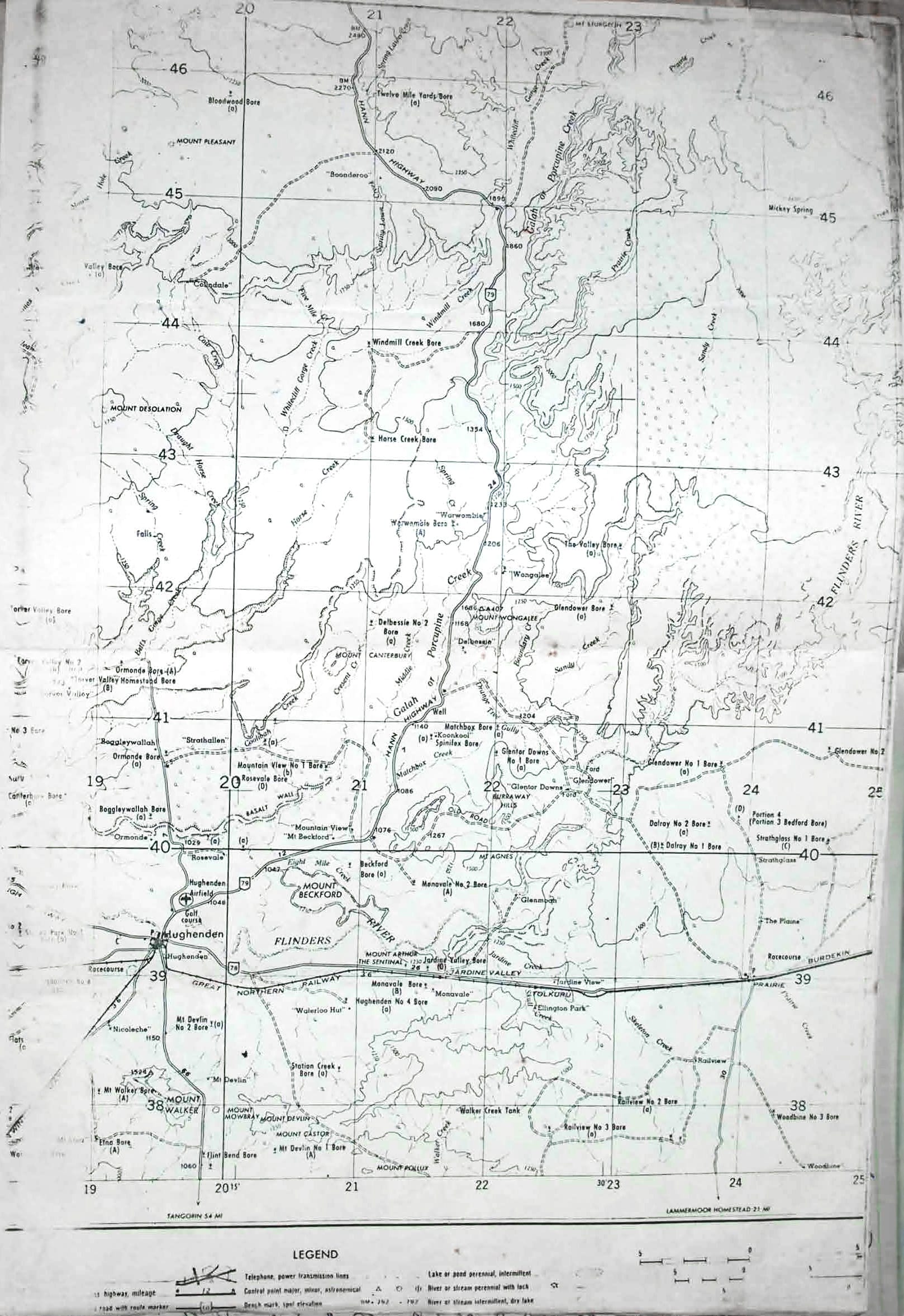
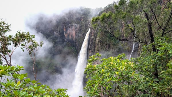
Left Townsville 6.30 am, Sat, and arrived at the Gorge in mid-afternoon after almost three hundred miles of driving. From Hughenden, the Hann Highway is followed until after about 40 miles a sign to Porcupine Gorge is sighted - this leads in to a steep section of the gorge where access may be difficult. Several miles further up the highway, another sign to Porcupine Gorge is placed. Turned off here & after three miles, another right turn led after 1 1/2 miles to the Gorge. The view is spectacular - gorge about 200ft deep or deeper; at this point, walls were gradual allowing easy access down cattle tracks.
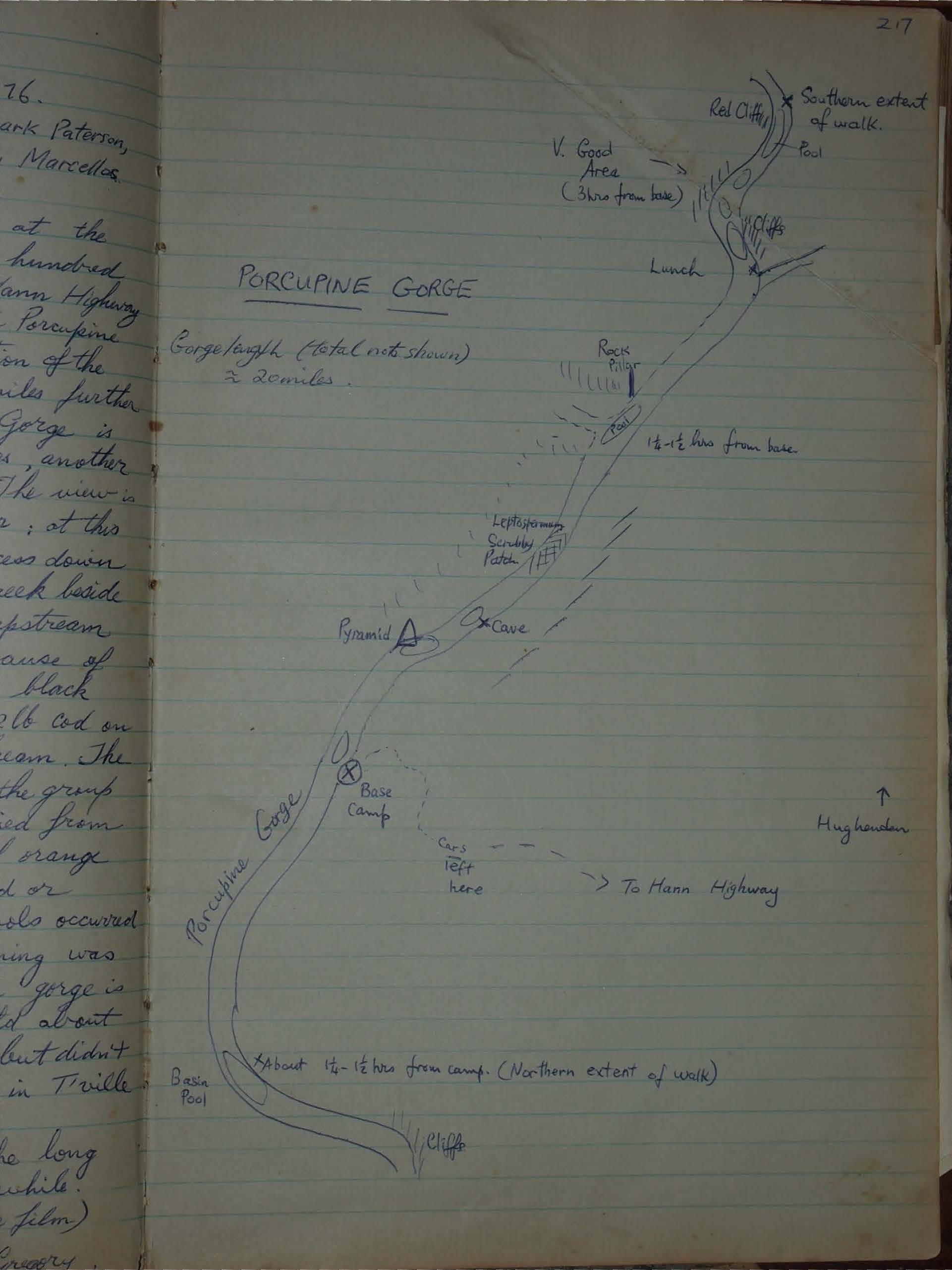
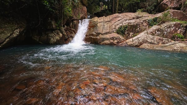
Base camp established on the creek beside a beautiful deep long pool, about 1/2 mile upstream from a rock wall called The Pyramid because of its shape. All pools seemed well stocked with black bream & the pool at base camp yielded a 1-2lb cod on a set line as well as 2 tortoises & black bream. The latter were hard to catch!
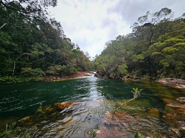
On Sunday, the group walked downstream - the gorge walls varied from gradual slopes to vertical sandstone cliffs of orange brown & yellow. Walking was easy on sand or sandstone & numerous beautiful tree-lined pools occurred. Water in the creek is permanent.
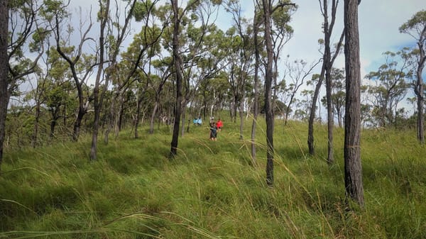
Monday morning was spent walking upstream from basecamp. The gorge is ideally suited to a throughwalk. We were told about a patch of banana trees further upstream but didn't have time to reach them. Arrived back in T'ville at about 10 p.m.
An excellent area for a 3-4 day walk; the long drive out there makes any shorter trip unworthwhile.