Shays' House - Mt Spec
In October 1965, Townsville Bushwalking Club explored Shays’ House at Mt Spec after fire destroyed the old homestead. The weekend trek included rainforest walks, Waterfall Creek’s trout pool, and Witts Lookout views, uncovering lost pioneer tracks in Paluma’s rugged mountain landscape.
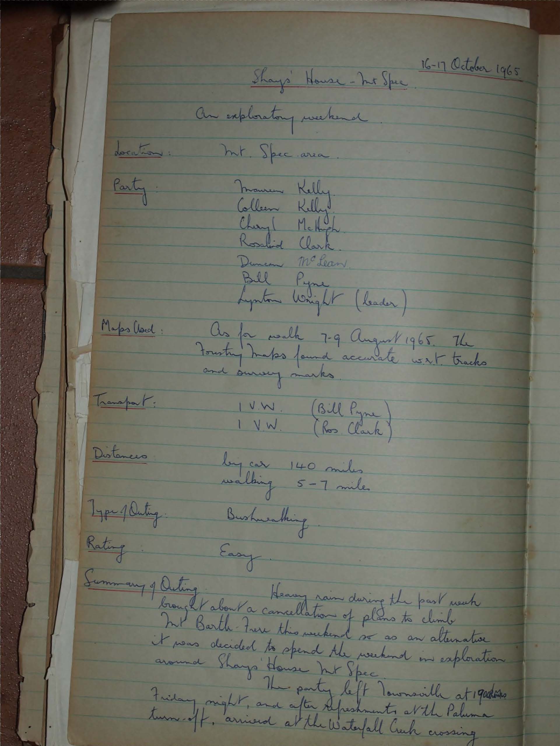
16-17 October 1965
An exploratory weekend.
Location:
Mt. Spec area.
Party:
Maureen Kelly
Colleen Kelly
Cheryl McHugh
Rosalind Clark
Duncan McLean
Bill Pyne
Lynton Wright (leader)
Maps Used:
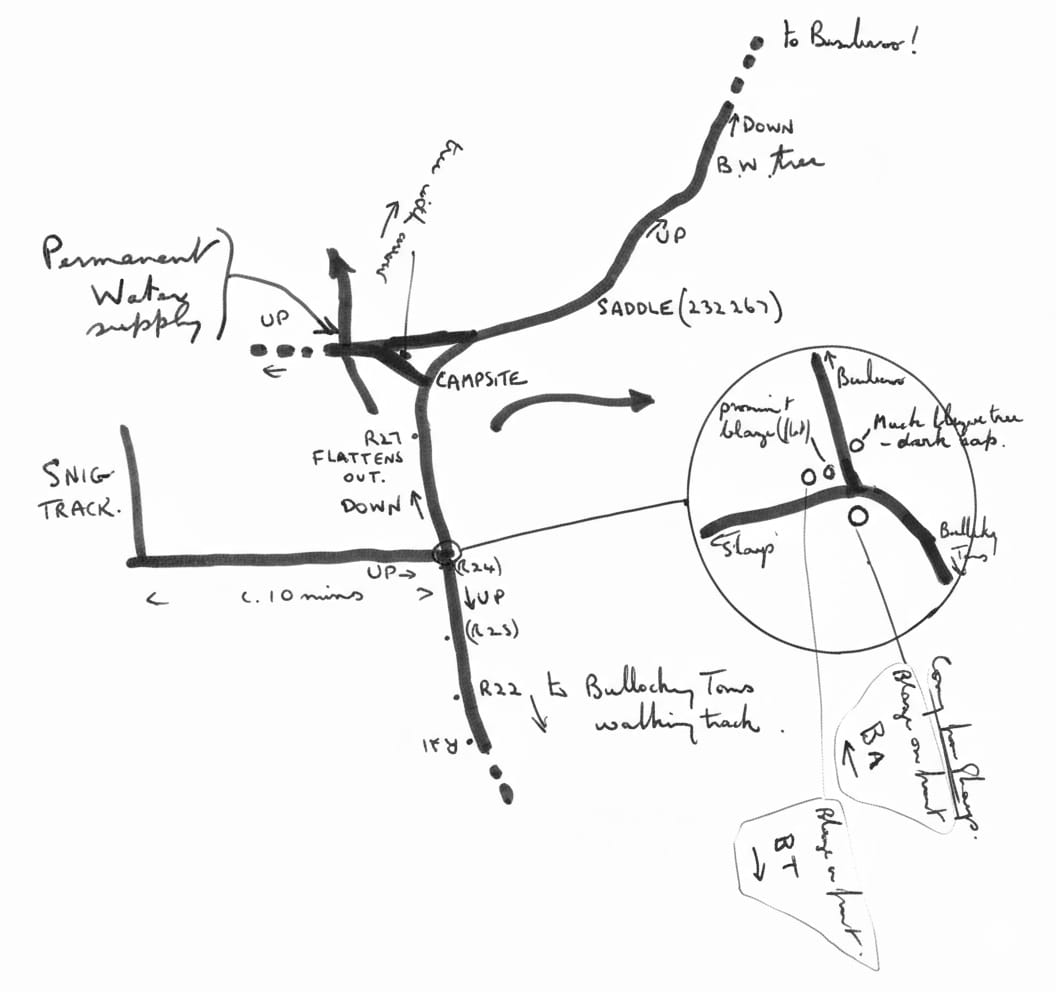
As for walk 7-9 August 1965. The Forestry maps found accurate w.r.t tracks and survey marks.
Transport:
1 V.W. (Bill Pyne)
1 V.W. (Ros Clark)
Distances:
by car 140 miles
walking 5-7 miles
Type of Outing:
Bushwalking
Rating:
Easy
Summary of Outing:
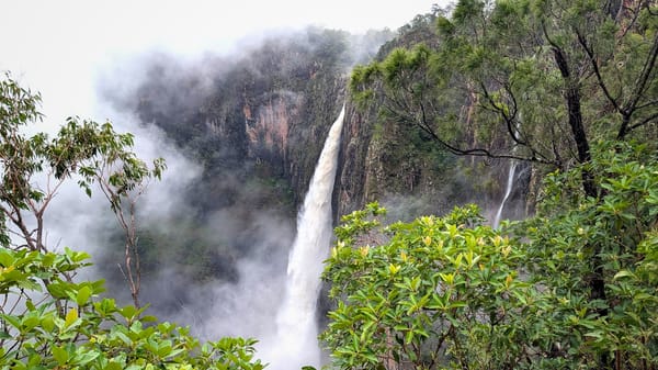
Heavy rain during the past week brought about a cancellation of plans to climb Mt Barth Frere this weekend so as an alternative it was decided to spend the weekend on exploration around Shays' House Mt Spec.
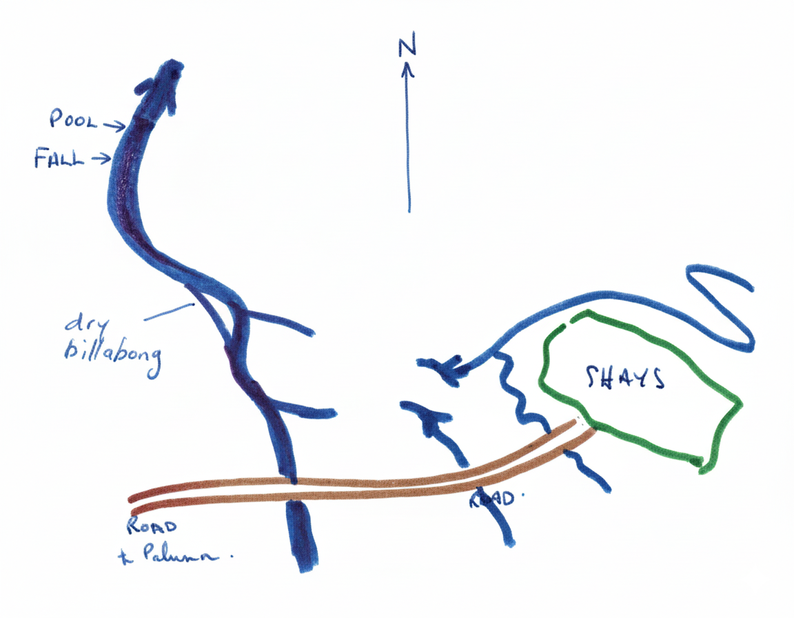
The party left Townsville at 1after refreshments at the Paluma turn-off, arrived at the Waterfall Creek crossing at about 2200 hours. The party was shocked as it hurried up the hill to find that Shays' House was a mere tangled heap of twisted iron, and that a bushfire which had burnt the clearing had razed the house to the ground. This had happened in the two months since walkers had visited Shays previously.
A base camp was established and exploration radiated from the camp.
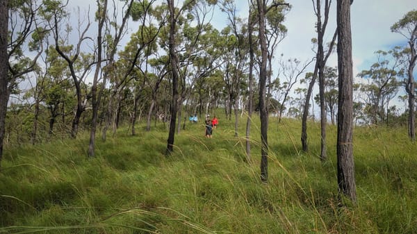
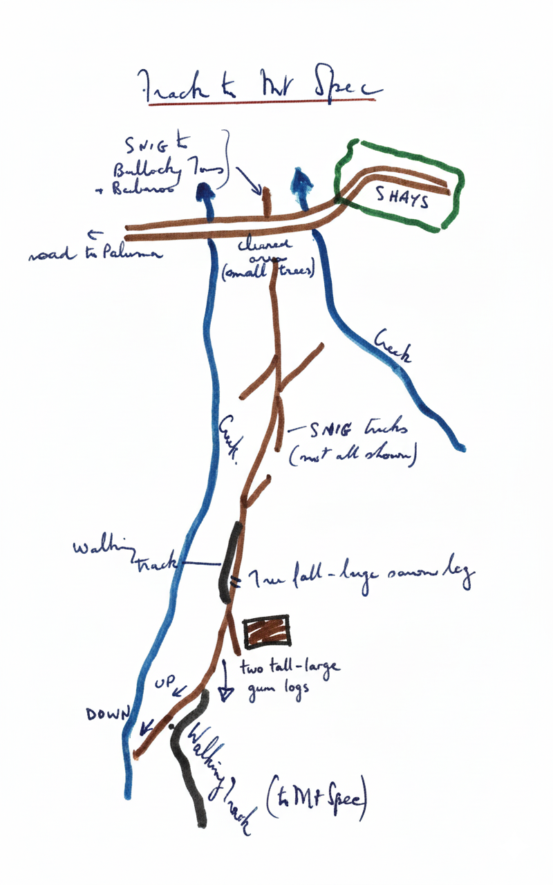
After a wet night the party set out Saturday morning in the rain to locate Bomberos track. This was achieved with the aid of Duncan's knowledge of surveying and after lunch back at camp, during which the sun shone brightly a search of the rainforest behind Shays' located the walking track to Mt Spec.
The weather held, to enable walkers to use their song books around the campfire.
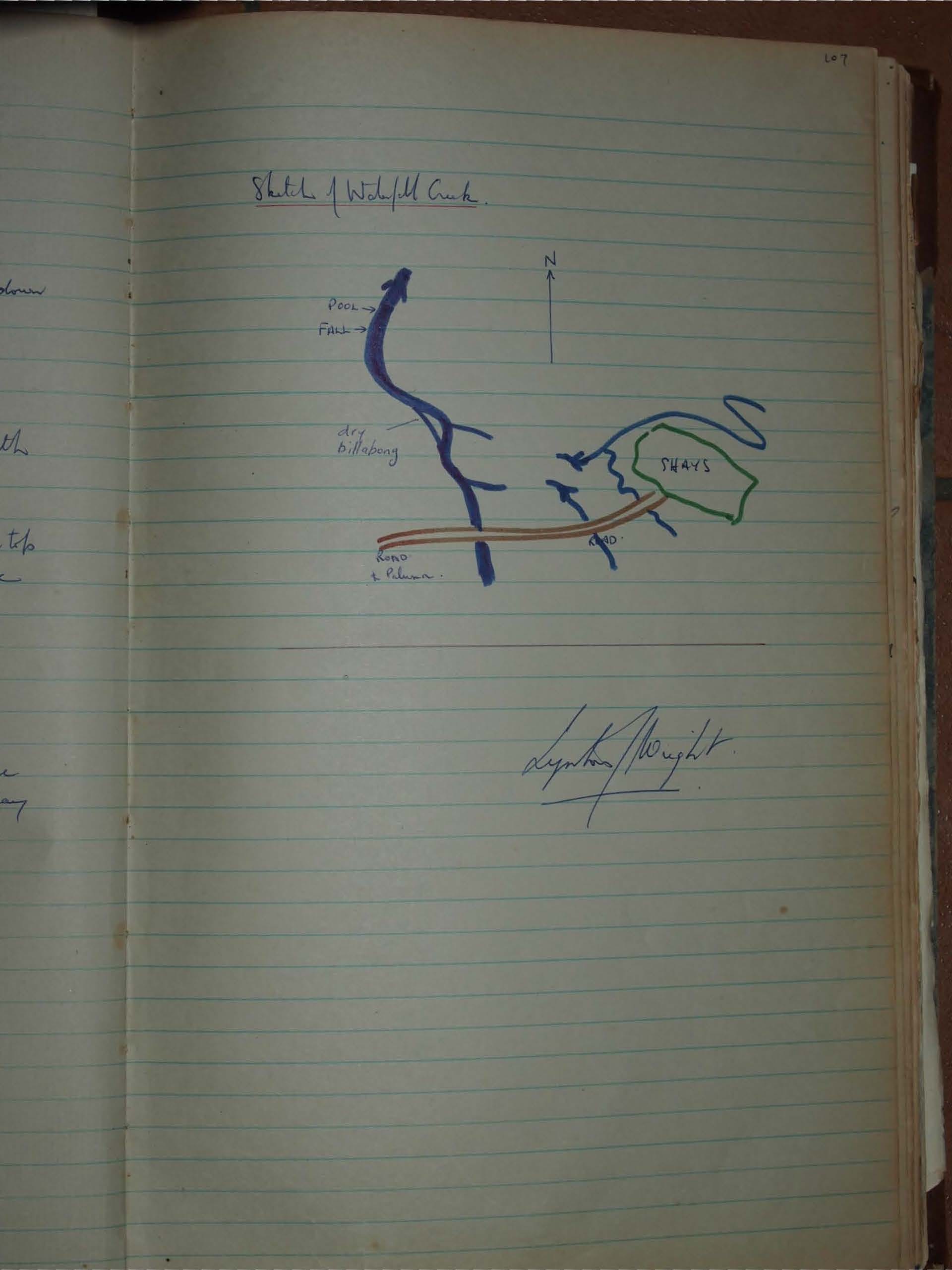
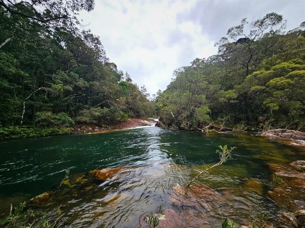
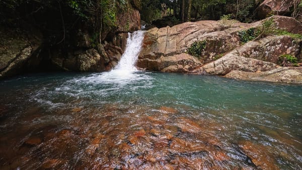
After early morning showers, walkers packed up and walked back to the cars, leaving packs at the cars, walkers followed Waterfall Creek down to the "trout-pool", passing a rather large carpet snake, which had eaten an even larger breakfast, sunning itself on a rock.
The party then drove around to Mt Spec, and walked the last 3/4 mile from a tree fall at about (197 248) [Map reference Mt Spec 8160 III, RASC 1964]
A walking track was followed from the mountain top, running east but lunch was calling loud and clear so the party returned to a creek bank near the cars for lunch.
Incidentally, Mt Spec is covered in rainforest and the Martins top at (217 243) can be distinguished by a small clearing with many names carved in the surrounding trees.
On the return to Townsville, walkers stopped at Witts Lookout to survey the area. Returned to Townsville 1830 hrs Sunday.
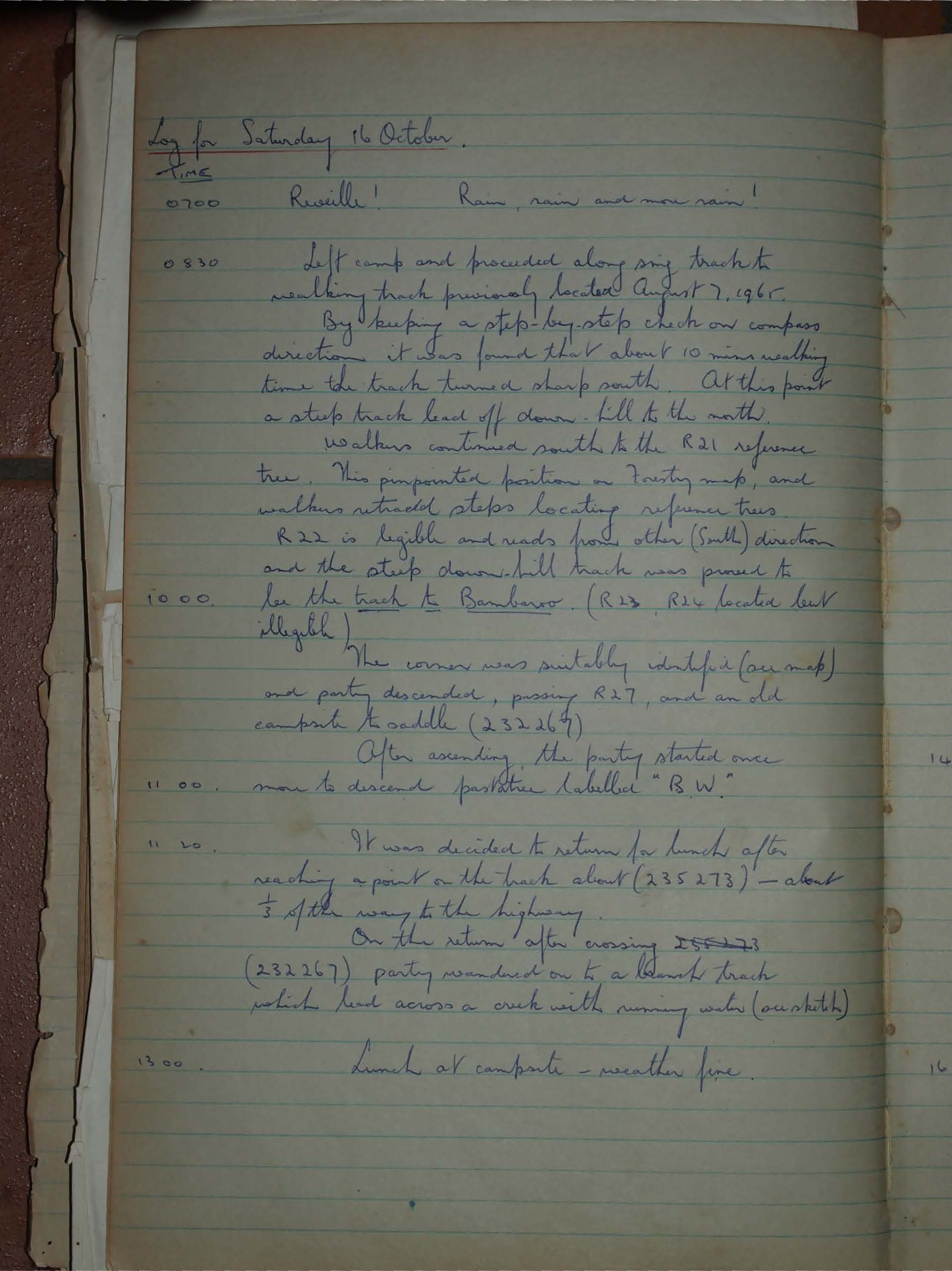
Log for Saturday 16 October.
TIME
0700 Reveille! Rain, rain and more rain!
0830 Left camp and proceeded along my track to walking track previously located August 7, 1965.
By keeping a step-by-step check on compass direction it was found that about 10 mins walking time the track turned sharp south. At this point a steep track lead off down-hill to the north.
Walkers continued south to the R21 reference tree. This pinpointed position on forestry map, and walkers retraced steps locating reference trees.
R22 is legible and reads from other (South) direction and the steep down-hill track was proved to be the track to Bambaroo. (R23, R24 located but illegible).
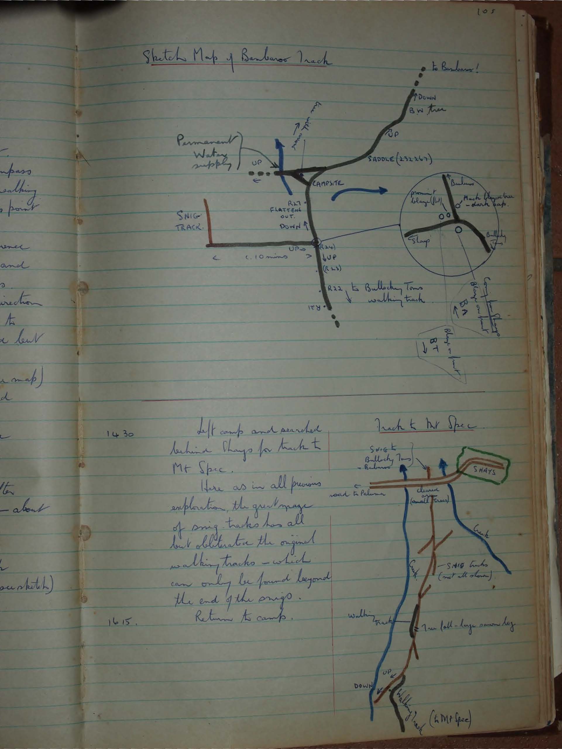
1000 The corner was suitably identified (on map) and party descended, passing R27, and an old campsite to saddle (232264)
1100 After ascending, the party started once more to descend pasture labelled "B.W".
1120 It was decided to return for lunch after reaching a point on the track about (235273) - about 1/3 of the way to the highway.
On the return after crossing 255273 (232267) party wandered on to a branch track which led across a creek with running water (on sketch).
1300 Lunch at campsite - weather fine.
Left camp and searched behind Shays for track to Mt Spec.
Here as in all previous exploration, the great maze of snig tracks has all but obliterate the original walking tracks - which can only be found beyond the end of the snigs.
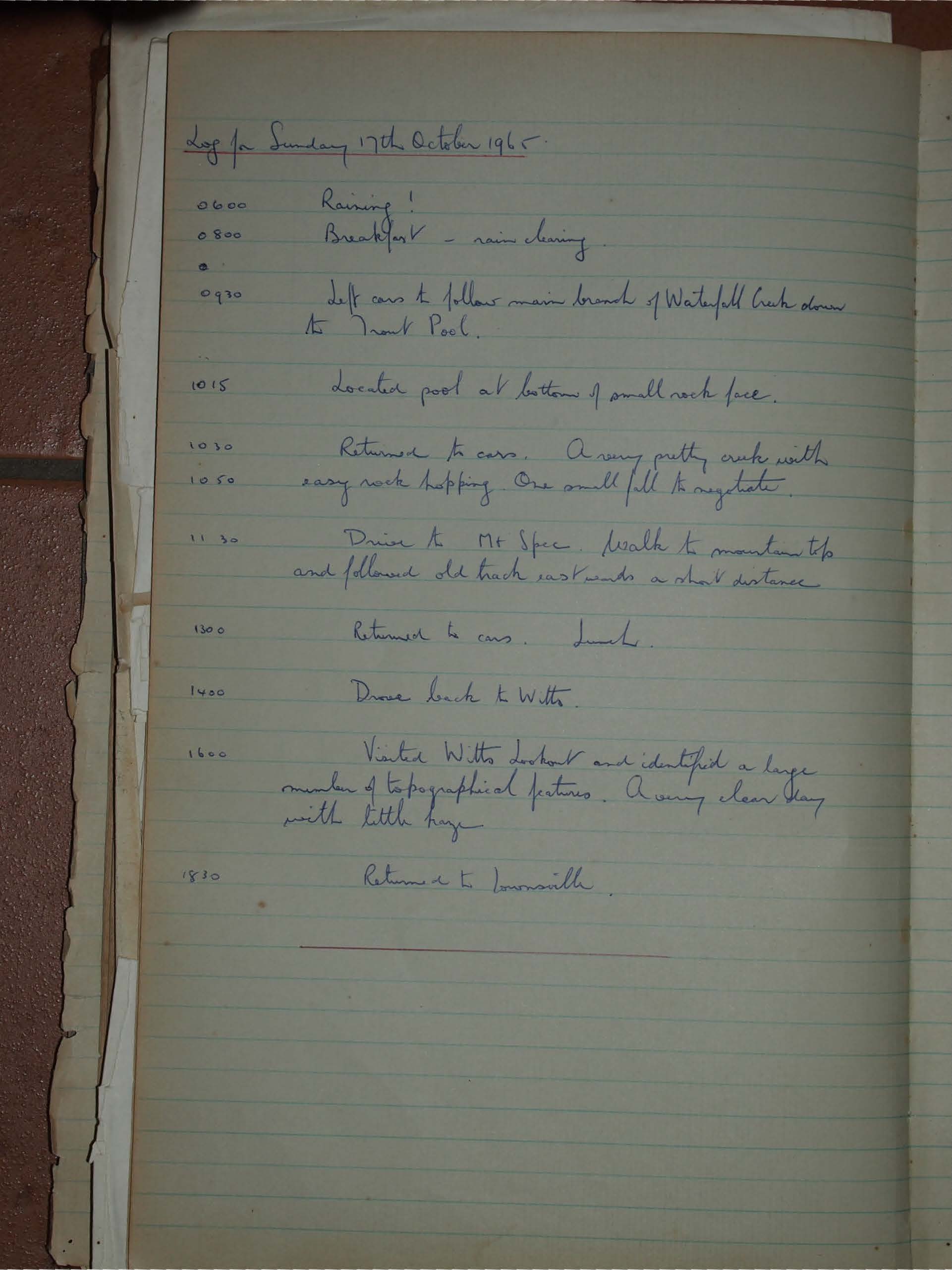
Log for Sunday 17th October 1965.
0600 Raining!
0800 Breakfast - rain clearing
0930 Left cars to follow main branch of Waterfall Creek down to Trout Pool.
1015 Located pool at bottom of small rock face.
1030 Returned to cars. A very pretty creek with
1050 easy rock hopping. One small fall to negotiate.
1130 Drive to Mt Spec. Walk to mountain top and followed old track eastwards a short distance.
1300 Returned to cars. Lunch.
1400 Drove back to Witts.
1600 Visited Witts lookout and identified a large number of topographical features. A very clear day with little haze.
1830 Returned to Townsville.
Lynton K Wright.