Walks Report April 2022
Townsville Bushwalking Club April 2022 trip report: Hermit Falls (Hidden Valley) waterfall walk, Puzzle Creek canyon classic, White Mountains eastern sandstone exploration, and a rapid Tasmania hiking tour—Freycinet, Walls of Jerusalem, Cradle & Frenchman’s Cap.
In this edition of recent adventures – Hermit Falls, Puzzle Creek, White Mountains eastern, and a Tassie Express tour.
Hermit Falls
Hermit Falls is located in Hidden Valley on Benham’s Creek. Parked at Running River pool, quick chat with Hidden Valley station owner ‘what are you doing?’. Walk along the road until the point where we go cross country, then through scrub down to Benham’s Creek. Then a nice rockhop up the creek to the waterfall. Good waterflow, surprising given lack of rain this year so far. After enjoying the waterfall, we proceed upstream for 1.5 hr to lunch spot at a nice creek area. Then after a relaxing lunch and swim, cross country to the road, then back to the cars. A nice swim at Running River pool, that was an enjoyable easy bushwalk to a great waterfall.
Puzzle Creek
Puzzle Creek is a club classic walk location in the Hidden Valley area. We used to do this a 2 day adventure, but in recent years have come up with a one day route. This walk is the one day version.
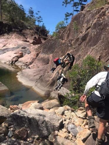
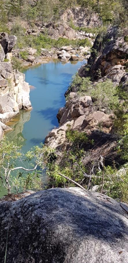
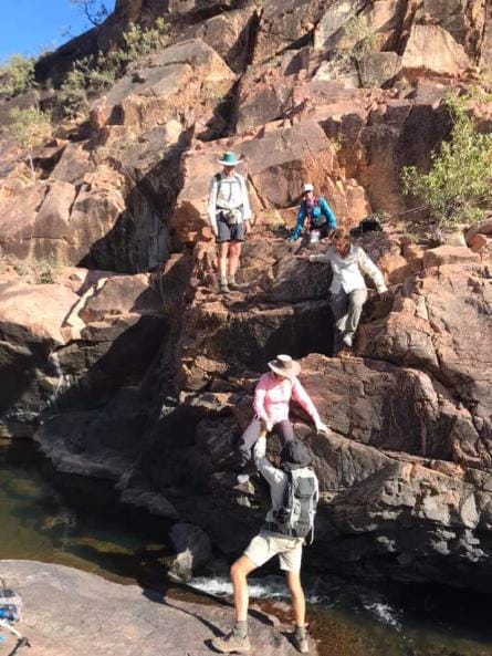
Six keen walkers set off from Paluma at 7am for the drive in via Sunset gap to the gate off the powerline track. There was some disappointment when we got to the upper falls to find that there was no water running over the falls, the rock face just had a trace of wet rock, where normally at this time of year there should be water gushing over the rock face. Everybody was brave and climbed down the waterfall rock face, no 'woozy' detour around the falls through the scrub. With these low water levels the rock hopping down the creek bed was easy, no struggle to keep our boots dry this time. Through cable gorge we continued on to 'the honeymoon suite' for a well deserved lunch break, including a refreshing swim in the deep slot canyon. After a scramble down beside the main falls, we continued past the junction with Thunderbolt creek to arrive at Peter's gate for a rest in the shade of the rock wall that forms Peter's gate. After the usual scramble up and down the bread knife we had an easy jump across Running river, it's only just living up to it's name, then climbing out of the gorge to see the long awaited sight of a white troopy to take us back to the starting point to pick up the other two vehicles. Weather conditions were perfect, not a cloud in the sky all day, which meant that it did get fairly warm in the middle of the day. Let's hope we get some decent rain later this week to put some water back into the western creeks.
Note that Puzzle Creek is on private properties and requires permission to enter the respective properties.
White Mountains eastern section
We usually go to White Mountains western area, an awesome sandstone landscape of sandstone walls, caves, ravines and canyons, a bushwalkers delight. But that trip requires a long drive, and really needs more than 4 days to give it justice. Last time we did 7 days which was fantastic.
I have been looking at the eastern section near Pentland (Poison Valley) for a shorter drive that makes a 3 day trip viable. A quick recce last year demonstrated this was feasible. So, off we go for a 3 day exploratory on the Anzac weekend. Weather forecast wasn’t great, but, hey, never rains out west does it !
Saturday - Driving in on the track, there are some waterholes on the track – hmhmhm. Drive to the national park campground for a quick look, then driving out of there up a slope was slippery. Will be fun after a few cars chew this up, but we are camping elsewhere, remote and by ourselves. We drive to the start of our first walk, Cann Creek Canyon.
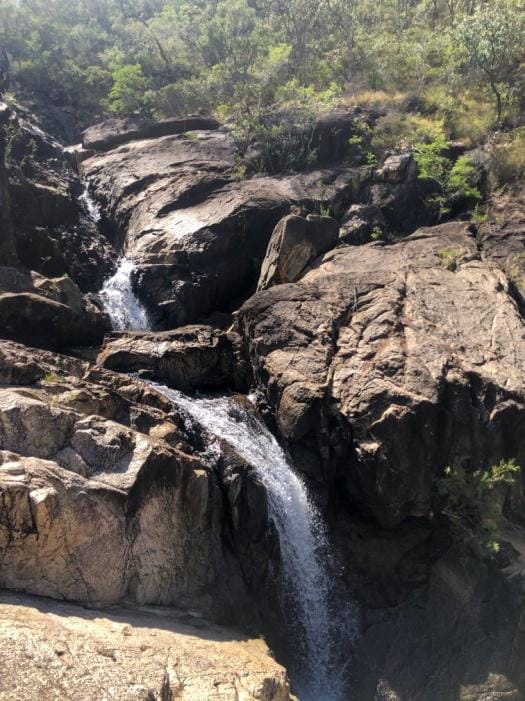
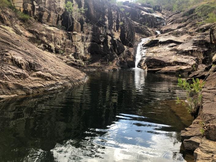
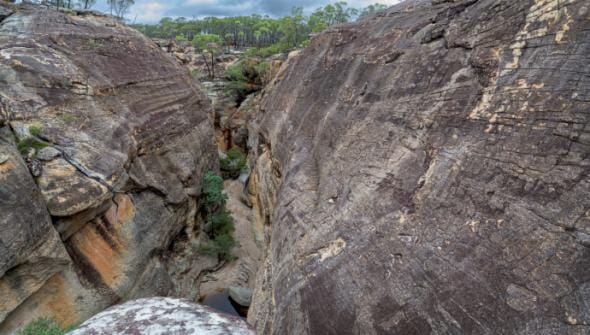
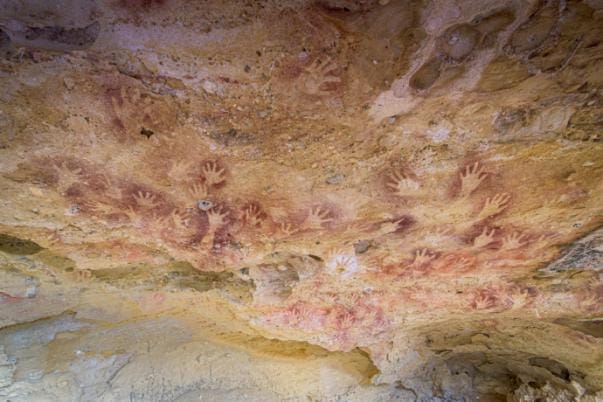
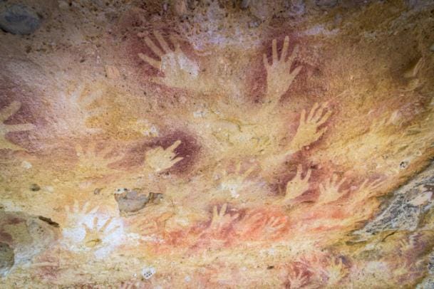
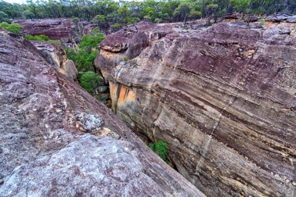
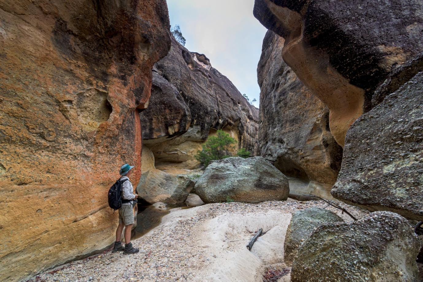
Walk down the canyon access track, 800 metres to the canyon. We then spend several hours and walk 6.5 km exploring this amazing canyon, both inside it and above. White Mountains is sandstone country, and some amazing canyon and rock formations can be found. Initially we clambered down into the canyon and walked upstream. Then we turned around, clambered out to walk along the escarpment top. At one side gully, spotted two owls. I was looking for a gully that would be above an interesting bowl feature that I saw in the creek. We found that, and also found a feature we called Red Hands Cave. Going downstream the sandstone changed to reddish and rough fragile stone outcrops. We clambered down into the creek, on crumbly sharp rock that was challenging to get a
secure foothold that wouldn’t collapse underfoot. Proceeded further downstream, the canyon rock type down here was different to the main canyon. We turned around and went back to main canyon to explore inside it, and amazing sight and interesting sandstone features. This is a superb creek to explore.
Then it was the drive to our campground. Now, Dyso needs to be banned from selecting campsites – chooses views over comfort and suitability for tents (frequent occurrence)! So we arrive at Sunset View, the highest point on the ridge and the area. Nice views over sandstone plateau with ravines dividing the landscape. But – how do you get tent pegs into sandstone ? uh oh ! And there were almost no rocks around to use to secure tents, and the few that where, crumbled when you picked them up. And the sunset view – well, on a clear day would be nice, but today was overcast and gloomy. And then the rain and strong wind started – being on the highest point and exposed to the wind, will the tents survive ? Light rain until 1130 pm, then wind blowing the tent all night with a fine drizzle falling.
Sunday - At 630 am, that fine drizzle continued. A miserable wet windy morning. Plan today was a 15-20km bushwalk explore along sandstone ravines down Sunset View. But we decided the conditions were unsuitable, and concerned about the road conditions deteriorating. So we decided to withdraw, and try Mondays planned walk in Sawpit Gorge today, as that is closer to the highway. Now, in the freezer I had ice creams to celebrate a great days exploring – but no rewards if we don’t do the planned Sunday walk !
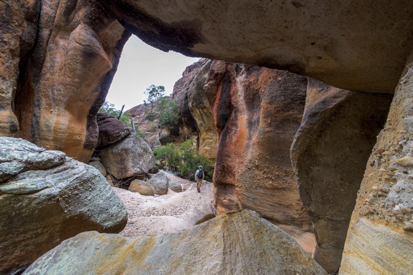
We drive back to Sawpit Gorge Lookout. The roads were slippery in one or two spots, but no problem. At Sawpit Gorge the weather improved, still overcast but not gloomy. We set off for a short explore, amongst amazing sandstone features. You have to be careful as the sandstone is fragile and the overhangs are very thin – be careful where you step and trust nothing! After an interesting explore, we went back to the cars, then drove back to the highway for the drive home a day early.
This area is good for future trips on 3 day weekends, and can even do a good 2 day weekend trip. About 3.5 hours from Townsville. Plenty of good areas to explore, and we have more ideas for the future. Exploration is in our club DNA !
Now – I have 6 ice creams to enjoy at home all by myself !
Tassie Express tour
Four club members embarked on a bushwalking trip in Tasmania. Plan was very full with no time for a rest - Cape Raoul, Mt Amos, Freycinet Circuit, Walls of Jerusalem circuit, Cradle Summit, and
Frenchman’s Cap Track. And if the weather is no good at any part, then plan for distilleries and food.
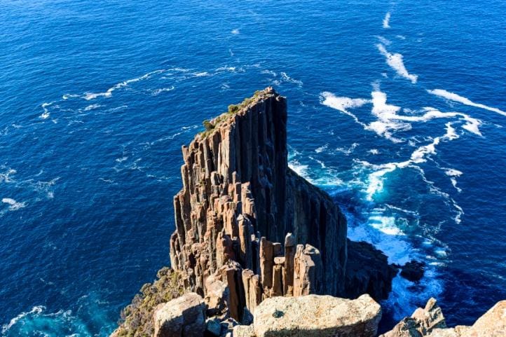
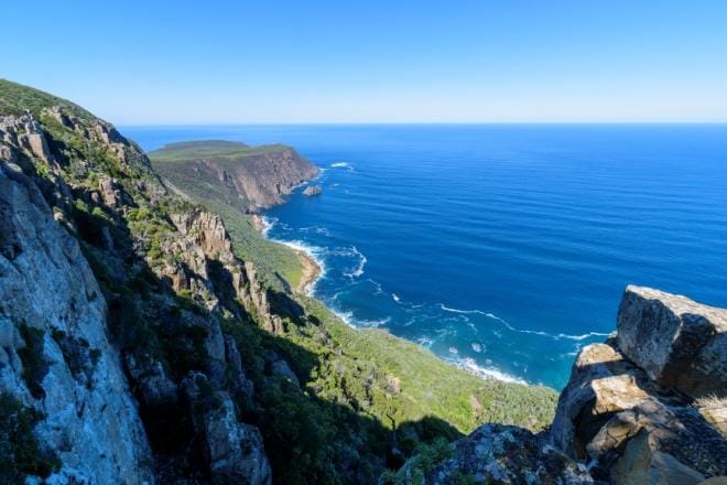
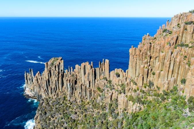
Sunday - First up was a day walk to Cape Rauol, part of the Three Capes. A lovely sunny day with no wind, perfect conditions for the 15 km cape walk. Superb coastal views, magnificent cliffs, and the rock formations at the cape are amazing. That evening nice sunset views at White Beach from our accommodation.
Monday - Drive up to Freycinet. Stop at Spiky Bridge, and pick wild blackberries. Arrive Coles Bay, start climb up Mt Amos. Overcast and gloomy, but should be ok ? But ¾ up, just at start of the very steep smooth granite slope, it starts to rain. The granite is now slippery, so we have to retreat.
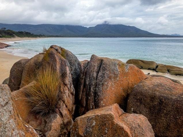
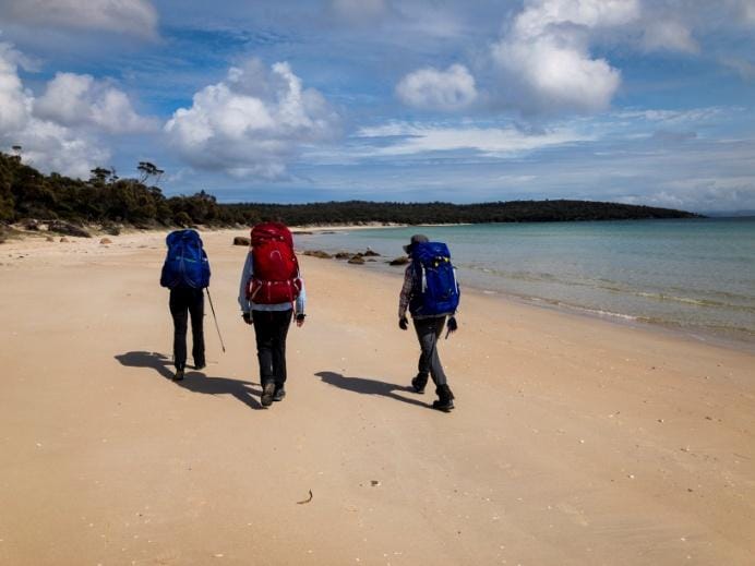
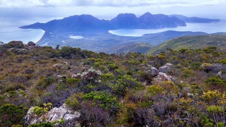
Freycinet Circuit - Tuesday we start the three day 30 km Freycinet Circuit. We go anti-clockwise, around the Hazards headland onto Hazards Beach. Continue along to Cooks Beach to campsite. The beaches are very nice. Ahead the Freycinet range looms above, we have to cross that tomorrow, a steep hard traverse. At Cooks Beach a large (1.5 meter long) glutinous blob with some skeletal spines is found on the rocks. Touch it, it wobbles, and is very smelly YUK. Very weird. Our chief researcher, who also found the blob, does some sleuthing and identify it as a sunfish remains - they are considered the largest bony fish in the world — weighing up to 2,500 kilograms and growing to three metres in length.
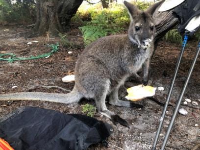
Wednesday is the 11 km traverse of the range – highest point of the track is 550 mr. A steady climb up the range. At side trip is to Mt Freycinet summit, highest point of the range 680 mr. Back on the main track, a rough steep track with water flowing down it, over Mt Graham, then all downhill for several hours. Arrive Indigo Creek at the end of Wineglass Bay and campsite. A wallaby decides that my porridge for tomorrow would be better for its dinner now than my breakfast. Wineglass Bay in the postcards is beautiful – today, it was ugly. Strong wind, overcast and gloomy, the beach was full of smelly seaweed and blue bottles. During the night there was a commotion, yells and screams, I just rolled over and went back to sleep – it must be a dream! Next morning – ‘why didn’t you come and see what was happening?’ I am asked by three unimpressed females. Apparently the possums attacked during the night, and ate holes in one tent and a bag.

We hike along the smelly ugly Wineglass Bay beach, to reach the 1,000 steps climb out of the bay. Near the saddle it starts to rain. Down at the car, rapid clothes change and repack car. Quick stop at the cafe, then the 3.5 hour drive to Deloraine. At Deloraine, we stop at Red Brick Road gin distillery!
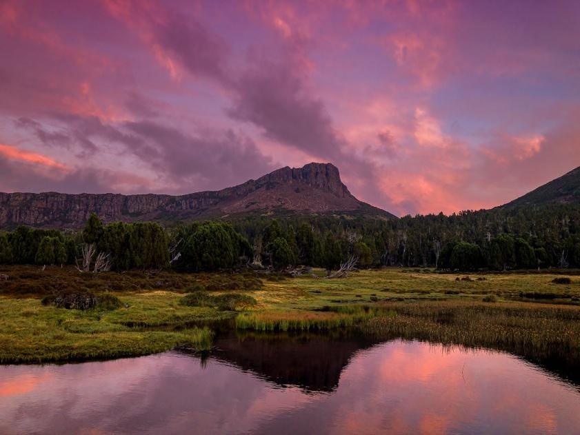
Friday, start the Walls of Jerusalem 30 km circuit walk. 600 mr climb up the range to the walls area. Lovely sunny day. Reach the main wall, hike along the track admiring the magnificent scenery. Stop at Pool Of Bethesda for the obligatory photos and a chat with the ranger. Then onto to campsite at Dixons Kingdom and base camp for two nights – that was a nice 10 km hike today. Saturday was the big day. Start with morning hike up Mt Jerusalem for great views of the lakes. Back to camp for
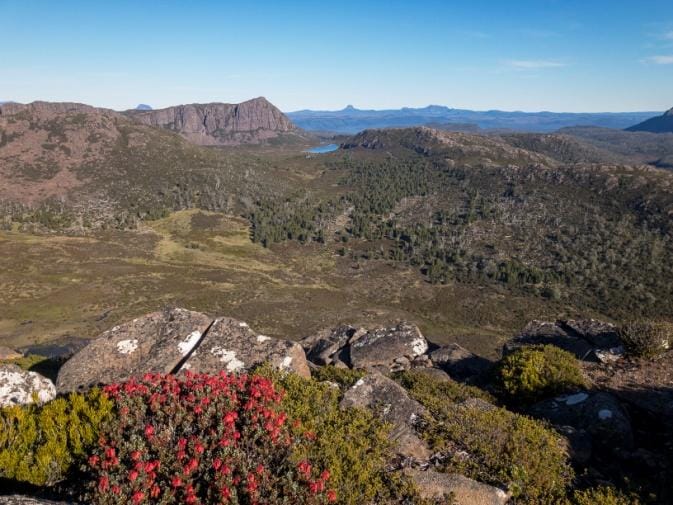
lunch, then the big walk, up the main wall to Solomon’s Throne then along the top scrambling to King David’s Peak, highlights of the walk. To the west can see Cradle Mountain, Barn Bluff, Mt Ossa and other features of the Overland Track.
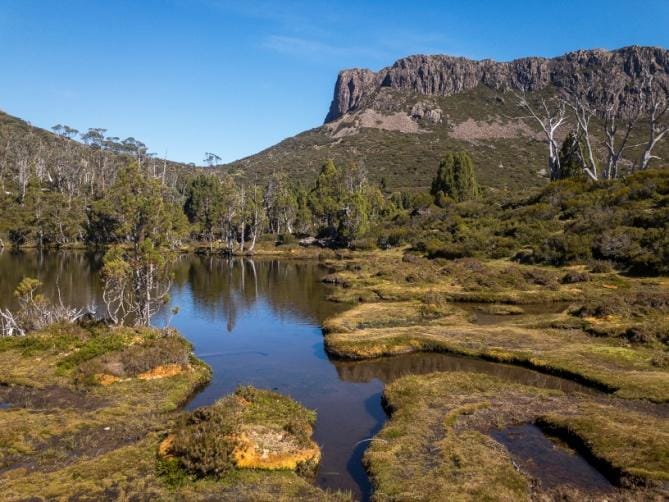
This walk was planned as a 4 day circuit, but there was much enthusiasm to achieve Cradle Mountain summit, and the forecast was deteriorating for the planned day. So we cut this walk back to 2.5 days, and left early without completing the circuit to bring forward the Cradle summit walk a day.
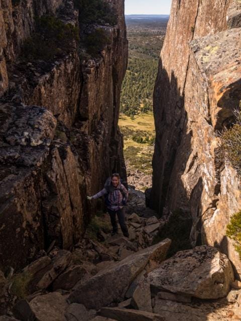
Monday, we start the 18 km Cradle summit walk, another 600 mr elevation climb. Overcast, gloomy and windy conditions. We go via Wombat Pool and Marion’s Lookout, a steep sweaty walk. Get to the base of the summit, it is covered in cloud. There is stream of people going up the track. We start up the summit track, steadily climbing. We meet many people coming down, all saying they couldn’t make it as very slippery up top. Only one group of three young dudes claimed to have made it, but slippery, no view, and dicey in parts. We push on upwards, then enter the cloud, and wet rocks.
Keep going little bit, to start of the very steep bouldery part just below the spires. It was wet and looked slippery. We had a break and watched others coming down. Then we decided the rocks were too wet and risky in the next part, nobody else was making it all the way, so we turned back. We made this a circuit walk by walking along the Face Track, then Twisted Lakes, and back to catch the shuttle bus.
Tuesday was a wet day, no walking. So we went for a drive down to the coast, stopped at a gin distillery and a berry farm, then early to Sheffield, our next overnight stop.
Wednesday was start of the 54 km Frenchman’s Cap track, we are doing as a 4 day walk. That provides two options to attempt Frenchman’s Cap summit. We were joined by a fifth member of the club for this walk. For this walk, the hardest of the trip, we stocked up with celebratory refreshments to drink at the huts. Yeah, hardest walk, and we make our packs heavier ! Today was a 15 km hike to Vera Hut. A nice walk, but the leg fatigue of previous mountain walking was starting to show. No views of the mountain peaks as they were covered by clouds. We used the huts on this walk, but still carried tents just in case.
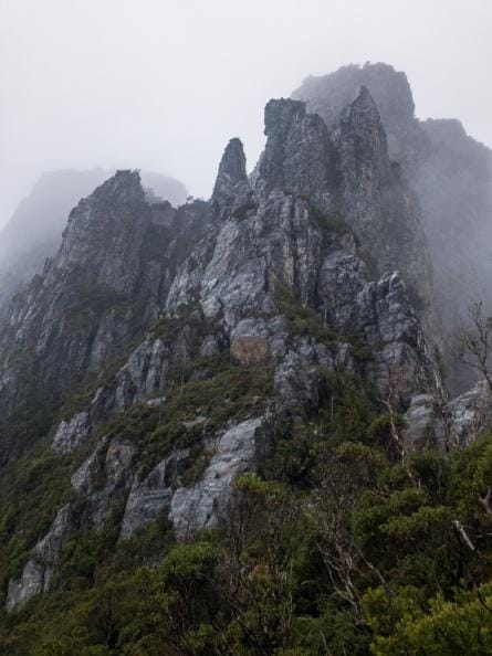
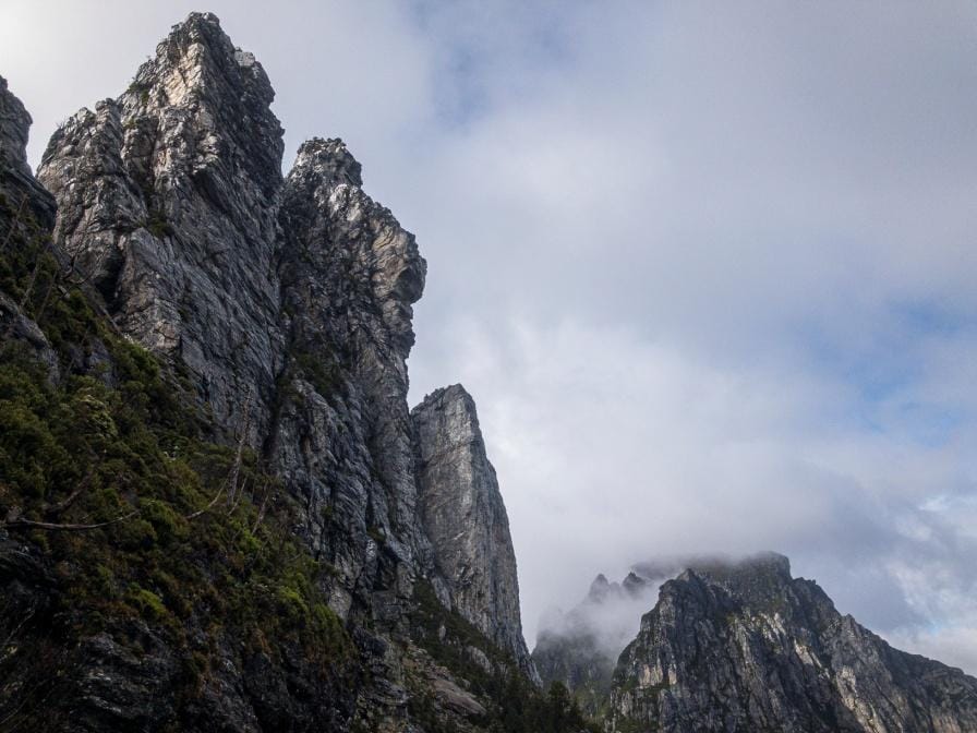
Thursday was a short 5.5 km hike but allow 4 to 5 hours. Wonder why ? This was a day of rough steep mountain track, constant climbing, with wet weather gear on and off and on. The track follows a rainforest creek with many rapids. A tough climb, we reach Baron’s Pass, a pass in between sharp towering peaks, grand views. The track then sidles along the top of the range, it is rough slow going, and lot of up and down. Thankfully we reach Tahune Hut at the base of Frenchman’s Cap, that was a tough ½ day hike. It is raining intermittingly, clouded in, no views, so no point in trying the summit this afternoon. The hut is new and magnificent, central constant heating, lighting, USB points, all powered by a hydro turbine in the creek waterfall nearby.
Friday – the plan is to see what weather is like before attempting the Cap summit, with 10 am as decision point. 6 am still light rain, 7 am bit heavier, 8 am light drizzle, all being clouded in with no views. At 9 am no change, so we decide to call it quits. Packs, on, we start to head back, when the valley below suddenly clears, rain stops. But the Cap above us, still clouded and looking wet. But 2 of the group decide to try the summit, whilst the other 3 continue on back to Vera Hut. Along the track back to Baron’s Pass, more light rain, wind, and no views due to cloud. At Vera Hut early, good time to dry clothes and gear. The two summiteers made it to the top of the Cap, no view though, and they rejoined us later at Vera Hut. Good time to consume those celebratory refreshments we carried.
Saturday – last day, 15 km hike out then 3.5 hr drive to Hobart. We were under time pressure due to timings with accommodation in Hobart (had to be there before 5 pm), so the 15 km hike back to the car was fairly quick – and that climb over Mt Mullens later in the walk was brutal ! In the distance, the peaks teased us as it was sunny and clear – Frenchman’s Cap was in clear view – damn ! But we completed the walk in great time, then a quick drive to Hobart arriving 4:45 pm, just in time. That
night we walk down to Salamanca Place for drinks and dinner – dinner included four bottles of bubbly, then the biggest cocktails ever seen (didn’t really need them) !
140 km hiking, 6,400 mr total ascent – wonder why the legs were fatigued at the end ?